The best road cycling routes around Bellflower
4.5
(56)
1,695
riders
50
rides
Road cycling routes around Bellflower offer access to an extensive network of paved trails and river greenways. The area is characterized by its urban environment with direct connections to major river corridors like the San Gabriel River and Rio Hondo, which provide dedicated cycling paths. These routes often feature flat terrain along riverbanks, with some options extending towards more challenging hills in areas like Turnbull Canyon. The region's infrastructure supports varied road cycling experiences, from leisurely rides to longer, more…
Last updated: July 10, 2026
5.0
(3)
84
riders
Moderate road ride. Good fitness required. Mostly well-paved surfaces and easy to ride.
5.0
(1)
35
riders
Easy road ride. Great for any fitness level. Mostly well-paved surfaces and easy to ride.

Sign up for free
3.0
(1)
57
riders
64.5km
03:06
100m
100m
Moderate road ride. Good fitness required. Mostly well-paved surfaces and easy to ride.
18
riders
Easy road ride. Great for any fitness level. Mostly well-paved surfaces and easy to ride.
12
riders
67.4km
04:39
440m
440m
Moderate road ride. Good fitness required. Some segments of this route may be unpaved and difficult to ride.
Get access to more routes and recommendations from other explorers.
Sign up for free
Already have an account?
Our route recommendations are based on thousands of hikes, rides, and runs completed by other people on komoot.
Start today with a free account
Your next adventure awaits.
Login or Signup
Popular around Bellflower


Tips from the Community

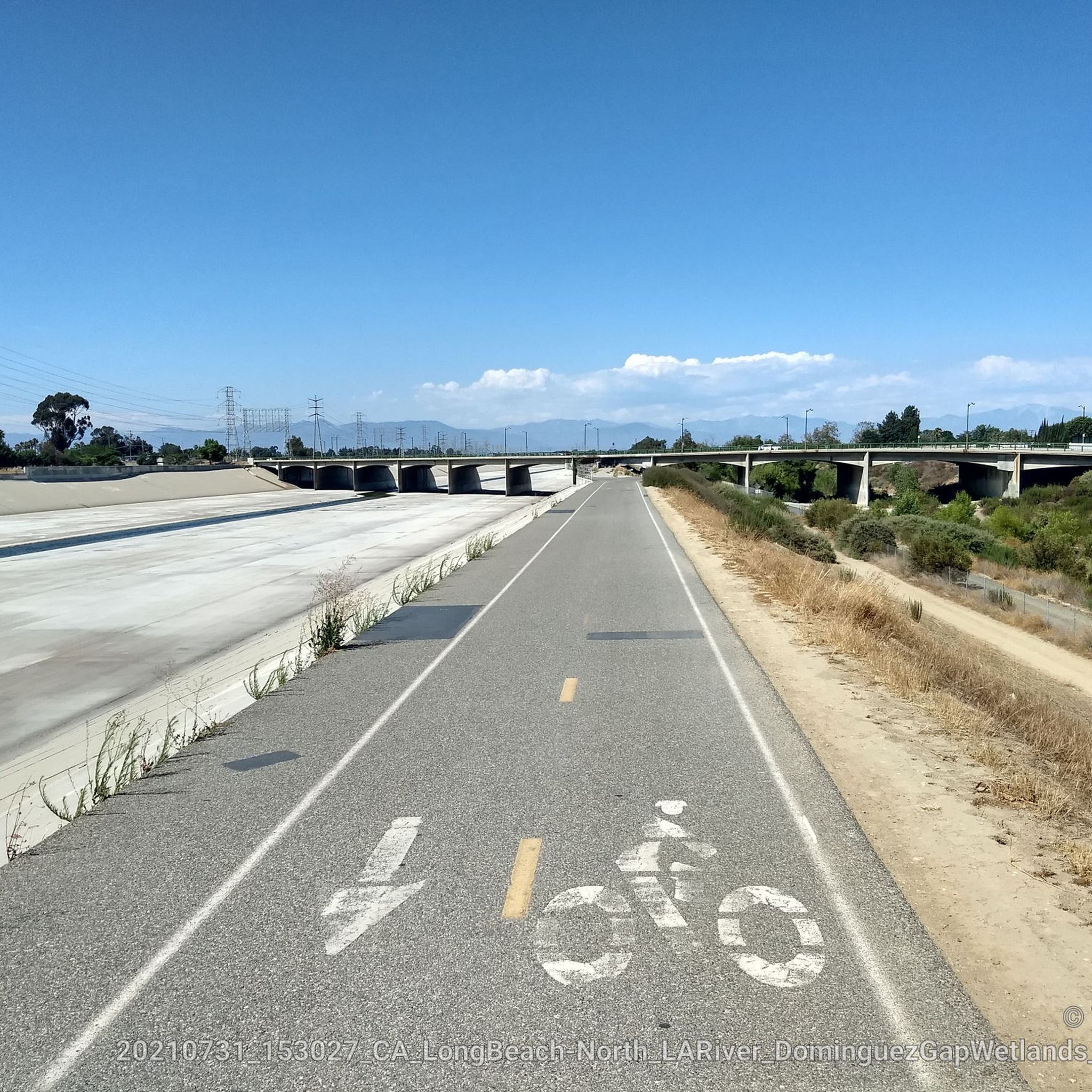
The Greenway is a paved two-lane multi-use path, which stretches for over 50 miles along the LA River.
0
0

The Rio Hondo Bike Bridge is an interesting structure that connects the bike trails that runs on either side of the Rio Hondo.
0
0
The San Gabriel Dam is a rock‑fill structure completed in 1939 on the San Gabriel River and is used for flood control.
0
0

Limited cars use the roads so it is nice to get away from traffic
0
0

Ride through Turnbull Canyon and be rewarded with stunning views of Los Angeles County and surround yourself with a mix of natural beauty and historical intrigue. The road climbs with an average gradient of 5.2%, gaining 775 feet in elevation and peaking at 1,161 feet. Be cautious of fast-driving vehicles on the winding roads.
1
0
There is a parking lot and restroom here at the trailhead, which provides access to a large network of paved and packed dirt trails along the beautiful Rio Hondo. The trailhead closes at sunset.
0
0

be cautious, lots of young fast and furious wannabe racers out on the canyon at all hours of the day. listen to your surroundings. be safe
0
0

As you bike near Turnbull Debris Basin, observe its crucial function in storing runoff and sediment, acting as a safeguard against downstream flooding and sedimentation, and protecting human life and property. Positioned along the canyon road en route to the Turnbull Canyon Trailhead, it plays a vital role in mitigating flood risks downstream, ensuring community safety.
0
0
Frequently Asked Questions
How many road cycling routes are available around Bellflower?
There are over 50 road cycling routes around Bellflower documented on komoot, offering a wide range of options for different skill levels and preferences.
Are there easy road cycling routes suitable for beginners or families in Bellflower?
Yes, Bellflower offers several easy, flat routes perfect for beginners and families. A great option is the San Gabriel River Trail – El Dorado East Regional Park loop from Bellflower, which is 22.1 km long and follows the dedicated San Gabriel River greenway, providing a safe path away from traffic. The San Gabriel River Trail – El Dorado East Regional Park loop from Lakewood is another easy choice, extending to 37.6 km.
Where can I find challenging road cycling routes with elevation gain near Bellflower?
For those seeking a challenge, the Turnbull Canyon – Turnbull Debris Basin loop from Norwalk offers a significant climb over its 69.2 km distance, rewarding riders with stunning views of Los Angeles County. Another moderate option with elevation is the Turnbull Canyon – Bosque del Rio Hondo loop from Lakewood Boulevard, covering 67.4 km.
What kind of scenery can I expect on road cycling routes around Bellflower?
Road cycling routes around Bellflower primarily follow river greenways like the San Gabriel River and Rio Hondo, offering a sense of nature within an urban environment. Routes like the Turnbull Canyon loop provide panoramic views of Los Angeles County from higher elevations. You can also pass by parks such as El Dorado East Regional Park.
Are there any notable landmarks or attractions along the cycling paths?
Yes, cyclists can encounter several points of interest. The Rio Hondo Bike Bridge is a significant structure connecting trails, and the San Gabriel River Trail itself is a major highlight. Ruth R. Caruthers Park serves as a key trailhead with amenities and direct access to trails.
What is the best season for road biking in Bellflower?
Bellflower, located in Southern California, generally offers good road cycling conditions year-round. However, spring and fall provide the most comfortable temperatures. Summers can be hot, especially in the middle of the day, so early morning or late afternoon rides are often preferred during those months.
Are there loop road cycling routes available?
Yes, many of the popular road cycling routes around Bellflower are loops. Examples include the San Gabriel River Trail – El Dorado East Regional Park loop from Lakewood and the Santa Fe Flood Control Basin – San Gabriel River Greenway loop from Norwalk, which provide circular journeys back to your starting point.
What do other road cyclists say about the routes in Bellflower?
The road cycling routes around Bellflower are highly regarded by the komoot community, with an average rating of 4.8 stars from over 50 reviews. Cyclists often praise the dedicated bike paths along the river greenways and the variety of routes available, from flat, easy rides to more challenging climbs with scenic views.
Where can I park when accessing road cycling routes in Bellflower?
Ruth R. Caruthers Park is a full-service trailhead that offers parking and restrooms, providing convenient access to both the Bellflower Bike Trail and the San Gabriel River Trail. Other parks along the river corridors may also offer parking facilities.
Are there any long-distance road cycling routes from Bellflower?
Yes, for longer rides, the Santa Fe Flood Control Basin – San Gabriel River Greenway loop from Norwalk is a substantial 84.9 km route that utilizes the extensive San Gabriel River Greenway, allowing for an extended journey through the region's river corridors.
What is the Bellflower Bike Trail?
The Bellflower Bike Trail is a dedicated 2.7-mile (4.3 km) path within the city, built along a former railway line. It features separate lanes for cyclists and pedestrians and connects directly to the larger San Gabriel River Trail at Ruth R. Caruthers Park, making it a convenient local option.
Most popular routes around Bellflower
Most popular attractions around Bellflower

Get inspired with the komoot mobile app


Explore more
Browse the best Road cycling routes in other regions.
