The best cycling routes around Pleasant Hill
4.6
(161)
1,626
riders
13
rides
Best touring cycling routes in Pleasant Hill, California, offer a diverse range of experiences, from flat, paved paths to challenging climbs. The region features varied terrain, including views of San Pablo Bay, the Delta, and rural landscapes. Prominent natural landmarks like Mount Diablo and the Carquinez Strait provide dramatic scenery and demanding routes. Cyclists can also explore areas around Briones Reservoir and along canal trails, offering a mix of natural and developed pathways.
Best touring cycling routes around Pleasant Hill
- The most popular touring cycling route is Carquinez Strait loop, a 35.2 miles (56.7 km) trail that takes 3 hours 37 minutes to complete. This difficult route offers diverse scenery and bridge crossings.
- Another top favourite among local touring cyclists is Briones Reservoir loop, a difficult 39.8 miles (64.0 km) path. This route provides a challenging touring experience with scenic views and a rural escape.
- Local touring cyclists also love the Historic Crockett loop, a 28.8 miles (46.3 km) trail leading through diverse scenery and the charming downtown area of Crockett, often completed in about 3 hours 3 minutes.
- Touring cycling around Pleasant Hill is defined by diverse terrain, views of the Carquinez Strait, and canal trails. The network offers options for different ability levels, from easy rides to very difficult ones.
- The routes in Pleasant Hill are highly rated by the komoot community with an average score of 4.6 stars from over 100 reviews. More than 1,600 touring cyclists have used komoot to explore Pleasant Hill's varied terrain.
Last updated: September 27, 2026
5.0
(2)
34
riders
46.3km
03:03
650m
650m
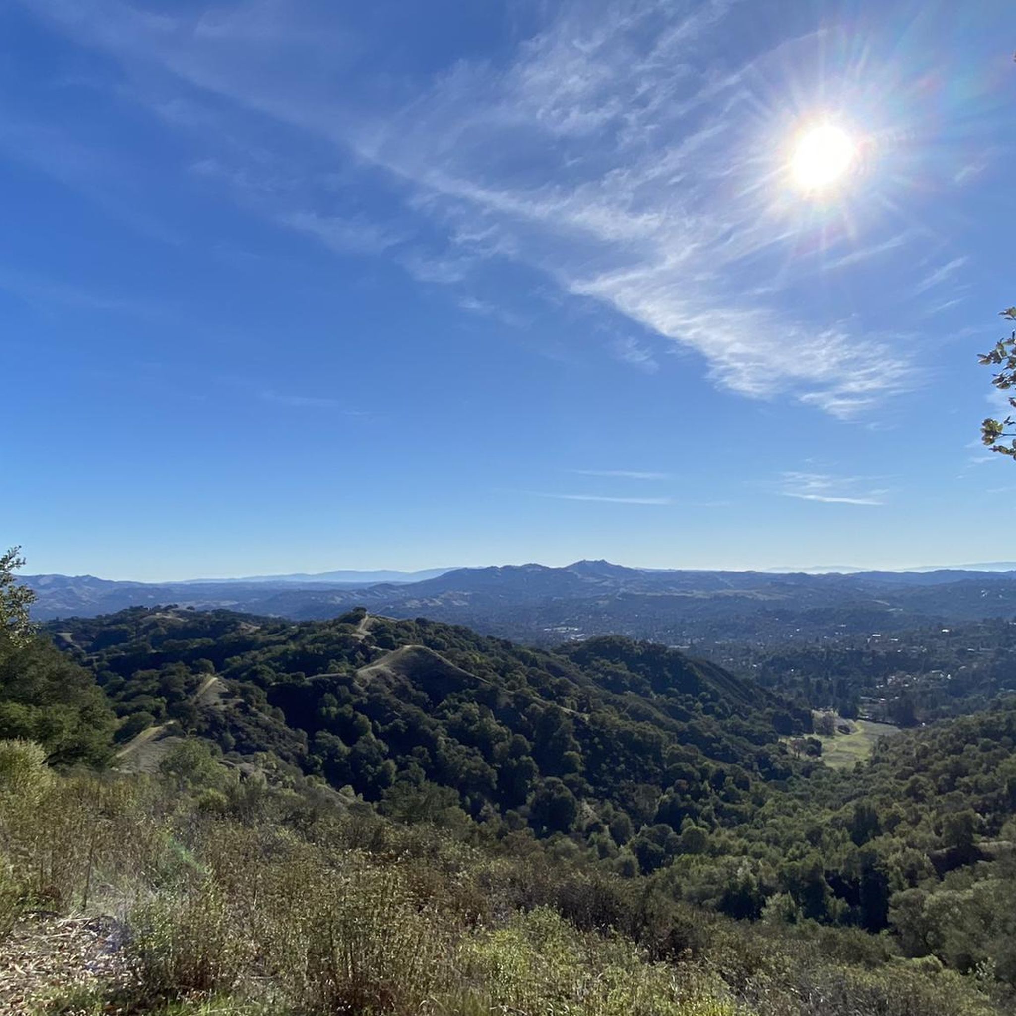
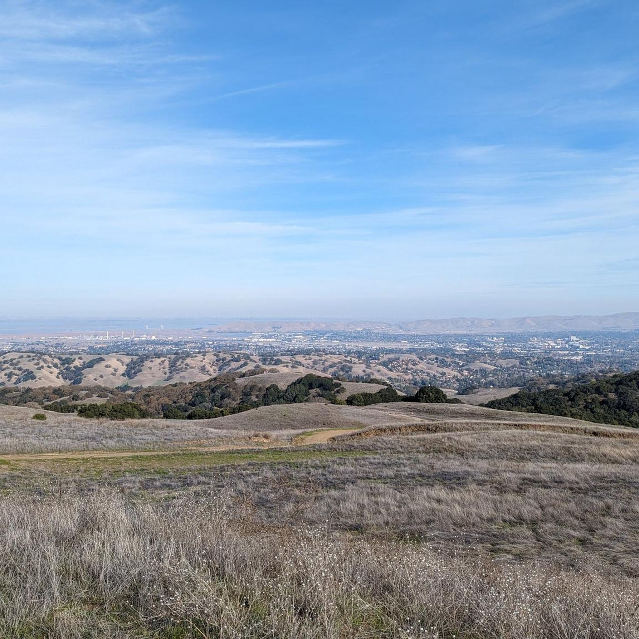
The Historic Crockett loop offers a challenging touring bicycle ride through diverse terrain, rewarding you with expansive views of San Pablo Bay, the Delta, Mount Tamalpais, and Mount Diablo. This difficult route covers 28.8 miles (46.3 km) and includes a significant 2145 feet (654 metres) of elevation gain, typically taking about 3 hours and 3 minutes to complete. You will find excellent viewpoints along ridgetop trails like the Soaring Eagle Trail, which are particularly beautiful in spring when wildflowers bloom.
When planning your visit, be aware that while this is a touring cycling route, some sections, especially within Crockett Hills Regional Park, feature terrain more suited for mountain biking. These areas include flow trails with rollers and berms, which might not be ideal if you are on a traditional touring setup. Always check local conditions before you head out, especially after rain, as parts of the trail can become bumpy and less enjoyable for touring bikes.
This loop takes you through the scenic Carquinez Strait Regional Shoreline, offering a unique blend of natural beauty and historical context. As you cycle, you will pass by notable landmarks such as the George Miller Regional Bike Trail and John Muir Memorial Park. The route provides a great opportunity to explore the region's landscape and history from your bike, making it a memorable outing for experienced cyclists.
4.3
(3)
57
riders
34.0km
02:01
110m
110m
Moderate bike ride. Good fitness required. Mostly paved surfaces. Suitable for all skill levels.

4.3
(3)
28
riders
Easy bike ride. Great for any fitness level. Mostly paved surfaces. Suitable for all skill levels.
1.0
(1)
13
riders
24.2km
01:28
100m
100m
Easy bike ride. Great for any fitness level. Mostly paved surfaces. Suitable for all skill levels.
11
riders
69.0km
04:16
470m
470m
Hard bike ride. Very good fitness required. You may need to push your bike for some segments of this route.
Get access to more routes and recommendations from other explorers.
Already have an account?
Our route recommendations are based on thousands of hikes, rides, and runs completed by other people on komoot.
Start today with a free account
Your next adventure awaits.

Tips from the Community

The Del Amigo Swim Club, officially known as the Del Amigo Pool Association, is a member-owned, nonprofit community pool that features two pools. The pool closes every year from mid‑September to March for major renovation.
0
0

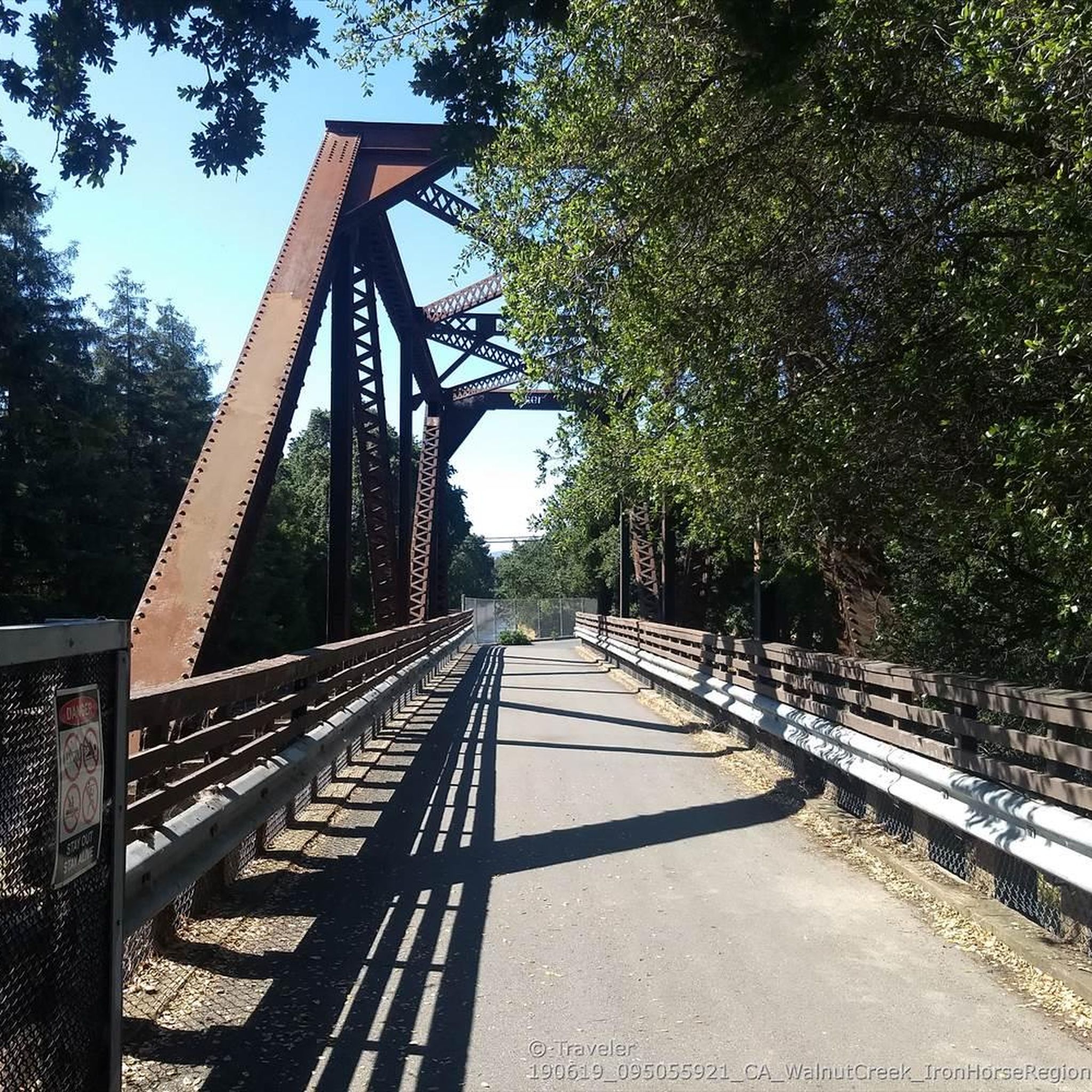
The Iron Horse Trail is a 32-mile multi-path that connects the towns of Concord and Pleasanton. It follows the route of the abandoned Southern Pacific Railroad. With its access to schools, business centers, and parks, the path is popular with commuters and recreationalists.
1
0

The Contra Costa Canal Trail stretches for several miles through the Concord Metro Area. The trail is mostly flat and paved, running alongside the Contra Costa Canal, passing through urban parks and open areas. It’s a great option for a leisurely stroll or bike ride.
1
0
Los Juntas Park is an open area beside the Contra Costa Canal. The small park features grassy areas, benches, and trees that provide some shade. There is also a public water fountain available.
0
0
This charming lake sits along the Ygnacio Canal Trail at Heather Farm Park. The park features two lakes, open grassy areas, playgrounds, picnic tables, and other facilities. The lake and surrounding areas are a great spot to take a break while cycling the Ygnacio Canal Trail.
0
0

The Lamorinda Trail Loop has an interesting beginning. Initially the three communities of Lafayette, Orinda and Moraga convened a committee to look at connecting themselves via trails. However, upon looking closely at existing trails they discovered a trail route already existed through the three cities and they simply need to raise funds for signage along the route. After placing the signs designating the route the trail was officially opened on August 10th, 2006.
0
0

By this spot on the Lafayette-Moraga Regional Trail, also known as the Lafayette-Moraga Regional Trail, the Las Trampas and Grizzly Creeks merge. Near this spot you can also access Burton Valley, a small neighborhood in Lafayette.
0
0

Pretty tree-shaded park with lawns, picnic facilities and great access at the intersection of two long distance trail networks
1
0
Frequently Asked Questions
How many touring cycling routes are available around Pleasant Hill?
Pleasant Hill offers a wide selection of touring cycling routes, with over 90 different options to explore. These routes cater to various skill levels, from easy rides to challenging climbs.
What kind of terrain can I expect on touring cycling routes in Pleasant Hill?
The region boasts diverse terrain, ranging from flat, paved paths ideal for leisurely rides to challenging climbs with significant elevation gains. You'll encounter scenic views of San Pablo Bay, the Delta, rural landscapes, and areas around natural landmarks like Mount Diablo and the Carquinez Strait.
What do other cyclists enjoy most about touring cycling in Pleasant Hill?
The komoot community highly rates touring cycling in Pleasant Hill, with an average score of 4.6 stars from over 100 reviews. Cyclists often praise the varied terrain, scenic views, and the extensive network of trails that connect different parts of the region.
Are there easy touring cycling routes suitable for beginners in Pleasant Hill?
Yes, Pleasant Hill has over 30 easy touring cycling routes. Many of these utilize paved paths like sections of the Iron Horse Trail or the Ygnacio Canal Trail, which offer mostly flat surfaces and are great for less strenuous rides. Heather Farm Park, located along the Ygnacio Canal Trail, provides a charming spot for a break.
What are some challenging touring cycling routes for experienced riders?
For experienced riders seeking a challenge, there are nearly 30 difficult routes. The Iron Horse Trail and Dougherty Valley Loop offers a moderate challenge with varied scenery. For a significant climb and dramatic views, consider routes that lead towards or up Mount Diablo, such as the Mount Diablo Summit – Iron Horse Trail junction loop from Pleasant Hill/Contra Costa Centre.
Are there any family-friendly touring cycling routes in Pleasant Hill?
Yes, the region offers several family-friendly options. The Iron Horse Trail is a popular choice, being a mostly flat, paved multi-use path. The Ygnacio Canal Trail also features mostly paved surfaces and sights of local wildlife, making it suitable for families. Heather Farm Park along this trail is a great spot for a break.
Can I bring my dog on touring cycling routes in Pleasant Hill?
While many trails in the Pleasant Hill area are multi-use, regulations regarding dogs can vary by specific park or trail section. It's always best to check the local rules for the particular route you plan to ride. Generally, dogs on leashes are permitted on many regional trails, but always be mindful of other users and wildlife.
Are there touring cycling routes that offer scenic views or natural landmarks?
Absolutely. Many routes provide magnificent views. Cycling loops around the Carquinez Strait offer diverse scenery and bridge crossings, including the Benicia-Martinez Bridge Bike Trail. Routes around Briones Reservoir provide scenic views and a rural escape, with an Overlook - Briones Reservoir offering panoramic vistas. Mount Diablo also provides dramatic scenery for those willing to tackle its slopes.
Are there any loop routes for touring cyclists in Pleasant Hill?
Yes, many touring cycling routes in Pleasant Hill are designed as loops, offering a convenient way to start and end your ride in the same location. Popular loop options include the Carquinez Strait loop and the Briones Reservoir loop, both providing diverse scenery and experiences.
What are some interesting places to explore along the touring cycling routes?
Beyond the natural beauty, you can explore charming areas like the downtown of Crockett on the Historic Crockett loop, which features independent restaurants and shops. The Iron Horse Trail connects to various towns and parks, while the Ygnacio Canal Trail passes by Heather Farm Park, known for its lakes and open spaces.
Are there options for public transport access to touring cycling routes?
Pleasant Hill benefits from its connection to the broader Bay Area bike trail network and public transport options. Many trails, like the Iron Horse Trail, are accessible from various points within the community, often near public transport hubs, making it convenient to start your ride without a car.
Where can I find parking for touring cycling routes in Pleasant Hill?
Parking is generally available at various access points along major trails and in parks throughout Pleasant Hill. For instance, trails like the Iron Horse Trail and Contra Costa Canal Trail often have designated parking areas at their trailheads or nearby public facilities. Specific parking information can usually be found on local park and trail websites.
Most popular routes around Pleasant Hill
Most popular attractions around Pleasant Hill

Get inspired with the komoot mobile app


Explore more
Browse the best Cycling routes in other regions.
