The best walks and hikes around Dam Saidenbach
4.6
(5017)
14,899
hikers
677
hikes
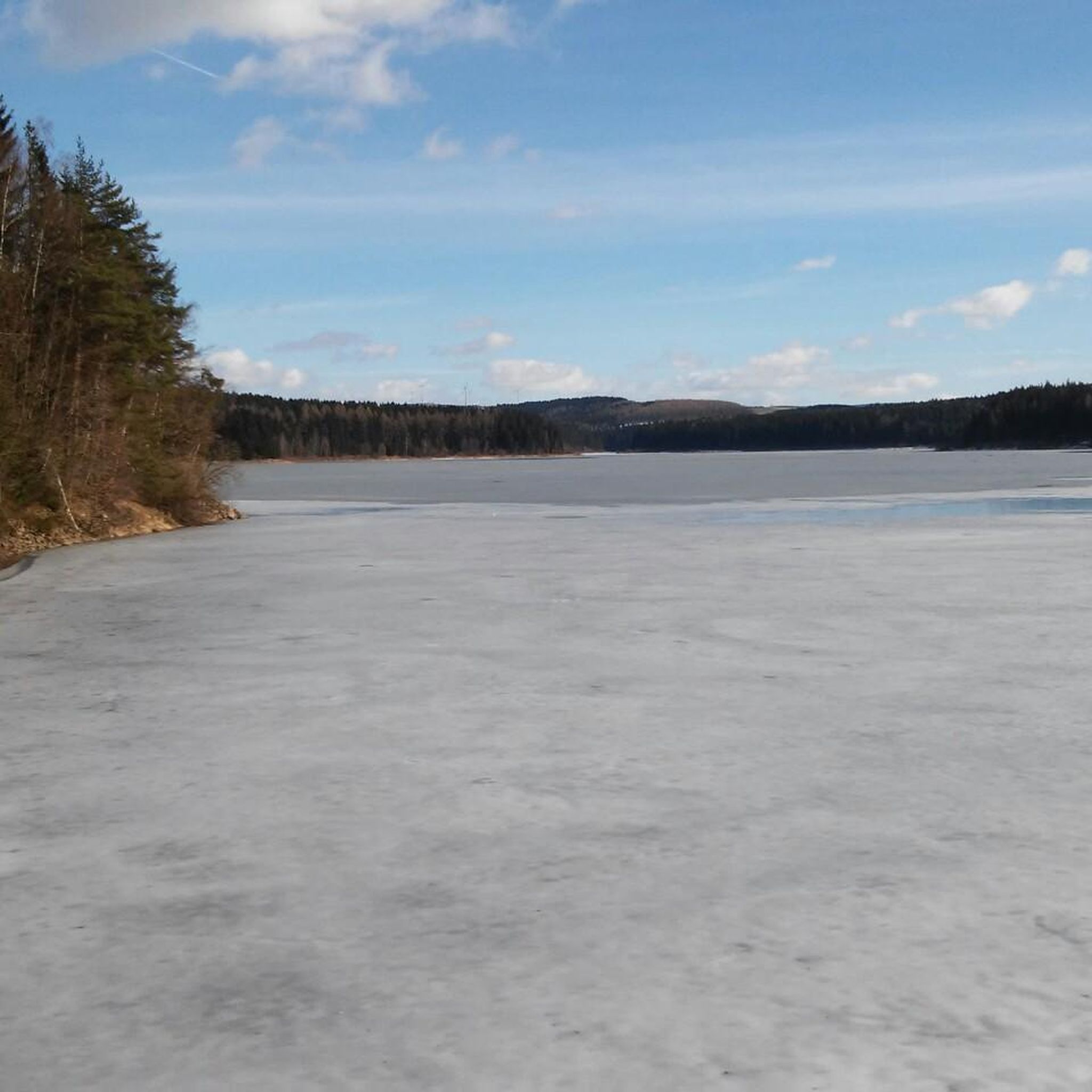
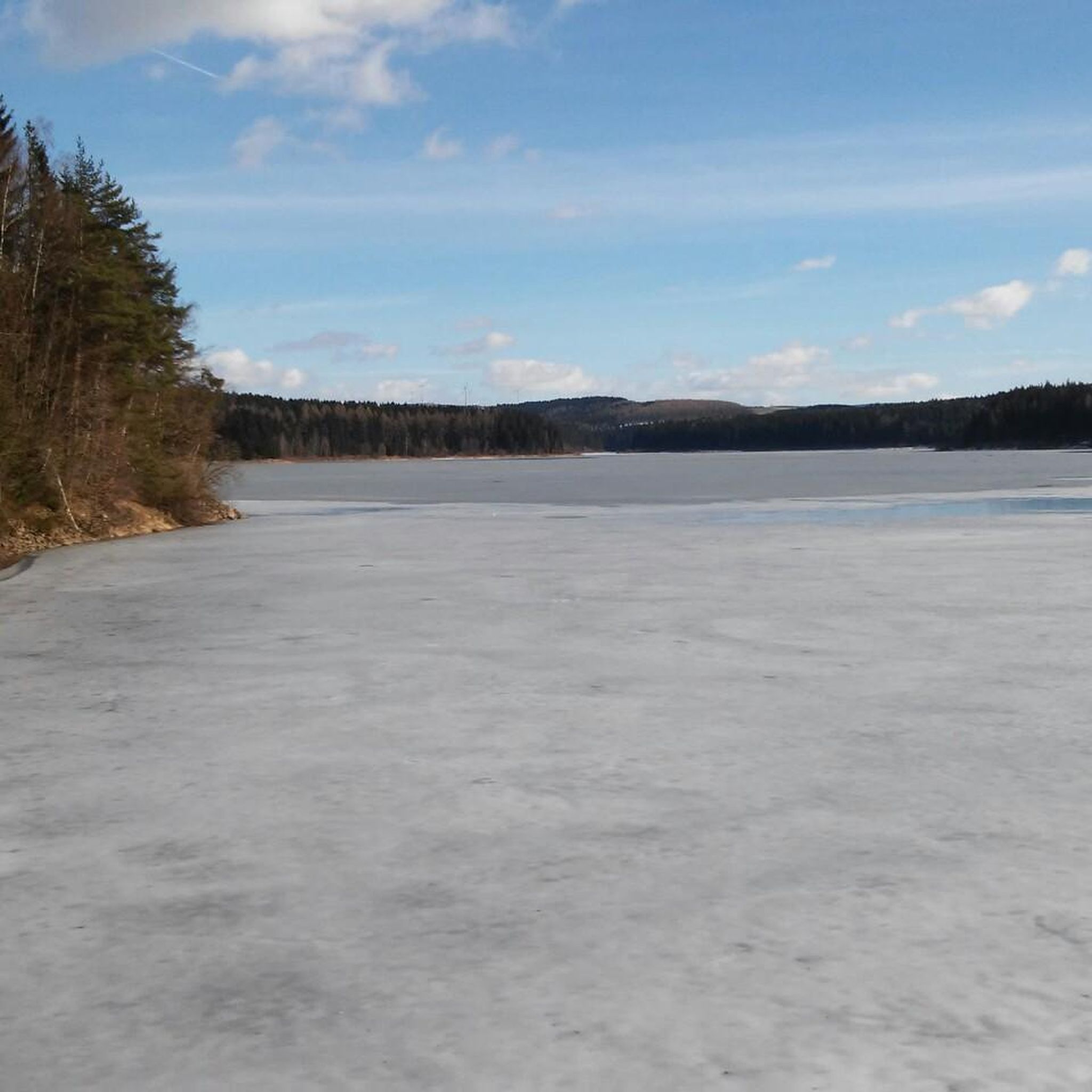
Hiking around Dam Saidenbach offers a network of trails within the scenic Ore Mountains of Saxony, Germany. The region is characterized by the tranquil Saidenbach Reservoir, surrounded by forested hills and a landscape protection area spanning approximately 4500 hectares. The dam itself is an impressive curved gravity dam, standing at an elevation of 445 meters, with a public footpath along its crest. The terrain around the lake provides intermediate trails, with diverse flora and fauna.
Best hiking trails around Dam…
Last updated: October 13, 2026
4.5
(8)
24
hikers
11.4km
03:06
160m
160m
Moderate hike. Good fitness required. Easily-accessible paths. Suitable for all skill levels.
4.6
(11)
28
hikers
Easy hike. Great for any fitness level. Easily-accessible paths. Suitable for all skill levels.

4.8
(8)
26
hikers
Easy hike. Great for any fitness level. Easily-accessible paths. Suitable for all skill levels.
4.5
(4)
21
hikers
6.69km
01:49
100m
100m
Easy hike. Great for any fitness level. Easily-accessible paths. Suitable for all skill levels.
4.8
(550)
1,514
hikers
Moderate hike. Good fitness required. Easily-accessible paths. Suitable for all skill levels.
Get access to more routes and recommendations from other explorers.
Already have an account?
Our route recommendations are based on thousands of hikes, rides, and runs completed by other people on komoot.
Start today with a free account
Your next adventure awaits.
Tips from the Community

Always so beautiful, whatever the weather. ☀️👍 It's also simply a dream for hiking.
0
0

very interesting, right next to the rest area
2
0

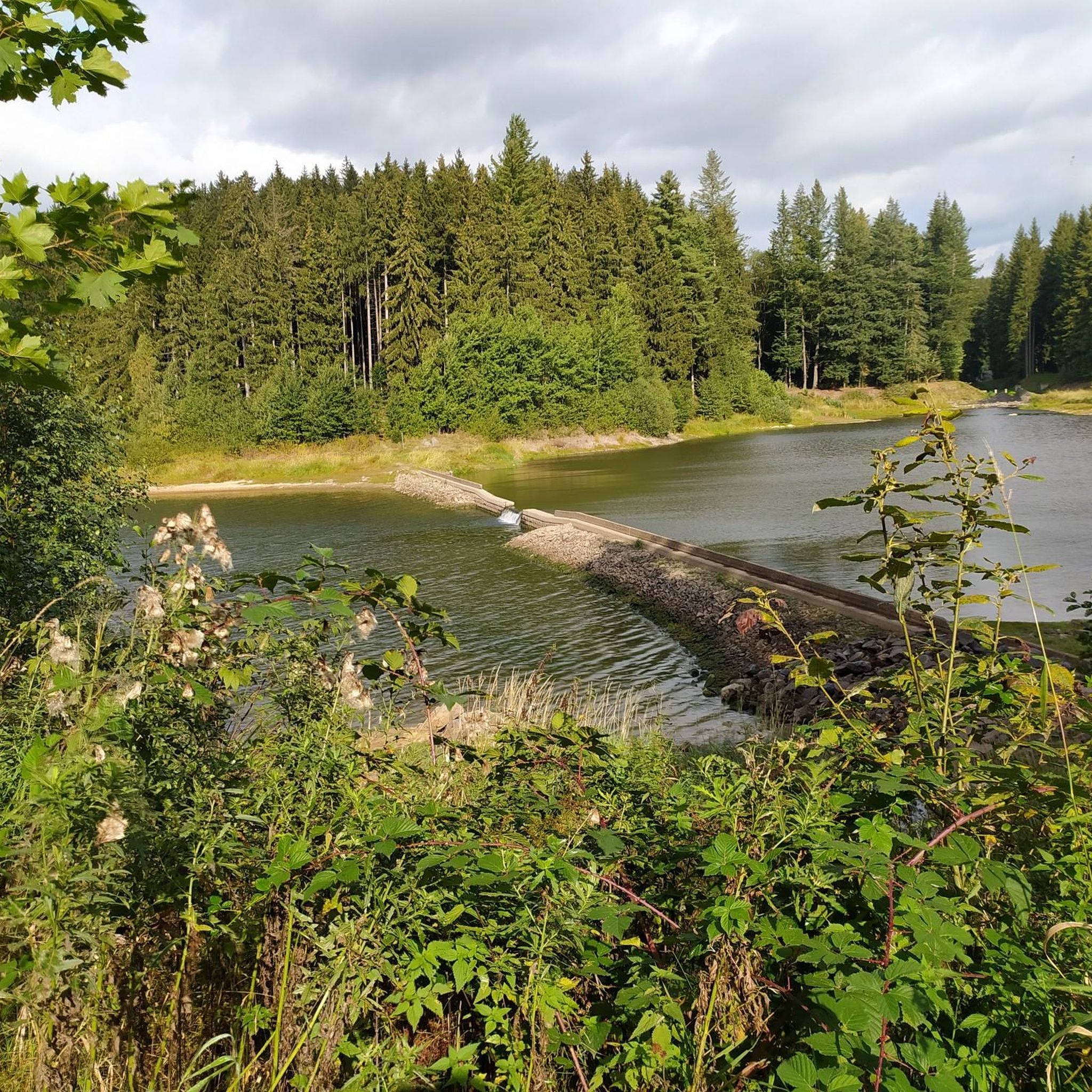
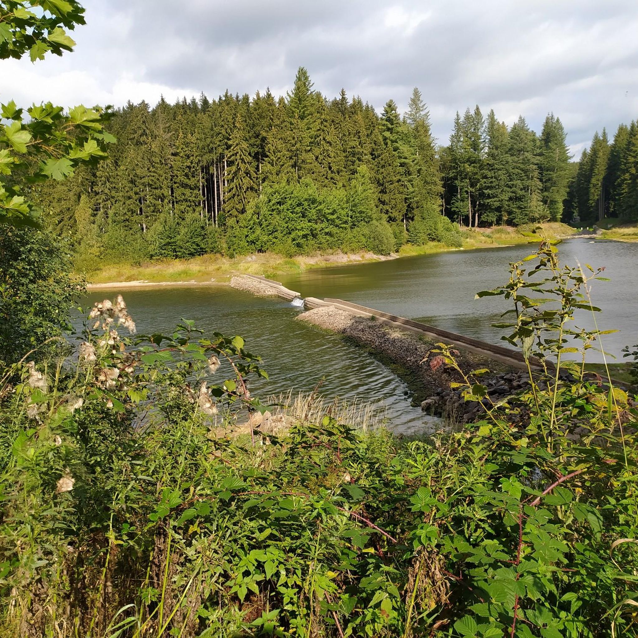
The dam is connected to the Neunzehnhain I and II dams and the Einsiedel dam via canals, pipelines, tunnels, and streams. A charming landscape conservation area of approximately 4,500 hectares extends around the Saidenbach Dam.
4
0
The Saidenbach drinking water reservoir was built between 1929 and 1933 northeast of Pockau-Lengefeld. It dams a total of six tributaries: the Forchheimer Dorfbach, Gründelbach, Haselbach, Hölzelbergbach, Lippersdorfer Bach, and Saidenbach. With over 146 hectares of water surface (22.4 million m³ of water), the reservoir is the largest reservoir in the Central Ore Mountains and also the largest drinking water reservoir in the "Central Ore Mountains" integrated water system. Together with the Einsiedel, Neunzehnhain 1, and Neunzehnhain 2 reservoirs, it provides raw water for the Einsiedel waterworks, which supplies Chemnitz and southern Saxony with drinking water. https://www.wasserwirtschaft.sachsen.de/TS_Saidenbach.html
4
0

A truly beautiful path and view. Especially recommended when the sun is setting. It feels like Canada. Hardly any people, no houses, and a fantastic landscape.
4
0

Next to the wedge-oval slide shown here at the hiking car park there is a covered rest area and a football pitch.
15
0
Frequently Asked Questions
How many hiking trails are available around Dam Saidenbach?
There are over 670 hiking routes around Dam Saidenbach, offering a wide range of options for different skill levels and preferences. This includes over 320 easy trails, 300 moderate routes, and more than 50 difficult hikes for those seeking a greater challenge.
What is the best time of year to hike around Dam Saidenbach?
The Dam Saidenbach area is particularly inviting during the warmer months, from spring through autumn. This period offers pleasant weather conditions ideal for exploring the extensive trail network and enjoying the scenic views of the reservoir and forested hills.
Are there easy hikes suitable for beginners or families?
Yes, Dam Saidenbach offers numerous easy trails perfect for beginners or families. For instance, the Saidenbach Reservoir Circular Trail – View of the Saidenbach Forebay loop from Forchheim is an easy 2.5-mile (4.0 km) path offering a shorter circular walk with views of the forebay. Another accessible option is the Reservoir Shore – Forchheim Pre-dam loop from Forchheim, which is 4.1 miles (6.7 km) long and also rated easy.
Are there circular walks around Dam Saidenbach?
Circular walks are a popular feature of the Dam Saidenbach area. Many trails are designed as loops, allowing you to experience the diverse scenery without retracing your steps. A notable example is the Reservoir Shore – View of the Saidenbach Reservoir loop from Forchheim, a 7.1-mile (11.4 km) moderate route that provides continuous views of the reservoir and surrounding forests.
What kind of landscapes and natural features can I expect to see?
Hikers around Dam Saidenbach will encounter a picturesque blend of tranquil reservoir views, surrounded by the scenic Ore Mountains. The area features extensive forested hills and is part of a charming landscape protection area. You can expect well-maintained trails, often with shoreline access and numerous viewpoints offering expansive vistas of the Saidenbach Reservoir.
Can I bring my dog on the trails around Dam Saidenbach?
While the region is generally welcoming to outdoor enthusiasts, specific regulations for dogs can vary. It's always recommended to keep dogs on a leash, especially in protected areas or near wildlife. Please be mindful of other hikers and local signage regarding pet policies.
Are there any viewpoints along the hiking trails?
Yes, the trails around Dam Saidenbach offer several viewpoints that provide stunning panoramas of the reservoir and its surroundings. These strategically placed spots allow hikers to pause and enjoy the expansive vistas, such as the View of the Saidenbach Reservoir.
Is there parking available for hikers at Dam Saidenbach?
While specific parking areas are not detailed, as a popular hiking destination, there are typically designated parking facilities near trailheads or access points around Dam Saidenbach. It is advisable to check local maps or signage upon arrival for the most convenient parking options.
What do other hikers enjoy most about hiking in Dam Saidenbach?
The area is highly rated by the komoot community, with an average score of 4.7 stars from over 3,400 reviews. Reviewers often praise the tranquil reservoir paths, the beauty of the forested hills, and the well-maintained circular walks that cater to various ability levels.
Are there any longer, more challenging hikes for experienced hikers?
Yes, for those seeking a greater challenge, Dam Saidenbach offers more difficult routes. An example of a longer, moderate hike is the View of the Saidenbach Reservoir – View of the Saidenbach Forebay loop from Forchheim, which spans 9.6 miles (15.5 km) and features over 230 meters of elevation gain.
Can I swim or engage in water sports in the Saidenbach Reservoir?
No, bathing and direct water sports are not permitted in the Saidenbach Reservoir. The reservoir serves as a drinking water source, and its primary role is to supply potable water. However, fishing is allowed with the necessary licenses.
Most popular routes around Dam Saidenbach
Most popular attractions around Dam Saidenbach

Get inspired with the komoot mobile app


Explore more
Browse the best Hikes in other regions.
