The best walks and hikes around Gila Crossing
4.8
(7)
87
hikers
13
hikes
If you've ever tried planning hiking around Gila Crossing, you know how quickly the options can feel overwhelming. With so many trails to choose from, it's tough to figure out which ones are genuinely worth your time and effort. That's exactly why we created this guide. Our komoot community has explored, mapped, and reviewed these routes, so we've done the legwork to bring you a curated shortlist of the best hikes around Gila Crossing, saving you the guesswork.
Hiking here…
Last updated: June 3, 2026
5.0
(1)
23
hikers
11.5km
03:35
400m
390m
The Goat Mountain via Pyramid, National and Lost Ranch Mine Loop offers a true taste of the Arizona desert, blending challenging climbs with expansive views and historical intrigue. You'll traverse…
5.0
(1)
13
hikers
22.3km
06:29
600m
530m
The National Trail in South Mountain offers a deep dive into Phoenix's desert landscape, presenting a challenging 13.9-mile (22.3 km) hike with 1976 feet (602 metres) of elevation gain. You'll…

9
hikers
6.34km
02:10
340m
270m
The Lost Ranch Ruins and Mines Loop offers a captivating blend of Sonoran Desert scenery and historical intrigue, making it one of the more unique hiking trails routes in Phoenix.…
5
hikers
11.3km
03:39
490m
470m
The Goat Hill via National and Pyramid Trail Loop offers a rewarding desert hiking experience with diverse terrain and expansive views. You'll traverse rocky sections and loose ground, especially on…
1.92km
00:34
0m
160m
Discover the unique desert flora of Phoenix's South Mountain Preserve on the Bursera Trail, a delightful and easy hiking route. This 1.2-mile (1.9 km) path is a flat, gentle walk…
Get access to more routes and recommendations from other explorers.
Already have an account?
Our route recommendations are based on thousands of hikes, rides, and runs completed by other people on komoot.
Start today with a free account
Your next adventure awaits.
Popular around Gila Crossing


Tips from the Community

San Juan Lookout is the highest point in the South Mountain Preserve. It is found at the most western point of the preserve, and getting here by bike is a good ride.
0
0

From this summit with breathtaking views, you should be able to see the Estrella mountain range to the west and a part of the South Mountain Preserve to the east. I would recommend to reach this point by following the trails in the clockwise direction as to avoid a steep uphill and turn it into a technical descent instead.
0
0

Telegraph Pass overlook gives riders a view down to the city of South Mountain, and around the mountain area of South Mountain Preserve. There are hiking trails near here as well but the overlook itself has a great view.
0
0
San Juan lookout is at the western end of the South Mountains and is usually accessible by the end point of East San Juan Road. It gets less traffic than nearby areas because it is farther out of the city. The scenery on the ride is great, and there is an unused shelter that provides some shade for visitors.
0
0

A remarkable leftover building from the depression era of the 1930's, where Civilian Conservation Corps and some 4000 men built over 40 miles of hiking trails. They made sure to build with enviornmentally compatible masonary stone. Appreciate the carftsmanship left behind.
0
0

This is a popular spot to watch the sunset but for the rest of the day it's not too busy. This is a great destination on its own or you can continue on to the summit of Mount Suappoa.
0
0

If you want to tackle the National Trail, start at Pima Canyon Trailhead and climb the National Trail until you reach Buena Vista Lookout. Then turn around and enjoy the downhill.
1
0
This is a popular spot to watch the sunset but for the rest of the day it's not too busy. There are a number of trails that start here so you'll have plenty of choices.
0
1
Frequently Asked Questions
How many hiking trails are available around Gila Crossing?
There are over 9 hiking routes around Gila Crossing, offering a diverse range of experiences. These trails vary in difficulty from easy to difficult, ensuring options for different skill levels.
What kind of landscapes can I expect to see while hiking near Gila Crossing?
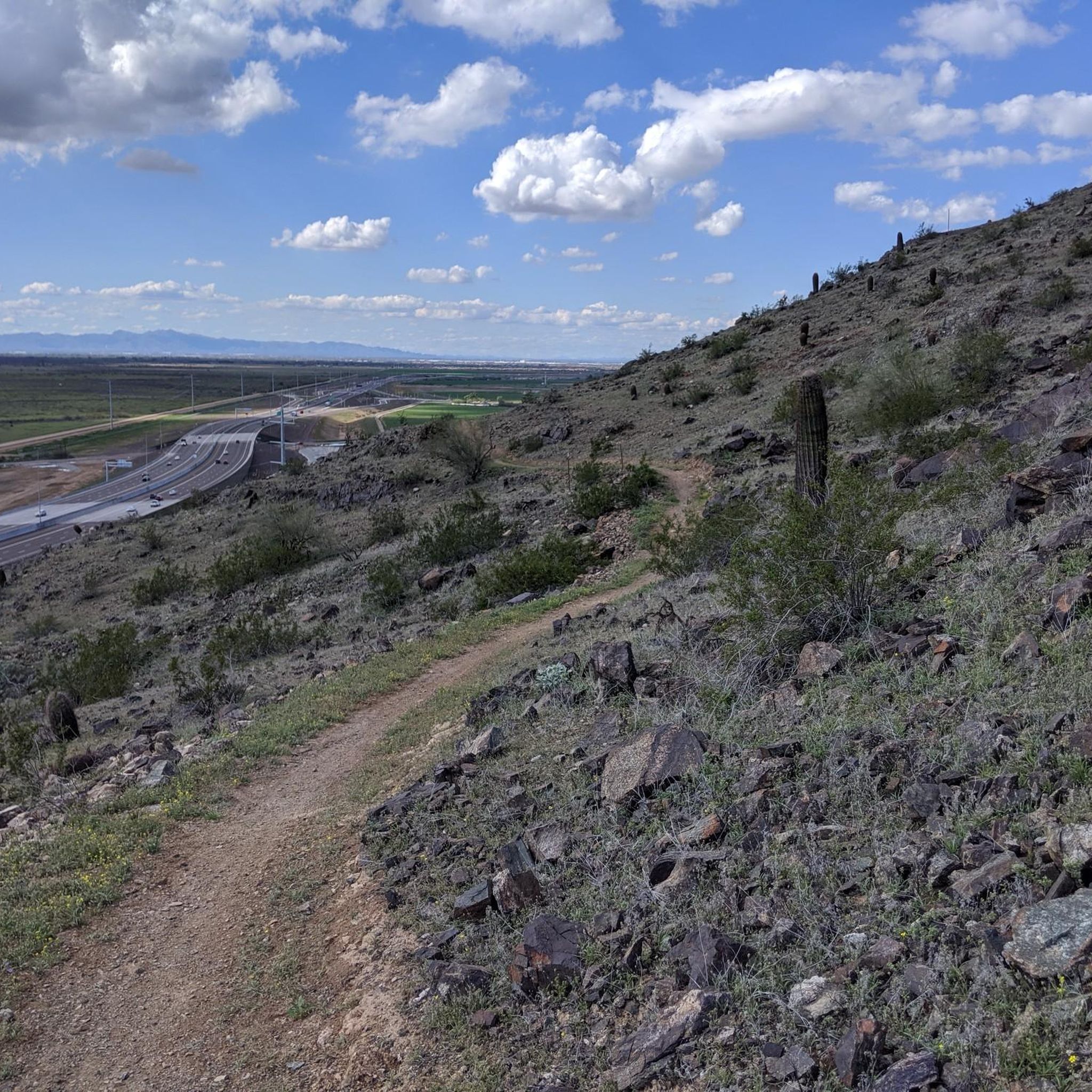
Hiking around Gila Crossing offers a remarkable variety of landscapes. You'll encounter arid desert environments with saguaros, ocotillos, and chollas, transitioning to lush riparian corridors along the Gila River, characterized by cottonwood and sycamore trees. The trails also lead through rugged canyons and offer expansive views of distant mountain ranges like the Strella and South Mountain ranges.
Are there easy hiking trails suitable for beginners or casual walkers?
Yes, there is at least one easy hiking trail available around Gila Crossing. While specific easy routes are not detailed in the guide, these trails typically offer flatter terrain and shorter distances, allowing for a more relaxed outdoor experience amidst the desert and riparian scenery.
What are some challenging hikes for experienced hikers?
For experienced hikers seeking a challenge, Gila Crossing offers several difficult routes. One such option is the National Trail & Pyramid Trail loop — South Mountain Preserve, a 10.5-mile path with extensive views. Another demanding option is the Alta Trail & National Trail loop — South Mountain Preserve, which covers nearly 12.3 miles and features significant elevation changes.
Are there any loop trails around Gila Crossing?
Yes, many of the popular routes around Gila Crossing are loop trails, providing varied scenery without retracing your steps. Examples include the Alta Trail & Bajada Trail loop — South Mountain Preserve and the Alta Trail & T-Bone Ridgeline loop — South Mountain Preserve.
What can I see along the hiking trails around Gila Crossing?
Along the hiking trails, you can explore various natural features and scenic points. Highlights include the Summit Road, offering elevated views, and the Pyramid Trail, known for its switchbacks and stunning vistas. The Alta Trail and T-Bone Ridgeline also provide unique perspectives of the South Mountain Preserve's rugged terrain and diverse ecosystems.
Is the Gila Crossing area dog-friendly for hiking?
While the guide does not specify dog-friendly trails, many areas within the broader Gila region, including parts of the Gila National Forest and South Mountain Preserve, generally allow dogs on leash. It's always best to check specific trail regulations before heading out, especially concerning heat and water availability in desert environments.
Are there family-friendly hiking options near Gila Crossing?
The Gila Crossing area offers a range of trails, including easier options that could be suitable for families. Look for shorter, less strenuous routes to enjoy the unique desert and riparian scenery with children. Always consider the weather, especially during warmer months, and ensure you carry plenty of water for everyone.
When is the best time of year to hike around Gila Crossing?
The best time to hike around Gila Crossing is typically during the cooler months, from late fall through early spring (October to April). During this period, temperatures are more moderate, making for a more comfortable hiking experience. Summer months can be extremely hot, so early morning or late evening hikes are recommended if you choose to hike then, with ample water.
What do other hikers enjoy most about hiking in Gila Crossing?
The hiking routes around Gila Crossing are highly rated by the komoot community, with an average score of 4.8 stars from 5 reviews. Hikers often praise the diverse terrain, from desert to riparian zones, and the expansive views of the surrounding mountain ranges. The variety of trails, catering to different ability levels, is also a frequently appreciated aspect.
Is parking available at the trailheads in the Gila Crossing area?
While specific parking details for each trailhead are not provided in the guide, areas like the South Mountain Preserve, which hosts many of the listed trails, typically offer designated parking facilities. It's advisable to check local park websites or trail information for precise parking locations and any potential fees before your visit.
Do I need a permit to hike on trails around Gila Crossing?
For most public trails in areas like the South Mountain Preserve, permits are generally not required for day hiking. However, if you plan to hike on lands managed by the Gila River Indian Community, it is essential to inquire about specific visitor policies and potential permit requirements, as regulations can vary for tribal lands.
Most popular routes around Gila Crossing
Most popular attractions around Gila Crossing

Get inspired with the komoot mobile app


Explore more
Browse the best Hikes in other regions.
