The best walks and hikes around Schluensee
4.6
(9019)
32,325
hikers
576
hikes
Hiking around Schluensee features a diverse landscape centered around the lake, which is the largest in the Black Forest. The region is characterized by dense forests, hilly moraine terrain, and varied shorelines. Trails often provide continuous lake views and lead through tranquil coves and wooded areas. The surrounding landscape includes gentle hills and valleys, offering a range of experiences from easy lakeside paths to more challenging routes.
Best hiking trails around Schluensee
- The most popular hiking route is Schluensee –…
Last updated: August 15, 2026
4.3
(3)
4
hikers
12.4km
03:14
80m
80m
Moderate hike. Good fitness required. Easily-accessible paths. Suitable for all skill levels.
5.0
(1)
3
hikers
2.73km
00:43
20m
30m
Easy hike. Great for any fitness level. Easily-accessible paths. Suitable for all skill levels.

Sign up for free
1
hikers
2.92km
00:46
20m
20m
Easy hike. Great for any fitness level. Easily-accessible paths. Suitable for all skill levels.
5.0
(1)
1
hikers
Easy hike. Great for any fitness level. Easily-accessible paths. Suitable for all skill levels.
4.7
(14)
58
hikers
7.73km
02:00
40m
40m
Easy hike. Great for any fitness level. Easily-accessible paths. Suitable for all skill levels.
Get access to more routes and recommendations from other explorers.
Sign up for free
Already have an account?
Our route recommendations are based on thousands of hikes, rides, and runs completed by other people on komoot.
Start today with a free account
Your next adventure awaits.
Login or Signup
Tips from the Community

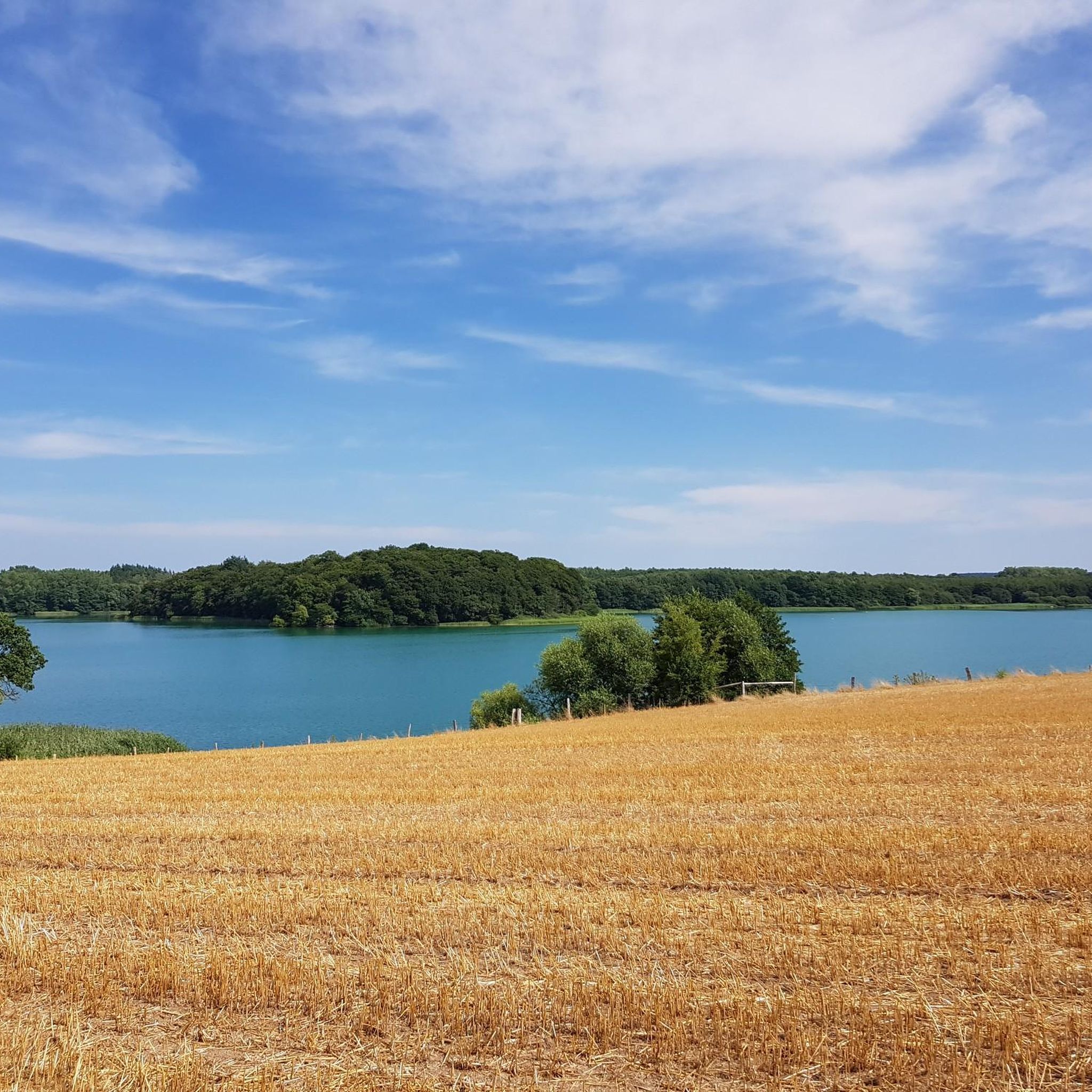
Stamp box no. 5 of the Holsteinische Schweiz hiking pass: Field path at the Schöhsee Plön. Shady, located directly on the lake shore. 54.1670012508051, 10.4355054015999 https://www.holsteinischeschweiz.de/wanderpass/wanderrouten-mit-stempelkaesten
0
0

Discover the Holstein Switzerland and enjoy your hike along the circular routes Kellersee, Plöner Seen and Segeberger Flüsse und Seen. Look out for our 20 stamp boxes and take a short break there. In the stamp boxes you will find a stamp with a motif from the Holstein Switzerland and a number as well as a stamp pad. Press the stamp onto the correspondingly numbered field in your hiking pass and continue to the next stamp box.
7
0
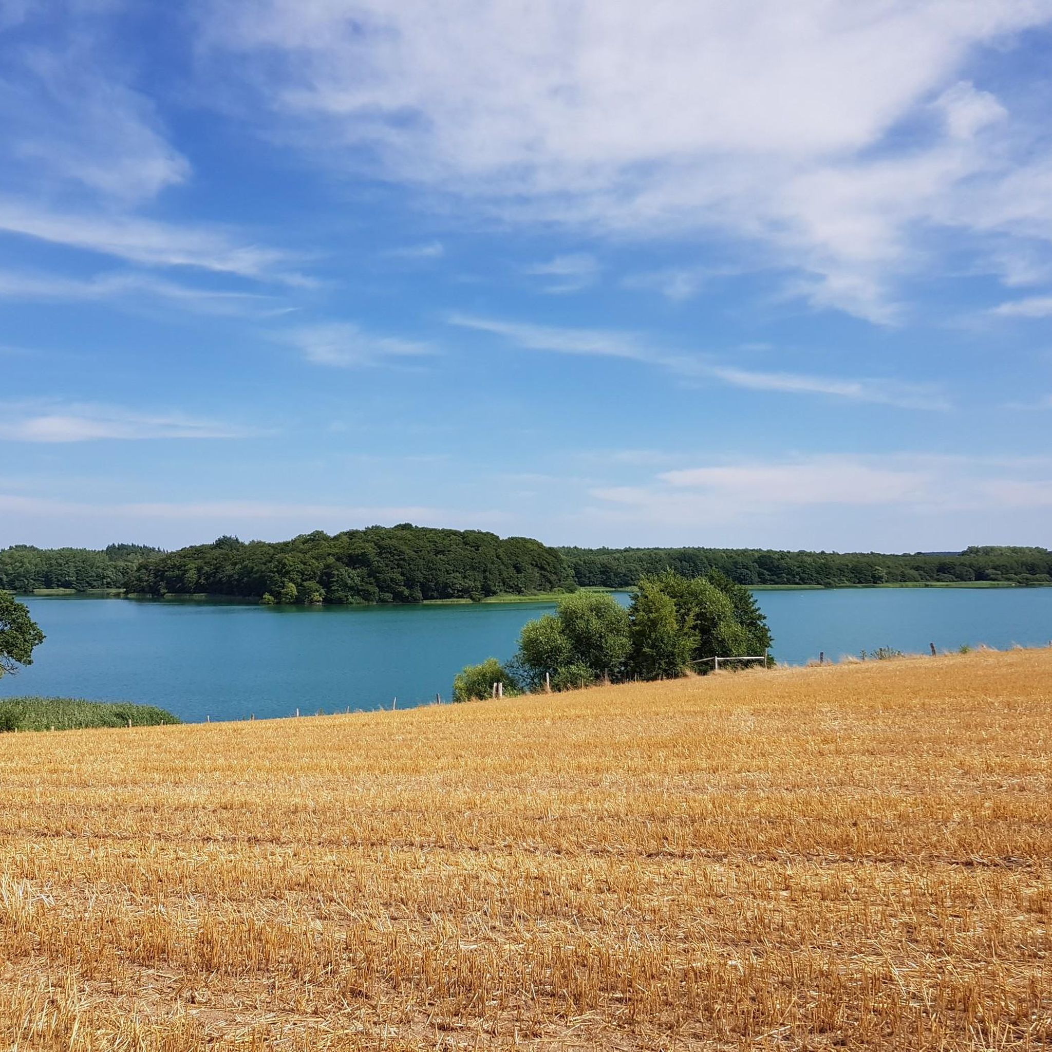
Lake Schluensee has a very irregular shape, running from southwest to northeast. It has a maximum length of approximately 2 km and a maximum width of approximately 600 m, is one of the deepest lakes in Schleswig-Holstein with a depth of approximately 45 m, and covers an area of about 127 hectares.
11
2
A beautiful place with a view of the lake
12
1
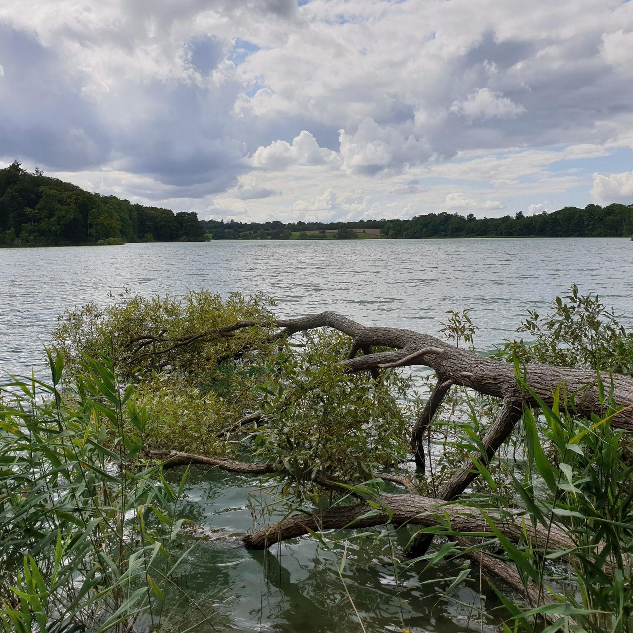
The path leads directly along the lake
12
0

Here are the links... Hiking pass: https://www.holsteinischeschweiz.de/wanderpass The Plöner Seen circuit: https://www.holsteinischeschweiz.de/tour/rundweg-ploener-seen
16
0
Lake Behler is located between the town of Plön and the village of Timmdorf in the heart of Holstein Switzerland. Like many other lakes, it is fed by the Schwentine River and is directly connected to Lake Langensee and Lake Höftsee. It is surrounded by Lake Schöhsee, Lake Schluensee, Lake Dieksee, and Lake Suhrer See. It covers 227 hectares and has a maximum depth of 43 meters. Fishing is currently prohibited in the lake. There is a swimming area on the outskirts of Timmdorf, where the shore is very shallow. There is a lawn at the edge of the forest and a restroom.
18
0
Schluensee Schluensee is located in the municipality of Lebrade, between the towns of Kossau and Grebin, which lie west and east of the lake. It covers 127 hectares and has a maximum depth of 45 meters, making it one of the deepest lakes in Schleswig-Holstein. A small island lies to the southwest of the lake, and the Sophienwarder peninsula extends to the northeast. A bathing area with restrooms is located on the northern shore of the lake. The bathing area can be reached by car via the main road in Görnitz. From there, a narrow path leads directly to the bathing area with a sunbathing lawn. This lake also offers great opportunities for anglers. You can catch eels, perch, bream, pike, tench, zander, carp, and roach here. For further important information and legal regulations regarding this fishing area, as well as for maps, please contact the following contact: Total Gas Station Plön – B430 Lütjenburger Str. 61
15
1
Frequently Asked Questions
How many hiking trails are available around Schluensee?
There are over 560 hiking routes in the Schluensee region, catering to a wide range of preferences. These include easy lakeside strolls, moderate forest paths, and some more challenging trails through varied terrain.
What kind of terrain can I expect on hikes around Schluensee?
The terrain around Schluensee is quite diverse. You'll find paths winding along the crystal-clear lake, through dense Black Forest woodlands, and across a hilly moraine landscape. Some routes feature dramatic gorges and smaller streams, offering varied scenery and experiences.
Are there family-friendly hiking options in Schluensee?
Yes, many trails around Schluensee are suitable for families. The classic Schluensee – Grebiner Mill loop from Grebin is an easy 2.7 km path, often completed in under an hour. The famous Seerundweg (Lake Circuit Trail) also has many sections that are largely flat and well-developed, making them accessible for all ages and even those with baby carriages.
Can I bring my dog on the hiking trails around Schluensee?
Many trails in the Schluensee area are dog-friendly, allowing you to enjoy the natural beauty with your canine companion. It's always a good idea to keep dogs on a leash, especially in nature protection areas or when encountering wildlife, and to check local regulations for specific routes.
Are there any circular hiking routes around Schluensee?
Yes, circular routes are a popular way to explore the region. A notable option is the Schluensee – Lake Behler loop from Grebin, a moderate 12.6 km trail offering views of both Schluensee and Lake Behler. The full Seerundweg around Schluchsee is also a classic circular path.
What are the best viewpoints or natural landmarks to see while hiking?
The region offers magnificent panoramic views. The Schluchseer Jägersteig Premium Trail, for instance, provides stunning vistas of Schluchsee and, on clear days, even glimpses of the Swiss Alps from viewpoints like the Bildstein. You'll also encounter picturesque shorelines, tranquil coves, and dense Black Forest scenery.
What is the best time of year to go hiking in Schluensee?
Schluensee is a great hiking destination year-round. While spring and autumn offer vibrant colors and pleasant temperatures, summer is ideal for combining hikes with swimming in the lake. Even in winter, the snow-covered landscapes provide a mystical calm and unique hiking experience.
Are there any challenging hikes for experienced trekkers?
While many routes are easy to moderate, the region does offer more challenging trails that demand good fitness and sure-footedness. Out of over 560 routes, 30 are classified as difficult, leading through varied terrain including mountains and gorges. These routes often provide a more intense experience of the Black Forest landscape.
How long do hikes typically take around Schluensee?
Hike durations vary significantly. You can find short walks like the Path Toward Kossau – View of Schluensee loop from Kossau, Abzw., which is 3.5 km and takes about 54 minutes. Longer routes, such as the Schluensee – Lake Behler loop from Grebin, can take over three hours, and the full Seerundweg can be an all-day excursion.
What do other hikers say about the trails in Schluensee?
The trails in Schluensee are highly regarded by the komoot community, with an average rating of 4.6 stars from over 7,600 reviews. Hikers often praise the diverse landscapes, the continuous lake views, and the well-maintained paths that cater to various skill levels.
Are there options for public transport or parking near the trailheads?
The region is generally well-equipped for visitors. While specific parking details vary by trailhead, many popular starting points offer parking facilities. For public transport, the Dreiseenbahn train service can be used to shorten sections of the Seerundweg, providing flexibility for hikers.
Can I find gorges or waterfalls on hikes in this area?
Yes, the surroundings of Schluensee feature breathtaking natural formations. You can explore dramatic gorges, such as the famous Wutach Gorge, and discover smaller wild streams and waterfalls. These offer a refreshing experience, especially during warmer days.
Most popular routes around Schluensee

Get inspired with the komoot mobile app


Explore more
Browse the best Hikes in other regions.
