The best road cycling routes around Tapolanjärvi
56
riders
3
rides
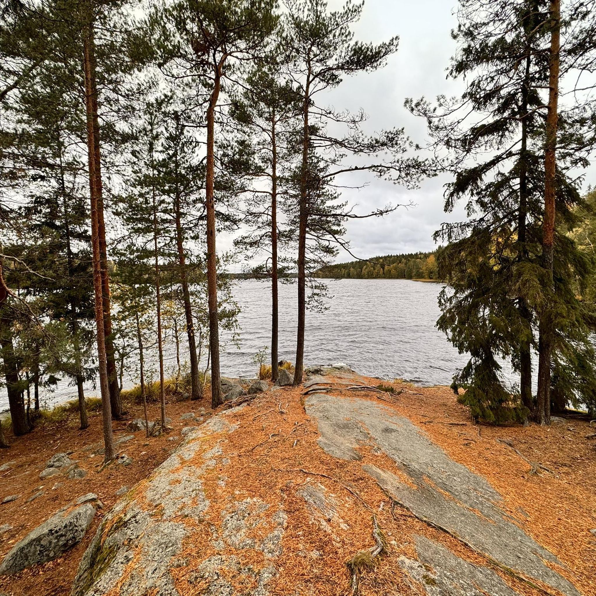
Road cycling around Tapolanjärvi, located within Liesjärvi National Park in Kanta-Häme, Finland, offers routes through classic Finnish lake and woodland scenery. The area features diverse South Finnish forest types and views of Tapolanjärvi, a medium-sized lake with a 12-kilometer shoreline. Cycling routes often traverse moraine-based forest land and include sections along the Kyynäränharju ridge, providing varied terrain. The region provides mostly paved surfaces suitable for road cycling.
Best road cycling routes around Tapolanjärvi
- The most popular road cycling route is…
Last updated: June 29, 2026
23
riders
108km
04:45
570m
570m
Moderate road ride. Good fitness required. Some segments of this route may be unpaved and difficult to ride.
6
riders
83.4km
03:22
500m
500m
Moderate road ride. Good fitness required. Mostly well-paved surfaces and easy to ride.

Sign up for free
4
riders
58.9km
02:22
280m
280m
Moderate road ride. Good fitness required. Mostly well-paved surfaces and easy to ride.
11
riders
81.0km
03:18
450m
450m
Moderate road ride. Good fitness required. Some segments of this route may be unpaved and difficult to ride.
Our route recommendations are based on thousands of hikes, rides, and runs completed by other people on komoot.
Start today with a free account
Your next adventure awaits.
Login or Signup
Popular around Tapolanjärvi
Tips from the Community

not much traffic, gently rolling with flat sections, good asphalt
0
0
gets you to/from the road heading north without having to ride more than a hundred metres or so on the highway, normal roadside path and a quiet village lane with okay asphalt (cracks)
0
0
unusual scenery for this part of the country, for a short while you could even think you were at Punkaharju or Pulkkilanharju
0
0
flat, little traffic across the path, good asphalt, brief glimpses of lake Pyhäjärvi in several places
0
0
not much traffic, rolling hills, several lakes next to the road but well hidden behind trees, asphalt okay (except there are little artificial grooves of 20–25 cm at the edge of the asphalt throughout, seems like a rumble strip trial or something)
0
0
little traffic, flat (on top of the 3rd Salpausselkä terminal moraine, goes around the Räyskälä aerodrome), asphalt old but okay save for a bumpier section next to the lake in the southeastern end
0
0
not too much traffic, gently rolling hills, okay asphalt part of the old highway from Turku to Hämeenlinna (as evidenced by the km-stones) and before that the medieval Tavastian Ox Road (Hämeen härkätie)
0
0
nice views of the lakes in many places (and the cutest little cast concrete bridge), not too much traffic, gently rolling, okay asphalt two sections with bike path towards Tammela (the bike route turns away from the road and partly into gravel for a while, this segment stays on the road)
0
0
Frequently Asked Questions
What kind of terrain can I expect when road cycling around Tapolanjärvi?
The region around Tapolanjärvi, particularly within Liesjärvi National Park, offers diverse South Finnish forest types and moraine-based forest land. You'll find mostly paved surfaces suitable for road cycling, with routes often traversing scenic areas like the Kyynäränharju ridge, providing varied and picturesque landscapes.
Are there any specific landmarks or points of interest to see along the road cycling routes?
Yes, road cycling routes in the area offer views of the tranquil Tapolanjärvi lake itself, and some paths lead to cultural sites like the Korteniemi Heritage Farm, where you can experience life from the 1910s. The notable Kyynäränharju ridge also offers unique geological views.
What are the typical distances and difficulties of road cycling routes in the Tapolanjärvi area?
The routes around Tapolanjärvi are generally moderate in difficulty. For example, the Susikkalantie Road – Lake Kuivajärvi loop from Eerikkilän urheiluopisto is about 108 km, while the Räyskäläntie – Tauluntie Road loop from P4 is around 59 km. These routes offer varying distances to suit different preferences, all on mostly paved surfaces.
Can I bring my dog on the cycling routes in Liesjärvi National Park?
While cycling is permitted on designated roads within Liesjärvi National Park, specific regulations regarding dogs should be checked with the park authorities. Generally, dogs are welcome in Finnish national parks but must be kept on a leash at all times to protect wildlife and ensure the safety of other visitors.
Are there any facilities like cafes or accommodation near the road cycling routes?
The region offers amenities, with places like Eerikkilän urheiluopisto providing facilities. While specific cafes directly on every route might vary, the area is part of a broader network, and you can find services in nearby villages or recreation areas like Ruostejärvi, known for its clear waters.
Where can I park my car when starting a road cycling tour around Tapolanjärvi?
Parking for cyclists is available at various points around Liesjärvi National Park and the wider Tapolanjärvi area. For instance, the Räyskäläntie – Tauluntie Road loop starts from P4, indicating designated parking areas are available to access the routes.
What is the best time of year for road cycling in the Tapolanjärvi region?
The best time for road cycling in the Tapolanjärvi region is typically during the warmer months, from late spring to early autumn (May to September). During this period, the weather is generally mild, and the roads are clear of snow and ice, allowing for comfortable riding conditions amidst the classic Finnish lake and woodland scenery.
Are there any national cycling routes that pass through or near Tapolanjärvi?
Yes, Liesjärvi National Park, which encompasses parts of Tapolanjärvi, is integrated into broader national cycling routes. These include sections of 'Häme by Cycle,' with routes like Ukon taival (140 km) and Viikingin kierros (560 km), indicating a well-established network for cyclists.
Are there any easy road cycling routes suitable for beginners or families?
While all routes listed are moderate, the region offers mostly paved surfaces, making it accessible. The presence of specific cycle paths, such as one leading from the former Häme Centre to Korteniemi Heritage Farm, suggests that easier sections or shorter rides can be found for those seeking a less challenging experience.
What do other road cyclists say about the routes around Tapolanjärvi?
More than 50 road cyclists have used komoot to explore Tapolanjärvi's varied terrain. They often praise the extensive views of the surrounding lake district and the characteristic Finnish forest landscape encountered on routes like the Sukulantie Road – Lake Kuivajärvi loop from Salibandyhalli.
Can I reach the Tapolanjärvi cycling areas using public transport?
While the region is known for its natural beauty, public transport options directly to specific trailheads within Liesjärvi National Park or around Tapolanjärvi might be limited. It's advisable to check local bus schedules or consider combining public transport with a short taxi ride to reach your starting point.
Are there any permits required for road cycling in Liesjärvi National Park?
Generally, cycling is permitted on designated roads within Finnish national parks without a specific permit. However, it's always good practice to check the official website of Liesjärvi National Park for any specific or updated regulations regarding cycling or access.

Get inspired with the komoot mobile app


Explore more
Browse the best Road cycling routes in other regions.
