The best walks and hikes in Molas Pass Wsa Wilderness Study Area
5.0
(4)
140
hikers
21
hikes
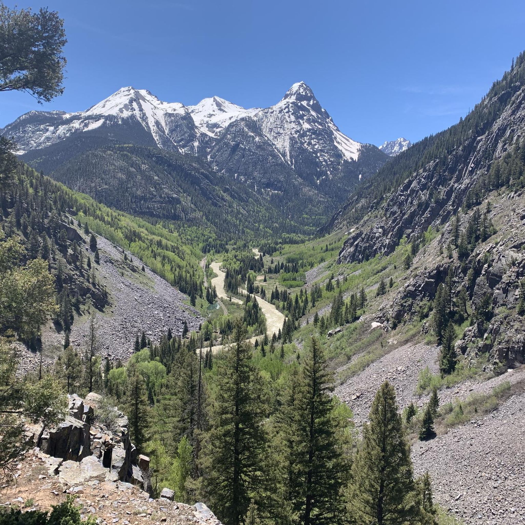
Hiking in Molas Pass Wsa Wilderness Study Area offers access to the San Juan Mountains, characterized by high alpine terrain, diverse geology, and panoramic vistas. The region features alpine meadows, picturesque lakes like Molas Lake and Little Molas Lake, and historic mining traces. These physical features provide varied landscapes for outdoor exploration.
Best hiking trails in Molas Pass Wsa Wilderness Study Area
- The most popular hiking route is Animas River & Molas Lake — Silverton, an 8.0 miles (12.9 km) trail that takes 4 hours 13 minutes to complete. This moderate route offers a wilderness descent through wildflower meadows.
- Another top favourite among local hikers is Crater Lake Trail, a difficult 11.1 miles (17.9 km) path. This trail leads through diverse terrain to Crater Lake, culminating in ridge views.
- Local hikers also love the Little Molas Lake to Lime Creek — Silverton, a 10.3 miles (16.6 km) trail leading through mountainous landscapes, often completed in about 4 hours 48 minutes.
- Hiking in Molas Pass Wsa Wilderness Study Area is defined by San Juan Mountain views, alpine meadows, and high-altitude lakes. The network offers options for different ability levels, from easy loops to challenging mountain ascents.
- The routes in Molas Pass Wsa Wilderness Study Area are highly rated by the komoot community with an average score of 5.0 stars from over 5 reviews. More than 98 hikers have used komoot to explore Molas Pass Wsa Wilderness Study Area's varied terrain.
Last updated: October 12, 2026
17
hikers
33.0km
11:48
1,000m
950m
Colorado Trail: Segment 25 offers an incredible high-alpine experience, guiding you through vast meadows and rolling tundra with constant 360-degree views of jagged mountains and distant peaks like Engineer Mountain. This difficult 20.5-mile (33.0 km) hike, with 3287 feet (1002 metres) of elevation gain, is a long day out, typically requiring 11 hours and 48 minutes, but the visual rewards are immense.
For planning your visit, aim for July or August to experience the best conditions, as much of the trail is above 11,000 feet. The route is accessible from Molas Pass, and while some sections have gentle switchbacks, the overall elevation and length make it a demanding trek. Be prepared for a full day on the trail and carry adequate supplies.
This segment is renowned for its exceptional scenic beauty, often cited as one of the most visually rewarding sections of the entire Colorado Trail. You'll encounter clear, cold creeks and waterfalls, and the area around Molas Pass is particularly celebrated for its expansive vistas. It's a prime example of the San Juan Mountains' dramatic landscape.
5.0
(1)
13
hikers
15.5km
06:20
1,020m
570m
Hike the difficult 9.6-mile Vestal Basin via Colorado and Elk Creek Trail for stunning views and a challenging climb in San Juan National Fo

14
hikers
6.67km
02:28
240m
160m
Hike the Colorado Trail - Twin Sisters Trail, a moderate 4.1-mile route in San Juan National Forest with 779 feet of elevation gain.
2
hikers
5.01km
03:07
680m
10m
Tackling Snowdon Peak is a proper mountain adventure, offering a taste of Wales' highest summit. The trail itself is a journey through changing landscapes, from the serene beauty around Andrews Lake to the increasingly rugged and rocky terrain as you gain elevation. Expect to navigate uneven ground and loose stones, with the reward of truly panoramic views from the top, stretching across Snowdonia National Park and beyond.
This is a difficult 3.1-mile (5.0 km) hike with a substantial 2217 feet (676 metres) of elevation gain, typically taking around 3 hours and 6 minutes. Given the challenging nature and the potential for rapid weather changes, always check conditions before heading out. An early start is recommended to secure parking and allow ample time for the ascent and descent.
Snowdon Peak, known as Yr Wyddfa in Welsh, holds the distinction of being the highest mountain in Wales, standing at 1,085 meters (3,560 feet). Its dramatic scenery and varied routes have even served as a training ground for legendary mountaineers like Edmund Hillary. The mountain is also a national nature reserve, home to rare flora and fauna, adding to its natural significance.
1
hikers
4.85km
01:37
40m
160m
The Little Molas and Molas Lakes trail offers a quintessential high-alpine experience, immersing you in vast meadows and fragrant spruce-fir forests. You'll be treated to panoramic views of the San Juan Mountains, with peaks like Engineer Mountain, Grand Turk, and Sultan Mountain dominating the skyline. Keep an eye out for vibrant wildflowers like Mountain Gentian and Fireweed, and you might even spot deer or elk grazing near the pristine waters of Little Molas Lake and Molas Lake.
This moderate hiking loop covers 3.0 miles (4.9 km) with a gentle 146 feet (44 metres) of elevation gain, typically taking around 1 hour and 37 minutes to complete. Located at approximately 11,000 feet, it's an accessible way to experience the high country, though you should always be mindful of the altitude. The trail is well-suited for a wide range of fitness levels, making it a popular choice for families and casual hikers.
Little Molas Lake is a significant access point for the epic Colorado Trail, specifically Segment 24, offering opportunities for longer adventures if you choose. Beyond hiking, the area around Molas Pass is a hub for diverse activities, including camping, fishing, kayaking, and even snowshoeing in winter. The scenic overlooks from Molas Pass itself provide breathtaking vistas, making it a notable destination near Silverton, Colorado.
1.64km
00:33
130m
0m
Embark on an easy hike up Sultan Peak, a short but rewarding route in the San Juan National Forest. This trail covers 1.0 miles (1.6 km) and involves a gentle climb of 441 feet (134 metres), taking approximately 32 minutes to complete. As you ascend, you will experience lush wildflower biozones and alpine tundra, leading to impressive 360-degree panoramic views of the surrounding San Juan Mountains. From higher points, you can spot Silverton and Kendall Mountain, along with a vast 'sea of peaks' that includes Engineer Mountain. It is a perfect way to quickly immerse yourself in the Colorado mountains and enjoy expansive vistas.
Before heading out to Sultan Peak, it is wise to check current local conditions, especially regarding snow or adverse weather, to ensure a pleasant hiking experience. The trail is generally accessible, and you will typically find parking available at the various trailheads within the San Juan National Forest. Planning your visit during the best season for hiking will help you avoid any unexpected challenges. Always be prepared for mountain weather changes, even on shorter excursions.
Sultan Peak is known for its unique position that offers a full circle of views, making it a standout in the region for its scenic payoff. The trail provides a quick escape into the high country, allowing you to witness the diverse ecosystems from wildflower meadows to alpine environments. It serves as an excellent introduction to the grandeur of the San Juan Mountains without requiring a full day's commitment, making it ideal for those with limited time or seeking a lighter adventure.
5.0
(1)
26
hikers
13.0km
04:13
590m
590m
Hike the Colorado Trail from Molas Pass to the Animas River, a moderate 8.0-mile route with stunning San Juan Mountain views.
5.0
(1)
19
hikers
17.9km
06:35
530m
530m
The Crater Lake Trail offers a quintessential Colorado alpine adventure, leading you through varied terrain to a spectacular high-mountain lake. You'll traverse through forests that gradually give way to more open, rugged landscapes, with the pristine Andrews Lake providing a scenic stop along the way. The ultimate reward is the stunning Crater Lake itself, nestled within the vast Weminuche Wilderness, making the effort well worth it for its breathtaking views.
Planning your visit means preparing for a full day on the trail. This difficult hiking route covers 11.1 miles (17.9 km) with a substantial 1749 feet (533 metres) of elevation gain, typically taking around 6 hours and 35 minutes. It's best tackled from late spring to early fall when snow has melted, and arriving early at the trailhead is advisable to secure parking, especially on weekends.
This particular Crater Lake Trail is situated in San Juan County, Colorado, offering a challenging yet incredibly rewarding experience for hikers. It's a prime example of the rugged beauty found in the San Juan Mountains, providing a deep dive into the wilderness away from more crowded spots. The trail's difficulty and length make it an excellent choice for those looking to push their limits and immerse themselves in the high-country environment.
10
hikers
16.6km
04:48
430m
430m
Hike the moderate Colorado Trail - Twin Sisters Trail, a 10.3-mile route with 1401 feet of gain in the San Juan National Forest.
5.0
(1)
6
hikers
9.85km
05:17
640m
640m
The Snowdon Peak from Andrews Lake route offers a diverse hiking experience, starting with a scenic walk around the popular Andrews Lake before ascending into the rugged Weminuche Wilderness. This difficult 6.1-mile (9.9 km) trail, gaining 2113 feet (644 metres) over an estimated 5 hours and 17 minutes, transitions from well-maintained paths through meadows and forests to a demanding summit push involving Class 3 scrambling on rock and tundra. You'll encounter stunning views of the San Juan Mountains, including Twin Sisters and Engineer Mountain, with the highlight being the dedicated viewpoint overlooking Snowdon Peak itself.
To make the most of your visit, plan to arrive early at the Andrews Lake trailhead, especially during peak season. Be aware that the higher altitude, starting at 10,750 feet, necessitates acclimatization for many hikers. While the initial section is family-friendly, the full ascent to Snowdon Peak is recommended only for experienced mountaineers due to challenging terrain and route finding. The wildflower season offers a particularly vibrant display in the meadows, but be prepared for potentially marshy conditions in some areas.
This trail is notable for its access to a "thirteener" (a peak over 13,000 feet) and its status as a gateway to the expansive Weminuche Wilderness. The initial section provides a great option for those seeking a shorter, scenic walk along the Million Dollar Highway, while the full summit offers a rewarding challenge for seasoned adventurers. Keep an eye out for diverse plant life, including beautiful columbine, and consider the northeast ridge route for a particularly fun and engaging ascent.
Get access to more routes and recommendations from other explorers.
Already have an account?
Our route recommendations are based on thousands of hikes, rides, and runs completed by other people on komoot.
Start today with a free account
Your next adventure awaits.
Popular around Molas Pass Wsa Wilderness Study Area
Tips from the Community

Lime Creek is the last decent and reliable water source if you hike the Colorado Trail southbound. There is a nicely shaded spot to take a break and filter the water. Campspots are not too easy to find here though.
1
0

Take a good look at Engineer Mountain, with its peak resembling a volcanic plug from a massive eruption 25–30 million years ago, sitting above a broad base. From the south, it looks like a balanced pyramid.
0
0
Celebration Lake is home to tons of axolotls! They are most active in the afternoon when the water is warmer. The lake is accessible by car, so you might have to share this spot with car campers. But no worries, there are plenty of options to pitch your tent.
1
0
The Colorado Trail is the only long-distance trail to let you stop a train in the middle of the wilderness. Take the short spur trail to Elk Park where you can flag down the train to take you into Silverton. The usual rate is 35 Dollars, but it is up to the conductor to charge less or even nothing.
0
0
Segment 25 of the Colorado Trail leads into the stunning, colorful San Juan Mountains and takes you along small lakes and to bubbling creeks and rushing rivers. The ascents and descents are not as steep as further north (east) along the trail.
1
0
Molas Pass sits a few yards below where the Colorado Trail passes the US 550 highway. Walk south 250 feet to the spur trail to the parking area and find Molas Overlook, a pit toilet, and parking at an elevation of 10,910 feet.
0
0

Mid-August the meadows and trail sides were a-bloom with Mountain Gentian, Fringed Gentian, and Agueweed (a species of dwarf gentian. Fireweed, lilac Fleabane, white Achillea were also in bloom. Views to the west include Engineer Mountain, Grand Turk, Bear Mountain, Sultan Mountain and more. Beautiful!
0
0

Little Molas Lake is a high-altitude body of water at about 11,000 feet. It is located nearby parking lots and provides easy access to the Colorado Trail. It is the ideal place to enjoy a packed lunch before or after your ride.
0
0
Frequently Asked Questions
How many hiking trails are available in Molas Pass Wsa Wilderness Study Area?
There are 14 hiking trails available in the Molas Pass Wsa Wilderness Study Area. These routes offer a variety of experiences, from easy strolls to challenging mountain ascents, all set against the backdrop of the San Juan Mountains.
Are there easy hiking options suitable for beginners or families in Molas Pass Wsa Wilderness Study Area?
Yes, there are accessible options. The Andrews Lake loop is an easy trail, perfect for a relaxed outing. Additionally, the Molas Pass Overlook offers a universally accessible walk with panoramic mountain views. The Animas River & Molas Lake — Silverton trail is also considered moderate but offers a gentle wilderness descent through wildflower meadows, suitable for various fitness levels.
What are some challenging hikes for experienced trekkers in the area?
For experienced hikers seeking a challenge, the Crater Lake Trail is a difficult 17.9 km adventure leading to Crater Lake with spectacular ridge views. Other demanding options include Vestal Basin via Colorado & Elk Creek Trail — Silverton and Whitehead Trail #674 — Silverton, both offering significant elevation gain and distance.
Are there any loop trails in Molas Pass Wsa Wilderness Study Area?
Yes, the Andrews Lake loop — San Juan National Forest is an easy circular route. While many trails are out-and-back, the area's extensive network, including sections of the Colorado Trail, allows for varied exploration and can be combined for longer, custom loop experiences.
What natural features or landmarks can I expect to see while hiking?
Hikers will encounter stunning natural beauty, including panoramic views of the San Juan Mountains, vibrant alpine meadows, and picturesque high-altitude lakes like Molas Lake and Little Molas Lake. The area also features diverse geology with visible rock layers and historic mining traces, such as those found along the Rainbow Trail — Silverton.
What is the best time of year to hike in Molas Pass Wsa Wilderness Study Area?
The best time to hike is typically during the warmer months when alpine meadows are in full bloom with wildflowers. However, the area is also popular for snowshoeing in winter, offering a different kind of outdoor experience. Always check local conditions before heading out, especially at higher elevations.
Are there opportunities for camping near the hiking trails?
Yes, camping is available near Molas Lake and Little Molas Lake. These sites provide convenient bases for multi-day hiking trips, allowing you to fully immerse yourself in the natural surroundings of the Molas Pass WSA.
What do other hikers enjoy most about the trails in Molas Pass Wsa Wilderness Study Area?
The area is highly rated by the komoot community, with an average score of 5.0 stars. Reviewers often praise the breathtaking San Juan Mountain views, the beauty of the alpine meadows, and the serene high-altitude lakes. The diverse terrain offers something for every ability level, making it a favorite among outdoor enthusiasts.
Can I bring my dog on the hiking trails?
While specific regulations for dogs can vary, the Molas Pass WSA is generally within the San Juan National Forest, which typically allows dogs on trails, often requiring them to be on a leash. It's always best to check the specific rules for the trail you plan to hike to ensure a pleasant experience for everyone.
Are there any trails that are part of the larger Colorado Trail system?
Yes, a significant portion of the high-country Colorado Trail system runs directly through Molas Pass. This offers extensive hiking opportunities with panoramic San Juan Mountain views and connects to various other trails within the area, such as the Vestal Basin via Colorado & Elk Creek Trail — Silverton.
Are there any trails with historical significance or unique geological features?
The Rainbow Trail — Silverton is a historic mining trail that showcases colorful mineral deposits and offers views of a large shrine overlooking Silverton. The entire area around Molas Pass is also known for its incredible geology, with visible layers in the mountains that tell a story of ancient formations and weathering.
Most popular routes in Molas Pass Wsa Wilderness Study Area

Get inspired with the komoot mobile app


Explore more
Browse the best Hikes in other regions.
