The best road cycling routes in Rattlesnake National Recreation Area
4.8
(9)
301
riders
18
rides
Road cycling in Rattlesnake National Recreation Area offers routes that lead to and around a landscape shaped by glaciated topography, featuring a U-shaped basin fed by numerous creeks and high mountain lakes. The area transitions from dense sub-alpine fir, lodgepole pine, and spruce forests to open Douglas fir and ponderosa pine parklands at lower elevations. While paved road cycling opportunities are limited within the recreation area's wilderness boundary, the Rattlesnake Greenway provides a paved path leading towards the area, and…
Last updated: October 12, 2026
4.5
(4)
36
riders
41.6km
02:05
120m
120m
Cycle the moderate Bitterroot Trail, a 25.9-mile paved route through Montana's scenic Bitterroot Valley with mountain and river views.
29
riders
34.5km
01:57
420m
420m
The East Missoula loop is a moderate 21.4-mile road cycling route with 1393 feet of elevation gain, offering scenic views of Missoula.

15
riders
50.9km
02:08
190m
190m
The Missoula/Clark Fork River loop offers road cyclists a scenic journey through urban landscapes and natural riverine beauty. You'll follow the Clark Fork River, enjoying picturesque views of the water…
5.0
(1)
11
riders
155km
07:48
370m
370m
Imagine cycling through a vast Montana valley, with the imposing Bitterroot Mountains rising to your west and the gentler Sapphire Mountains to your east. The Bitterroot Trail offers this experience,…
16
riders
37.2km
01:44
190m
190m
Easy road ride. Great for any fitness level. Mostly well-paved surfaces and easy to ride.
12
riders
32.3km
01:32
270m
270m
Easy road ride. Great for any fitness level. Mostly well-paved surfaces and easy to ride.
9
riders
30.9km
01:19
120m
120m
Easy road ride. Great for any fitness level. Mostly well-paved surfaces and easy to ride.
11
riders
40.7km
01:45
260m
260m
Easy road ride. Great for any fitness level. Mostly well-paved surfaces and easy to ride.
7
riders
24.0km
01:06
120m
120m
Moderate road ride. Great for any fitness level. Some segments of this route may be unpaved and difficult to ride.
7
riders
24.6km
01:32
220m
220m
Moderate road ride. Great for any fitness level. Some segments of this route may be unpaved and difficult to ride.
Get access to more routes and recommendations from other explorers.
Already have an account?
Our route recommendations are based on thousands of hikes, rides, and runs completed by other people on komoot.
Start today with a free account
Your next adventure awaits.
Popular around Rattlesnake National Recreation Area


Tips from the Community

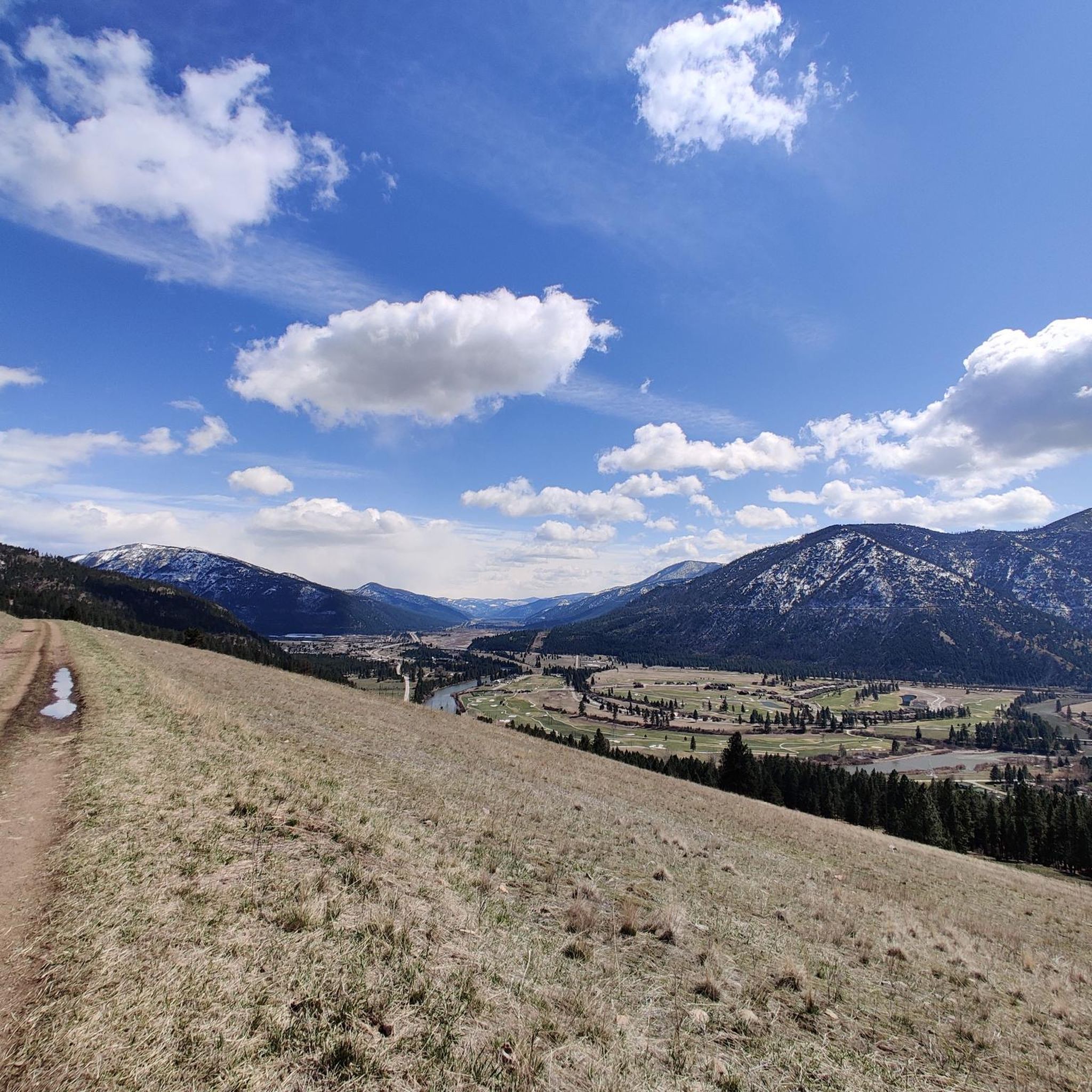
Stretching for more than 50 miles between Hamilton and Missoula, the paved Bitterroot Trail offers a flat, traffic-free corridor through the heart of the valley. Riders enjoy wide-open views of the Bitterroot Mountains to the west and the Sapphire Range to the east, with small towns, cafes, and services dotted along the way. As the route leads into Missoula, the trail provides a welcoming and scenic approach; heading south, it eases you gently back into rural landscapes.
0
0

The Beartracks Bridge is a four-lane bridge over the Clark Fork River in downtown Missoula. It was constructed in 1962 and recently renovated to improve pedestrian safety. The bridge now has dedicated bike lanes and widened sidewalks.
0
0

Jacob's Island is a dog park on the banks of Clark Fork River. The park is 6-acres and the river works as a beautiful natural barrier for the dogs. It also offers a series of paved and unpaved trails, benches, picnic tables and dog-waste bags.
0
0
Jacob's Island is a dog park on the banks of Clark Fork River. The park is 6 acres and the river works as a beautiful natural barrier for the dogs. It also offers a series of paved and unpaved trails, benches, picnic tables and dog-waste bags.
0
0
The Clark Fork River is one of the longest stretches of water in Montana. Along with its tributaries, they are some of the most popular fly fishing destinations in the United States.
1
0

Nestled in the northern Rockies, the city is known as the "Garden City" for its lush surroundings as well as trout fishing. The city is home to the University of Montana, founded in 1893.
0
0

The completely paved Bitterroot Trail totals over 50 miles through the state of Montana. This particular section is sandwiched between the freeway and the Bitterroot River. There are some great lookouts over the river as the trail winds its way towards Lolo.
0
0
McCormic Park marks the western terminus of the Kim Williams Trail and the eastern terminus of the Milwaukee Trail. The park has some playing fields, open space, picnic areas, and is nestled up right next to the river.
0
0
Frequently Asked Questions
How many road cycling routes are available in Rattlesnake National Recreation Area?
There are 20 road cycling routes available in and around the Rattlesnake National Recreation Area. These routes cater to various skill levels, with 7 easy, 12 moderate, and 1 difficult option.
What kind of terrain and difficulty can I expect on road cycling routes in the Rattlesnake National Recreation Area?
Road cycling in this region offers a mix of terrain, from paved paths like the Rattlesnake Greenway to roads leading into the recreation area. The landscape is characterized by glaciated topography, dense forests, and river valleys. Routes vary in difficulty, with options ranging from easy, gentle grades to more challenging paths with significant elevation gains, such as the East Missoula loop which features varied terrain and elevation.
Are there family-friendly road cycling options in the Rattlesnake National Recreation Area?
Yes, the area offers family-friendly options, particularly the paved Rattlesnake Greenway, which provides a scenic and accessible ride. Additionally, some of the easier routes, like the Jacob's Island loop from Missoula, are suitable for families looking for less challenging rides.
Can I bring my dog on road cycling routes in the Rattlesnake National Recreation Area?
While the Rattlesnake National Recreation Area is generally dog-friendly on trails (typically requiring leashes), specific regulations for road cycling routes can vary. Paved paths like the Rattlesnake Greenway are often suitable for cycling with leashed dogs. Always check local signage for specific rules regarding pets on trails and roads.
What are some notable landmarks or viewpoints along the road cycling routes?
While dedicated road cycling routes primarily lead to the area, you can find scenic viewpoints and natural features. The region offers vistas of the Missoula Valley and surrounding mountain ranges. Highlights within the broader recreation area include Snowbowl Overlook and various points offering a View of Rattlesnake National Recreation Area itself. The routes often follow river valleys, providing picturesque natural beauty.
What is the best time of year for road cycling in the Rattlesnake National Recreation Area?
The best time for road cycling is typically from spring through fall when the weather is mild and roads are clear of snow. While the area is accessible for winter sports like cross-country skiing, road cycling opportunities are limited during snowy conditions. Always check local weather forecasts before heading out.
Are there any loop road cycling routes in the area?
Yes, there are several loop routes available for road cyclists. A popular option is the Missoula/Clark Fork River loop, which takes you through the scenic Clark Fork River valley. Another well-liked choice is the East Missoula loop, offering varied terrain.
Where can I park when road cycling in the Rattlesnake National Recreation Area?
Parking is generally available at trailheads and access points leading into the recreation area. For routes like the Rattlesnake Greenway, you can often find parking in Missoula that provides access to the path. When cycling on Rattlesnake Drive, be aware that it leads to the main trailhead and can have mixed traffic, so plan your parking accordingly.
Is public transport available to access road cycling routes?
Public transportation options to directly access the Rattlesnake National Recreation Area for road cycling may be limited. However, Missoula, which is adjacent to the area and serves as a starting point for many routes like the Rattlesnake Greenway, has public transport services. You may need to cycle from a public transport stop to reach your desired route.
What do other road cyclists enjoy most about road cycling in Rattlesnake National Recreation Area?
The road cycling routes in and around the Rattlesnake National Recreation Area are highly rated by the komoot community, with an average score of 4.8 stars from 8 reviews. Cyclists often praise the scenic views of the Missoula Valley and surrounding mountain ranges, as well as the diverse terrain that offers options for various skill levels.
Are there cafes or accommodation options near the road cycling routes?
The Rattlesnake National Recreation Area is located just north of Missoula, Montana. This means that while the recreation area itself is wilderness, you'll find a wide array of cafes, restaurants, and accommodation options in Missoula, which serves as a convenient base for exploring the cycling routes.
What kind of wildlife might I encounter while road cycling?
The Rattlesnake National Recreation Area is home to diverse wildlife. While road cycling, especially on routes leading into the more natural areas, you might have the opportunity to observe deer, elk, beaver, and various bird species. Mountain goats are also present in higher elevations. Remember to maintain a respectful distance from all wildlife.
Most popular routes in Rattlesnake National Recreation Area
Most popular attractions in Rattlesnake National Recreation Area

Get inspired with the komoot mobile app


Explore more
Browse the best Road cycling routes in other regions.
