The best walks and hikes in Berryessa Snow Mountain National Monument
5.0
(9)
219
hikers
23
hikes
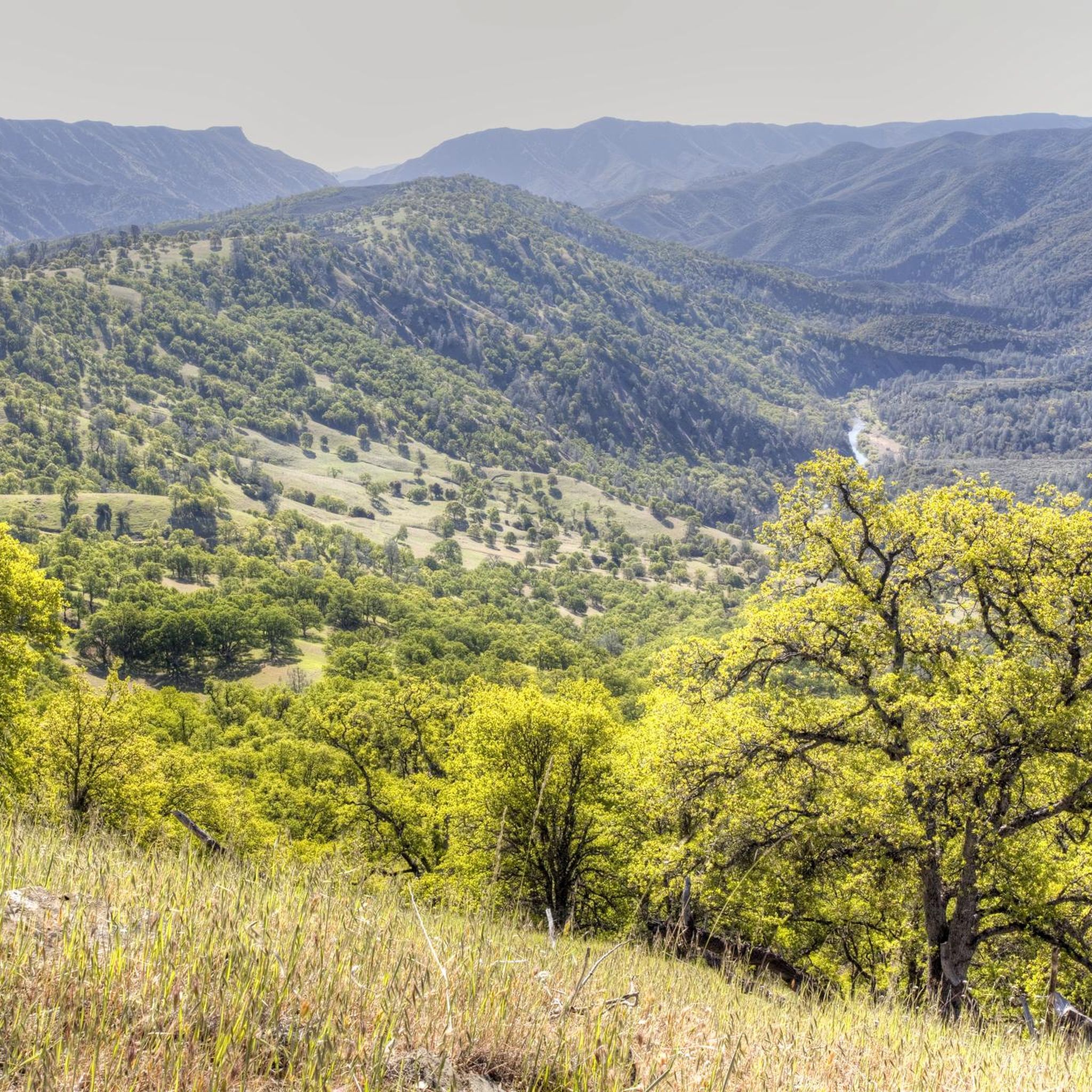
Hiking in Berryessa Snow Mountain National Monument offers diverse landscapes, spanning from near sea level to 7,000 feet. The region is characterized by rugged terrain, including rolling oak woodlands, steep creek canyons, and high-elevation wilderness routes. It encompasses areas like the Snow Mountain Wilderness and Cache Creek Wilderness, providing varied natural features for exploration. The southern portion of the monument borders Lake Berryessa, adding further recreational opportunities.
Best hiking trails in Berryessa Snow Mountain National Monument
- The most popular hiking…
Last updated: July 7, 2026
2.36km
00:44
130m
10m
The Redbud Trail in California's Cache Creek Wilderness is a fantastic option for a relatively short but incredibly scenic hike. This easy 1.5-mile (2.4 km) route takes you through beautiful…
6.75km
02:44
560m
220m
Hike the moderate 4.2-mile Homestead and Blue Ridge Loop in Stebbins Cold Canyon Reserve, offering panoramic views of Lake Berryessa.

Sign up for free
6.42km
01:39
30m
30m
The Anderson Flats and Ridge Trail Loop offers a delightful journey through the varied landscapes of Anderson Marsh State Historic Park. You'll wander through marshlands teeming with birdlife, cross open…
5.0
(1)
93
hikers
7.90km
03:13
370m
370m
Hike the moderate Blue Ridge and Homestead Loop Trail for 4.9 miles with 1214 feet of gain, offering panoramic views of Lake Berryessa.
2
hikers
4.24km
01:05
20m
20m
The Anderson Flats and Ridge Trail Loop offers a delightful and accessible journey through the varied landscapes of Anderson Marsh State Historic Park in Lake County, California. You'll experience a…
1
hikers
6.36km
01:50
160m
160m
If you're seeking an easy hike with big scenic payoffs, the Redbud Loop delivers a delightful journey through the Cache Creek Wilderness. This 4.0-mile (6.4 km) route, with its 511…
20.7km
06:25
750m
750m
Embark on the Brushy Sky High Trail, a difficult hiking route spanning 12.9 miles (20.7 km) with a significant elevation gain of 2451 feet (747 metres). This challenging journey typically…
10.8km
02:47
50m
50m
Embark on the Clear Lake via the McVicar Trail, a moderate hike spanning 6.7 miles (10.8 km) with a gentle elevation gain of 172 feet (52 metres). You can expect…
2.36km
00:36
10m
10m
The Cache Creek Nature Trail is a wonderfully accessible hike, offering a tranquil journey through a surprisingly varied landscape. You'll stroll through shaded riparian forests, open grasslands, and past a…
18.9km
05:27
490m
490m
Hike the difficult 11.7-mile Walker Ridge Trail in Berryessa Snow Mountain National Monument, gaining 1598 feet with diverse views.
Get access to more routes and recommendations from other explorers.
Sign up for free
Already have an account?
Our route recommendations are based on thousands of hikes, rides, and runs completed by other people on komoot.
Start today with a free account
Your next adventure awaits.
Login or Signup
Popular around Berryessa Snow Mountain National Monument

Tips from the Community

With its majestic landscapes, diverse wildlife, and a history spanning 14,000 years, Anderson Marsh State Historic Park is the home of the Koi people who were the first humans to colonize the area and who are still there to this day. Their deep cultural heritage prompted the struggles to protect the amazing resources that the park holds. Native inhabitants were pushed out particularly from the 1850s. The Grigsby brothers built a farm here in the mid 1850s. It was purchased by Scottish immigrant Anderson in 1885 whose descendants sold it in the 1960s to become a state park. https://www.parks.ca.gov/?page_id=483 Guides can point out petroglyphs along Mash Trail. To arrange Anderson Marsh Interpretive Association (AMIA) monthly nature walks and ranch tours, visit www.andersonmarsh.org
0
0

This short trail goes out to where Cache Creek meets Clear Lake. It's flat and easy, so it makes a good option for those with kids. It can stay wet long after rain though so be sure to bring proper footwear.
0
0
The McVicar Trail takes you through the marshes the park is named for, and provides great opportunities to spot wildlife. However, these same marshes can remain flooded or muddy long after the last rain, so if you plan on hiking this trail be sure to wear appropriate footwear.
0
0
Clear Lake is the largest natural, freshwater lake in California, and at over 500,000 years old it is also the oldest lake in North America. The lake is a popular destination for outdoor enthusiasts of all kinds. Around the lake a number of parks, marinas, and boat ramps provide access to the water for swimming, fishing, boating, paddleboarding and more. There are also miles of trails on the surrounding hills that provide excellent views across the water.
0
0
At just under 3,200 feet, Brushy Sky High is the tallest peak within the Cache Creek Wilderness. The trail to the summit is a gradual climb up a ridge that gives you excellent views over the surrounding hills. Keep in mind that this trail isn't very busy so you'll likely see few, if any, other hikers and some spots can get overgrown at times.
0
0
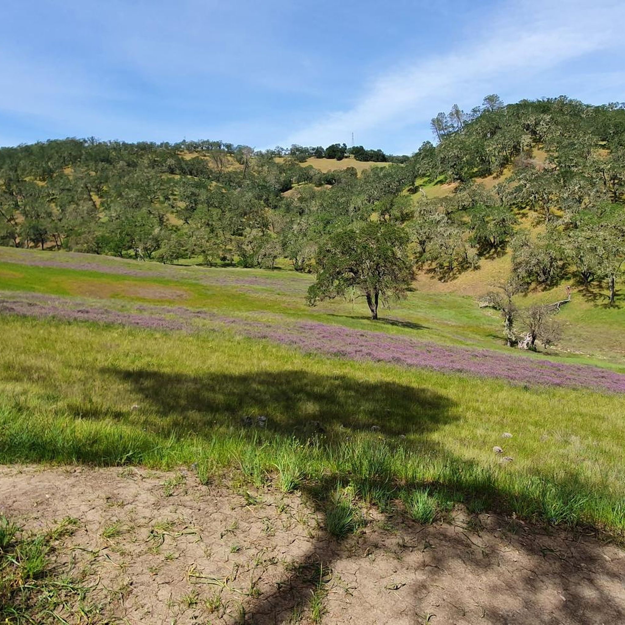
This trail winds through the hills of the Cache Creek Wilderness and provides great opportunities to spot wildflowers and birds of prey. Be sure to check yourself and any four legged companions after the hike as there are ticks in the area.
0
0

Stebbins Cold Canyon Reserve is beautiful. Nestled in a steep, north-facing canyon of the northern Coast Range, it showcases a range of undisturbed habitats with year-round springs providing crucial watering areas for a wide variety of wildlife, including deer, mountain lion and bear. Dogs are not allowed in the reserve, so you'll need to leave your pup home to enjoy exploring this stunning area.
0
0

Sitting at 3,587 feet, Cold Spring Mountain is the highest point on Walker Ridge Road. The geographical peak can be obtained by straying off the road on a spur trail lasting about 100 feet, but the views from the road summit are much the same.
0
0
Frequently Asked Questions
What types of landscapes can I expect to see while hiking in Berryessa Snow Mountain National Monument?
The monument offers a diverse range of landscapes, from rolling oak woodlands and steep creek canyons to high-elevation wilderness routes. You'll find dramatic topography with breathtaking scenic vistas across the Inner Coast Range, including areas with unique serpentine soils. The southern part of the monument also borders Lake Berryessa.
Are there hiking trails suitable for beginners or families with children?
Yes, Berryessa Snow Mountain National Monument has several easy trails perfect for beginners or families. For example, the Anderson Marsh State Historic Park loop is a 2.6-mile (4.2 km) trail through marshland and oak woodlands. Another easy option is the Cache Creek Wilderness loop via the Redbud Trail, which is 4.0 miles (6.4 km) and offers expansive views.
What are some longer or more challenging hikes available?
For more adventurous hikers, the monument offers challenging routes. The Brushy Sky High — Cache Creek Wilderness is a difficult 12.8-mile (20.7 km) trail with significant elevation gain. Another demanding option is the Cold Spring Mountain via Walker Ridge OHV Road, which spans 11.7 miles (18.9 km) and is also rated difficult.
Can I bring my dog on the hiking trails?
While many national monuments have specific rules regarding pets, generally, dogs are allowed on trails within Berryessa Snow Mountain National Monument, provided they are on a leash. However, it's always best to check specific trail regulations before you go, as some areas or wilderness sections might have restrictions. Always practice Leave No Trace principles and clean up after your pet.
What kind of wildlife might I encounter?
Berryessa Snow Mountain National Monument is one of California's most biodiverse regions. You might spot bald eagles, especially soaring above Cache Creek during winter, as well as black bears, river otters, coyotes, deer, and Tule elk. It's also home to threatened and endangered species like northern spotted owls and martens. Always maintain a safe distance and never feed wildlife.
Are there any circular hiking routes?
Yes, many trails in the monument are designed as loops. Popular circular routes include the Blue Ridge Trail loop — Stebbins Cold Canyon Reserve, a moderate 4.9-mile (7.9 km) path, and the Cache Creek Wilderness loop via the Redbud Trail, an easier 4.0-mile (6.4 km) option. The Anderson Marsh Natural Preserve loop is another short, easy loop.
What are the best times of year to go hiking?
The monument's diverse elevations mean hiking conditions vary. Lower elevations are generally pleasant in spring and fall, offering mild temperatures. Summer can be very hot in the lower areas, but higher elevations like Snow Mountain provide cooler conditions. Winter offers unique opportunities, especially in higher areas where snow can be present, but some trails may be inaccessible. Always check weather conditions before heading out.
Are there any notable landmarks or viewpoints along the trails?
The monument is rich in natural features and viewpoints. The Snow Mountain Wilderness offers ascents to the twin peaks of Snow Mountain, reaching up to 7,000 feet with expansive views. Stebbins Cold Canyon Reserve also provides breathtaking vistas from its steep trails. The Cache Creek Wilderness features steep canyons and ridgelines with expansive views, and the southern portion borders Lake Berryessa, offering scenic lake views.
How many hiking trails are there in Berryessa Snow Mountain National Monument?
There are over 15 hiking routes available in Berryessa Snow Mountain National Monument, catering to various skill levels from easy strolls to difficult mountain ascents. The komoot community has explored these trails extensively, with over 200 hikers having used komoot to navigate the area.
What do other hikers enjoy most about hiking in Berryessa Snow Mountain National Monument?
The hiking experience in Berryessa Snow Mountain National Monument is highly rated by the komoot community, with an average score of 4.9 stars from more than 5 reviews. Hikers frequently praise the diverse terrain, from serene oak woodlands to challenging mountain paths, and the stunning scenic vistas across the Inner Coast Range.
Is there parking available at trailheads?
Parking is generally available at designated trailheads throughout the monument. Specific parking information can often be found on individual trail pages or by consulting official Bureau of Land Management resources. For more detailed information on the monument, you can refer to the official BLM brochure: Berryessa Snow Mountain National Monument Brochure.
What are some attractions near the hiking areas?
Beyond the trails, the monument and its surroundings offer additional attractions. Lake Berryessa, bordering the southern portion, provides opportunities for water sports and further recreational activities. The monument also encompasses areas like the Snow Mountain Wilderness and Cache Creek Wilderness, which are attractions in themselves for their rugged beauty and wildlife viewing opportunities.
Most popular routes in Berryessa Snow Mountain National Monument

Get inspired with the komoot mobile app


Didn’t find what you were looking for?
Check out more Hikes throughout Berryessa Snow Mountain National Monument below and find the perfect route in your destination.
Explore more
Browse the best Hikes in other regions.
