The best walks and hikes in Colville National Forest
39
hikers
40
hikes
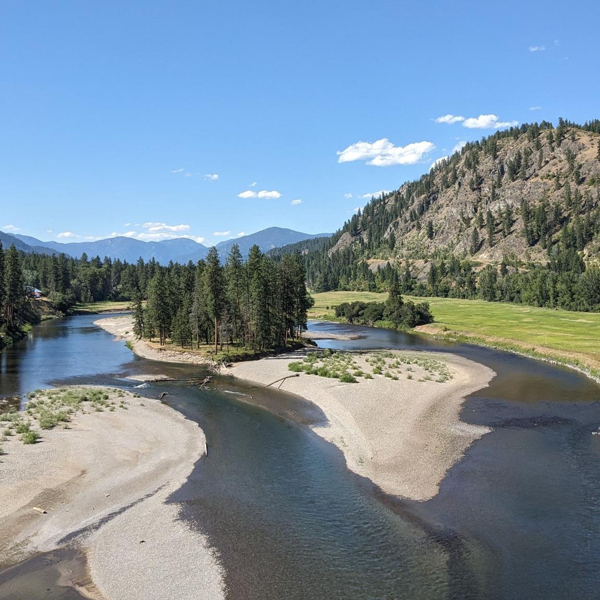
Hiking in Colville National Forest offers a diverse landscape characterized by rolling, tree-covered mountains, pristine lakes, and dense woodlands. This region in northeastern Washington features prominent ranges like the Kettle River Range and the Selkirk Mountains, with elevations reaching notable peaks. The forest's topography includes major valleys carved by Ice Age glaciers, alongside numerous water features such as Sullivan Lake and Bead Lake.
Best hiking trails in Colville National Forest
- The most popular hiking route is Sherman Peak Loop Trail — Colville National Forest, a 5.3 miles (8.5 km) trail that takes 2 hours 43 minutes to complete. This moderate route offers views of the surrounding mountain landscape.
- Another top favourite among local hikers is Bead Lake Trail, a moderate 10.5 miles (16.9 km) path. This trail provides views along the shoreline of Bead Lake.
- Local hikers also love the Freezeout Ridge Trail — Colville National Forest, a 4.3 miles (6.9 km) trail leading through forested ridges, often completed in about 2 hours 35 minutes.
- Hiking in Colville National Forest is defined by mountain ranges, pristine lakes, and dense woodlands. The network offers options for various ability levels, from easy walks to challenging long-distance routes.
- The guide includes highly-rated routes that showcase the best of the region's landscape. More than 40 hikers have used komoot to explore Colville National Forest's varied terrain.
Last updated: July 8, 2026
35.3km
10:58
1,220m
1,650m
Embark on the Salmo-Priest Loop, a challenging 21.9 miles (35.3 km) hiking route that takes you deep into a remote wilderness. You will navigate through lush, old-growth cedar and hemlock forests, reminiscent of a rainforest, especially in the Salmo River basin. As you ascend, the scenery opens up to expansive meadows and broad vistas along the Shedroof Divide Trail, offering panoramic views of surrounding mountains and valleys, with glimpses into Canada. This difficult route involves a significant elevation gain of 4002 feet (1220 metres) and typically takes around 10 hours and 58 minutes to complete.
Planning your visit requires careful consideration for this backcountry experience. Be aware that river crossings can be difficult before mid-July due to high water levels, and you might encounter snow at higher elevations until early July. Water sources are spread out, particularly along a seven-mile stretch of the Shedroof Divide, so plan your hydration carefully. There is also no cell service along the entire loop, so be prepared for self-reliance.
The Salmo-Priest Loop offers a true sense of solitude and rugged beauty, making it a notable trail for those seeking an immersive wilderness adventure. The transition from dense, ancient forests to open alpine meadows highlights the diverse ecosystems within the Salmo-Priest Wilderness. This area is known for its pristine natural environment and provides a unique opportunity to disconnect and experience the wild landscapes of the region.
7.57km
02:20
250m
310m
Embark on the Hoodoo Canyon Trail, a moderate hike spanning 4.7 miles (7.6 km) with an 822 feet (250 metres) elevation gain, typically completed in 2 hours and 20 minutes. As you traverse the route, you will discover striking rock walls and the distinctive hoodoo formations that define the canyon's character. The path winds through diverse forest environments, shifting from verdant areas to sun-drenched clearings, offering expansive views of the Kettle Range and the scenic lakes below.
Before you set out, be aware that a challenging side trip to Emerald Lake features a very steep descent, best suited for experienced hikers. Additionally, reports indicate a slide about 1.6 miles from the Trout Lake trailhead, which could present a difficult obstacle on your journey. Plan your visit accordingly to ensure a safe and enjoyable experience on the trail.
The canyon is renowned for its geological wonders, specifically the towering rock walls and the unique hoodoo formations that lend the trail its name. These natural sculptures create a distinct landscape, offering a sense of isolation and quietude as you explore. The trail provides a unique opportunity to immerse yourself in a landscape shaped by ancient forces, making it a standout experience in the region.

Sign up for free
6.65km
01:51
110m
110m
Embark on an easy hike along the Sullivan Lakeshore Trail, a 4.1-mile (6.6 km) route that winds through a varied forest reminiscent of eastern hardwood landscapes. You'll gain 373 feet (114 metres) in elevation over approximately 1 hour and 50 minutes, making it a pleasant journey for most. As you go, discover rocky benches offering excellent viewpoints of the expansive Sullivan Lake and Hall Mountain. Look for quiet coves and beaches, and notice how damp areas transform into a "Middle Earth" scene with ferns and moss.
The Sullivan Lakeshore Trail connects the East Sullivan Campground and Noisy Creek Campground, providing convenient access from either end. You'll find parking readily available at both trailheads, making it easy to start your adventure. While hiking, remember to be aware of your surroundings, as black bears are known to frequent the area, especially where berries grow. Plan your visit during daylight hours to fully enjoy the scenery and ensure a safe return.
This trail is particularly notable for its spectacular fall foliage, with vibrant golden larch displays creating a stunning visual experience in October. The route offers a unique opportunity to explore the diverse ecosystems surrounding the 1,300-acre Sullivan Lake. It's a perfect choice if you are looking for a tranquil lakeside walk with rich natural beauty.
3.16km
00:59
150m
50m
Embark on an easy hike along the Columbia Mountain Loop Trail, a 2.0-mile (3.2 km) route that takes just under an hour, around 58 minutes, to complete. You will gain 504 feet (154 metres) in elevation as you explore varied terrain. The path winds through fragrant pine and aspen forests, past aromatic sagebrush, and into mountain meadows that burst with wildflowers. As you ascend, switchbacks lead you past rocky outcroppings, offering glimpses of the expansive landscape. Reach the summit for impressive 360-degree views, including sightlines along the Kettle Crest Trail and clear vistas of Snow Peak.
To begin your adventure, find the trailhead for the Columbia Mountain Loop Trail by accessing the Kettle Crest Trail #13 North, starting directly from the Sherman Pass parking area. This convenient access point makes planning your visit straightforward. If you encounter springs about two miles into your hike and plan to use them, remember to filter the water as cattle are present in the area. While camping is permitted along the route, be aware that fires are not allowed in or near the historic lookout structure at the summit.
This trail offers a unique opportunity to visit one of Washington State's oldest restored fire lookout cabins, located at the summit. This historic structure provides a fascinating resting spot and adds a layer of cultural interest to your outdoor experience. The route's position within the Colville National Forest also places you in a rich natural environment, making it a notable destination for those seeking both scenic beauty and a touch of history.
9
hikers
8.51km
02:43
360m
360m
Embark on the Sherman Peak Loop Trail for a moderate hike that takes you through a varied landscape of mixed conifer forests and open meadows. As you ascend, you will encounter the striking legacy of the 1988 White Mountain Fire, where silvered snags stand tall against vibrant new growth. From the western slopes, you can enjoy expansive views stretching across the Okanogan Highlands and towards the distant North Cascades. This 5.3-mile (8.5 km) route involves a total elevation gain of 1173 feet (357 metres) and typically takes around 2 hours and 42 minutes to complete.
Planning your visit to the Sherman Peak Loop Trail is straightforward, as parking is conveniently available right at the trailhead. While the trail is generally accessible, be aware that snow can persist into October, and you might need microspikes for traction during that time. Although considered kid-friendly, some sections can be steep, especially if you are hiking in winter conditions. This makes it an ideal day hike for those looking for a rewarding outdoor experience without extensive travel.
The Sherman Peak Loop Trail offers a unique opportunity to witness nature's resilience and beauty. In summer, the meadows burst with a colorful array of wildflowers, creating a picturesque scene. Come autumn, the western larches transform, painting the landscape in brilliant golden hues. This trail stands out in the Colville National Forest for its clear views and the visible history of forest regeneration, providing a compelling backdrop for your adventure.
Get access to more routes and recommendations from other explorers.
Sign up for free
Already have an account?
Our route recommendations are based on thousands of hikes, rides, and runs completed by other people on komoot.
Start today with a free account
Your next adventure awaits.
Login or Signup
Popular around Colville National Forest

Other adventures in Colville National Forest

Tips from the Community

Along the shoreline, you can explore the rocky beaches. Discover a variety of fauna that are sure to delight as you wonder the northeast side of the lake. In the fall, the alpine larches paint the hillside an amazing gold color!
0
0
Nice loop trail with beautiful views of rocky mountain, Sherman Peak and Snow Peak. Just South of Sherman peak is the junction to continue your journey on the kettle Crest Trail.
0
0
Frequently Asked Questions
How many hiking trails are available in Colville National Forest?
Colville National Forest offers a wide range of hiking opportunities, with over 35 trails documented on komoot. These routes cater to various skill levels, from easy walks to more challenging long-distance routes.
What kind of terrain can I expect when hiking in Colville National Forest?
The terrain in Colville National Forest is diverse, characterized by rolling, tree-covered mountains, pristine lakes, and dense woodlands. You'll find prominent ranges like the Kettle River Range and the Selkirk Mountains, with trails often leading through forests of ponderosa pine, Douglas fir, western red cedar, and subalpine fir. Many routes feature significant elevation changes due to the mountainous landscape.
What natural features or landmarks can I see while hiking in Colville National Forest?
While hiking, you can encounter a variety of natural features and landmarks. The forest is home to numerous lakes such as Sullivan Lake and Bead Lake. You might also explore areas like the Salmo-Priest Wilderness or reach summits like Abercrombie Mountain, which offer expansive views.
Are there options for easy hikes in Colville National Forest?
Yes, Colville National Forest provides several options for easy hikes. Out of the 36 available routes, 4 are classified as easy, making them suitable for a more relaxed outdoor experience. These trails often offer gentle gradients and shorter distances.
Are there any challenging long-distance hikes in the forest?
For those seeking a challenge, Colville National Forest has 12 routes classified as difficult. The region is known for trails like the Kettle Crest Trail and routes within the Salmo-Priest Wilderness, which includes the 21.8-mile Shedroof Divide Trail. These trails often feature significant elevation gains and cover longer distances.
Can I find any trails with lakes or water features?
Absolutely. Water features are plentiful in Colville National Forest. You can find trails that lead to or along notable bodies of water such as Sullivan Lake, Bead Lake, and Frater Lake. The Bead Lake Trail, for instance, offers spectacular views along the shoreline.
Are there any trails that offer panoramic views?
Yes, several trails in Colville National Forest are known for their panoramic views. The Sherman Peak Loop Trail provides excellent views of the surrounding mountain landscape. Additionally, routes to Abercrombie Mountain offer sweeping vistas of the Selkirk Mountains.
What is the best time of year to go hiking in Colville National Forest?
The best time to hike in Colville National Forest is generally from late spring through early fall. During these months, trails are typically clear of snow, and the weather is more favorable. Some higher elevation trails may still have snow into early summer. Always check current conditions before heading out.
Are there any circular hiking routes available?
Yes, there are several circular hiking routes in Colville National Forest. A popular option is the Sherman Peak Loop Trail, which is a moderate 5.3-mile (8.5 km) route. The Frater Lake Trail also features a multi-loop system, including the Tiger Loop and Coyote Loop.
What kind of wildlife might I encounter on the trails?
Colville National Forest is rich in wildlife. Hikers might spot moose, elk, black bears, cougars, mule and white-tailed deer, mountain goats, and bald eagles. Rare species like woodland caribou and grizzly bears also inhabit the area. Always be aware of your surroundings and practice Leave No Trace principles.
What do other hikers enjoy the most about hiking in Colville National Forest?
The area is highly rated by the komoot community, with an average score of 5.0 stars. Reviewers often praise the diverse landscape, including the rolling, tree-covered mountains and pristine lakes, as well as the variety of trails suitable for different skill levels.
Are there any specific attractions near the hiking trails that are worth exploring?
Beyond the trails, you can explore nearby attractions such as the historic settlement of Metaline Falls, known for its annual Bigfoot Festival. The rustic Snow Peak Cabin is also available for rent, offering a unique base for exploration.
Most popular routes in Colville National Forest
Most popular attractions in Colville National Forest

Get inspired with the komoot mobile app


Explore more
Browse the best Hikes in other regions.
