The best walks and hikes in Custer Gallatin National Forest
4.6
(212)
4,758
hikers
121
hikes
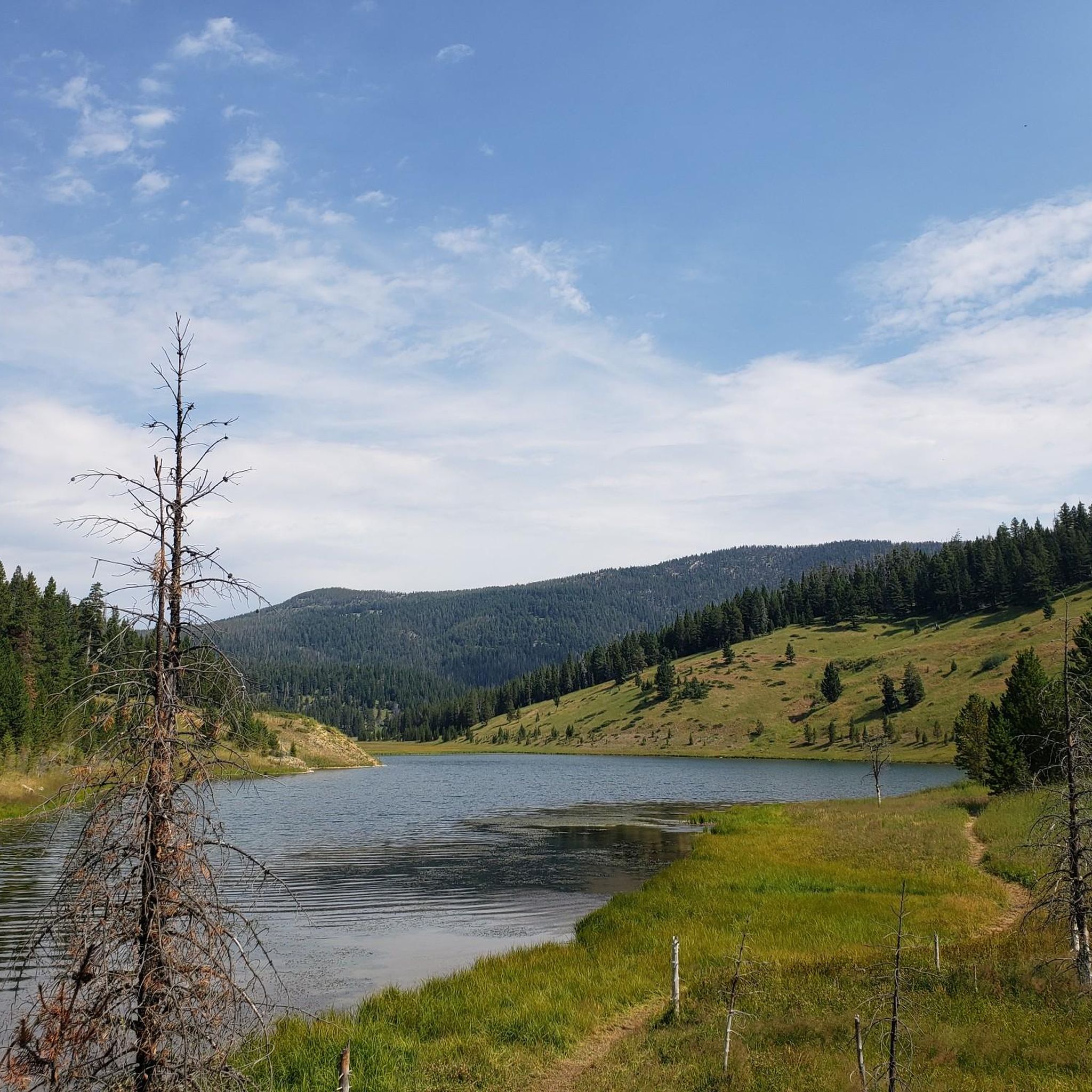
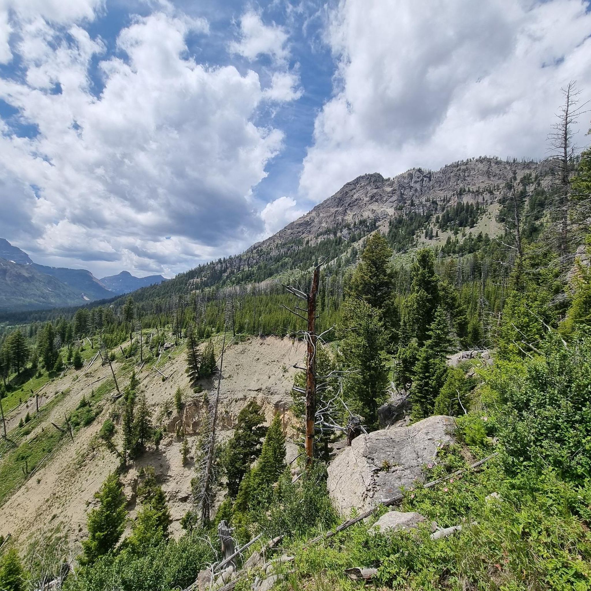
Hiking in Custer Gallatin National Forest encompasses over 3.1 million acres across southern Montana and into northwestern Wyoming, forming part of the Greater Yellowstone Ecosystem. The region is characterized by six distinct mountain ranges, including the Beartooth, Gallatin, and Bridger Ranges, offering varied terrain from subalpine forests to grasslands. Numerous rivers, streams, and high-elevation lakes are present, providing diverse natural features for exploration. The landscape transitions from sagebrush and grasses at lower elevations to forests of Douglas fir, aspen, cottonwood, and spruce.
Best hiking trails in Custer Gallatin National Forest
- The most popular hiking route is Lava Lake Trail — Lee Metcalf Wilderness, a 5.5 miles (8.8 km) moderate trail that takes 3 hours 44 minutes to complete. This route leads to a scenic alpine lake within a designated wilderness area.
- Another top favourite among local hikers is Ousel Falls Trail, an easy 1.7 miles (2.7 km) path. This trail offers an accessible walk through a serene forest to a prominent waterfall.
- Local hikers also love the Beehive Basin Trail No. 40, a 6.4 miles (10.3 km) trail leading through a glacial cirque to a high-elevation lake, often completed in about 3 hours 14 minutes.
- Hiking in Custer Gallatin National Forest is defined by vast mountain ranges, pristine lakes, and diverse forest ecosystems. The network offers options for various ability levels, from easy waterfall walks to challenging mountain ascents.
- The routes in Custer Gallatin National Forest are highly rated by the komoot community with an average score of 4.6 stars from over 130 reviews. More than 2900 hikers have used komoot to explore Custer Gallatin National Forest's varied terrain.
Last updated: October 11, 2026
14
hikers
5.59km
01:55
480m
0m
The Beehive Basin Trail No. 40 delivers a classic Montana alpine experience, leading you through diverse terrain to a stunning glacial lake. You'll start by crossing Beehive Creek, then ascend through meadows and a unique dead-tree forest, with consistent views of the Big Sky valley. This moderate 3.5-mile (5.6 km) hike involves 1569 feet (478 metres) of elevation gain, typically taking just under two hours, making it a rewarding challenge for its length.
Planning your visit means aiming for an early start, especially in summer, as the trailhead parking can fill up quickly due to the trail's popularity. Be aware of the high altitude and the presence of wildlife, including bears, so come prepared with bear spray. The trail is accessible year-round, offering vibrant wildflowers in summer and opportunities for snowshoeing in winter.
What makes this trail truly special is its access to the pristine Lee Metcalf Wilderness, providing a backcountry feel without a multi-day commitment. The glacial lake at the top is often described as a "nature's infinity pool," perfect for a picnic or even a swim. It's consistently ranked among the top hikes in the country for its spectacular views and the chance to spot local wildlife like elk and moose.
13
hikers
9.66km
02:53
340m
250m
The Hyalite Creek Trail offers a moderate hiking experience through a stunning glacial U-shaped canyon. As you hike, you will pass through dense coniferous forests and open meadows, with the sound of rushing water accompanying you. The route is famous for its many waterfalls; you can expect to see at least eleven cascades, including the notable Hyalite Creek Waterfalls and Grotto Falls, as you ascend. This trail covers 6.0 miles (9.7 km) with an elevation gain of 1109 feet (338 metres), typically taking around 2 hours and 53 minutes to complete.
When planning your visit, be aware that the trail includes varied terrain with rocky sections and roots. You will also encounter several stream crossings that do not have bridges, so waterproof footwear is a good idea. Snow can linger at higher elevations well into spring and summer, which can make conditions slick during colder months. Always check local regulations, as the trail is multi-use and may have specific days for different activities.
This route provides increasingly grand canyon views as you climb, with massive cliff walls and majestic peaks framing your path. It is a popular choice for those seeking a rewarding outdoor experience close to Bozeman. The trail's unique geological features, like the U-shaped canyon, highlight the powerful forces of nature that shaped this landscape, making it a distinctive hike in the Custer Gallatin National Forest.

6
hikers
1.82km
00:30
30m
30m
The Ousel Falls Trail offers a delightful journey through a vibrant mixed forest, following a well-maintained, mixed-gravel path that descends into the South Fork ravine. You'll meander alongside the active South Fork of the West Fork of the Gallatin River, crossing rustic bridges, before reaching the impressive 100-foot Ousel Falls. Multiple viewpoints allow you to take in the dramatic cascade, which is particularly powerful during spring snowmelt and transforms into massive icicles in winter. This easy 1.1-mile (1.8 km) hike, with only 105 feet (32 metres) of elevation gain, is a high-reward option for all ages.
Accessing the Ousel Falls Trail is simple, as the trailhead is conveniently located in Big Sky and is open year-round. While it's a popular spot, parking is generally available. If you're visiting in spring, expect muddy sections due to runoff, and during winter, the trail can become slick and icy, so microspikes or snowshoes are highly recommended for safety. The trail's accessibility and short 30-minute estimated duration make it an ideal choice for a quick, scenic outing.
What makes the Ousel Falls Trail truly stand out is its combination of accessibility and stunning natural beauty, making it a top recommendation for visitors to Big Sky. Interpretive signage along the path provides insights into the local ecology and wildlife, including the American Dipper, which inspired the trail's name. The trail's geology features dark grey shale rock, formed from ancient marine mud, adding another layer of interest to this family-friendly route.
9
hikers
6.59km
02:20
580m
40m
Embark on the Blue Lake Trail, a moderate hike that takes you through varied terrain and subalpine forests. You will ascend through meadows, experiencing a true sense of wilderness as you climb. A key highlight is Upper Big Timber Falls, where you can enjoy the cascading water and picturesque views. This route covers 4.1 miles (6.6 km) and involves a significant elevation gain of 1915 feet (584 metres). Plan for approximately 2 hours and 20 minutes to complete this journey.
When planning your visit, note that general parking is usually available directly at the trailhead. During peak season, arriving early is advisable to ensure you secure a spot. Before heading out, always check local forest service websites for current alerts. This includes information on road conditions or any potential seasonal closures that might affect your trip. There are no specific permits or fees mentioned for accessing this trail, making it straightforward to enjoy.
This trail is situated within the expansive Custer Gallatin National Forest, offering a classic Montana wilderness experience. The environment is characterized by its subalpine features, providing a rich habitat and diverse plant life as you gain elevation. The journey culminates at Blue Lake, a serene alpine lake that serves as a tranquil reward for your efforts. This area is known for its rugged beauty and opportunities for quiet contemplation in nature.
7
hikers
5.32km
01:29
100m
100m
The Porcupine Creek Trail in Montana offers a delightful journey through pleasant spruce and pine forests, frequently opening up to sunny, grassy slopes dotted with limber pines. You'll follow the namesake creek, enjoying its continuous presence, and eventually reach a wooded ridge that provides classic Montana views of broad, grassy valleys and distant forested peaks.
This easy 3.3-mile (5.3 km) hike involves a gentle 327 feet (100 metres) of elevation gain and typically takes around 1 hour and 28 minutes to complete, making it a great option for beginner hikers or those seeking a shorter, rewarding outing. Keep in mind that the trail is open to hikers only from April 1 to June 15, and you should always be prepared for bear country.
Situated within the Hyalite-Porcupine-Buffalo Horn Wilderness Study Area, the trail is a vital winter range for elk and provides habitat for moose, deer, and coyotes. It also acts as a popular backcountry portal into the larger Gallatin National Forest, offering various loop options for more extensive exploration.
Get access to more routes and recommendations from other explorers.
Already have an account?
Our route recommendations are based on thousands of hikes, rides, and runs completed by other people on komoot.
Start today with a free account
Your next adventure awaits.
Popular around Custer Gallatin National Forest

Unforgettable MTB Adventures – IMBA Epic Trails in USA and Canada
MTB Trails in Custer Gallatin National Forest
Road Cycling Routes in Custer Gallatin National Forest
Cycling in Custer Gallatin National Forest
Running Trails in Custer Gallatin National Forest

Gravel biking in Custer Gallatin National Forest
Other adventures in Custer Gallatin National Forest

Tips from the Community

A short hike from the Big Timber trailhead near the Halfmoon campground takes you to the viewing point of the powerful Big Timber Creek Falls, a spot you might be able to catch extreme kayakers daring Montana's steepest falls.
1
0
Easy well-maintained hike to the falls from the parking lot. If you want a little more interesting of a hike, make sure you don't miss the "connector", which adds some more climbing and descending, but it takes you closer to the Gallatin River, and there is another beautiful small stream that you cross along the way. Built up. nicely with boardwalks that would be fun on a mountain bike.
0
0

Grotto Falls is the first of many (nine named) waterfalls on the way up Hyalite Creek Trail towards Hyalite Peak. The trail leading to the falls is easy and wheelchair accessible, and you can even make your way down to the base of the falls to feel water spraying off of the rock walls.
0
0

Big Sky Resort opened for it's first winter season in 1973. Encompassing over 5800 acres, Big Sky Resort has the status as one of Montana's best ski resorts.
0
0
Beehive Basin is one of the best places to spot wild flowers in the summer and great opportunities for wildlife viewing in the fall.
0
0

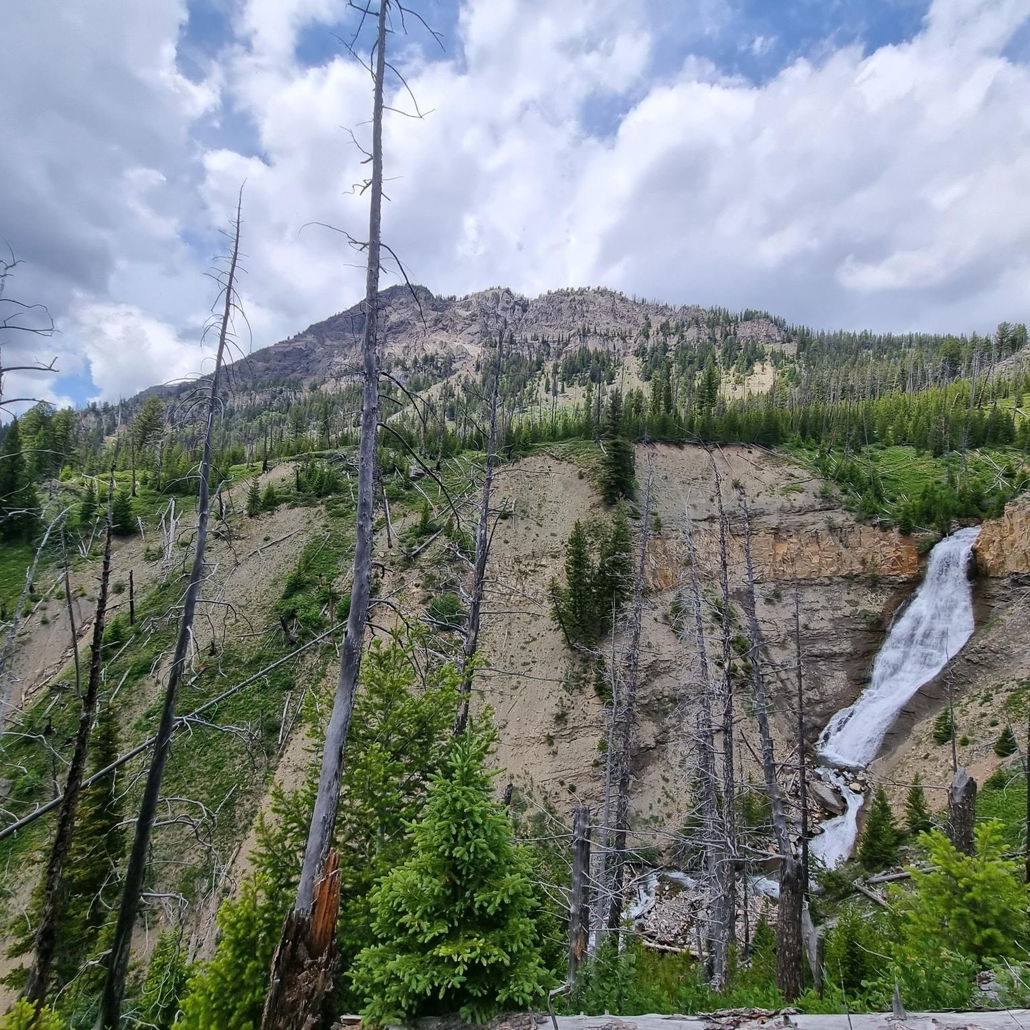
Hiking the Hyalite Creek Trail offers views of many waterfalls.
1
0
Ousel Falls is a popular waterfall you can enjoy after an easy hike in the south of Big Sky. The trail and the waterfall offer a quiet moment into the forest, and if you are lucky, you can see ouzel birds diving into the river.
1
0
Frequently Asked Questions
How many hiking trails are available in Custer Gallatin National Forest?
Custer Gallatin National Forest offers a wide array of hiking opportunities with over 70 trails. These range from easy strolls to challenging mountain ascents, catering to various skill levels.
What kind of terrain and difficulty can I expect on hikes in Custer Gallatin National Forest?
The Custer Gallatin National Forest features incredibly diverse terrain, from subalpine forests and high-elevation lakes to grasslands and remote buttes. You'll find trails ranging from easy, gentle paths like the Ousel Falls Trail, to moderate routes such as the Lava Lake Trail, and more difficult, challenging climbs in the higher mountain ranges. Approximately 10 trails are considered easy, 37 moderate, and 23 difficult.
Are there any trails with waterfalls in Custer Gallatin National Forest?
Yes, the Custer Gallatin National Forest is home to several beautiful waterfalls. A popular and easily accessible option is the Ousel Falls Trail, which leads to a prominent waterfall through a serene forest. Pine Creek Falls is another national recreation trail suitable for various skill levels. You can also find Upper Big Timber Falls within the forest.
What are some family-friendly hiking options in the Custer Gallatin National Forest?
For families, the Custer Gallatin National Forest offers several accessible and enjoyable trails. The Ousel Falls Trail is an excellent choice, being an easy 1.7-mile path through a serene forest to a waterfall. Many of the easier trails are suitable for children and offer a great introduction to the region's natural beauty.
Can I bring my dog on the hiking trails in Custer Gallatin National Forest?
Many trails within the Custer Gallatin National Forest are dog-friendly, but regulations can vary, especially in designated wilderness areas like the Lee Metcalf Wilderness or near Yellowstone National Park. It's always best to check specific trail regulations before heading out. Generally, dogs should be kept on a leash to protect wildlife and ensure a pleasant experience for all hikers.
Are there any circular hiking routes in Custer Gallatin National Forest?
While many trails in Custer Gallatin National Forest are out-and-back, there are options for circular routes or loops, particularly when combining different trail segments. For example, the Bridger Foothills National Recreation Trail in the Bridger Mountains offers opportunities for longer ridgeline hikes that can be combined with other trails to form loops. It's recommended to consult a detailed map for specific loop configurations.
What natural features or landmarks can I see along the hiking trails?
The Custer Gallatin National Forest is rich in natural landmarks. You can hike to stunning high-elevation lakes like Fairy Lake and Beehive Basin Lake. The forest also encompasses six distinct mountain ranges, including the Beartooth Mountains, home to Montana's highest point, Granite Peak. Other notable features include Mount Blackmore and Storm Castle, offering spectacular views and geological significance.
What is the best time of year to hike in Custer Gallatin National Forest?
The best time to hike in Custer Gallatin National Forest is typically from late spring through early fall (May to October). During this period, most trails are free of snow, and the weather is generally favorable. Summer offers lush landscapes and wildflowers, while fall brings vibrant autumn colors. Higher elevation trails may retain snow into July, so always check conditions before you go. Winter hiking is possible but requires appropriate gear and experience due to snow and colder temperatures.
Do I need a permit to hike in Custer Gallatin National Forest?
Generally, day hiking in the Custer Gallatin National Forest does not require a specific permit. However, if you plan on backpacking overnight in wilderness areas like the Absaroka-Beartooth Wilderness or Lee Metcalf Wilderness, or if you are entering Yellowstone National Park, permits may be required. Always check with the local ranger district or park service for the most current regulations regarding permits and fees.
What do other hikers enjoy most about Custer Gallatin National Forest?
The Custer Gallatin National Forest is highly rated by the komoot community, with an average score of 4.7 stars from over 130 reviews. Hikers frequently praise the stunning natural beauty, diverse landscapes, and the sense of wilderness. The variety of trails, from easy waterfall walks to challenging mountain ascents, is also a common highlight, along with opportunities for wildlife viewing.
Are there opportunities for wildlife viewing while hiking?
Yes, the Custer Gallatin National Forest is part of the Greater Yellowstone Ecosystem and is home to a remarkably diverse array of wildlife, including grizzly bears, bald eagles, elk, moose, bison, and wolves. Hikers often have opportunities to spot these animals, particularly in quieter areas. Always practice bear awareness and maintain a safe distance from all wildlife.
Is parking available at trailheads in Custer Gallatin National Forest?
Most major trailheads in the Custer Gallatin National Forest offer designated parking areas. However, during peak season or on popular trails, these can fill up quickly. It's advisable to arrive early, especially for well-known routes like the Beehive Basin Trail or Lava Lake Trail. Some areas may require a recreation pass or have a small fee for parking.
Most popular routes in Custer Gallatin National Forest
Most popular attractions in Custer Gallatin National Forest

Get inspired with the komoot mobile app


Explore more
Browse the best Hikes in other regions.
