The best walks and hikes around Sainte-Catherine-de-la-Jacques-Cartier
4.8
(11)
426
hikers
17
hikes
Hiking trails around Sainte-Catherine-de-la-Jacques-Cartier traverse a landscape shaped by the Jacques-Cartier River, which carves a glacial valley up to 550 meters deep. The region features Laurentian hills, with Mont Bélair reaching 410 meters, and is characterized by mountains, hills, and numerous lakes. Forests of coniferous and deciduous trees are abundant, alongside significant wetlands.
Best hiking trails around Sainte-Catherine-de-la-Jacques-Cartier
- The most popular hiking route is Belair Ourdoor Center Marsh Trail loop, a 5.1 miles (8.2 km) trail that takes 2…
Last updated: October 17, 2026
4.8
(4)
176
hikers
8.21km
02:13
110m
110m
Moderate hike. Good fitness required. Easily-accessible paths. Suitable for all skill levels.
5.0
(1)
42
hikers
5.13km
01:28
130m
120m
Easy hike. Great for any fitness level. Easily-accessible paths. Suitable for all skill levels.

5.0
(1)
2
hikers
Hard hike. Very good fitness required. Easily-accessible paths. Suitable for all skill levels.
Moderate hike. Good fitness required. Easily-accessible paths. Suitable for all skill levels.
7
hikers
5.56km
01:28
50m
50m
Easy hike. Great for any fitness level. Easily-accessible paths. Suitable for all skill levels.
Get access to more routes and recommendations from other explorers.
Already have an account?
Our route recommendations are based on thousands of hikes, rides, and runs completed by other people on komoot.
Start today with a free account
Your next adventure awaits.
Popular around Sainte-Catherine-de-la-Jacques-Cartier
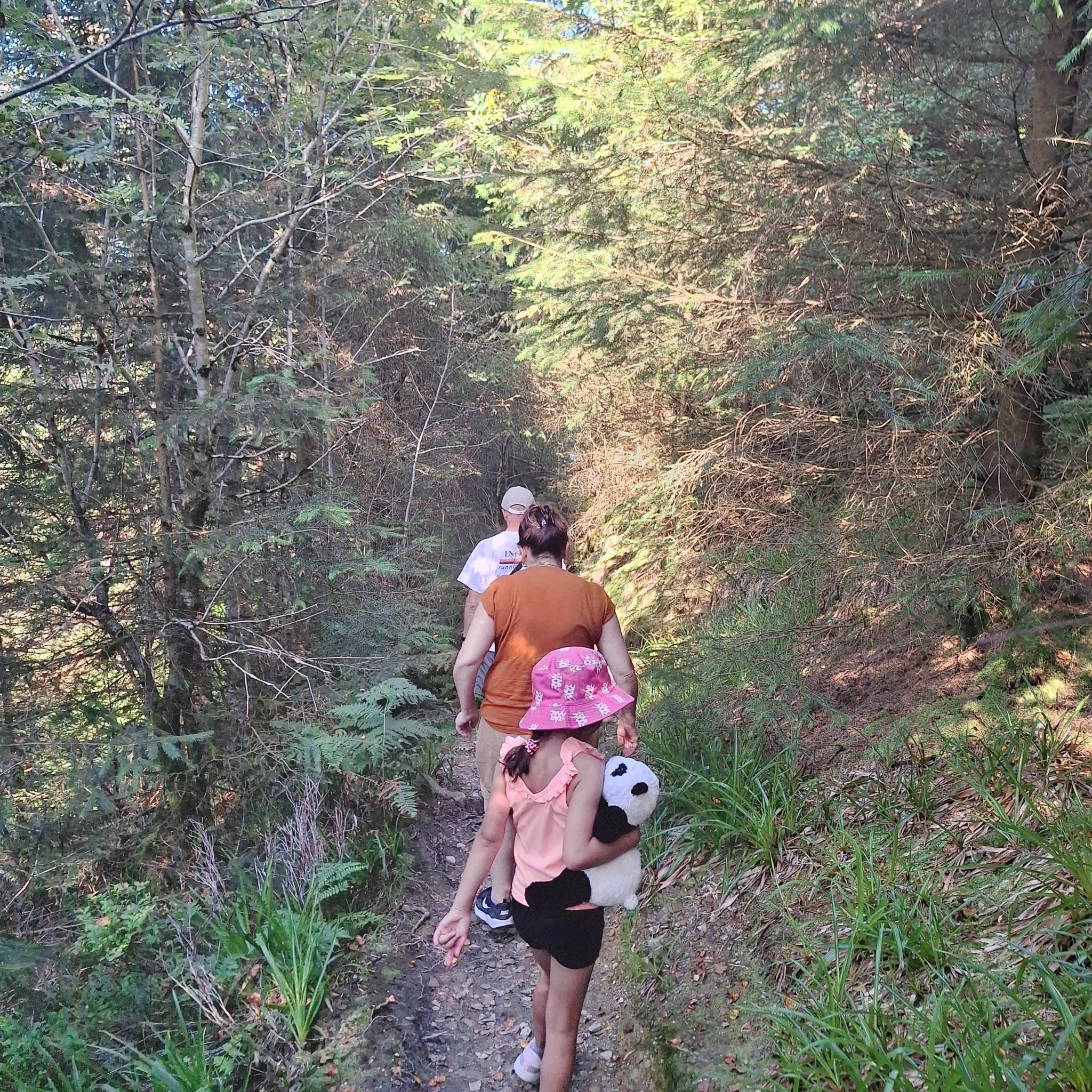
Tips from the Community

Very beautiful place to relax
0
0

At 485 metres, Mont-Bélair is one of the highest points in the Québec City region. Rocky escarpments, extensive wetlands, and mature forest create a surprisingly wild landscape just a short drive from the city, while viewpoints across the Laurentians reward the climb.
0
0

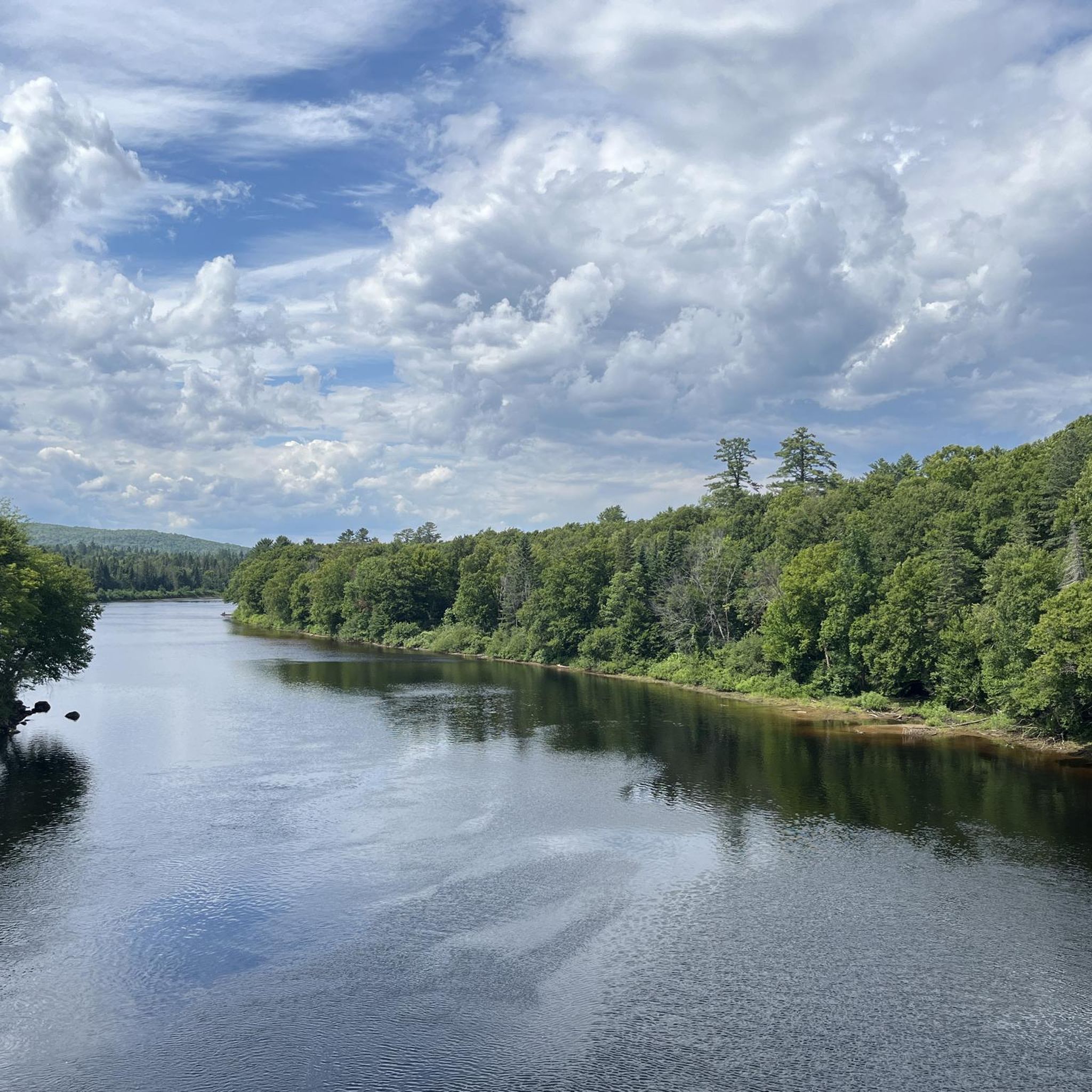
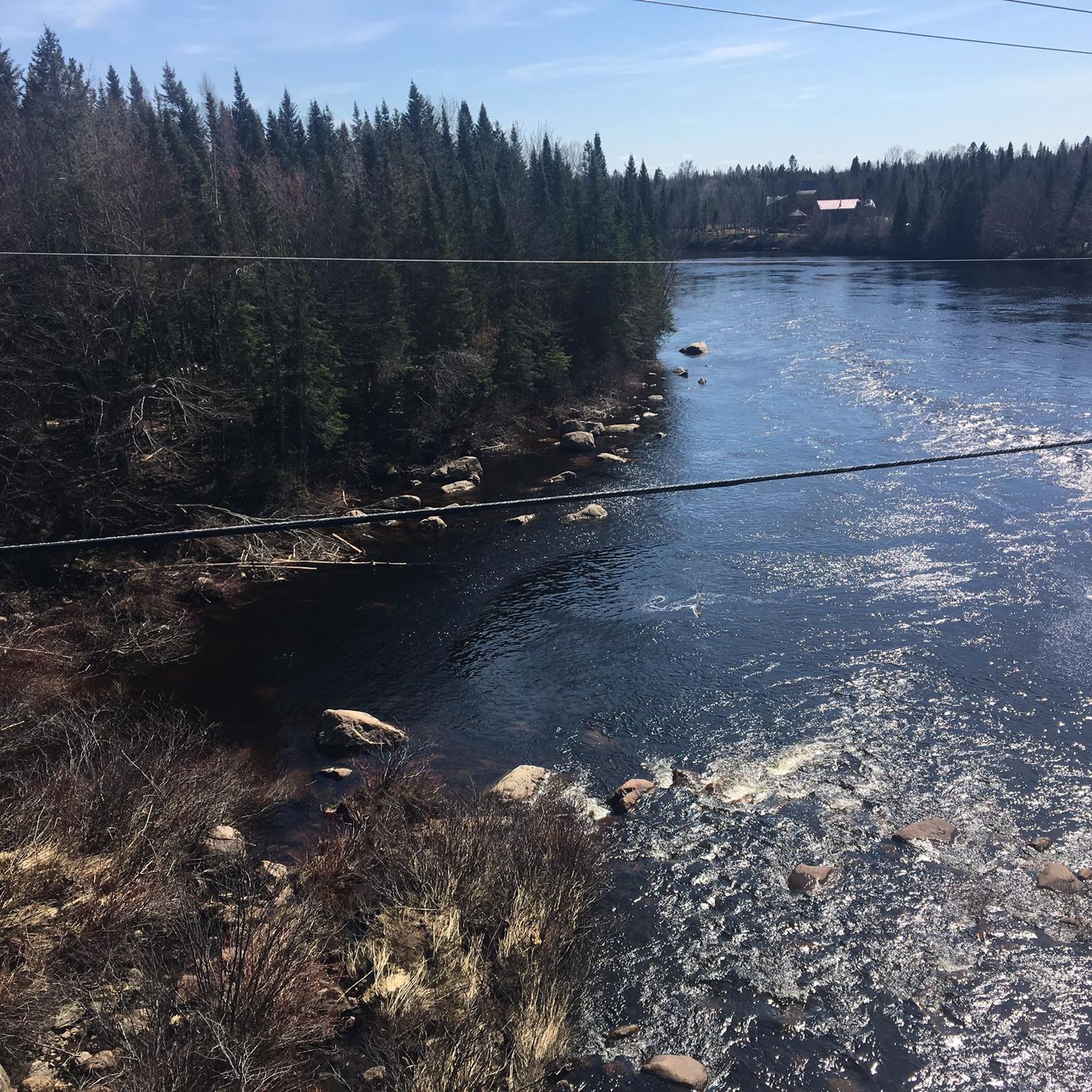
Pause here to admire the Jacques-Cartier River as it winds through the valley, with its clear waters and lively rapids below. The river is one of Québec's last major rivers to remain largely undammed, allowing it to flow freely through the spectacular Jacques-Cartier Valley.
0
0
Rest awhile on this bench before continuing along the La Liseuse Trail. The scenic woodland route is known for its peaceful setting and abundant birdlife.
0
0
Mont-Bélair Natural Park protects one of the highest points in the Québec City region, rising to 485 metres above sea level. The park is known for its rocky escarpments, forests, wetlands, and three small lakes, creating a surprisingly varied landscape within the city limits. Trails lead through quiet woodland, around Lac Alain and nearby marshes, and up to viewpoints overlooking the surrounding countryside. The mix of summit views, wetland habitats, and diverse ecosystems makes this one of the most rewarding natural areas in the Québec City region.
0
0
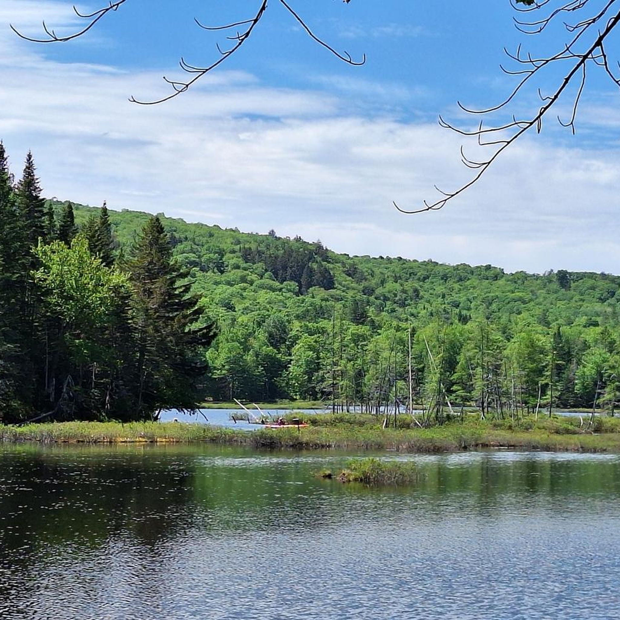
Nestled beneath the slopes of Mont-Bélair, Lac Alain provides a peaceful contrast to the park's higher viewpoints and rocky ridges. A trail circles much of the shoreline, passing through forest and wetland habitat where beavers, waterfowl, and other wildlife are often seen.
0
0

Vélopiste Jacques-Cartier / Portneuf is a 68-kilometre multi-use rail trail built along a former railway corridor, linking Saint-Gabriel-de-Valcartier to Rivière-à-Pierre, passing through forest and along rivers, lakes, and small communities northwest of Québec City. The Shannon to Sainte-Catherine-de-la-Jacques-Cartier section follows one of the trail’s quieter stretches, passing through picturesque wooded landscapes and open views near the Jacques-Cartier River on a gentle, crushed-stone surface that's ideal for cycling and walking. Connected to Québec City via the Corridor des Cheminots, the route combines easy grades with peaceful scenery and access to nearby outdoor recreation, making it one of the region’s most popular long-distance trails.
0
0
Fossambault-sur-le-Lac sits on the southeastern shore of Lac Saint-Joseph, about 30 kilometres northwest of Québec City, known for its lakeside setting, forested surroundings, and long history as a vacation destination. Originally developed as a resort community in the early 1900s, the town grew around summer homes and tourism, with much of its character still shaped by the lake and natural landscape. Today, visitors come for its beaches, boating, and quiet residential streets framed by mature trees, making it a peaceful place to stop along the Vélopiste Jacques-Cartier / Portneuf route. From this spot, it’s a short trek into the small, charming town, or you can take a break here at Fernand Lucchesi Park, nestled right along the trail and Rue Gingras.
0
0
Frequently Asked Questions
How many hiking trails are available in the Sainte-Catherine-de-la-Jacques-Cartier region?
The Sainte-Catherine-de-la-Jacques-Cartier region offers a diverse network of over 15 hiking trails. These routes cater to various skill levels, from easy strolls to more challenging ascents, allowing you to explore the area's glacial valleys, Laurentian hills, and dense forests.
What is the best time of year to go hiking in Sainte-Catherine-de-la-Jacques-Cartier?
The Sainte-Catherine-de-la-Jacques-Cartier region is a year-round outdoor destination. Spring and fall offer vibrant foliage and comfortable temperatures, while summer is ideal for combining hikes with water activities. Winter transforms the landscape into a snowy wonderland, perfect for snowshoeing or winter hiking on designated trails like the Chemin du Parc-National in Parc national de la Jacques-Cartier.
Are there any family-friendly hiking trails in the area?
Yes, the region offers several family-friendly options. Within Parc national de la Jacques-Cartier, trails like Cascades and Tourbière are ideal for beginners and some are even stroller-friendly. For a shorter, easy walk, consider the Hiking loop from Réserve naturelle du Marais-Léon-Provancher, which explores diverse natural habitats.
Can I bring my dog on the hiking trails in Sainte-Catherine-de-la-Jacques-Cartier?
Dog policies vary by park and trail. While some areas, like Parc national de la Jacques-Cartier, have specific regulations regarding pets, many local trails outside the national park may be dog-friendly. Always check the specific trail regulations before heading out with your canine companion. For example, the Belair Outdoor Center Marsh Trail loop is a popular moderate option that might be suitable, but verify local rules.
Are there any circular hiking routes available?
Yes, many trails in the region are designed as loops, offering a complete experience without retracing your steps. Examples include the Belair Outdoor Center Marsh Trail loop and the Passe du Lac au Chien loop from Île Wasat, which takes you through varied terrain near Lac au Chien.
What kind of natural landscapes can I expect to see while hiking here?
Hikers in Sainte-Catherine-de-la-Jacques-Cartier will encounter a rich variety of landscapes. The majestic Jacques-Cartier River carves a deep glacial valley, surrounded by Laurentian hills and numerous lakes. You'll traverse lush forests, with coniferous trees on high plateaus and deciduous trees in the valleys, alongside important wetlands and other rivers like the Ontaritzi and Rivière aux Pommes.
What are the parking options for hikers in the region?
Most major trailheads, especially within parks like Parc national de la Jacques-Cartier, offer designated parking areas. It's advisable to check the specific park or trail website for details on parking availability, fees, and any required permits before your visit, as these can vary.
Are there any public transport options to reach hiking areas?
While public transport directly to all trailheads might be limited, Parc national de la Jacques-Cartier, a primary hiking destination, is approximately 45 minutes from Québec City. It's recommended to check local transit services or consider carpooling for access to more remote trailheads.
What are some notable attractions or points of interest along the trails?
The region itself is a natural attraction. Within Parc national de la Jacques-Cartier, you can find elevated viewpoints offering panoramic vistas of the valley and Mont Adante. The Jacques-Cartier River itself is a highlight, with its calm and turbulent sections. Grand Héron Park offers picturesque riverside paths, and the area is rich in wildlife, including moose, beavers, and various bird species.
What do other hikers enjoy most about hiking in Sainte-Catherine-de-la-Jacques-Cartier?
The hiking experiences in Sainte-Catherine-de-la-Jacques-Cartier are highly rated by the komoot community, with an average score of 4.9 stars. Reviewers often praise the stunning natural beauty, the diversity of landscapes from deep valleys to forested hills, and the well-maintained trails that cater to all abilities.
Are there any longer, more challenging hikes for experienced hikers?
Yes, while many trails are easy to moderate, the region also offers more challenging options. For instance, the Lac Jaune loop from Fossambault-sur-le-Lac is a moderate 17.2 km route with significant elevation gain, providing a longer and more strenuous experience for those seeking a greater challenge.
What kind of wildlife might I encounter on the trails?
The diverse ecosystems of the Sainte-Catherine-de-la-Jacques-Cartier region are home to a variety of wildlife. Hikers, especially in areas like Parc national de la Jacques-Cartier, might spot moose, beavers, white-tailed deer, foxes, porcupines, and over 130 species of birds. Maintaining a respectful distance and observing quietly is always recommended.
Most popular routes around Sainte-Catherine-de-la-Jacques-Cartier
Most popular attractions around Sainte-Catherine-de-la-Jacques-Cartier

Get inspired with the komoot mobile app


Explore more
Browse the best Hikes in other regions.
