The best walks and hikes around Albufeira do Alto Rabagão
4.6
(13)
74
hikers
2
hikes
Hiking around Albufeira do Alto Rabagão, situated within the Peneda-Gerês National Park, offers diverse landscapes centered around the large reservoir. The region is characterized by varied terrain, including areas around the Albufeira do Alto Rabagão Lake, streams, and notable waterfalls such as Cela Cavalos. The trails traverse a mix of natural features, providing different levels of challenge for hikers.
Best hiking trails around Albufeira do Alto Rabagão
- The most popular hiking route is Hiking loop from Outeiro, an easy…
Last updated: July 4, 2026
3.0
(1)
1
hikers
6.29km
01:47
140m
140m
Easy hike. Great for any fitness level. Easily-accessible paths. Suitable for all skill levels.
5.0
(3)
16
hikers
13.9km
04:11
450m
450m
Moderate hike. Good fitness required. Easily-accessible paths. Suitable for all skill levels.

Sign up for free
4.3
(3)
13
hikers
13.2km
03:43
270m
270m
Moderate hike. Good fitness required. Easily-accessible paths. Suitable for all skill levels.
5.0
(1)
3
hikers
Moderate hike. Good fitness required. Easily-accessible paths. Suitable for all skill levels.
5.0
(4)
33
hikers
3.22km
01:00
130m
130m
Easy hike. Great for any fitness level. Easily-accessible paths. Suitable for all skill levels.
Our route recommendations are based on thousands of hikes, rides, and runs completed by other people on komoot.
Start today with a free account
Your next adventure awaits.
Login or Signup
Popular around Albufeira do Alto Rabagão

Tips from the Community

Cela Cavalos Waterfall, or Cela de Cavalos, is a paradisiacal waterfall located in the municipality of Montalegre, in the Peneda-Gerês National Park. With crystal-clear waters, it's a perfect spot for summer swimming, hiking, and nature contemplation. The main access point is from the village of Cela.
0
0
This type of pit consists of an enclosure surrounded by a stone wall, inside which a live animal was left to attract the wolf. In this case, the loose stone wall was built around a boulder located in a highly visible location (Portela da Fairra), where a live goat was placed.
0
0

This wolf den, one of the largest of its kind on the Iberian Peninsula, is believed to have been built in the 18th century and used regularly until the 1930s. A small ladder provides access.
0
0

Formerly a facility for wolf hunting, today wolves are protected
0
0

At the end of the wooden staircase, you are greeted by a spectacle of nature, the Pitões das Júnias Waterfall, which descends in force, imposing and vibrant before you. Down below, the valley stretches out in silence, vast and majestic, a sight that takes your breath away and leaves your heart lighter.
1
0
At the end of the wooden staircase, you will be greeted by a stunning view of the Pitões waterfall in all its grandeur. In the background, the valley stretches out majestically, creating a simply breathtaking scene.
1
0
One of the most beautiful waterfalls in the National Park, the Cela Cavalos Waterfall is fed by the crystal clear waters of the Cavadas and Cela Cavalos streams and, in addition to the striking waterfall that forms a large natural pool, it also has a beautiful lagoon of emerald green water hidden at the top of the waterfall.
3
3
Frequently Asked Questions
Are there easy hiking trails suitable for beginners in Albufeira do Alto Rabagão?
Yes, Albufeira do Alto Rabagão offers several easy trails. For instance, the Hiking loop from Outeiro is an easy 3.9-mile (6.3 km) route that takes approximately 1 hour 47 minutes to complete, offering accessible paths for various fitness levels. Another easy option is the Cela Cavalos Waterfall loop from Capela de Santa Luzia, which is 2 miles (3.2 km) long.
What kind of terrain can I expect on the hiking trails around Albufeira do Alto Rabagão?
The region features diverse terrain, ranging from paths around the Albufeira do Alto Rabagão Lake to trails along streams and near waterfalls. You'll encounter a mix of natural features, with some paths being relatively flat and accessible, while others, particularly those leading to features like the Cela Cavalos Waterfall, may involve some climbing and require sure-footedness.
Are there any waterfalls to see on the hikes in this area?
Yes, a significant natural highlight is the Cela Cavalos Waterfall, known for its crystal-clear waters, natural pool, and an emerald-green lagoon. The Cela Cavalos Waterfall loop from Capela de Santa Luzia is an easy route that allows you to experience this beautiful feature. Another route, the Campesinho Stream – View of Pitões Waterfall loop from Outeiro, offers views of streams and other waterfalls.
What natural features or landmarks can I explore while hiking?
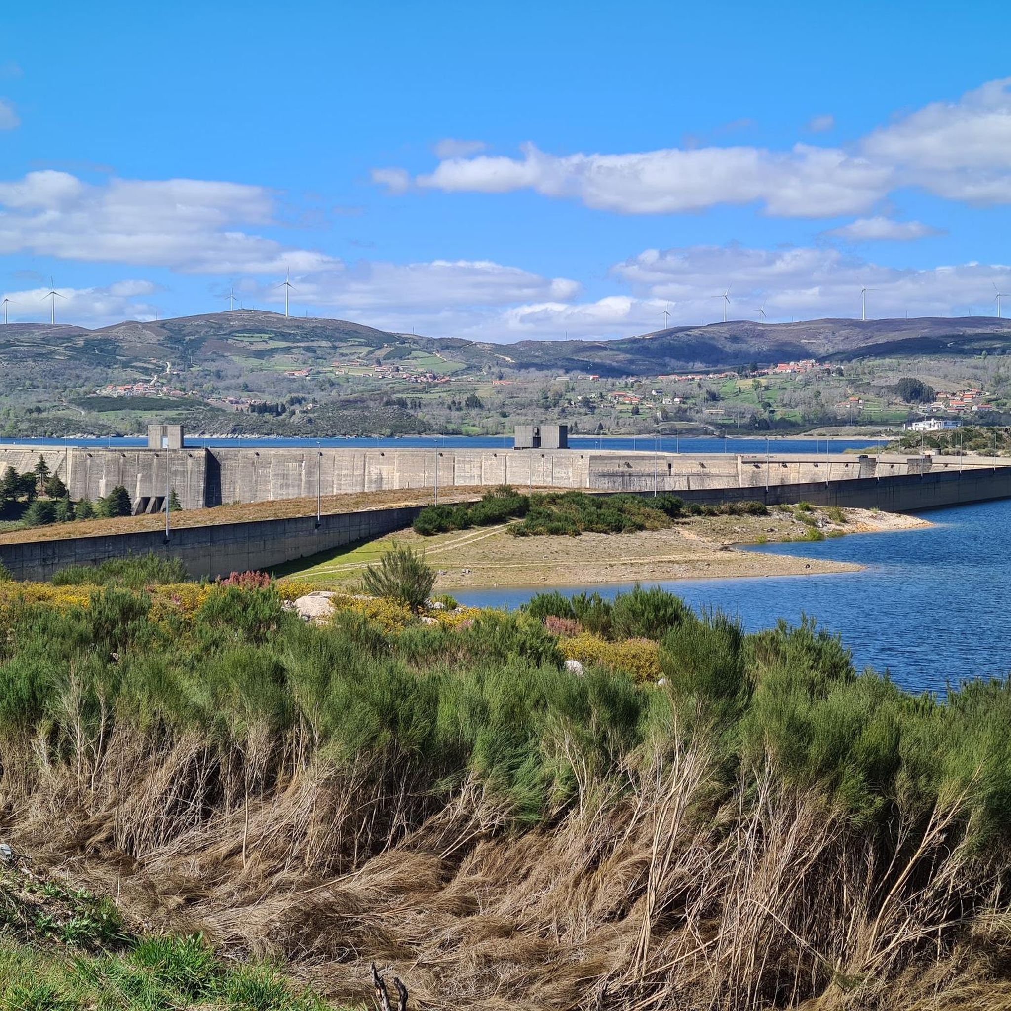
Beyond the trails themselves, you can explore the vast Albufeira do Alto Rabagão Lake, which is the second-largest dam in Portugal and offers opportunities for fishing and boating. The region also has historical interest, such as the ruins of old mills near the Cela Cavalos Waterfall and a 'wolf pit' in Portela da Fairra, an ancient enclosure reflecting the area's past ecology.
Can I find circular hiking routes in Albufeira do Alto Rabagão?
Yes, several circular routes are available. Examples include the Hiking loop from Outeiro, the Campesinho Stream – View of Pitões Waterfall loop from Outeiro, and the Castro de Carvalhelhos loop from Vilar. These loops allow you to start and end your hike in the same location.
Is there parking available near the trailheads?
While specific parking details for every trailhead are not provided, it is generally advisable to look for designated parking areas in villages or near popular starting points for trails. Many routes, especially those starting from locations like Outeiro or Vilar, typically have some form of local parking available.
Are the hiking trails suitable for families with children?
Yes, there are trails suitable for families. The easier routes, such as the Hiking loop from Outeiro, are generally accessible and can be enjoyed by families with children, depending on their age and hiking experience. The varied terrain means you can choose paths that match your family's comfort level.
Can I bring my dog on the hikes in Albufeira do Alto Rabagão?
Many trails in natural areas like Albufeira do Alto Rabagão are dog-friendly, but it's always recommended to keep dogs on a leash, especially within the Peneda-Gerês National Park, to protect wildlife and ensure the safety of other hikers. Please check local regulations or specific trail signs for any restrictions.
When is the best time of year to go hiking in Albufeira do Alto Rabagão?
The best time to hike is typically during spring (April to June) and autumn (September to October) when the weather is milder and the natural scenery is vibrant. Summers can be hot, while winters may bring colder temperatures and potentially challenging conditions, especially at higher elevations.
What do other hikers enjoy the most about hiking in Albufeira do Alto Rabagão?
The area is highly rated by the komoot community, with an average score of 4.6 stars from over 10 reviews. Hikers often praise the diverse landscapes, including the large reservoir and significant waterfalls, and appreciate the variety of routes available for different ability levels.
Are there any moderate or challenging routes for more experienced hikers?
Yes, for those seeking more challenge, there are moderate trails available. The Campesinho Stream – View of Pitões Waterfall loop from Outeiro is a moderate 8.6-mile (13.9 km) path, requiring approximately 4 hours 11 minutes. Another moderate option is the Castro de Carvalhelhos loop from Vilar, which is 8.2 miles (13.2 km) long.
Most popular routes around Albufeira do Alto Rabagão

Get inspired with the komoot mobile app


Explore more
Browse the best Hikes in other regions.
