The best walks and hikes around Mississippi Mills
5.0
(4)
52
hikers
12
hikes
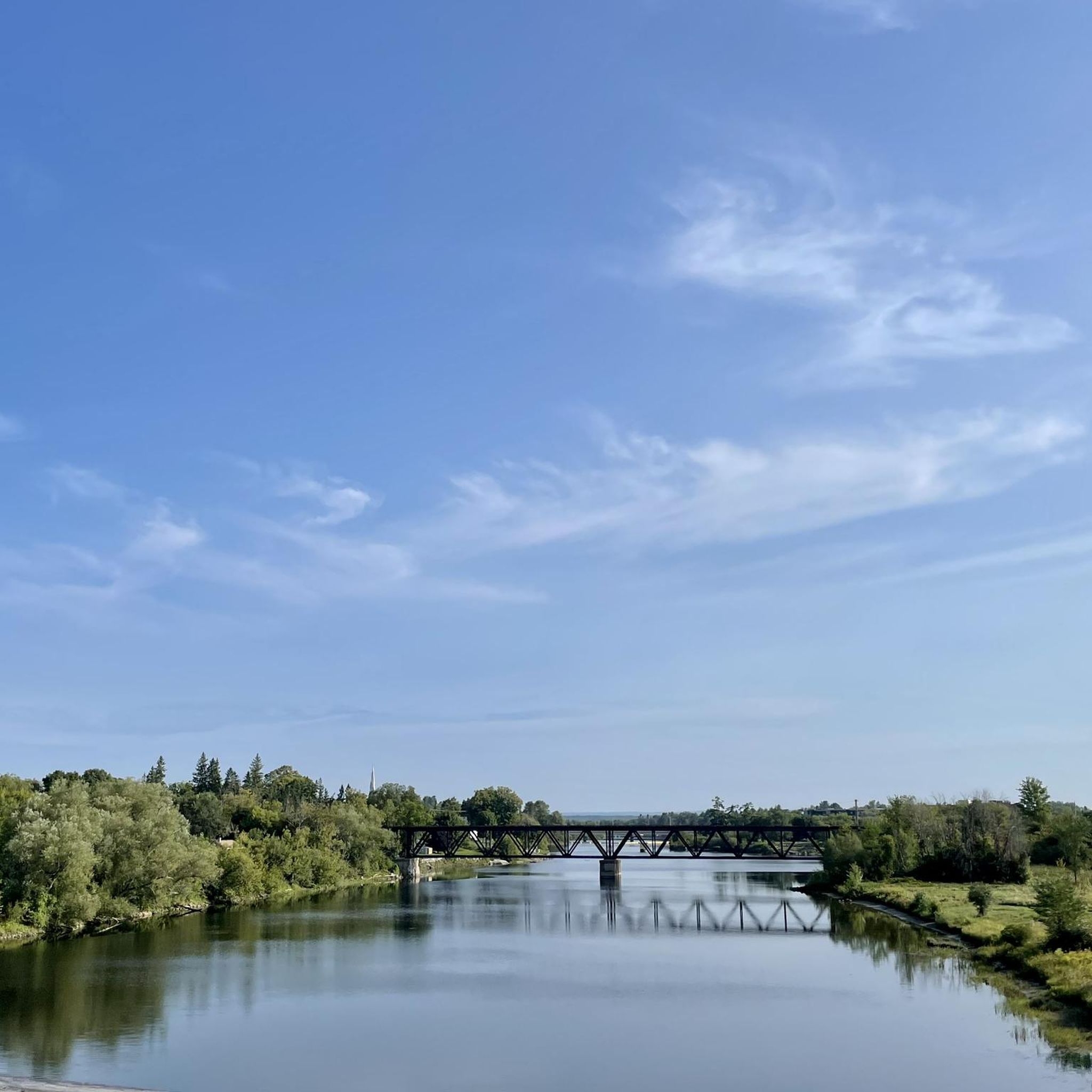
Hiking around Mississippi Mills offers diverse trails through picturesque landscapes shaped by the Mississippi River and various conservation areas. The region features a mix of forests, open fields, and riverfront paths, providing varied terrain for outdoor activities. Hikers can explore former rail lines, nature reserves, and community parks, with elevations generally remaining gentle. This area is characterized by its natural beauty and commitment to accessible outdoor spaces.
Best hiking trails around Mississippi Mills
- The most popular hiking route is Ottawa Valley Recreational Trail via Carleton Place — Ottawa, an 11.4 miles (18.3 km) trail that takes 4 hours 38 minutes to complete. This moderate route follows a former rail line, offering extensive views.
- Another top favourite among local hikers is Hiking loop from Mill of Kintail Conservation Area, an easy 2.6 miles (4.2 km) path. This trail winds through the conservation area, featuring well-marked paths and natural scenery.
- Local hikers also love the Beaver Pond loop from High Lonesome Nature Reserve, a 2.9 miles (4.7 km) trail leading through forests and past ponds, often completed in about 1 hour 13 minutes.
- Hiking around Mississippi Mills is defined by the scenic Mississippi River, diverse conservation areas, and varied trail systems. The network offers options for different ability levels, from easy loops to moderate, longer routes.
- The routes in Mississippi Mills are highly rated by the komoot community with an average score of 5.0 stars from more than 4 reviews. More than 50 hikers have used komoot to explore Mississippi Mills's varied terrain.
Last updated: July 7, 2026
6
hikers
6.85km
01:51
30m
30m
Moderate hike. Great for any fitness level. Mostly accessible paths. Sure-footedness required.
2
hikers
4.25km
01:05
10m
10m
Easy hike. Great for any fitness level. Easily-accessible paths. Suitable for all skill levels.

Sign up for free
18.3km
04:38
40m
40m
Moderate hike. Good fitness required. Easily-accessible paths. Suitable for all skill levels.
5.0
(1)
7
hikers
4.23km
01:07
30m
30m
Easy hike. Great for any fitness level. Easily-accessible paths. Suitable for all skill levels.
7
hikers
3.98km
01:01
20m
20m
Easy hike. Great for any fitness level. Easily-accessible paths. Suitable for all skill levels.
Get access to more routes and recommendations from other explorers.
Sign up for free
Already have an account?
Our route recommendations are based on thousands of hikes, rides, and runs completed by other people on komoot.
Start today with a free account
Your next adventure awaits.
Login or Signup
Popular around Mississippi Mills

Tips from the Community

Parking is fairly informal here, with a handful of roadside spaces available near the trail access point rather than a dedicated trailhead lot. It's an easy place to start the hike, and finding a spot is usually straightforward outside of busy weekends. From the roadside, the Mississippi Valley Trail quickly leaves the developed area behind and heads into the forest.
0
0
The Mississippi River is the defining feature of this trail, winding through forests, wetlands, and small communities on its journey to the Ottawa River. Along this section, the river moves at a relaxed pace, creating a peaceful backdrop for the walk and attracting a variety of birds and wildlife. Once an important transportation and milling route for early settlers, the river continues to shape the landscape and character of the Mississippi Valley today.
0
0
Part of Ontario's long-distance Adventure Routes Trail network, the Mississippi Valley Trail winds through a diverse landscape of hardwood forest, wetlands, rocky ridges, and quiet rural countryside. Following the watershed of the Mississippi River, the route combines forest paths, former rail corridors, and rugged Canadian Shield terrain while connecting a series of small communities across eastern Ontario. This section near Mississippi Mills offers a good introduction to the trail's character, with peaceful woodland walking and a strong sense of the region's natural and cultural history.
0
0

The trails can get a little wet in spring, but come at the right time of year and the woods are filled with wildflowers. This is a great spot for wildlife sightings too, including birds and sometimes coyotes.
0
0
There are four to five parking spots here by the dog park, but you can also find street parking by the snow dump to get access to the woods. There is a well-maintained gravel spur trail that leads to Ferrill Park in town and makes for a great alternate entrance.
0
0
This is a quiet, easy network of trails with some rooted sections that takes you on a stroll through the forest. You may want to download the komoot map before you go, since the trails is person are not well marked - otherwise they are pleasant.
0
0
Carleton Junction Park sits right beside the Ottawa Valley Recreational Trail and makes an easy starting point for walks or rides around Carleton Place. The park has open green space, a paved path, and quick access to the old rail corridor, so it’s a simple spot to pause before continuing along the route. Expect steady views of the passing trail and a relaxed, community feel.
0
0
Carleton Place is a small riverside town in the Ottawa Valley, set along the Mississippi River and connected by several easy pathways, including access to the Ottawa Valley Recreational Trail. The town has a relaxed, walkable centre with parks, river views, and quick links to nearby green spaces. It’s a handy starting point or stopover for exploring this stretch of eastern Ontario.
0
0
Frequently Asked Questions
What types of hiking trails can I find in Mississippi Mills?
Mississippi Mills offers a diverse range of trails, from easy loops through conservation areas to moderate routes along former rail lines. You'll find paths winding through forests, alongside the Mississippi River, and across open fields. The region is known for its natural beauty and commitment to accessible outdoor spaces.
Are there any easy hiking trails suitable for beginners or families?
Yes, Mississippi Mills has several easy trails. For example, the Hiking loop from Mill of Kintail Conservation Area is an easy 4.2 km path with well-marked trails and natural scenery. The Morris Island Conservation Area also provides an easy hiking loop suitable for all fitness levels. Many trails are designed to be multi-generational and accessible.
Are there any longer or more challenging hikes in the area?
While most trails in Mississippi Mills are easy, there are moderate options for those seeking a longer experience. The Ottawa Valley Recreational Trail via Carleton Place — Ottawa is a moderate 18.3 km route that follows a former rail line, offering extensive views and a longer duration.
What natural features or landmarks can I expect to see on the trails?
Many trails in Mississippi Mills feature the scenic Mississippi River, providing beautiful backdrops. You can also explore conservation areas like Mill of Kintail and High Lonesome Nature Reserve, which offer forests, ponds, and diverse wildlife. Notable landmarks include the impressive Pakenham 5 Arched Stone Bridge and the historic sites along the Almonte Riverwalk.
Are the hiking trails in Mississippi Mills dog-friendly?
Many trails in Mississippi Mills are dog-friendly, especially those in conservation areas and former rail lines like the Ottawa Valley Recreational Trail. It's always recommended to keep dogs on a leash and clean up after them to ensure a pleasant experience for all users and to protect local wildlife.
Are there any circular hiking routes available?
Yes, several circular routes are available. The Hiking loop from Mill of Kintail Conservation Area and the Beaver Pond loop from High Lonesome Nature Reserve are popular easy circular options that allow you to return to your starting point without retracing your steps.
What is the best time of year to go hiking in Mississippi Mills?
Mississippi Mills offers hiking opportunities year-round. Spring and fall are particularly beautiful for enjoying the changing foliage and comfortable temperatures. Summer is ideal for longer days and exploring riverfront paths, while some trails, like those at Mill of Kintail Conservation Area, are open year-round for winter hiking and snowshoeing.
Are there any trails suitable for birdwatching?
Yes, the Almonte Lagoons, located behind the Waste Water Treatment plant, offer a trail through a small woodlot leading to observation towers and a bird-viewing shelter. This area is excellent for birdwatching, especially during spring and fall migrations.
What do other hikers say about the trails in Mississippi Mills?
The hiking routes in Mississippi Mills are highly rated by the komoot community, with an average score of 5.0 stars. Hikers often praise the well-marked paths, the scenic beauty of the Mississippi River, and the peaceful atmosphere of the conservation areas.
Are there any trails that offer viewpoints or scenic lookouts?
The Blakeney Trail is known for its beautiful scenery, including a sunny lookout over rapids. Additionally, trails along the Mississippi River, such as the Almonte Riverwalk, offer picturesque views of the water and surrounding landscapes.
Is parking available at the trailheads?
Parking is generally available at conservation areas like Mill of Kintail and Morris Island. Many community parks and trail access points also offer designated parking. It's advisable to check specific trail information for detailed parking instructions.
Can I access any trails using public transport?
While many trails are best accessed by car, some routes, particularly sections of the Ottawa Valley Recreational Trail, may have access points closer to public transport hubs in nearby towns like Carleton Place or Almonte. However, direct public transport to all trailheads may be limited.
Most popular attractions around Mississippi Mills

Get inspired with the komoot mobile app


Explore more
Browse the best Hikes in other regions.
