The best walks and hikes around Scugog
4.9
(25)
161
hikers
28
hikes
Hiking around Scugog offers diverse landscapes, natural features, and well-maintained trail systems. The region is characterized by the prominent Lake Scugog, which provides scenic backdrops for many routes, and portions of the Oak Ridges Moraine, a significant geological formation offering unique hiking experiences. Several conservation areas, including Purple Woods and Durham East Cross Forest, contribute to the area's outdoor appeal, featuring varied woodlands and multi-use paths.
Best hiking trails around Scugog
- The most popular hiking route is Purple Woods loop via Discovery Trail, an easy 0.8 miles (1.3 km) trail that takes about 22 minutes to complete. This loop explores the natural setting of Purple Woods Conservation Area.
- Another top favourite among local hikers is Durham Regional Forest loop from Durham Regional Forest, a moderate 7.6 miles (12.3 km) path. This route winds through the varied terrain of the Durham Regional Forest, part of the Oak Ridges Moraine.
- Local hikers also love the Steep Rocky Section loop from Durham Regional Forest, a 9.5 miles (15.3 km) trail leading through the diverse landscapes of the Durham Regional Forest, often completed in about 4 hours 5 minutes.
- Hiking around Scugog is defined by the shores of Lake Scugog, the rolling topography of the Oak Ridges Moraine, and extensive conservation areas with diverse woodlands. The network offers options for various ability levels, from short, easy walks to longer, moderate routes.
- The routes in Scugog are highly rated by the komoot community with an average score of 4.8 stars from over 20 reviews. More than 160 hikers have used komoot to explore Scugog's varied terrain.
Last updated: October 4, 2026
6
hikers
9.11km
02:26
110m
110m
Moderate hike. Good fitness required. Easily-accessible paths. Suitable for all skill levels.
2
hikers
2.97km
00:47
30m
30m
Easy hike. Great for any fitness level. Easily-accessible paths. Suitable for all skill levels.

2
hikers
3.54km
00:55
20m
20m
Easy hike. Great for any fitness level. Easily-accessible paths. Suitable for all skill levels.
1
hikers
1.30km
00:22
20m
20m
Easy hike. Great for any fitness level. Easily-accessible paths. Suitable for all skill levels.
5.0
(3)
13
hikers
18.1km
04:51
210m
210m
Moderate hike. Good fitness required. Easily-accessible paths. Suitable for all skill levels.
Get access to more routes and recommendations from other explorers.
Already have an account?
Our route recommendations are based on thousands of hikes, rides, and runs completed by other people on komoot.
Start today with a free account
Your next adventure awaits.

Tips from the Community

On September 27, 2026, we will be hitting the trails in Glen Major and Walker Woods. There is a branched network of paths in the region that is used by numerous cyclists and hikers. Parking is paid; we paid $6 via a QR code link. The East Duffins Headwaters region is more or less completely forested – predominantly with maple, but also beech, red oak, and cedar. At the beginning of the hike, we have some views to the south. However, the open areas on the map are now mostly forested. Map of East Duffins Headwaters: https://trcaca.s3.ca-central-1.amazonaws.com/app/uploads/2016/02/11100856/EDHTrailhead_2019.pdf
0
0

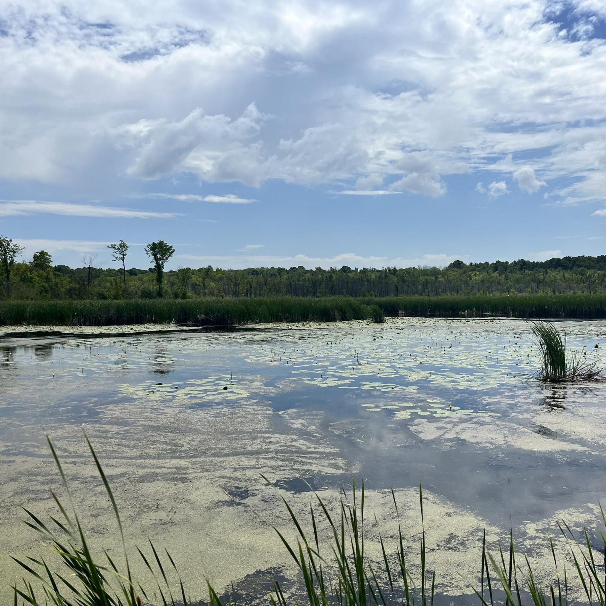
Lake Scugog wetlands are the lake's rich ecosystems, full of reeds, cattails, and aquatic plants. The shallow waters are home to birds, turtles, fish, and amphibians. These wetlands filter water, provide flood control, store stormwater, and support the lake's teeming biodiversity.
0
0
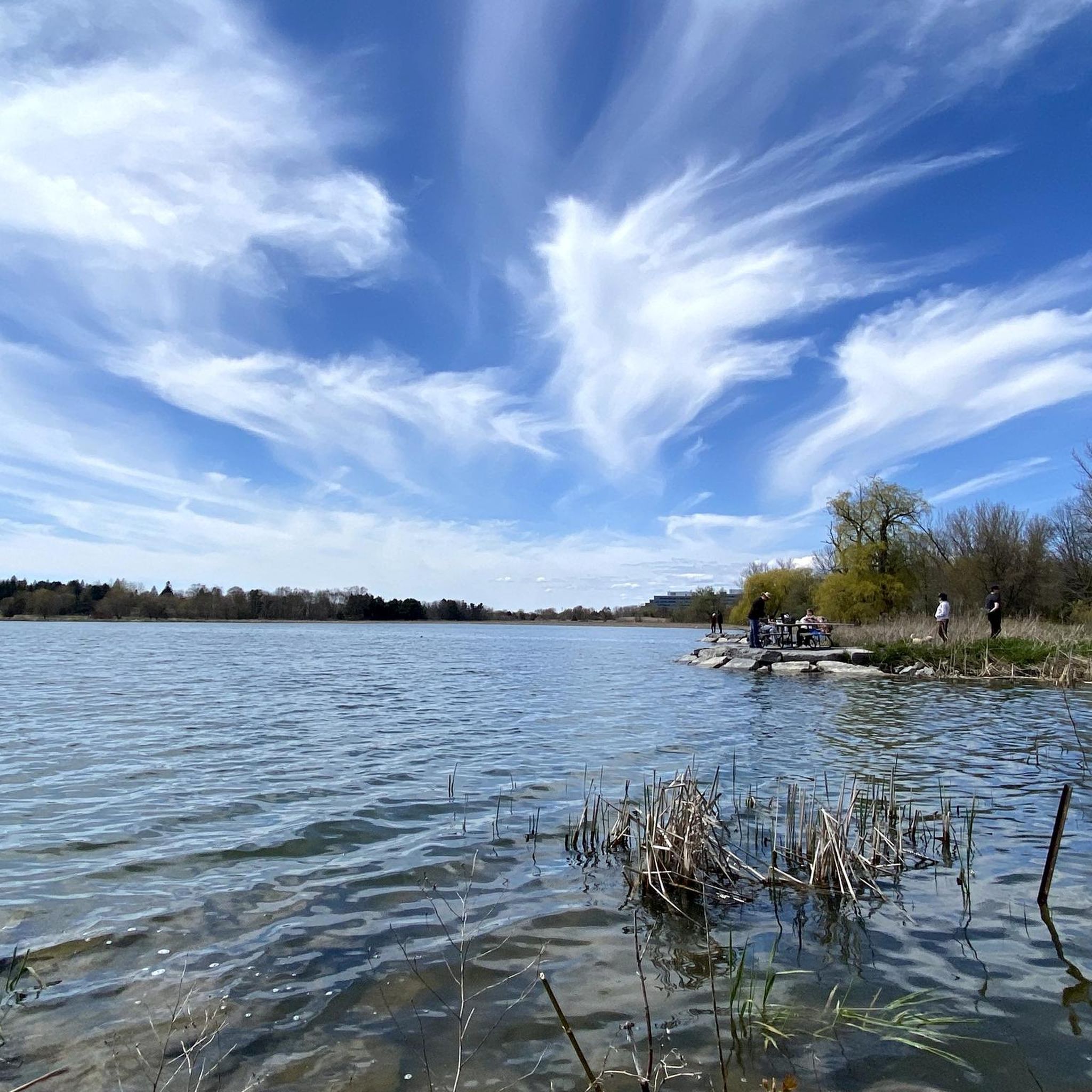
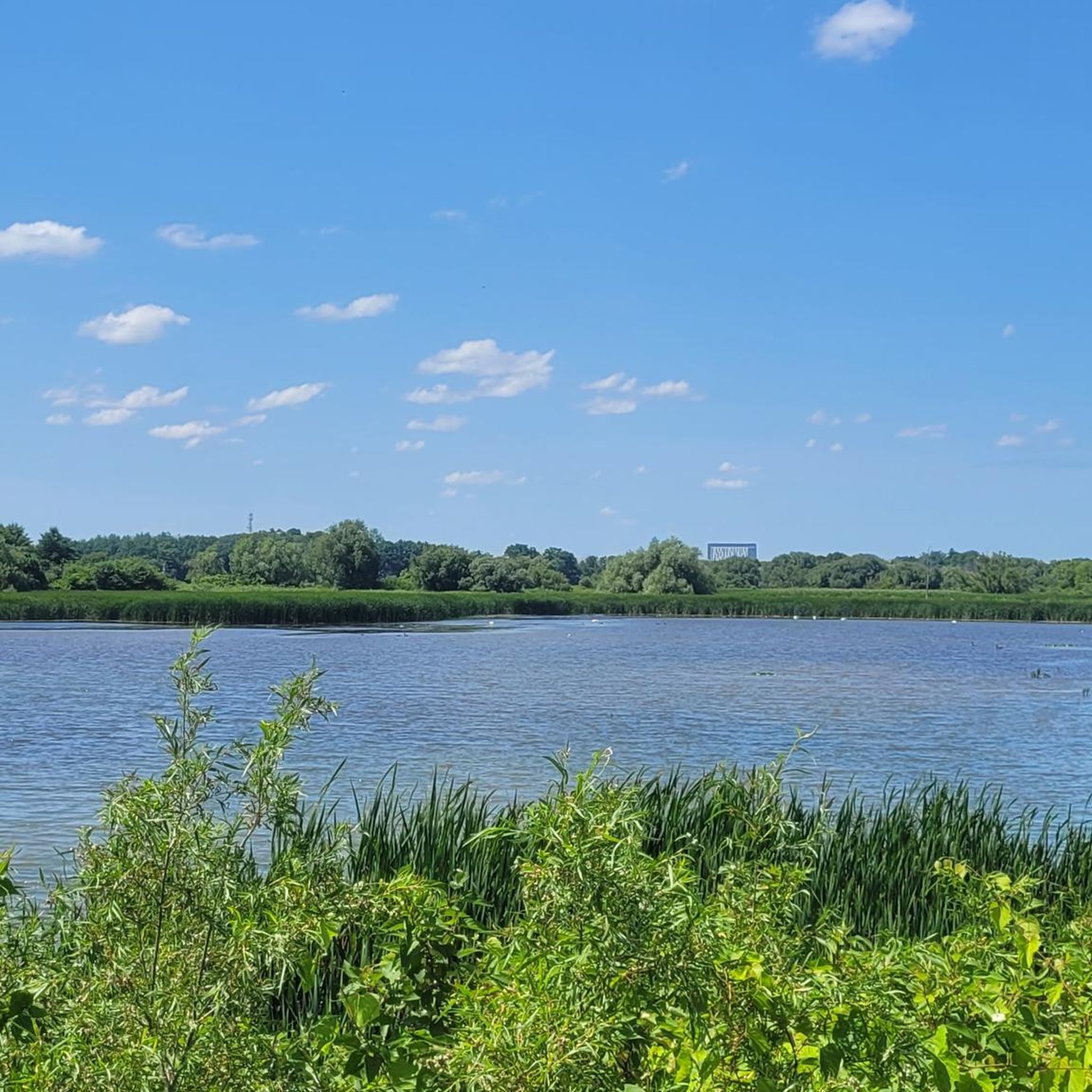
Lake Scugog is a large, shallow lake stretching about 60 square kilometres between Port Perry and Lindsay. The average depth of the lake is only 1.5 meters, so it's full of shores made up of marshland and animals that fish in the shallow water. There are often boaters, paddlers, and fishermen enjoying this lake in the summer.
0
0
The scenic Waterfront Trail is made up of a mix of limestone, woodchips, and wooden boardwalks along the marshland and over creeks. The terrain is flat with no elevation gain the entire way and explores some beautiful local ecosystems and neighbourhoods along Lake Scugog.
0
0

Crow’s Pass Conservation Area spans 64 hectares on the Oak Ridges Moraine, with a diverse landscape of forests, wetlands, and gently rolling hills. As part of a larger Natural Core Area, it plays a vital role in protecting important wildlife habitats and preserving ecological connections throughout the moraine. Several trails run through the area, including the Crows Pass trail, which is ideal for spending time enjoying a hike in a peaceful, relatively undisturbed setting.
0
0
Oak Ridges Moraine Trail is a long-distance, 275-kilometre multi-use route that follows the Oak Ridges Moraine, one of the most distinct physiographic landforms of southern Ontario, passing through forests, wetlands, and glacially formed hills. Within Crow’s Pass Conservation Area, a section of the trail briefly overlaps with the Crow's Pass trail, tracing a narrow path through mixed woodland and small clearings before continuing on its broader route. This stretch captures the Moraine’s gentle rises and dips, perfect for a quiet walk through ecologically significant terrain that connects larger natural areas across the region.
0
0
Crow's Pass trail is a picturesque loop that winds through forested landscape, gently traversing the ridges and low-lying areas of the Oak Ridges Moraine. As you walk the trail, you’ll experience a blend of mixed woodlands, moving from bright, sunlit high points to quiet, damp lowlands filled with seasonal pools and dense undergrowth. Portions of the trail connect with the Oak Ridges Moraine Trail, and despite its short length, the varied terrain and steady ups and downs make it an enjoyable trek through this beautiful area.
0
0

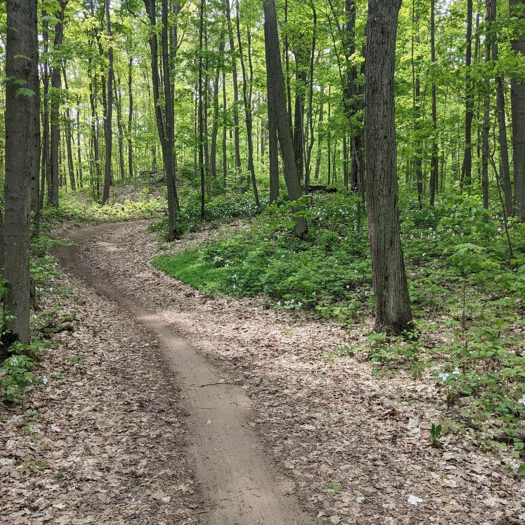
This is a super flowy singletrack between the pines. Visibility is good, but there are also a number of doubletrack trails in this part of the park that you can use to give space to other trail users.
0
0
Frequently Asked Questions
How many hiking trails are available in Scugog?
Scugog offers a diverse network of over 25 hiking routes, catering to various skill levels. You'll find a good mix of easy and moderate trails to explore the region's natural beauty.
Are there any easy, family-friendly hiking trails in Scugog?
Yes, Scugog has several easy trails perfect for families. The Purple Woods loop via Discovery Trail is an easy 1.3 km route through the natural setting of Purple Woods Conservation Area. Other options include the Port Perry Waterfront Trail System, which features accessible sections, and the 0.5 km Cartwright Fields Trail, ideal for nature lovers and family outings.
What kind of terrain can I expect on Scugog's hiking trails?
Scugog's trails offer varied terrain. You'll encounter paths along the shores of Lake Scugog, rolling topography within the Oak Ridges Moraine, and diverse woodlands in conservation areas. Surfaces can range from lime-stoned, paved, and wood-chipped sections, particularly along the Port Perry Waterfront Trail, to more natural forest paths.
Are there any circular hiking routes in Scugog?
Yes, many trails in Scugog are designed as loops. For instance, the Durham Regional Forest loop from Durham Regional Forest is a popular moderate 12.3 km circular path. The Purple Woods loop via Discovery Trail is another excellent easy option.
What natural features or landmarks can I see along the hiking trails in Scugog?
Scugog's trails showcase beautiful natural features like Lake Scugog and the Oak Ridges Moraine. You can also explore various conservation areas such as Purple Woods and Durham East Cross Forest. Notable highlights include the Durham Regional Forest Trails, the Wetlands Boardwalk on Uxbridge Rail Trail, and the Trans Canada Trail Singletrack.
Are there any trails that offer views of Lake Scugog?
Absolutely. Lake Scugog is a central feature of the region. The Port Perry Waterfront Trail System runs along the lake, providing picturesque views. The Canterbury Common Loop, part of this system, also offers a lookout point over Lake Scugog, as does the Rotary Environment Park Trail which follows the natural shoreline.
What do other hikers enjoy most about hiking in Scugog?
The area is highly rated by the komoot community, with an average score of 4.8 stars from over 20 reviews. Reviewers often praise the diverse landscapes, the scenic backdrops of Lake Scugog, and the unique experiences offered by trails within the Oak Ridges Moraine and various conservation areas.
Are there any longer, more challenging hikes in Scugog?
While Scugog primarily offers easy to moderate trails, some routes provide a longer, more immersive experience. The Steep Rocky Section loop from Durham Regional Forest is a moderate 15.3 km trail, often completed in about 4 hours, winding through diverse landscapes. The Brock/Scugog Oak Ridges Trail is also a more extensive option, spanning 70 km.
Are there trails suitable for dog walking in Scugog?
Many trails in Scugog's conservation areas and regional forests are generally dog-friendly, provided dogs are kept on a leash. The Durham Regional Forest trails, for example, are popular for walking with pets. Always check specific trail regulations before heading out.
Where can I find parking for hiking trails in Scugog?
Parking is available at various access points for Scugog's trails. For the Port Perry Waterfront Trail System, access points with parking can be found at Queen Street, Casimir Street, and Mary Street. Many conservation areas and regional forests, such as the Durham Regional Forest, also provide designated parking areas, like the Public parking - Durham Forest East Gate.
What is the best time of year to go hiking in Scugog?
Scugog offers enjoyable hiking experiences throughout the year. Spring brings blooming wildflowers, while autumn showcases vibrant fall foliage, making these seasons particularly scenic. Summer is great for longer days, and winter can offer beautiful snow-covered landscapes for those prepared for colder conditions.
Are there any historical sites or points of interest near the trails?
Yes, beyond the natural beauty, you can find points of interest. The Spencer School and Silver Maple is a historical site worth noting. Additionally, the Scugog Shores Museum Village, while not a trail itself, offers cultural enrichment with heritage buildings and gardens, often complementing a day of outdoor exploration.
Most popular attractions around Scugog

Get inspired with the komoot mobile app


Explore more
Browse the best Hikes in other regions.
