The best walks and hikes around Area A (Upper Flathead/Elk Valley)
4.7
(123)
1,951
hikers
30
hikes
Hiking around Area A (Upper Flathead/Elk Valley) encompasses a region straddling Montana (USA) and British Columbia (Canada), characterized by the Rocky Mountains, pristine forests, and numerous lakes and rivers. The terrain includes dramatic peaks, alpine vistas, and varied landscapes suitable for outdoor activities. This area offers a network of trails through diverse ecosystems, from dense woodlands to high alpine meadows.
Best hiking trails around Area A (Upper Flathead/Elk Valley)
- The most popular hiking route is Mount Fernie Ridge Trail —…
Last updated: October 19, 2026
4.7
(3)
62
hikers
7.92km
03:52
880m
880m
Moderate hike. Good fitness required. Easily-accessible paths. Suitable for all skill levels.
4.0
(1)
16
hikers
6.77km
02:45
530m
530m
Moderate hike. Good fitness required. Easily-accessible paths. Suitable for all skill levels.

7
hikers
6.05km
01:42
120m
120m
Easy hike. Great for any fitness level. Easily-accessible paths. Suitable for all skill levels.
7
hikers
8.04km
02:30
300m
300m
Moderate hike. Good fitness required. Easily-accessible paths. Suitable for all skill levels.
3
hikers
11.1km
02:53
70m
70m
Moderate hike. Good fitness required. Easily-accessible paths. Suitable for all skill levels.
Get access to more routes and recommendations from other explorers.
Already have an account?
Our route recommendations are based on thousands of hikes, rides, and runs completed by other people on komoot.
Start today with a free account
Your next adventure awaits.
Popular around Area A (Upper Flathead/Elk Valley)
Other adventures around Area A (Upper Flathead/Elk Valley)

Tips from the Community

Hidden in the forest on the lower slopes of Mount Proctor, Fairy Creek Falls is one of Fernie's most accessible waterfalls. Fairy Creek tumbles over a rocky ledge into a narrow gorge, creating a picturesque cascade surrounded by mossy forest and steep canyon walls.
0
0
Mount Proctor Trail climbs steadily through dense forest before emerging onto open slopes and rocky terrain high above Fernie. The route is known for its sustained elevation gain and rewarding views, making it one of the area's classic summit hikes. As you climb, the forest gives way to increasingly expansive views of the Elk Valley, surrounding mountain ranges, and the town of Fernie far below.
0
0
A break in the trees opens up a sweeping view across the Elk Valley to the rugged peaks of the Lizard Range. Snow often lingers on the higher summits well into summer, creating a striking contrast with the forested slopes below. The narrow singletrack leading through the viewpoint makes this one of the most scenic sections of the Montane Trail Network.
0
0
Montane Blue is one of the easier trails within Fernie’s Montane Trail Network, winding through open Douglas fir forest and grassy hillsides on the lower slopes of Castle Mountain. The mostly smooth singletrack makes for a pleasant walking route, while frequent openings in the trees reveal views across the Elk Valley and surrounding peaks. Wildflowers are common along the trail in summer, and the gentle gradients make it a good introduction to the wider Montane network before tackling the steeper trails higher up.
0
0
Hyperventilation is a steep forest trail that climbs the lower slopes of Castle Mountain through dense conifer forest. Roots, loose dirt, and sustained elevation gain make it one of the more demanding sections of the route, but it provides a direct link towards the upper viewpoints and trail network. If you are hiking this trail watch for mountain bikes, as this is a shared-use trail and a popular part of Fernie's riding system.
0
0

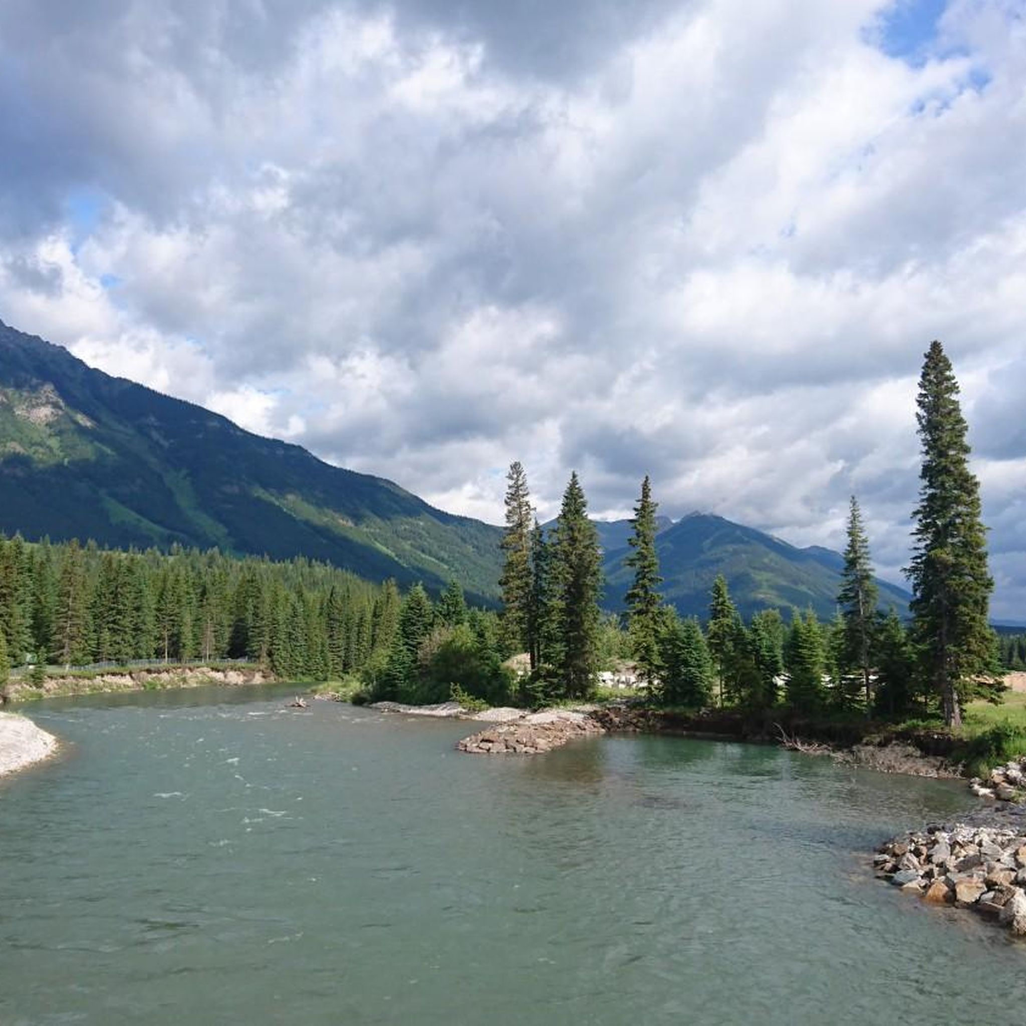
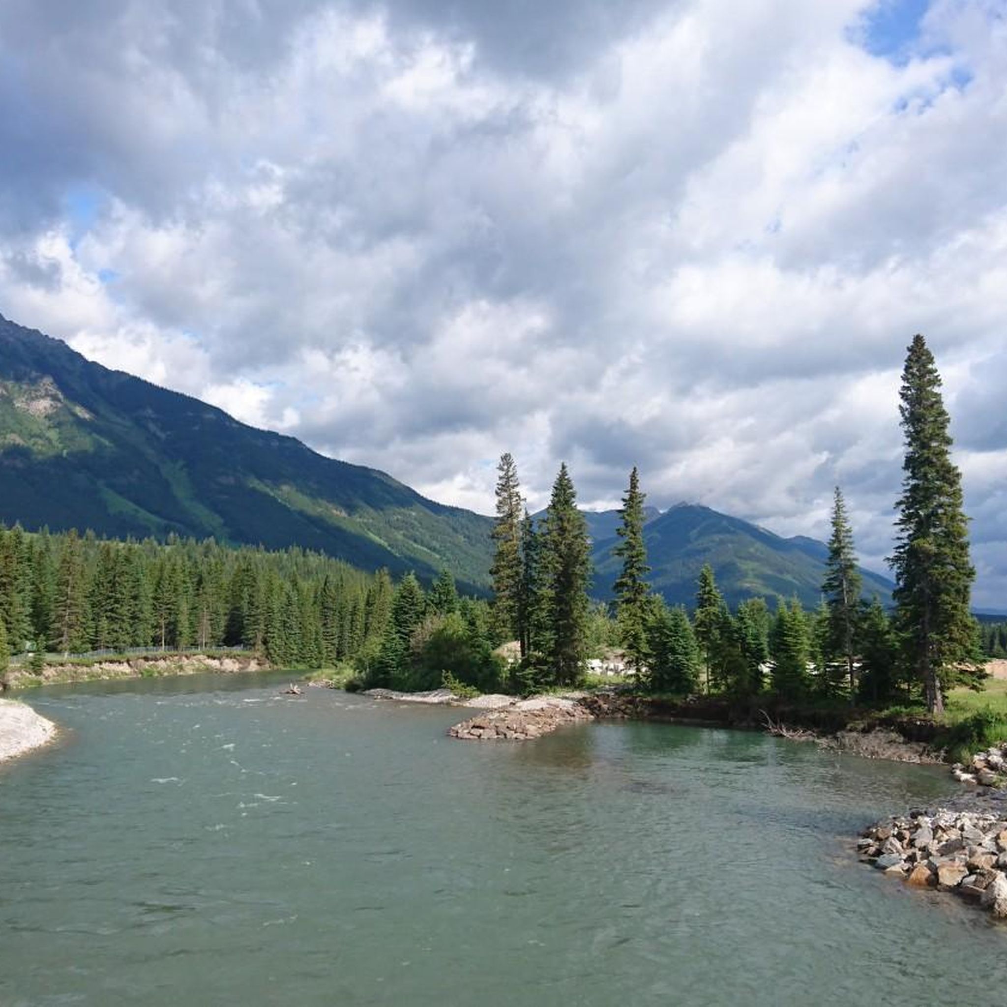
The Elk River flows 220 kilometres until reaching the Lake Koocanusa reservoir by the U.S.-Canada border. It is managed as a "Quality Waters Fishery," which is open to fishing with certain regulations so as to help with larger, healthier fish populations. There's also summer rafting, with rapids near Fernie, and a mellower river float.
0
0
Fernie is a little mountain town, home to year-round outdoor activity. In winter there's the Fernie Alpine Resort for skiing and snowboarding, and in summer there's downhill biking, hiking, and resort activities. Fernie has a population under 10,000 people, and it has a charming downtown to explore.
0
0
The Fairy Creek Pedestrian and Cyclist Bridge is a wooden-covered bridge with a wooden carving of "Fernie" on top, sitting just 400 meters west of the Tourism Fernie centre. It's an iconic local landmark and is best experienced from the bike path and not the road.
0
0
Frequently Asked Questions
How many hiking trails are available in Area A (Upper Flathead/Elk Valley)?
Area A offers a diverse network of over 20 hiking trails, catering to various skill levels. You'll find everything from easy walks to challenging multi-day treks across the region's stunning landscapes.
What is the best time of year to go hiking in Area A?
The best time for hiking in Area A is generally during the summer months, from late June to early September, when alpine meadows burst with wildflowers and trails are mostly snow-free. However, spring and fall offer cooler temperatures and vibrant foliage, while some areas may provide winter hiking opportunities, particularly in the Elk Valley.
Are there family-friendly hiking options in Area A?
Yes, Area A provides several family-friendly trails. For example, the Fairy Falls – Fairy Creek Falls loop from Fernie is an easy 4.4-mile (7.1 km) path leading to waterfalls, suitable for families. The Jewel Basin area in Montana also features trails for all levels, including easier options.
Are there any dog-friendly trails in Area A?
Many trails in Area A are dog-friendly, but regulations can vary by specific park or wilderness area. It's always best to check local rules for areas like Glacier National Park, Flathead National Forest, or Elk Lakes Park before heading out with your canine companion. Generally, dogs are welcome on leash in most national forests and provincial parks, but may be restricted on certain trails or in specific seasons.
Can I find trails with waterfalls in Area A?
Absolutely! Area A is home to several beautiful waterfalls. In British Columbia, you can hike to the impressive Petain Creek Waterfall in Elk Lakes Park. In Montana, Holland Falls offers a scenic wilderness experience. The Fairy Falls – Fairy Creek Falls loop from Fernie also leads to lovely cascades.
Are there any circular hiking routes in Area A?
Yes, Area A features several circular routes. A popular option is the Fairy Falls – Fairy Creek Falls loop from Fernie. Another highly-rated loop is the View of Goldilocks loop from Bear Lodge Bistro, offering great views.
What are some challenging hikes for experienced hikers in Area A?
For experienced hikers seeking a challenge, Area A offers demanding routes. In the Elk Valley, trails to West Elk Pass, Fox Lake, Frozen Lake, and Coral Pass in Elk Lakes Park provide significant challenges. In Montana, the Bob Marshall Wilderness Complex is known for its iconic Chinese Wall and challenging routes. The Mt. Aeneas Trail in Jewel Basin is also considered challenging.
What are some notable landmarks or attractions I can see along the hiking trails?
Area A is rich in natural landmarks. You can explore stunning geological formations like the Chinese Wall in the Bob Marshall Wilderness. Hikers can also discover beautiful lakes such as Summit Lake and Cameron Lake. The region also features impressive waterfalls like Turret Falls and the Castelnau Hanging Glacier.
What do other hikers enjoy most about hiking in Area A (Upper Flathead/Elk Valley)?
The area is highly rated by the komoot community, with an average score of 4.7 stars from over 60 reviews. Reviewers often praise the diverse and dramatic Rocky Mountain landscapes, including towering peaks, pristine lakes, and expansive forests. The well-maintained trail networks and access to renowned parks like Glacier National Park are also frequently highlighted.
Are there less crowded hiking options in Area A?
While popular areas can get busy, you can find less crowded trails. In the Flathead National Forest, hikes like Stanton Lake offer pristine waters and mountain views with fewer crowds. The Mission Mountains also provide picturesque scenery and solitude on trails such as Crow Creek Trail and Turquoise Lake Trail. Exploring trails outside of peak tourist seasons can also help avoid crowds.
Are there any long-distance or multi-day hiking opportunities?
Yes, Area A is ideal for longer treks. The Elk Valley Trail, part of the larger Great Trail (Trans Canada Trail), is a 198-kilometer multi-use trail traversing mountainsides and the Elk River Valley. In Montana, the Bob Marshall Wilderness Complex offers extensive backcountry experiences, and Jewel Basin provides backpacking options like the Picnic Lakes Trail.
Do I need a permit to hike in Area A?
Permit requirements vary depending on the specific location within Area A. While many trails in national forests and provincial parks do not require permits for day hiking, some wilderness areas, backcountry camping, or specific trails within Glacier National Park or Elk Lakes Park might. Always check the regulations for your chosen destination in advance.
What kind of views can I expect on hikes in Area A?
Hikes in Area A offer breathtaking views of the Rocky Mountains, including dramatic peaks, alpine vistas, and expansive valleys. You can expect panoramic views of Glacier National Park, the Flathead Valley, and the Swan Range from trails like Scalplock Lookout. Many trails also provide stunning perspectives of pristine lakes, dense forests, and cascading waterfalls.
Most popular routes around Area A (Upper Flathead/Elk Valley)
Most popular attractions around Area A (Upper Flathead/Elk Valley)

Get inspired with the komoot mobile app


Explore more
Browse the best Hikes in other regions.
