The best running trails around Tyrifjorden
4.4
(13)
1,546
runners
117
runs
Jogging around Tyrifjorden offers diverse landscapes for outdoor activities. The region is characterized by its large lake, surrounding hills, and dense forests, providing a varied terrain for runners. Trails range from gentle lakeside paths to more challenging routes through nature reserves and up to viewpoints. This area features a mix of paved surfaces and accessible paths, catering to different fitness levels and preferences.
Best jogging routes around Tyrifjorden
- The most popular jogging route is Running loop from Steinsvika naturreservat,…
Last updated: June 26, 2026
152
runners
13.5km
01:28
130m
130m
Moderate run. Good fitness required. Mostly paved surfaces. Suitable for all skill levels.
14
runners
9.49km
01:17
410m
410m
Hard run. Very good fitness required. Mostly accessible paths. Some sure footedness required.

Sign up for free
8
runners
4.99km
00:32
70m
70m
Easy run. Great for any fitness level. Mostly paved surfaces. Suitable for all skill levels.
3
runners
7.12km
00:48
160m
160m
Moderate run. Good fitness required. Mostly paved surfaces. Suitable for all skill levels.
5
runners
12km
01:18
150m
150m
Moderate run. Good fitness required. Mostly paved surfaces. Suitable for all skill levels.
Get access to more routes and recommendations from other explorers.
Sign up for free
Already have an account?
Our route recommendations are based on thousands of hikes, rides, and runs completed by other people on komoot.
Start today with a free account
Your next adventure awaits.
Login or Signup

Tips from the Community

A great rest area right next to Kongens Utsikt. Here you'll find a covered bench, which also serves as a shelter for the night if necessary.
7
0

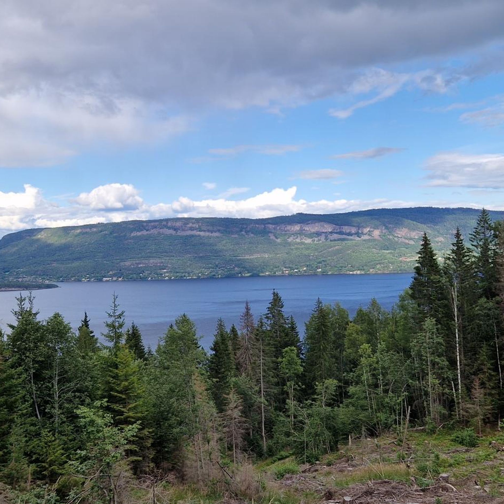
A beautiful vantage point overlooking the fjord. From the hiking parking lot at the hotel, it's a short hike that's also doable with children.
4
0
Great vantage point overlooking the fjord. There are plenty of benches and an emergency shelter. There is currently a forest fire risk, as at least the signs on site warn of this.
3
0

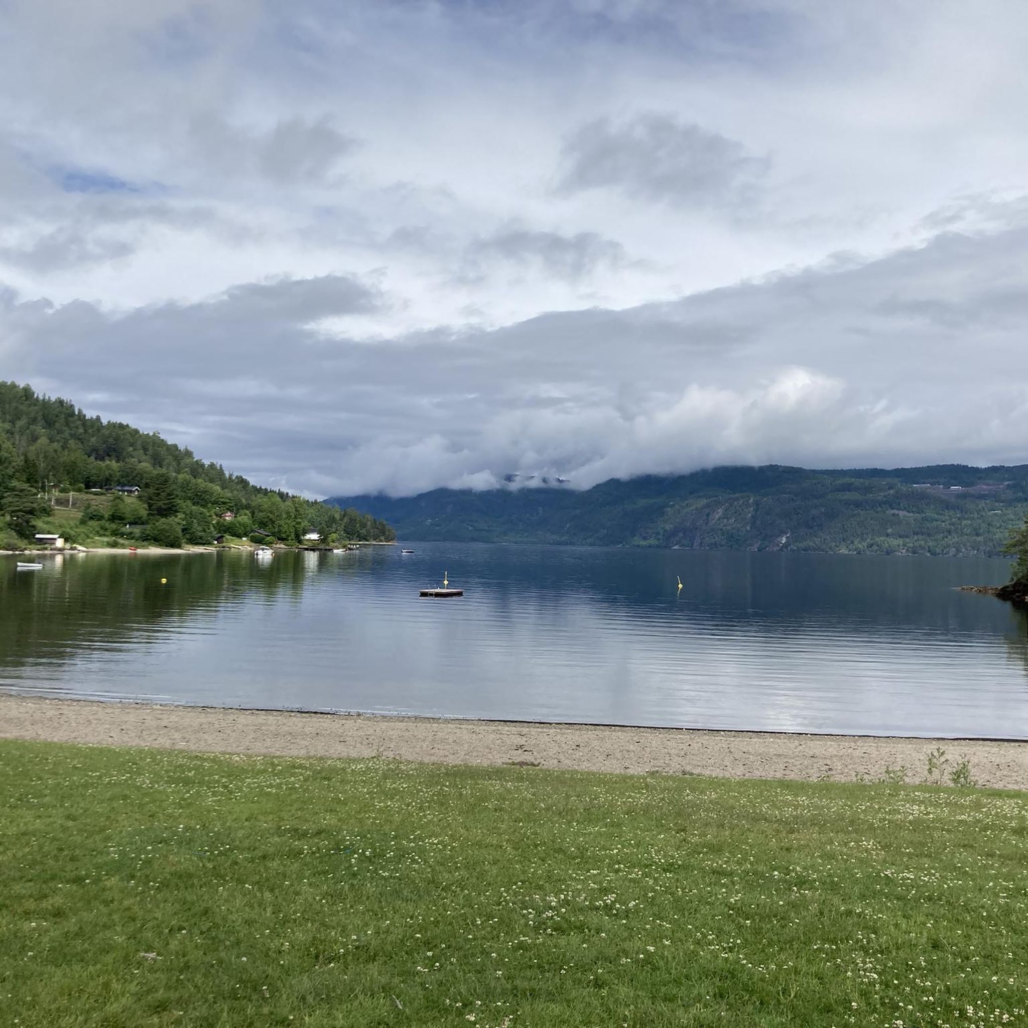
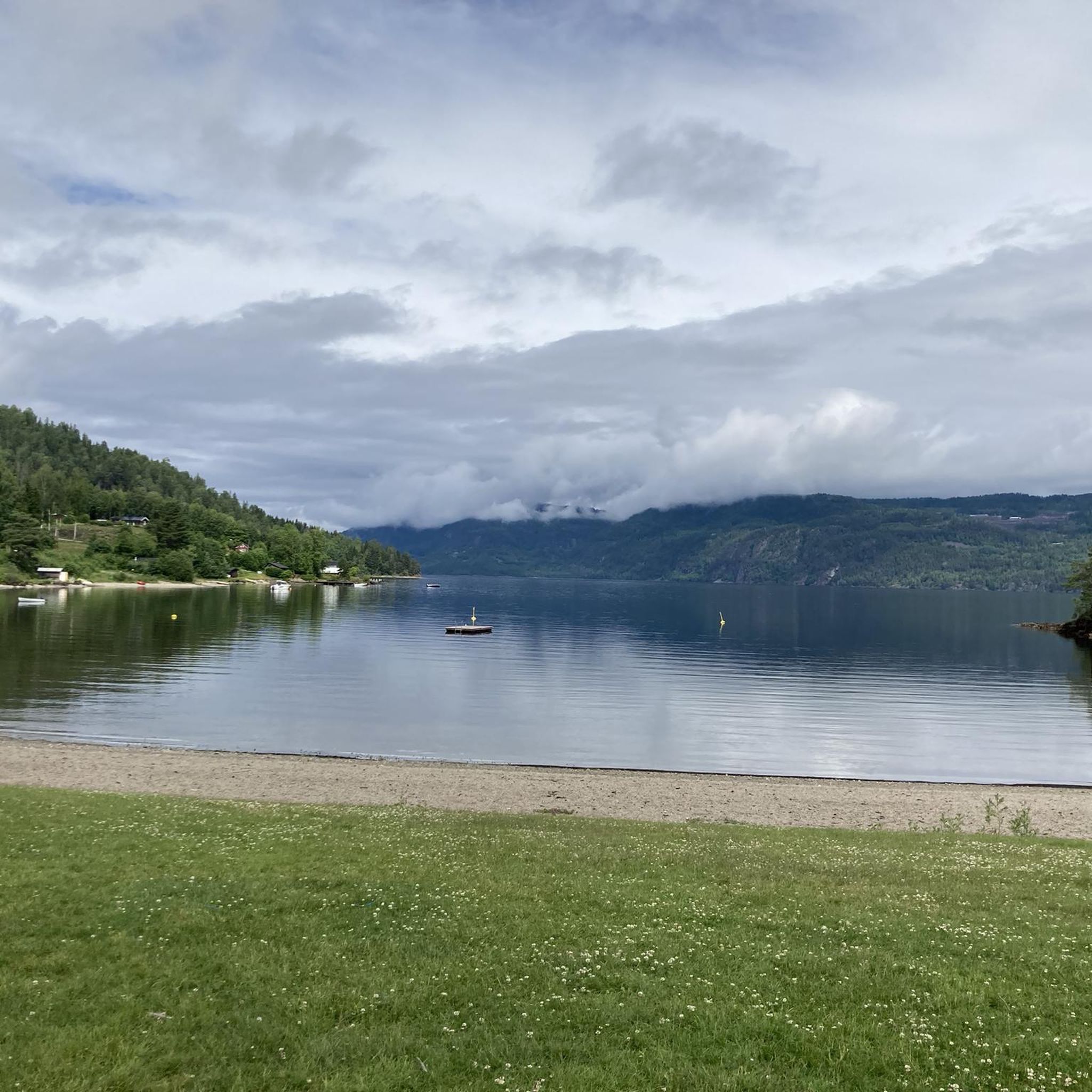
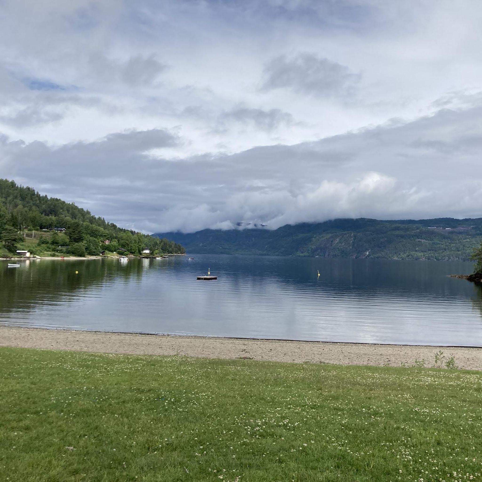
Tyrifjorden is a picturesque inland lake in the Viken county in southeastern Norway, located about 40 kilometers northwest of Oslo. With a surface area of approximately 139 km², it is the fifth largest lake in the country and has an impressive volume of over 13 km³. The lake's deepest point reaches 295 meters. The region around Tyrifjorden is popular for recreational activities such as hiking, camping, swimming, and fishing. The flora and fauna are also diverse, making it an attractive destination for nature lovers.
0
0

The view is outstandind. One of the best in the whole region, photos do not give justice to it.
0
0

A "royal view" is actually offered here! Stunning!!!
4
0

Kongens Utsikt - the royal lookout point - is 484 meters above the Tyrifjorden and Steinsfjorden lakes. From here you have a great view over large parts of Ringerike and Hole. King Karl Johan visited this place in 1832, from which the name is derived.
0
0

Beautiful view and great hiking trail. Giant stones distributed all the way. There is also a covered place if you are surprised by the rain or want to stay overnight.
0
0
Frequently Asked Questions
How many running routes are available around Tyrifjorden?
Tyrifjorden offers a wide selection of running routes, with over 130 trails available for exploration. These routes cater to various fitness levels, from easy lakeside paths to more challenging trails through nature reserves.
What kind of terrain can I expect on jogging trails in Tyrifjorden?
The terrain around Tyrifjorden is quite diverse. You'll find a mix of mostly paved surfaces, accessible paths, and more rugged trails through dense woodlands and nature reserves like Krokkleiva. Many routes also feature tranquil lakeside paths, offering a serene running experience.
Are there any easy or beginner-friendly running routes in Tyrifjorden?
Yes, Tyrifjorden has several easy running routes suitable for beginners or those looking for a gentle jog. The region offers paths that are less demanding, often along the lakeside, providing a pleasant experience without significant elevation gain.
Where can I find challenging running trails with significant elevation gain?
For a more challenging experience, consider routes that ascend to viewpoints or traverse rugged nature reserves. An example is the difficult route Kongens utsikt – Krokkleiva naturreservat loop from Sundvollen, which features panoramic views and explores varied terrain. Another challenging option is the Gyrihaugen loop from Mørkgonga naturreservat, known for its significant elevation changes.
Are there any running routes that offer panoramic views?
Absolutely! Tyrifjorden is renowned for its breathtaking vistas. Routes like the Kongens utsikt – Krokkleiva naturreservat loop from Sundvollen lead to iconic viewpoints such as Kongens utsikt (King's View) and Kronprinsens utsikt, offering expansive views over the lake and surrounding mountains. The Ringerike Panorama Trail also provides extensive scenic outlooks.
Can I find circular running routes around Tyrifjorden?
Yes, many of the running routes in Tyrifjorden are designed as loops, allowing you to start and finish at the same point. For instance, the popular Running loop from Steinsvika naturreservat is a moderate circular trail that combines lakeside scenery with natural reserve exploration.
Are the running trails in Tyrifjorden suitable for families?
Yes, Tyrifjorden offers several family-friendly jogging options, particularly the easier, flatter routes along the lakeside or through less challenging forest paths. These provide a great way for families to enjoy the outdoors together.
Are dogs allowed on the running trails around Tyrifjorden?
Generally, dogs are welcome on many outdoor trails in Norway, but specific rules can vary, especially in nature reserves. It's always best to keep dogs on a leash and ensure you clean up after them. Check local signage for any specific restrictions in certain areas.
What do other runners say about the jogging routes in Tyrifjorden?
The running routes in Tyrifjorden are highly rated by the komoot community, with an average score of 4.6 stars from over 10 reviews. Runners often praise the diverse landscapes, from tranquil lakeside paths to challenging forest trails, and the stunning panoramic views from various viewpoints.
Are there specific natural features or landmarks I can see while jogging?
Absolutely! While jogging, you can encounter diverse natural features like the dense woodlands and tranquil waterways, especially along the western shores. Notable landmarks include the historic Kongens utsikt viewpoint and the rugged terrain of Krokkleiva nature reserve, a gorge-like area that has inspired artists for centuries.
What are the best seasons for jogging around Tyrifjorden?
The warmer months, from spring through autumn, are generally ideal for jogging around Tyrifjorden, offering pleasant temperatures and lush scenery. During these seasons, you can fully enjoy the lakeside paths, forest trails, and panoramic viewpoints.
Is it possible to jog in Tyrifjorden during winter?
While many trails are accessible in winter, conditions can vary significantly. Some areas might be suitable for winter running, but others may be covered in snow and ice, making them more appropriate for cross-country skiing. Always check local conditions and be prepared for colder weather and potentially slippery surfaces.
Are there any long-distance running trails for endurance training?
Yes, for those seeking longer distances, Tyrifjorden offers several extensive routes. The Solvang Asatua Nature Kindergarten loop from Åsa kraftstasjon is a challenging 22.9 km trail, and the Solvang Asatua Nature Kindergarten loop from Steinsfjorden biotopvernområde is another difficult option spanning 23.5 km, both providing ample opportunity for endurance training.
Most popular routes around Tyrifjorden

Get inspired with the komoot mobile app


Explore more
Browse the best Running Trails & Routes in other regions.
