The best walks and hikes around Area D (Lardeau Valley/Duncan Lake)
4.7
(17)
260
hikers
11
hikes
Hiking around Area D (Lardeau Valley/Duncan Lake) offers diverse experiences within British Columbia's pristine wilderness. The region is characterized by the Purcell Mountains, featuring alpine meadows, glaciers, and mountain lakes, alongside the Lardeau Valley situated at the north end of Kootenay Lake and the Lardeau River. This area transitions through multiple biogeoclimatic zones, from wet valleys with towering cedar and cottonwood trees to high alpine environments, providing varied terrain for hikers.
Best hiking trails around Area D (Lardeau Valley/Duncan Lake)
…Last updated: September 2, 2026
3.7
(3)
27
hikers
3.39km
00:58
80m
80m
Easy hike. Great for any fitness level. Easily-accessible paths. Suitable for all skill levels.
5.0
(2)
18
hikers
2.58km
00:46
80m
80m
Easy hike. Great for any fitness level. Easily-accessible paths. Suitable for all skill levels.

Sign up for free
5.0
(1)
15
hikers
10.1km
03:37
590m
590m
Moderate hike. Good fitness required. Easily-accessible paths. Suitable for all skill levels.
5.0
(1)
6
hikers
15.5km
06:12
1,160m
1,160m
Hard hike. Very good fitness required. Sure-footedness, sturdy shoes and alpine experience required.
6
hikers
10.7km
04:49
1,020m
1,020m
Hard hike. Very good fitness required. Easily-accessible paths. Suitable for all skill levels.
Get access to more routes and recommendations from other explorers.
Sign up for free
Already have an account?
Our route recommendations are based on thousands of hikes, rides, and runs completed by other people on komoot.
Start today with a free account
Your next adventure awaits.
Login or Signup
Popular around Area D (Lardeau Valley/Duncan Lake)
Tips from the Community

Located in British Columbia's West Kootenay region, the Kaslo River is a stunning waterway that serves up picturesque views around every bend. The river makes its short 58-kilometre run from the mountains to Kootenay Lake at the town of Kaslo. It's here, near the mouth, where you'll find the family friendly Kaslo River Trail, which is a must do short loop that's fun for all ages.
0
0
A number of statues, known as Koots, are dotted along the Kaslo River Trail. Some of them are quite obvious while others are a bit more hidden. Keep your eyes peeled as you walk along the river and through the forest, you never know what you might see looking back at you.
0
0
This picturesque covered bridge is one of two that cross over the Kaslo River on the Kaslo River Trail. This is the closest one to town, so even if you don't have time to do the full trail, it's worth it to come out here to see the fairytale like setting.
0
0

Around 2.5 kilometres before reaching Cobalt Lake, the trail passes a small alpine waterfall cascading down smooth granite slabs into a clear pool below. Surrounded by rocky slopes and sparse alpine vegetation, it’s one of the more scenic stopping points along the climb and a good place to cool off before the steeper final approach toward the lake basin.
0
0
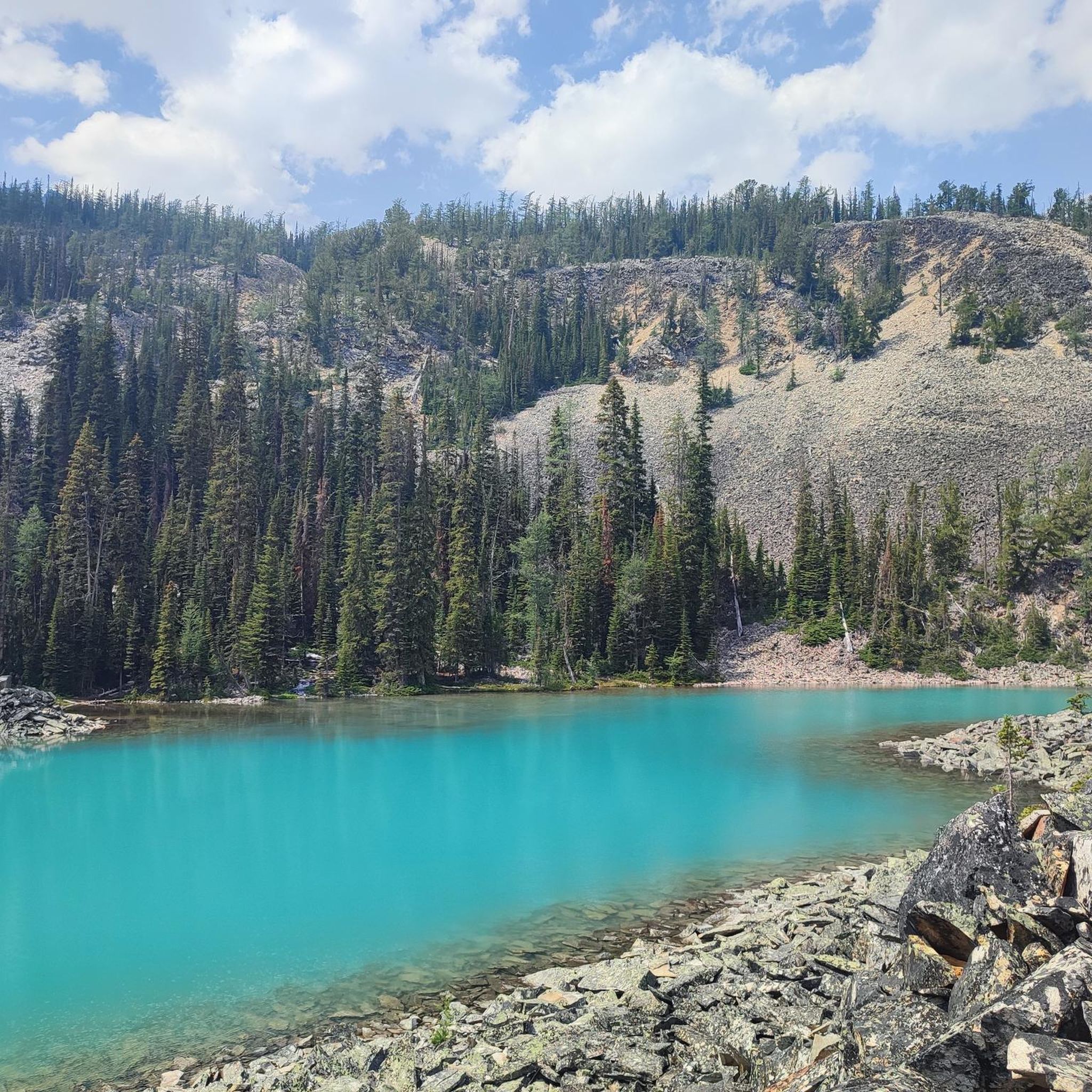
Set beneath glaciers and the jagged granite peaks of the Bugaboos, Cobalt Lake is known for its striking blue colour created by glacial silt suspended in the water. The alpine lake sits in a rugged basin surrounded by steep rock walls, lingering snowfields and scattered larch trees, with reflections of the surrounding peaks often visible on calmer days.
0
0
The Cobalt Lake Trail climbs through dense forest and steep alpine terrain to a vivid turquoise lake surrounded by glaciers and the towering granite spires of the Bugaboos. Higher sections of the trail become increasingly exposed, with rocky slopes, loose terrain and expansive views across the Purcell Mountains. In late September, golden larch trees add colour to the otherwise rugged alpine landscape.
0
0
Kokanee Creek Old Growth Recreation Site protects a rare section of inland temperate rainforest in British Columbia’s Kootenays, where massive western red cedars and hemlocks tower above a forest floor thick with moss, ferns and fallen logs. Some of the cedars along the trail are estimated to be more than 800 years old, with interpretive signs explaining both the ecology of the forest and its logging history. Kokanee Creek flows through the site below steep forested slopes, adding to the cool and sheltered atmosphere beneath the canopy.
0
0
The Old Growth Recreation Trail winds through a dense stand of ancient western red cedar and hemlock forest in the inland rainforest region of British Columbia’s Kootenays. Thick moss covers the forest floor and fallen logs, while towering old growth trees line the route, creating a cool and shaded atmosphere even in summer. Short boardwalk sections and packed dirt paths make the trail relatively accessible, though conditions can become slippery after rain.
0
0
Frequently Asked Questions
How many hiking trails are available in Area D (Lardeau Valley/Duncan Lake)?
Area D offers a variety of hiking experiences, with over 9 routes available. These range from easy strolls to more challenging alpine treks, ensuring options for different fitness levels.
What kind of landscapes can I expect to see while hiking in Area D?
The region boasts diverse landscapes, transitioning through five biogeoclimatic zones. You'll find wet valleys with towering cedar and cottonwood trees, views of Kootenay Lake and the Lardeau River, and access to the spectacular Purcell Mountains with their alpine meadows, glaciers, and mountain lakes. Old-growth forests are also a prominent feature.
Are there any easy hiking trails suitable for beginners or families in Area D?
Yes, there are easier options. For a gentle walk, consider the Stone Sculptures in the Forest loop from Kaslo, which is just over 3 km and takes less than an hour. Another easy option is the 20-minute walk through old-growth forest at John Fenger Memorial Park in Gerrard.
What are some challenging or longer day hikes in the Lardeau Valley area?
For those seeking a challenge, the Conrad Kain Hut loop from Walter Lake is a moderate 8 km hike with significant elevation gain. The Monica Meadows Trail, at 10.1 km, offers high alpine hiking experiences and requires good fitness.
Are there any trails that lead to unique natural features like hot springs or waterfalls?
Yes, the Dewar Creek Trail, located in the Purcell Wilderness Conservancy Provincial Park, leads to the unique Dewar Creek Hot Springs. While specific waterfalls aren't highlighted in the data, the diverse river and mountain landscapes suggest potential for scenic water features.
What is the best time of year to go hiking in Area D?
The hiking season generally runs from spring to fall. Many trails, like Fry Creek, are accessible from mid-April to early November. Higher elevation trails in the Purcell Mountains are best enjoyed from late spring through early fall when snow has melted, typically from late May to late October for routes like Davis Creek.
Are dogs allowed on the hiking trails in Area D?
While specific regulations for each trail vary, many trails in British Columbia's wilderness areas permit dogs, often requiring them to be on a leash. It's always best to check local signage at trailheads or the specific park regulations for the trail you plan to hike to ensure compliance and safety for your pet and local wildlife.
What kind of wildlife might I encounter on the trails?
Area D is home to a rich variety of wildlife. Hikers might spot deer, moose, elk, black and grizzly bears, mountain caribou, wolverine, and wolves. Over 68 species of birds have been recorded, and streams contain native fish like cutthroat and rainbow trout. Always be bear-aware and carry bear spray.
Are there any circular hiking routes in Area D?
Yes, there are several loop options. The Conrad Kain Hut loop from Walter Lake is a popular choice. Another is the Stone Sculptures in the Forest loop from Kaslo, which is an easier, shorter option.
What do other hikers enjoy most about hiking in Area D (Lardeau Valley/Duncan Lake)?
The area is highly rated by the komoot community, with an average score of 4.5 stars from over 10 reviews. Hikers often praise the pristine wilderness, diverse landscapes ranging from wet valleys to alpine meadows, and the variety of trails suitable for different fitness levels.
Are there any nearby attractions or points of interest to explore besides hiking?
Beyond hiking, the Lardeau Valley and Duncan Lake area offer opportunities for camping, river walks, caving, climbing, and various water activities on Kootenay Lake and Duncan Lake, such as swimming, fishing, and sailing. The Lardeau Regional Park also provides day-use activities like picnicking and beach access.
Where can I find more information about the Lardeau Valley region?
For additional information about the Lardeau Valley and surrounding areas, you can visit the local tourism resources. For instance, you can explore more about the Meadow Creek and Lardeau area at visitkaslo.com, or find day trip ideas at visitkaslo.com/day-trips/.
Most popular routes around Area D (Lardeau Valley/Duncan Lake)
Most popular attractions around Area D (Lardeau Valley/Duncan Lake)

Get inspired with the komoot mobile app


Explore more
Browse the best Hikes in other regions.
