Area J (Copper Desert Country)
Area J (Copper Desert Country)
Top 13 Natural Monuments around Area J (Copper Desert Country)
Natural monuments around Area J (Copper Desert Country) are found within an electoral area of British Columbia, Canada, known for its diverse landscape. This region features desert-like shores of Kamloops Lake, high-altitude forests, and various lakes. The area holds cultural significance for the local Secwepemc First Nations, with sites like Coyote Rock serving as traditional boundary markers. Its geological formations, including numerous hoodoos and volcanic remnants, offer unique natural attractions.
Best natural monuments around Area J (Copper Desert Country)
- The…
Last updated: July 10, 2026
Battle Bluff Cairn and View of Kamloops Lake
Highlight • Viewpoint
Tip by

Junction and trail to Cinnamon Ridge
Highlight • Trail
Tip by
Sign up now to discover places like this
Get recommendations on the best single tracks, peaks, & plenty of other exciting outdoor places.
Sign up for free
View of basalt columns
Highlight • Natural Monument
Tip by
Hoodoos and rock formations
Highlight • Natural Monument
Tip by
Mara Hill Trail
Highlight • Trail
Tip by
Sign up for free to discover even more natural monuments around Area J (Copper Desert Country).
Sign up for free
Already have an account?
Start today with a free account
Your next adventure awaits.
Login or Signup
Popular around Area J (Copper Desert Country)

Forests, desert, wilderness - day tours in British Columbia
Hiking around Area J (Copper Desert Country)
Running Trails around Area J (Copper Desert Country)
Cycling around Area J (Copper Desert Country)
Road Cycling Routes around Area J (Copper Desert Country)
MTB Trails around Area J (Copper Desert Country)

Gravel biking around Area J (Copper Desert Country)
Other adventures around Area J (Copper Desert Country)

Tips from the Community

Wonderful view over Lake Kamloops
0
0

Once you've made the rather steep climb to Battle Bluff, a breathtaking view of Kamloops Lake, the surrounding mountains, and Kamloops to your left awaits you alongside an imposing cairn. The light conditions are especially beautiful at sunset, but remember to descend before it gets really dark. Also, since cougars are native to this area. The name of the lookout rock probably goes back to First Nations battles. Below the lookout and about 15 meters above the water's edge of Kamloops Lake, red markers made of paint indicate the blood that is said to have been spilled here. The markers are only accessible by boat.
6
0
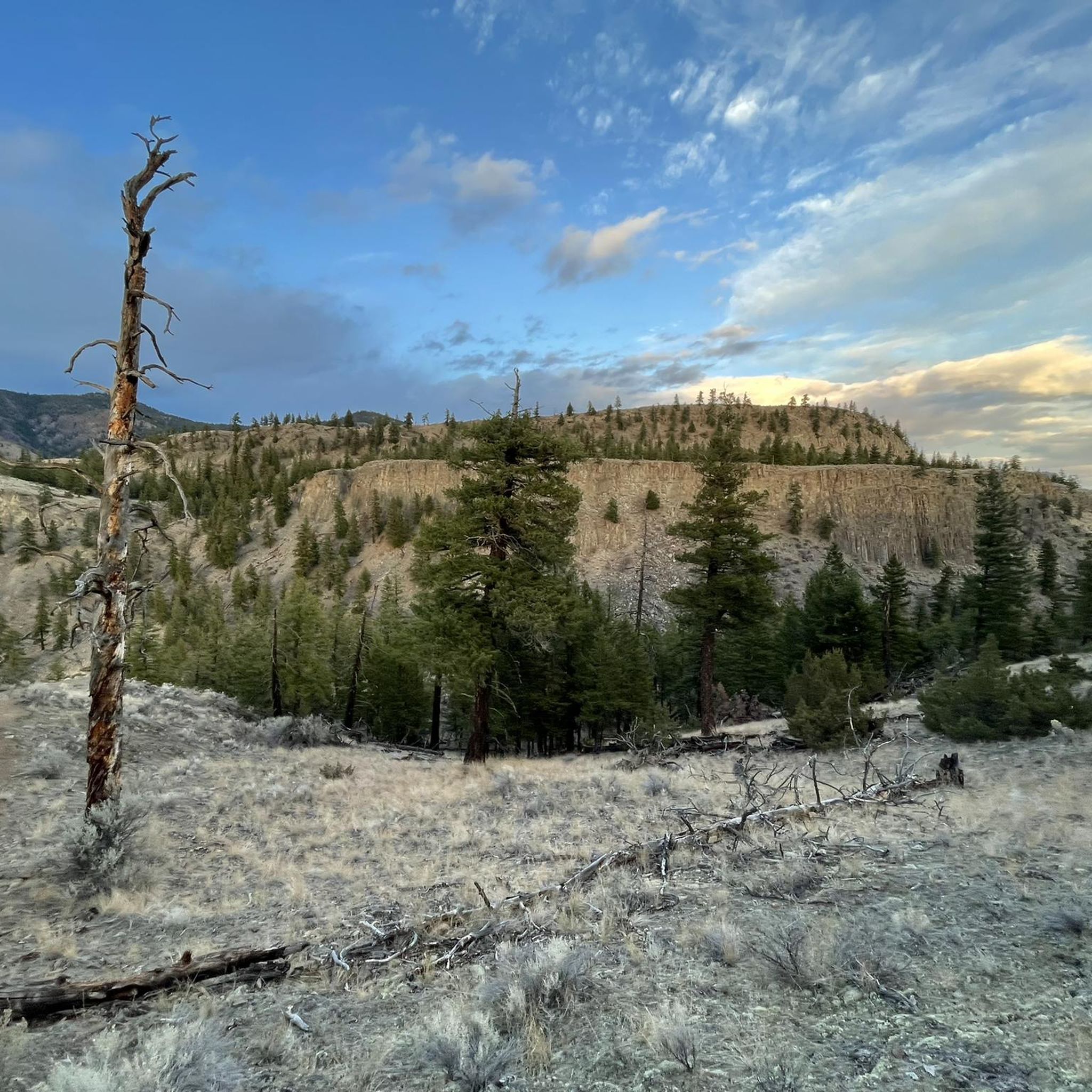
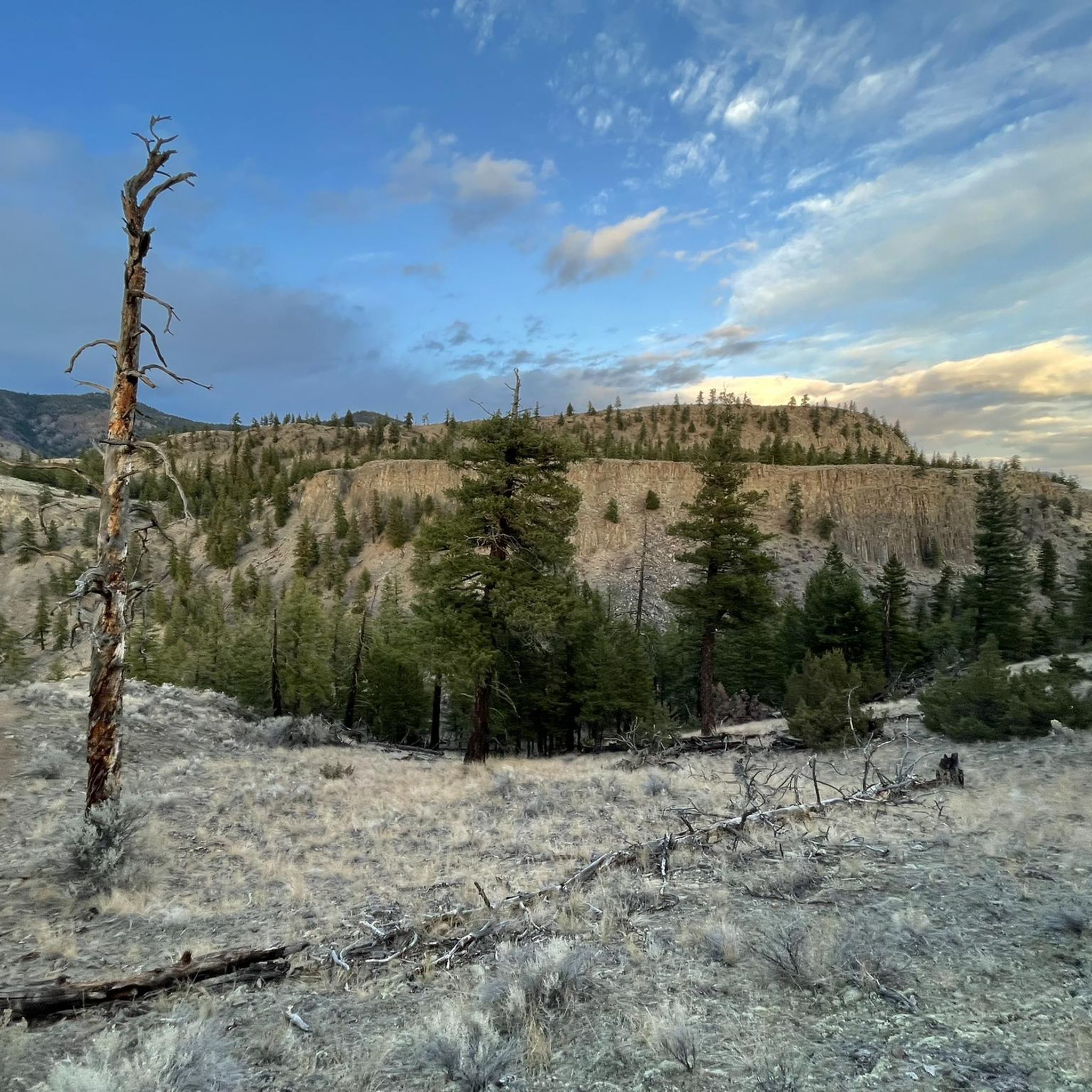
As you hike the trail to the popular Battle Bluff, you can see another mountain with countless uniform columns on its opposite side. These are made of ancient basaltic rock formed during volcanic activity. They resemble those of the famous Devil's Postpile in the Eastern Sierra in California.
4
0
If you want to see unique (especially for Canada) stone formations and hoodoos, Kamloops is the place to go. The hike to Cinnamon Ridge takes you deep into the canyon and along fascinating towers and walls of cooled lava and sandstone.
3
0
The Cinnamon Ridge Trail branches off from the Mara Hill Trail here. You hike up a bit further west and pass two more small signs that point you in the right direction. As soon as you reach a small hilltop, you no longer follow the signs up to the ridge (which leads you back to the Mara Hill Trail), but take the side trail down into the canyon (see photo with the two shadows). Here you follow the river bed and can admire amazing rock formations like hoodoos and volcanic gorges and rock walls. Basically, there is an option to climb out at the end of the canyon and hike a loop back via the Mara Hill Trail. However, the last section is very steep and slippery, so if you are unsure, just go back the same way you came.
5
0
The Mara Hill Trail starts at the end of Ord Road, a dirt road west of Kamloops. You hike through desert grassland and can spot hoodoos and volcanic formations. The climb is very steep in places and the scree is absolutely slippery, but you will be rewarded with beautiful views over the valley and the Thompson River. From the ridge you have a great view into the nearby canyon. A small side trail leads you closer there.
5
0
Frequently Asked Questions
What unique geological features can I see in Area J (Copper Desert Country)?
Area J is rich in unique geological formations. You can explore intriguing hoodoos, such as those at Hoodoos and rock formations near Cinnamon Ridge, or the balancing rock formation known as Coyote Rock (Savona Balancing Rock). The region also features ancient basalt columns, visible near the trail to Battle Bluff Cairn and View of Kamloops Lake, which are remnants of volcanic activity.
Are there any culturally or historically significant natural monuments in Area J (Copper Desert Country)?
Yes, several natural monuments hold cultural and historical significance. Coyote Rock (Savona Balancing Rock) is considered a boundary marker by the local Secwepemc First Nations, who refer to it as "The Old One." Battle Bluff Cairn and View of Kamloops Lake is also significant, with its lookout rock linked to First Nations battles and red markers below indicating historical events. Lac Le Jeune Provincial Park also protects two Native archaeological sites, and Mount Savona Provincial Park contains a well-preserved pictograph in a cave formation and ancient burial sites.
Where can I find hoodoo formations in Area J (Copper Desert Country)?
Hoodoo formations are a prominent feature of Area J. You can find them at various locations, including Hoodoos and rock formations and along the Mara Hill Trail, which leads to the Cinnamon Ridge area. Other notable hoodoo sites mentioned in the region include Castle Rock Hoodoos Provincial Park, East Shuswap Road, and Dallas-Barnhartvale Nature Park.
What kind of landscapes can I expect to see when visiting natural monuments in Area J?
Area J (Copper Desert Country) offers a diverse range of landscapes. You'll encounter desert-like shores along Kamloops Lake, high-altitude forests and lakes, rugged cliffs and canyons, dry ridges, and expansive grasslands. This variety provides stunning scenery, from the volcanic formations of Cinnamon Ridge to the cooler climate and forests of Lac Le Jeune Provincial Park.
Are there hiking trails near the natural monuments in Area J (Copper Desert Country)?
Yes, there are numerous hiking opportunities. Trails like the Mara Hill Trail offer challenging climbs with rewarding views of the Thompson River Valley and access to hoodoos. The trail to Battle Bluff Cairn and View of Kamloops Lake is another popular option. For more extensive hiking, Lac Le Jeune Provincial Park connects to the Stake Lake trail system, and Mount Savona Provincial Park is excellent for hikers seeking superb scenery and wildlife viewing. You can find more hiking routes in the Running Trails around Area J (Copper Desert Country) guide.
What outdoor activities can I do near these natural monuments?
Beyond hiking, Area J offers a variety of outdoor activities. Lac Le Jeune Provincial Park is popular for swimming, fishing, and boating. The region also has extensive trails suitable for mountain biking and gravel biking. You can explore routes in the Gravel biking around Area J (Copper Desert Country) and MTB Trails around Area J (Copper Desert Country) guides.
What is the best time of year to visit the natural monuments in Area J?
The best time to visit depends on your preferred activities. For cooler temperatures and a break from the desert heat, Lac Le Jeune Provincial Park is a popular summer retreat due to its higher elevation. Generally, spring and fall offer pleasant weather for hiking and exploring the geological formations, avoiding the extreme heat of summer or potential snow in winter at higher elevations.
Are there any natural monuments suitable for families in Area J (Copper Desert Country)?
While many trails can be challenging, some areas offer more accessible experiences. Lac Le Jeune Provincial Park, with its opportunities for swimming, fishing, and easy trails, can be a good option for families. For viewing hoodoos, driving along East Shuswap Road provides excellent views without extensive hiking. Always check trail difficulty before heading out with children.
What do visitors enjoy most about the natural monuments in Area J (Copper Desert Country)?
Visitors frequently praise the breathtaking views, especially from viewpoints like Battle Bluff Cairn and View of Kamloops Lake, which offers expansive vistas of Kamloops Lake. The unique geological formations, such as the hoodoos and basalt columns, are also a major draw. Many appreciate the sense of wilderness and the opportunity for nature study and wildlife viewing in areas like Mount Savona Provincial Park and Lac Le Jeune Provincial Park.
Are there less crowded natural monuments to visit in Area J?
While popular spots like Battle Bluff can attract visitors, areas like Mount Savona Provincial Park offer a protected wilderness experience, making them excellent for those seeking solitude and nature study. Exploring the various hoodoo formations beyond the most well-known spots, such as those in Dallas-Barnhartvale Nature Park or along East Shuswap Road, might also provide a less crowded experience.
What wildlife can I expect to see around the natural monuments?
The diverse ecosystems of Area J support a variety of wildlife. Lac Le Jeune Provincial Park is known for important wildlife habitats, including moose, bear, lynx, and various bird species. Mount Savona Provincial Park is also excellent for wildlife viewing. Hikers in areas like Battle Bluff are advised to be aware of local wildlife, including cougars.
What should I wear when hiking to natural monuments in Area J?
Given the diverse terrain, it's advisable to wear sturdy hiking boots, especially for trails with steep sections or scree, like the Mara Hill Trail. Layered clothing is recommended to adapt to changing temperatures, particularly if you're exploring areas that range from desert-like valleys to higher elevations. Sun protection, including a hat and sunscreen, is also essential.
Most popular routes around Area J (Copper Desert Country)
Most popular attractions around Area J (Copper Desert Country)

Get inspired with the komoot mobile app


Explore more
Extend your search for the best caves by checking out these guides of the top ones around Area J (Copper Desert Country):
