The best walks and hikes in Wind Cave National Park
4.8
(17)
188
hikers
12
hikes
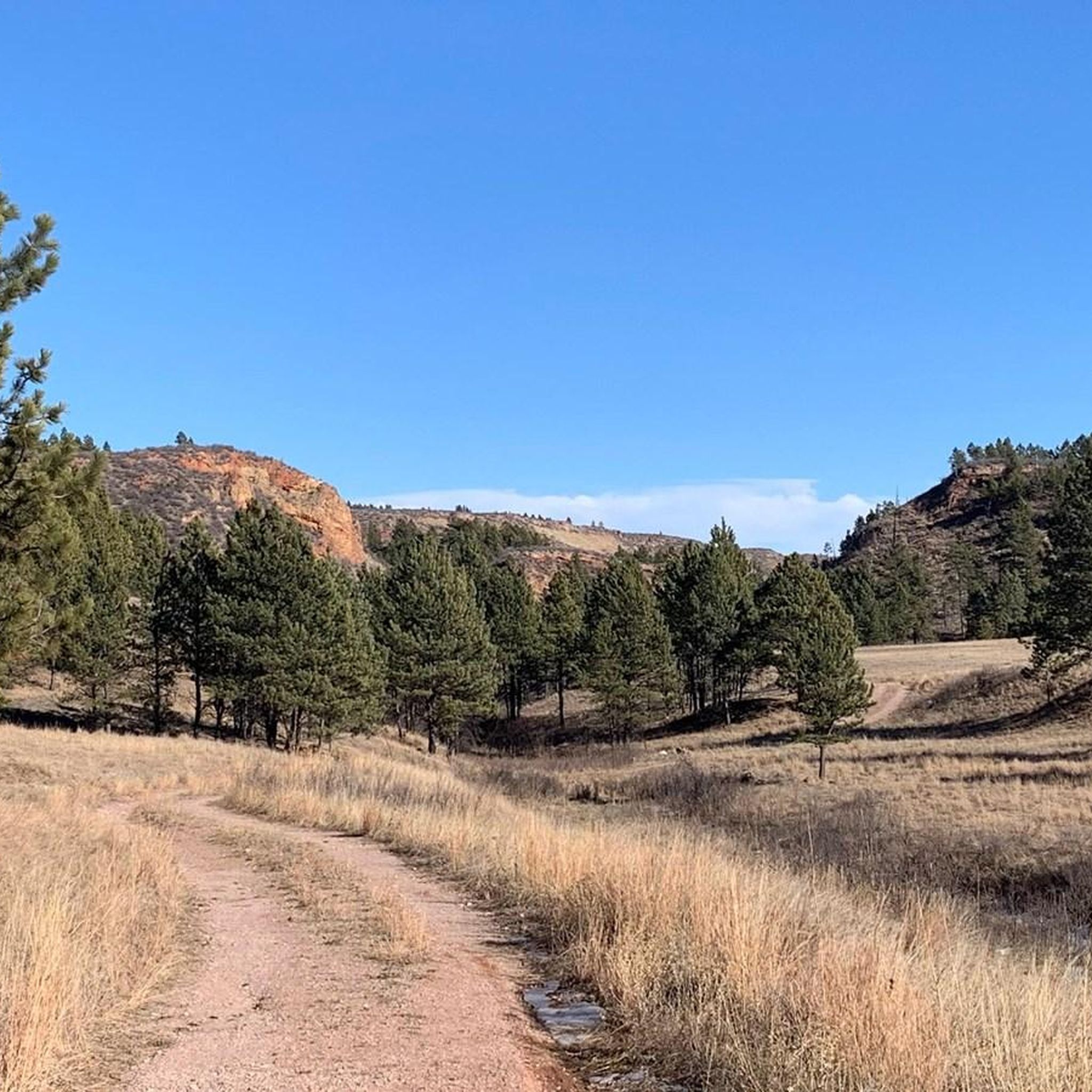
Hikes in Wind Cave National Park traverse a landscape of mixed-grass prairie, ponderosa pine forests, and limestone canyons. Located in the southern Black Hills of South Dakota, the park's surface features a mix of rolling grasslands and forested areas. The trails offer a variety of experiences, from open prairie walks to routes through rugged canyons.
Best hiking trails in Wind Cave National Park
- The most popular hiking route is Lookout Point Trail and Centennial Trail loop — Wind Cave National Park, a 4.8 mile (7.7 km) trail that takes about 2 hours 10 minutes to complete. This route combines rolling prairie landscapes with the cliff-lined path of the Centennial Trail.
- Another top favourite among local hiking enthusiasts is Rankin Ridge Trail loop — Wind Cave National Park, an easy 1.7 mile (2.8 km) path. The trail is a loop that provides panoramic views from the highest point in the park.
- Local hiking enthusiasts also love the Wind Cave Canyon Trail — Wind Cave National Park, a 3.6 mile (5.8 km) trail leading through a canyon with limestone cliffs, often completed in about 1 hour 30 minutes.
- Hiking in Wind Cave National Park is defined by mixed-grass prairies, ponderosa pine forests, and canyons. The trail network provides options for different ability levels, from short nature walks to longer routes.
- The routes in Wind Cave National Park are highly rated by the komoot community with an average score of 4.8 stars from more than 10 reviews. More than 160 hikers have used komoot to explore Wind Cave National Park's varied terrain.
Last updated: July 8, 2026
2
hikers
9.38km
02:39
190m
180m
The Centennial Trail #89 offers a moderate hiking experience through the varied landscapes of Wind Cave National Park. You'll cover 5.8 miles (9.4 km) with an elevation gain of 631 feet (192 metres), typically taking about 2 hours and 38 minutes to complete. As you hike, you'll transition from open meadows and rolling hills into dense ponderosa pine forests. Keep an eye out for impressive granite spires as the route ascends into the Black Hills, providing expansive viewpoints of the surrounding area. This section provides a good feel for the diverse ecosystems of South Dakota.
When planning your hike on Centennial Trail #89, be aware that while this specific segment is moderate, the overall Centennial Trail can be quite challenging in other sections. General parking should be available at the trailhead, making access straightforward for most visitors. No specific permit requirements are mentioned for this particular segment. Always check local conditions before you head out, as weather and trail status can change rapidly in the Black Hills. Consider an early start to enjoy cooler temperatures and potentially spot more wildlife.
This segment of the Centennial Trail #89 allows you to observe the rich wildlife and flora of the region. You might encounter bison and pronghorn antelope as you traverse the mixed-grass prairie sections. The trail showcases the diverse ecosystems of South Dakota, from its open grasslands to its distinct pine forests. The route also offers chances to see Bear Butte in the distance from higher vantage points. It's a great way to experience the natural beauty and ecological variety within Wind Cave National Park.
5.0
(5)
45
hikers
7.68km
02:09
150m
150m
Embark on the Lookout Point and Centennial Trail Loop, a moderate hike covering 4.8 miles (7.7 km) with a 505-foot (154 metres) elevation gain. This route typically takes about 2 hours and 9 minutes to complete. You will experience a diverse landscape, moving from rolling prairies into Ponderosa pine forests. The trail leads you through a wide, U-shaped canyon, featuring tall stone outcroppings and lush meadows along Beaver Creek, providing plenty of shade.
Plan your visit during spring or fall for the most pleasant hiking conditions. If you hike in summer, be aware that poison ivy can be present along the route. Always remember to check yourself for ticks after your hike. Maintain a safe distance from any wildlife you encounter, especially bison, for your safety and theirs.
This loop in Wind Cave National Park offers excellent opportunities to spot local wildlife. Keep an eye out for bison, prairie dogs, elk, and pronghorn as you traverse the varied terrain. The trail's blend of prairie and forest ecosystems makes it a unique experience within the park.

Sign up for free
4.8
(4)
27
hikers
4.85km
01:20
80m
80m
Embark on the Cold Brook Canyon Trail for an easy 3.0-mile (4.8 km) hike that guides you through a varied landscape. You will experience the transition from shaded ponderosa pine forests to wide-open prairie, with limestone walls rising impressively 100 to 200 feet high along the canyon floor. The route involves a gentle elevation gain of 258 feet (79 metres) and typically takes about 1 hour and 19 minutes to complete, offering a pleasant outdoor experience.
When planning your visit, remember that while the trail is generally easy, you will encounter some initial elevation change and a climb on your return. It is crucial to carry plenty of water, as there are no drinking water sources available along the route. Keep an eye out for wildlife, including bison; always maintain a safe distance and never approach them.
This trail offers a unique opportunity to observe the diverse ecosystem of Wind Cave National Park. As you hike, you might spot prairie dogs in their towns and various raptors soaring overhead, adding to the natural charm of the area. The route also provides scenic views of the prairie valley, especially as you make your way back.
19
hikers
2.75km
00:49
80m
80m
Embark on the Rankin Ridge Trail, an easy hiking route that takes you through a beautiful Ponderosa Pine forest. As you ascend, the path gradually becomes rocky in places, featuring natural stone steps that add to the adventure. Reaching the ridge rewards you with expansive 360-degree panoramic views, where you can gaze across the rugged Black Hills, vast prairies, and even spot the distant Badlands National Park. This short, 1.7 miles (2.8 km) loop involves a gentle climb of 278 feet (85 metres) and can typically be completed in about 48 minutes, making it a perfect quick escape.
Planning your visit to Rankin Ridge Trail is straightforward. Parking is generally available right at the trailhead, making access simple. Many consider this the best sunrise hike in Wind Cave National Park, thanks to its stunning east-facing views, so consider an early start. The trail is also family friendly, offering an accessible outdoor experience for all ages.
This trail stands out for its unique educational opportunity within Wind Cave National Park. You can enhance your experience by using the self-guided tour available on the NPS app, which provides detailed information at 14 interpretive sites along the route. This allows you to learn more about the surrounding environment and history as you hike, adding depth to your exploration of the ridge.
4.0
(2)
20
hikers
5.78km
01:32
60m
60m
The Wind Cave Canyon Trail offers a delightful journey through Wind Cave National Park, transitioning from sun-drenched mixed-grass prairies into cool ponderosa pine forests. As you follow the old dirt road, you'll be flanked by impressive limestone cliffs, which are often home to nesting birds like cliff swallows. This easy 3.6-mile (5.8 km) out-and-back hike, with a gentle 199 feet (61 metres) of elevation gain, provides a serene experience, taking roughly 1 hour and 32 minutes to complete.
Planning your visit to this family-friendly trail is straightforward. The trailhead is easily accessible, and while parking is generally available, arriving earlier in the day is recommended to secure a spot and enjoy the tranquility. This trail is an excellent option for beginner hiking, offering a rewarding experience without significant physical demands.
What makes this trail stand out is its unique position as a transition zone, showcasing both the dramatic canyon geology and the surrounding prairie. It's a fantastic spot for wildlife viewing, with opportunities to spot bison, deer, and various bird species. Plus, it serves as a gateway to longer adventures, connecting to trails like the East Bison Flats Trail for those looking to explore further into the park's backcountry.
Get access to more routes and recommendations from other explorers.
Sign up for free
Already have an account?
Our route recommendations are based on thousands of hikes, rides, and runs completed by other people on komoot.
Start today with a free account
Your next adventure awaits.
Login or Signup
Popular around Wind Cave National Park
Tips from the Community


This is the southernmost part of the 111-mile-long Centennial Trail that stretches across the state through the Black Hills and ends at Bear Butte State Park. This short section of trail traverses next to Beaver Creek and crosses the open prairie and stands of ponderosa pines. This is a great place to look for animals like prairie dogs, bison, pronghorns, mule deer, and coyotes. You can also frequently see raptors, grouse, and songbirds in this area.
0
0
The Wind Cave Canyon Trail is an easy trail that follows a former road over gently rolling hills to the very edge of Wind Cave National Park. As you hike down the trail, the limestone cliffs that make up the canyon quickly come into view. These cliffs provide nesting areas for cliff swallows, canyon wrens, and great horned owls. This is also a great place to look for woodpeckers among the trees on the hillsides above the rocks.
0
0
This is the southernmost part of the 111-mile-long Centennial Trail that stretches across the state through the Black Hills and ends at Bear Butte State Park. This short section of trail traverses next to Beaver Creek and crosses the open prairie and stands of ponderosa pines. This is a great place to look for animals like prairie dogs, bison, pronghorns, mule deer, and coyotes. You can also frequently see raptors, grouse, and songbirds in this area.
1
0
This historic fire tower sits at the highest point in the park. Although you cannot climb the structure, you can still appreciate the panoramic views across the prairie from this spot. On clear days you can see all the way to Badlands National Park and Buffalo Gap. Be on the lookout for wildlife such as bison, pronghorns, and prairie dogs.
0
0
Standing about 240 feet above Cold Brook Canyon floor on its southern edge, the Fossil Ridge summit provides great views to the south and west. This small, unranked peak is a nice place to stop on your hike along the Cold Brook Canyon Trail. While there is no official trail to the summit, Wind Cave National Park is an open hike park, meaning visitors are welcome to hike off trails. This peak is relatively popular, however, so there are social trails to the top you can follow with relative ease. Be sure to look for fossils of shells and other ancient marine creatures in the rocks up here!
0
0
Cold Brook Canyon is comprised of rocky, loose cliffs among sparse ponderosa forest that turns into open prairie. The trail in the canyon crosses a few prairie dog towns, which are great places to see both prairie dogs, prairie falcons, and other raptors. You also have a good chance of seeing bison in this area too. Remember to keep your distance from these amazing animals. Although they look slow and hulking, they are actually quite fast and can be dangerous.
1
0
Frequently Asked Questions
Are there any easy, family-friendly hikes in Wind Cave National Park?
Yes, the park has several great options for families. A good choice is the Wind Cave Natural Entrance and Prairie Vista loop. It's a short, 1.4-mile (2.2 km) walk with interpretive signs that offer insights into the prairie ecosystem, making it both educational and manageable for all ages.
What are the best trails for seeing wildlife like bison and pronghorn?
While wildlife can be seen throughout the park, trails that cross open, mixed-grass prairies offer the best opportunities. The Cold Brook Canyon Trail to Fossil Ridge is a great option as it traverses these open landscapes where bison and pronghorn frequently graze. Always remember to keep a safe distance from all wildlife.
Can I bring my dog on the hiking trails?
Pets are not permitted on any of the hiking trails or in the backcountry of Wind Cave National Park. They are allowed only in the grassy areas near the visitor center and along roadsides, but they must be on a leash at all times.
Which trail offers the best panoramic views?
For the most expansive views, head to the Rankin Ridge Trail loop. This 1.7-mile (2.8 km) hike takes you to the highest point in the park, offering spectacular 360-degree views of the Black Hills and the surrounding prairie. On a clear day, you might even see the Badlands in the distance.
Are there any circular walks or loop trails available?
Yes, the park features several excellent loop trails. One of the most popular is the Lookout Point Trail and Centennial Trail loop. This 4.8-mile (7.7 km) route combines rolling prairie with a section along the cliff-lined Beaver Creek, providing a diverse hiking experience without needing to backtrack.
What is the terrain like in the park's canyons?
The canyons, like the one explored on the Wind Cave Canyon Trail, typically feature a relatively flat path along a dry creek bed flanked by dramatic limestone cliffs. The trail surface is often a mix of dirt and gravel, making for a straightforward walk through a very scenic and distinct landscape.
What should I know before hiking in Wind Cave National Park?
Be prepared for encounters with wildlife, especially bison; never approach them and always maintain a safe distance. The weather can change quickly, so dress in layers. Most trails are exposed to the sun, so bring plenty of water, sunscreen, and a hat. Finally, watch out for prairie dog burrows and rattlesnakes, especially in the grasslands.
How can I check for trail closures or current conditions?
For the most up-to-date information on trail conditions, safety alerts, or potential closures, it is always best to check the official National Park Service website for Wind Cave National Park or inquire at the visitor center upon arrival. You can find hiking information on their site here: NPS Hiking Page.
What do other hikers think of the trails in Wind Cave National Park?
The trails in this region are highly regarded by the komoot community, earning an average rating of 4.8 out of 5 stars. Hikers frequently praise the abundant wildlife viewing opportunities and the unique beauty of the mixed-grass prairie landscape.
Is it possible to hike off-trail in the park?
Yes, Wind Cave National Park has an "open hike" policy, which allows experienced hikers to explore the backcountry off-trail. If you choose to do so, you must be skilled in navigation with a map and compass, be prepared for rugged terrain, and take all necessary safety precautions.
What part of the Centennial Trail runs through the park?
A scenic portion of the 111-mile Centennial Trail passes through the eastern side of Wind Cave National Park. This section follows Beaver Creek and is known for its flat terrain and limestone cliffs. It can be accessed via the Lookout Point Trail or the Centennial Trailhead on Highway 87.
Most popular routes in Wind Cave National Park
Most popular attractions in Wind Cave National Park

Get inspired with the komoot mobile app


Explore more
Browse the best Hikes in other regions.
