Top 6 Mountain Passes in Yosemite National Park
Best mountain passes in Yosemite National Park traverse a landscape characterized by granite peaks, alpine meadows, and deep valleys. The park's diverse terrain offers routes for both scenic drives and challenging hikes. These passes often mark significant geographical boundaries, providing varied perspectives on the Sierra Nevada's natural features. The region is known for its high-elevation routes that connect different ecological zones.
Best mountain passes in Yosemite National Park
- The most popular mountain passes is Donohue Pass, a mountain pass…
Last updated: July 10, 2026
Tioga Pass
Highlight • Mountain Pass
Tip by

Donohue Pass
Highlight • Mountain Pass
Tip by
Sign up now to discover places like this
Get recommendations on the best single tracks, peaks, & plenty of other exciting outdoor places.
Sign up for free
Mono Pass
Highlight • Mountain Pass
Tip by

Yosemite National Park Eastern Entrance Gate
Highlight • Rest Area
Tip by

Tioga Pass Climb
Highlight (Segment) • Climb
Tip by

Sign up for free to discover even more mountain passes in Yosemite National Park.
Sign up for free
Already have an account?
Start today with a free account
Your next adventure awaits.
Login or Signup
Popular around Yosemite National Park

John Muir Trail – Along the legendary trail through the magical Sierra Nevada

The Sierra High Route — Solitude in California's alpine country

California to Nevada – hiking between Volcanoes, Water & Forest

The pristine beauty of the US National Parks
Hiking in Yosemite National Park
Cycling in Yosemite National Park
Road Cycling Routes in Yosemite National Park
MTB Trails in Yosemite National Park
Running Trails in Yosemite National Park
Other adventures in Yosemite National Park


Tips from the Community

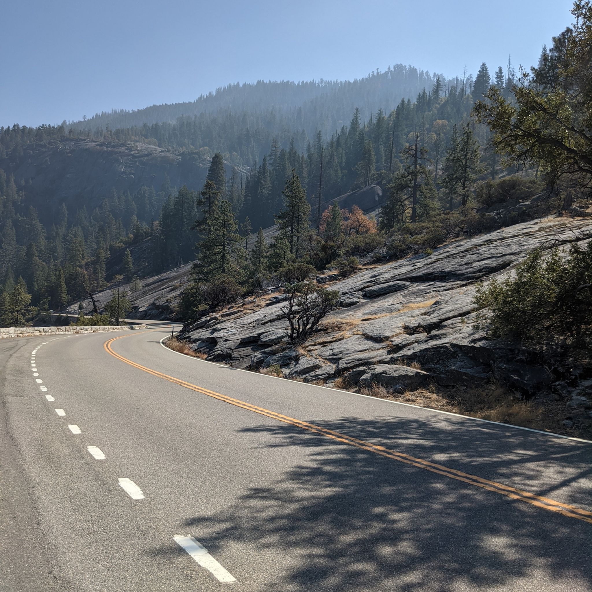
The Tioga Pass climb from Lee Vining is an absolutely spectacular and challenging road biking ascent on Highway 120, leading you to the highest mountain pass in the Sierra Nevada and into the eastern entrance of Yosemite National Park. Starting around 6,784 feet in Lee Vining, you'll climb approximately 12 to 12.5 miles, gaining about 3,160 to 3,170 feet to reach the 9,943-foot summit, with a moderate average gradient around 4.4-5.1% that becomes more sustained in the middle section. The scenery is breathtaking, transitioning from views of Mono Lake to alpine lakes, granite domes, and stunning mountain vistas as you ascend through forests into the high alpine environment.
0
0


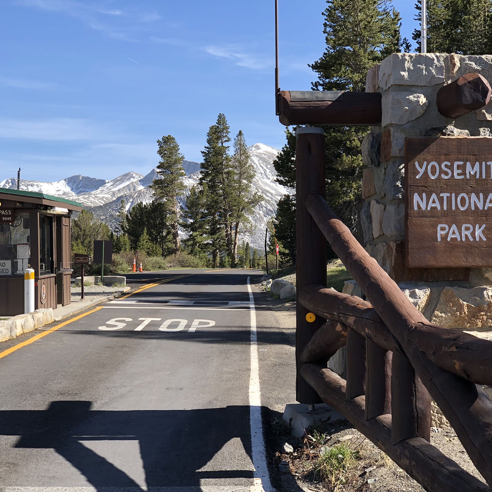
This is the eastern entrance gate to Yosemite National Park, located at Tioga Pass. Here you can find more about the current opening hours of the pass: nps.gov/yose/planyourvisit/tiogaopen.htm
1
0

Donohue Pass is the last major pass along the PCT if you hike northbound. It is snow covered until early summer or late spring. The view into the valley with blue shimmering lakes is stunning. The climb from the north side (hiking southbound) is much steeper than from the south side.
5
0
In the summer months, Highway 120 is the access gateway into Yosemite National Park if you are coming from the Eastern Sierra side. It is closed until late spring and sometimes early summer. In late June 2019, the pass was opened for only one hour each morning and afternoon. So showing up on time is important. Here you can find more about the current opening hours of the pass: https://www.nps.gov/yose/planyourvisit/tiogaopen.htm
1
0

Clearing of the Tioga Road normally begins on April 15 each year and usually takes between one and two months. Typically, it closes around mid November, although this varies.
1
1

Here they reach with 3031m height, the highest point of Tioga Road. A toll booth also serves as the entrance or exit of the Yosemite National Park.
2
2
Frequently Asked Questions
When is the best time to visit the mountain passes in Yosemite National Park?
The best time to visit depends on whether you plan to drive or hike. Driving passes like Tioga Pass are typically open from late May to early November, depending on snow conditions. Hiking passes, especially those at higher elevations like Donohue Pass, can be snow-covered until early summer, making late summer to early fall ideal for hiking.
Which mountain passes offer scenic drives near Yosemite National Park?
For breathtaking scenic drives, Tioga Pass (Highway 120) is the most famous, offering sweeping views within Yosemite. Just north of the park, Sonora Pass (Highway 108) provides a steeper, winding route with spectacular High Sierra vistas. Further north, Monitor Pass (Highway 89) is known for its remote feel, light traffic, and vibrant fall colors.
What should I know about driving Tioga Pass?
Tioga Pass, at 9,945 feet (3,031 meters), is the highest automobile route in the Sierra Nevada and serves as the eastern entrance to Yosemite National Park. The 46-mile Tioga Road offers stunning views of granite domes, alpine lakes, and meadows. Notable stops include Olmsted Point and Tenaya Lake. It's typically open from late May to early November, but it's crucial to check current conditions as opening hours can vary. You can find more information about its status at nps.gov.
Are there less crowded scenic drives near Yosemite National Park?
Yes, Sonora Pass (Highway 108) and Monitor Pass (Highway 89) are excellent alternatives if you're looking for scenic drives with less congestion than Tioga Pass. Sonora Pass offers a challenging, winding road with access to unique geological features like Columns of Giants. Monitor Pass, located further north, is popular for its open views and brilliant aspen groves in the fall, attracting motorcyclists and cyclists.
Which mountain passes are best for hiking in Yosemite National Park?
For hikers, Donohue Pass is a significant point on both the John Muir Trail and the Pacific Crest Trail, offering stunning views into valleys with blue shimmering lakes. Mono Pass provides a unique perspective on the region's ecological diversity, contrasting lush alpine environments with the desert-like Mono Valley. Vogelsang Pass is ideal for backpackers seeking challenging treks into Yosemite's high-alpine wilderness.
What kind of views can I expect from Donohue Pass?
From Donohue Pass, hikers are rewarded with stunning panoramic views into the valley, often featuring picturesque blue shimmering lakes. As a key milestone on the John Muir Trail and Pacific Crest Trail, it offers a true wilderness experience with spectacular vistas in both directions, towards Lyell Canyon and towards Island Pass and Thousand Island Lake.
How challenging are the hiking passes in Yosemite's high country?
Many hiking passes in Yosemite's high country, such as Donohue Pass, Mono Pass, and Benson Pass, are considered challenging. They often involve significant elevation gains, long distances, and can be snow-covered until early summer. For example, the climb to Benson Pass is described as long and strenuous, but the views from the top are notable.
Are there specific trails or long-distance routes that cross these mountain passes?
Yes, several iconic trails traverse the mountain passes. Donohue Pass is a significant point on both the John Muir Trail and the Pacific Crest Trail. Sonora Pass also crosses the Pacific Crest Trail, offering opportunities for hikers to explore the backcountry. These passes are crucial segments for long-distance hikers seeking true wilderness experiences.
What outdoor activities can I do near these mountain passes?
The areas around Yosemite's mountain passes offer a wealth of outdoor activities, primarily hiking. You can find challenging routes like the Vernal and Nevada Falls via Mist Trail or the Yosemite Falls Trail. For easier options, consider the Lower Yosemite Fall Trail or the Tuolumne Grove Trail. Explore more hiking opportunities in the region through komoot's guides on Hiking in Yosemite National Park or Waterfall hikes in Yosemite National Park.
Are there any permits or special considerations for accessing mountain passes in Yosemite National Park?
While driving passes like Tioga Pass require a park entrance fee, specific permits are often needed for backcountry hiking and overnight stays, especially on long-distance trails like the John Muir Trail or Pacific Crest Trail that cross passes like Donohue Pass. Always check the official Yosemite National Park website for the latest permit requirements and regulations before your trip.
Can I see wildflowers on the mountain passes in Yosemite National Park?
Yes, the high-country meadows and alpine environments around Yosemite's mountain passes can be spectacular for wildflowers, especially in early to mid-summer after the snowmelt. Areas along Tioga Road and near Tuolumne Meadows, accessible via Tioga Pass, are known for their vibrant displays of alpine flora.
What unique ecological features can be observed at Mono Pass?
Mono Pass offers a unique ecological contrast. On its western slope within the Sierra, you'll find lush alpine environments. In stark contrast, the eastern side provides views of the more desert-like landscape of Mono Lake and the Mono Valley, showcasing the dramatic transition between two distinct ecosystems.
Most popular routes in Yosemite National Park
Most popular attractions in Yosemite National Park

Get inspired with the komoot mobile app


Explore more
See even more epic mountain passes by checking out these guides in Yosemite National Park:
