The best walks and hikes in Columbia County
4.8
(115)
1,375
hikers
46
hikes
Hiking in Columbia County, Wisconsin, offers routes through a landscape shaped by glacial activity. The region is characterized by state natural areas, river trails, and nature preserves. Trails here often follow waterways like the Yahara River or lead into distinct geological features such as Parfrey's Glen. The varied terrain includes glens and river valleys, providing diverse hiking experiences.
Best hiking trails in Columbia County
- The most popular hiking route is Parfrey's Glen Trail, a 1.7 miles (2.8 km) trail that takes about 48 minutes to complete. This is an easy route within a state natural area.
- Another top favourite among local hikers is Ice Age Trail - Sauk Point Segment, a moderate 7.5 miles (12.1 km) path. This trail leads through a state natural area with varied terrain.
- Local hikers also love the Steenbock Preserve loop from Merrimac, a 7.5 miles (12.0 km) trail leading through a preserve, often completed in about 3 hours 35 minutes.
- Hiking in Columbia County is defined by river trails, nature preserves, and glens. The trail network provides a mix of easy, moderate, and difficult routes suitable for different ability levels.
- The routes in Columbia County are highly rated by the komoot community with an average score of 4.8 stars from over 120 reviews. More than 1,400 hikers have used komoot to explore Columbia County's varied terrain.
Last updated: June 25, 2026
14
hikers
12.2km
03:27
250m
260m
Moderate hike. Good fitness required. Easily-accessible paths. Suitable for all skill levels.
7
hikers
18.8km
05:37
440m
380m
Hard hike. Very good fitness required. Mostly accessible paths. Sure-footedness required.

Sign up for free
4
hikers
3.73km
01:08
130m
100m
Easy hike. Great for any fitness level. Easily-accessible paths. Suitable for all skill levels.
3
hikers
2.09km
00:34
20m
20m
Easy hike. Great for any fitness level. Easily-accessible paths. Suitable for all skill levels.
3.02km
00:47
10m
30m
Easy hike. Great for any fitness level. Easily-accessible paths. Suitable for all skill levels.
5.0
(8)
48
hikers
2.78km
00:48
70m
70m
Easy hike. Great for any fitness level. Easily-accessible paths. Suitable for all skill levels.
5.0
(2)
7
hikers
12.1km
03:29
300m
300m
Moderate hike. Good fitness required. Easily-accessible paths. Suitable for all skill levels.
7
hikers
10.1km
02:38
70m
70m
Moderate hike. Good fitness required. Easily-accessible paths. Suitable for all skill levels.
5.0
(2)
33
hikers
3.54km
01:12
90m
90m
Moderate hike. Great for any fitness level. Mostly accessible paths. Sure-footedness required.
4.0
(1)
13
hikers
7.17km
02:00
140m
140m
Moderate hike. Good fitness required. Easily-accessible paths. Suitable for all skill levels.
Get access to more routes and recommendations from other explorers.
Sign up for free
Already have an account?
Our route recommendations are based on thousands of hikes, rides, and runs completed by other people on komoot.
Start today with a free account
Your next adventure awaits.
Login or Signup


Tips from the Community


The walls of Parfrey's Glen are composed of sandstone with fragments of quartzite and feature a stream flowing through the floor, creating an awe-inspiring sight. It's important to note that pets are not allowed on the trail, and once you reach the waterfall, venturing beyond that point is not permitted.
0
0

This nature preserve along the Ice Age Trail is the site of mesic prairie, a native grassland that stewards are working to preserve and rid of invasive species. It's also very close to the Merrimac Ferry, which is free for pedestrians.
0
0
This natural area is a popular hiking destination along the Ice Age Trail. A trail leads to the top of Gibraltar Rock, which offers a great viewpoint over the surrounding landscape.
1
0
The Ice Age Trail is a 1,000-mile-long trail that runs throughout the state of Wisconsin. This particular section passes through the Merrimac Preserve, providing pleasant dirt trails, several wooden bridge crossings and stunning meadows views.
0
0
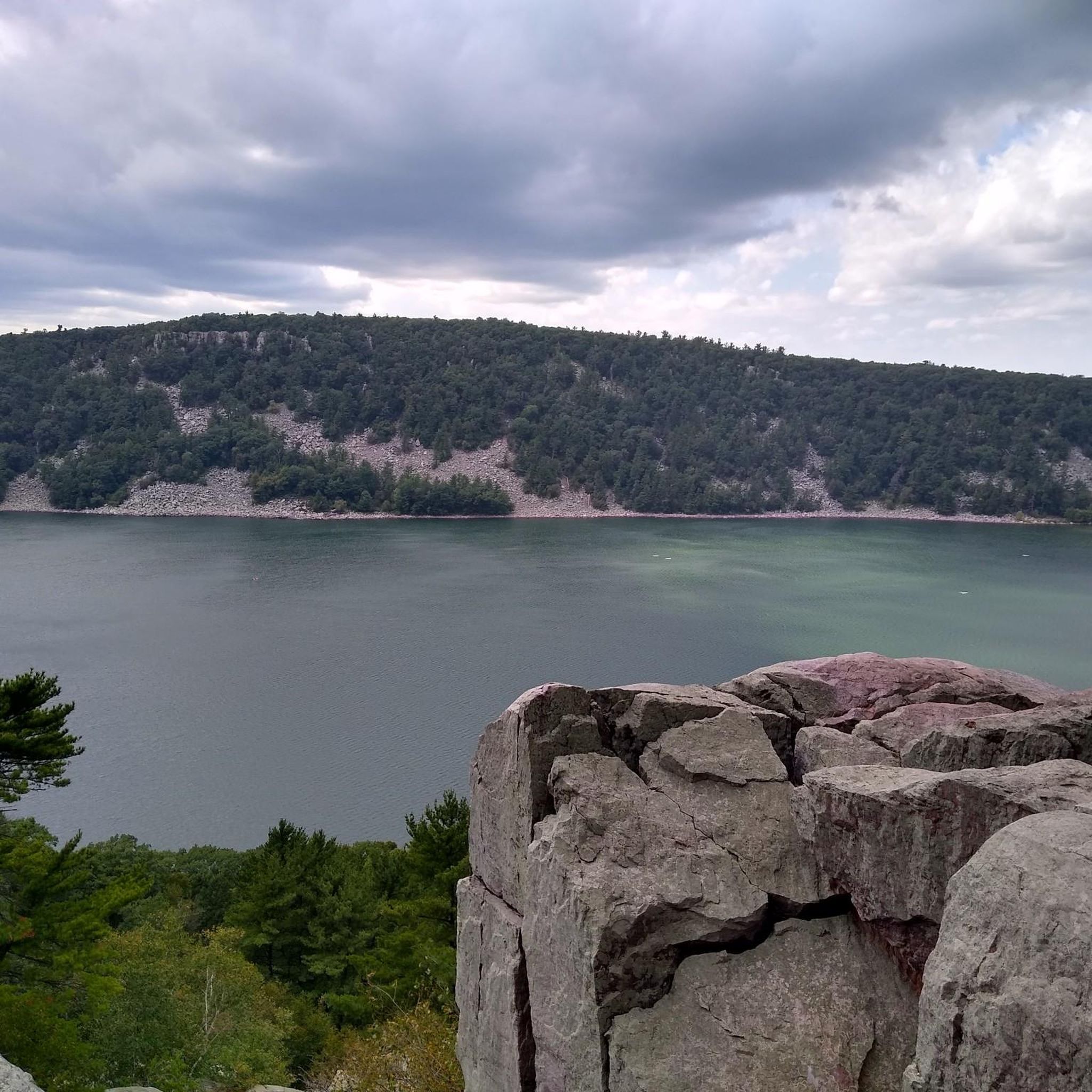
The Sauk Point Trail is a segment of the Ice Age Loop, a thousand-mile footpath, and extends from County Highway DL to State Highway 113. This trail takes you through a shaded, lush section before opening up to offer stunning views of the Baraboo Range and meadows.
0
0
The walls of Parfrey's Glen are composed of sandstone with fragments of quartzite and feature a stream flowing through the floor, creating an awe-inspiring sight. It's important to note that pets are not allowed on the trail, and once you reach the waterfall, hiking beyond that point is not permitted.
0
0

Gibraltar Rock is a popular hiking destination on the Ice Age Trail. An old paved road leads up to the top. The pavement is in very rough condition and it has very steep sections. It's not entirely clear if cycling is prohibited on the road (it definitely is not allowed on the hiking trail) and difficult to ride both uphill and downhill. But the view from the top is spectacular.
0
0
Frequently Asked Questions
Are there any dog-friendly hiking trails in Columbia County?
Yes, many trails in Columbia County are welcoming to leashed dogs. State parks like Taconic State Park and Lake Taghkanic State Park generally allow dogs on their trails. The carriage roads at Olana State Historic Site are also a great option for a walk with your canine companion. Always check the specific regulations for the park or preserve you plan to visit before you go.
What are the best waterfall hikes in the area?
Columbia County is home to some beautiful waterfalls. The most notable is at High Falls Conservation Area, which features the county's highest waterfall. A family-friendly loop trail leads to a great viewpoint. For more options, Taconic State Park also has several waterfalls, including the popular Bash Bish Falls, which is just across the border in Massachusetts but accessed via trails from the New York side.
Can you recommend some easy, family-friendly hikes?
Absolutely. For a gentle walk with fantastic views, the five miles of carriage roads at the Olana State Historic Site are perfect for all ages. Another excellent choice is the High Falls Conservation Area, which has a relatively short 1.5-mile loop to see the waterfall. For a lakeside stroll, the trails at Lake Taghkanic State Park offer easy terrain and lovely scenery.
Are there any challenging hikes for more experienced hikers?
Yes, the Taconic and Berkshire mountain ranges offer several rewarding challenges. The hike to the summit of Alander Mountain is a strenuous climb that rewards you with nearly 360-degree views. Another great option is the trail to Sunset Rock in the Taconic Range, which provides sweeping vistas of the Hudson Valley and the Catskills.
What's the best time of year to hike in Columbia County?
Each season offers a unique experience. Spring brings blooming wildflowers, while summer is perfect for enjoying the shade of the forests. However, autumn is particularly spectacular when the fall foliage is at its peak, creating stunning colorful landscapes. Winter hiking and snowshoeing are also possible, but be sure to check trail conditions and come prepared for ice and snow.
Are there any hikes with interesting art or architecture?
Yes, for a unique experience combining nature and art, visit Art Omi. This 120-acre sculpture and architecture park in Ghent has well-groomed paths that wind through fields and forests, allowing you to view large-scale artworks in an outdoor setting. The Olana State Historic Site also offers a blend of designed landscapes and historic architecture with its scenic carriage roads.
How many hiking trails are available in Columbia County?
There are dozens of trails to explore across the county's state parks, state forests, and conservation areas. Between destinations like Taconic State Park, Beebe Hill State Forest, and the numerous properties managed by the Columbia Land Conservancy, you'll find well over 50 miles of marked trails catering to all skill levels.
Where can I find hikes with the best views?
For panoramic vistas, head to the Taconic Range. The hike to Sunset Rock offers incredible west-facing views over the Hudson Valley, making it a prime spot for watching the sun go down. The summit of Alander Mountain also provides spectacular, far-reaching views. For river scenery, the trails at Greenport Conservation Area have clay bluffs overlooking the Hudson River and the Catskill Mountains.
What are the trail options at Beebe Hill State Forest?
Beebe Hill State Forest offers over 10 miles of trails through rugged terrain. A popular hike leads to a historic fire tower at the summit, which you can climb for expansive views of the surrounding landscape. The forest also features a connector trail that leads to the adjacent Harvey Mountain State Forest, allowing for longer, more extensive hikes.
Can I get to any trailheads using public transport?
Reaching trailheads in Columbia County via public transport can be challenging as most are in rural locations. Your best option is typically to drive. However, some taxi services or ride-sharing apps may be available from towns like Hudson. It's recommended to arrange transportation in advance.
What do other hikers enjoy about Columbia County?
The region is highly regarded for its scenic diversity. Hikers often praise the variety of trails, from gentle riverside walks to challenging mountain climbs in the Taconics. The well-maintained paths in state parks and conservation areas, combined with stunning viewpoints and natural features like waterfalls, make it a favorite destination.
Are there any long-distance trails that pass through the county?
Yes, portions of two major long-distance trails run through Columbia County, offering great opportunities for walking and biking. You can access sections of the Harlem Valley Rail Trail in the eastern part of the county and the Empire State Trail, which provides routes for cyclists and walkers through various landscapes.
Most popular routes in Columbia County

Get inspired with the komoot mobile app


Didn’t find what you were looking for?
Check out more Hikes throughout Columbia County below and find the perfect route in your destination.
Explore more
Browse the best Hikes in other regions.
