Routes

Planner

Features

Updates

App

Login or Signup

Get the App

Login or Signup

Routes
MTB trails
United States
Colorado

Gunnison County

The best MTB trails in Gunnison County

5.0

(18)

2,092

riders

104

rides

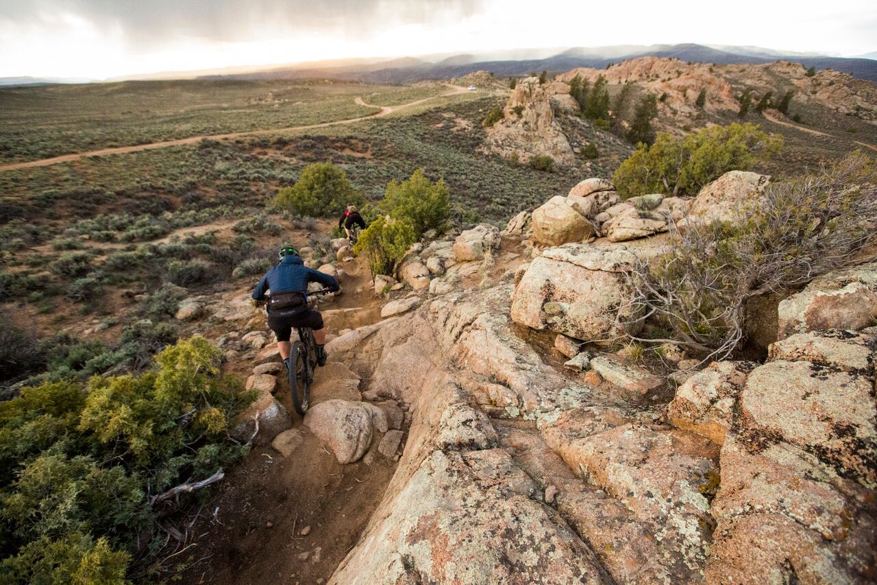
Mountain biking in Gunnison County offers a diverse landscape, ranging from high desert to high alpine environments within Colorado's Rocky Mountains. The region features an extensive network of singletrack trails, including technical terrain around Hartman Rocks and scenic alpine routes near Crested Butte. This varied topography provides options for all skill levels, from beginner-friendly paths through sagebrush to challenging high-elevation descents. Towering peaks and vast forests characterize much of the riding experience.

Best mountain bike trails in Gunnison County

  • The most popular mountain bike trail is 401 Trail Loop, a 13.8 miles (22.3 km) trail that takes 2 hours 41 minutes to complete, known for its high-alpine singletrack and wildflower meadows.
  • Another top favourite among local mountain bikers is Monarch Crest to Rainbow Trail, a difficult 35.2 miles (56.7 km) path. This route is part of the region's extensive backcountry trail network.
  • Local mountain bikers also love the Doctor Park Loop, a 19.4 miles (31.3 km) trail leading through challenging technical terrain and flowy alpine sections, often completed in about 3 hours 16 minutes.
  • Mountain biking in Gunnison County is defined by high desert trails, alpine singletrack, and wildflower meadows. The network offers options for different ability levels, from technical descents to more mellow rides.
  • The routes in Gunnison County are highly rated by the komoot community with an average score of 5.0 stars from more than 20 reviews. More than 2000 mountain bikers have used komoot to explore Gunnison County's varied terrain.

Last updated: June 23, 2026

5.0

(5)

262

riders

#1.

401 Trail Loop

22.3km

02:41

680m

680m

The 401 Trail Loop offers a quintessential high-alpine mountain biking adventure, pushing your limits with its difficult rating and substantial climbs. You'll experience the raw beauty of the mountains as you tackle 2234 feet (681 metres) of elevation gain over 13.8 miles (22.3 km), with the route typically taking around 2 hours and 40 minutes. The trail winds through scenic mountain passes like Schofield Pass, promising a memorable ride for those up to the challenge.

To plan your trip, aim for the summer and early fall months when the trail is free of snow. The trailhead is generally accessible by car, but given its popularity as one of the best trails for mountain biking, arriving early is recommended to secure parking. Always check local conditions before heading out, as weather can change rapidly in the mountains.

This loop is widely considered one of the most popular routes for mountain biking in the Crested Butte area, drawing riders from all over. Its reputation for demanding terrain and incredible views makes it a must-do for advanced mountain bikers looking for an iconic Colorado experience. It's a true test of skill and stamina, rewarding riders with a profound sense of achievement.

Navigate with device

Send to Phone

Save

Hard

5.0

(3)

221

riders

Embark on the Monarch Crest to Rainbow Trail, a difficult mountain biking adventure spanning 35.2 miles (56.7 km). You will climb 2175 feet (663 metres) over an estimated 4 hours and 30 minutes, making this a truly challenging ride. The route offers expansive high-alpine views, especially along the Continental Divide where you can enjoy unrestricted 360-degree vistas of the Sawatch, San Juan, Elk, and Sangre de Cristo mountain ranges. As you ride, you will pass through scenic aspen groves and flower-filled meadows, experiencing a diverse mix of terrain from smooth singletrack to technical, rocky sections.

Planning your visit requires some foresight, as the full route is typically shuttle-accessed, starting at Monarch Pass. Shuttle services are readily available to help you reach the starting point. The trail is usually free of snow and open during July and August, with mid-to-late September also being an excellent time to experience the vibrant fall colors. Always be prepared for potential adverse weather conditions, including snow or sleet, even if you are riding in the summer months.

This classic route is consistently ranked among the top mountain biking trails in the country, drawing riders from all over. It is known for its epic ride experience and the stunning natural beauty of the Gunnison National Forest. The diverse terrain and high-alpine environment make it a standout choice for experienced mountain bikers seeking a memorable challenge.

Hard
guide_signup
Let us show you the way with the komoot mobile app
With a free komoot account, you can easily find, customize, and navigate endless outdoor adventures.

Sign up for free

119

riders

31.3km

03:17

830m

820m

The Doctor Park Loop is a classic mountain biking route near Crested Butte, renowned for its challenging climbs and exhilarating descent. You'll grind up the steep Doctor Gulch, rewarded with stunning alpine views, before dropping into the acclaimed Doctor Park singletrack. This trail offers a diverse experience, from high-alpine meadows to high-desert terrain, with sections ranging from fast and flowy to technical rock gardens and tight switchbacks.

Planning your visit requires attention to the seasons; the trail is typically open from late June to early October, with spring closures for snow and habitat protection. E-bikes are not permitted on this route. Be ready for a significant creek crossing early on and remember that the high elevation makes this a demanding day, so start early and be prepared for a difficult ride.

Considered one of the most popular trails for advanced mountain biking in the region, Doctor Park Loop is a full-value ride that demands strong fitness and bike handling skills. Its world-class descent is a major draw, offering a thrilling mix of speed and technical challenge that makes it a must-ride for experienced riders in the Crested Butte area.

Hard

5.0

(1)

88

riders

18.0km

02:09

640m

640m

The Teocalli Ridge Loop offers a quintessential Crested Butte mountain biking adventure, combining a challenging ascent with a memorable downhill. You'll navigate varied terrain, from forested climbs to open ridge lines, culminating in panoramic views from the Teocalli Lookout. The route is a moderate 11.2-mile (18.0 km) ride, featuring a substantial 2107 feet (642 metres) of elevation gain, making it a rewarding experience for those seeking a good workout and scenic payoff.

To make the most of your ride, plan to visit during the summer or early fall when the trail is clear of snow. Parking is available at the trailhead, but it's wise to arrive early, especially on weekends, to ensure a spot and beat any afternoon weather. Always pack enough water and be prepared for the high-alpine environment.

This route is one of the more popular trails in the Crested Butte area, known for its classic singletrack and the thrilling Teocalli Ridge descent. It's a fantastic option for riders looking to experience the region's renowned mountain biking, offering a balanced challenge with incredible natural features and viewpoints.

Moderate

66

riders

The Snodgrass, Lupine, Lower Loop mountain biking route offers a quintessential Crested Butte experience, winding through diverse landscapes that showcase the region's natural beauty. You'll traverse a mix of forested singletrack and open meadows, with the highlight being the expansive Views of Mt. Crested Butte that emerge throughout the ride. The terrain is varied and engaging, providing a true mountain biking adventure for those ready for a challenge.

This is a difficult 22.0-mile (35.4 km) ride with a substantial 1836 feet (560 metres) of elevation gain, typically taking around 2 hours and 56 minutes to complete. It's best suited for experienced mountain bikers comfortable with sustained climbs and technical sections. Plan your visit for the summer or early fall to ensure optimal trail conditions, and consider an early start to beat any crowds and enjoy the cooler morning air.

This route is a fantastic way to explore some of the most popular mountain bike trails Crested Butte has to offer, combining the well-known Snodgrass Trail with the scenic Lupine and Lower Loop sections. It provides a comprehensive tour of the area's varied ecosystems and offers a rewarding workout with incredible payoffs in terms of scenery. The proximity to Crested Butte Downtown also means easy access to amenities before or after your ride.

Hard

47

riders

45.1km

04:07

840m

840m

The Deer Creek Loop offers a quintessential Crested Butte mountain biking experience, blending challenging climbs with scenic descents. As you navigate the Deer Creek Trail, you'll encounter a mix of terrain, from forested sections to more open areas, providing a dynamic ride. The route's character changes throughout, keeping you engaged with varied surfaces and views that capture the essence of the Colorado high country.

Planning your ride on this 28.0-mile (45.1 km) loop, which includes 2748 feet (838 metres) of elevation gain and takes about 4 hours and 6 minutes, means preparing for a moderate but rewarding effort. Starting early is advisable to secure parking and make the most of the cooler morning temperatures. Always carry sufficient water and be ready for the unpredictable mountain weather.

This loop is a great way to immerse yourself in the mountain biking culture that thrives around Crested Butte Downtown, known for its extensive trail network. It provides a solid workout and a chance to explore the natural beauty of the area, making it a popular choice for those seeking a substantial day on the bike.

Moderate

43

riders

20.7km

02:51

390m

390m

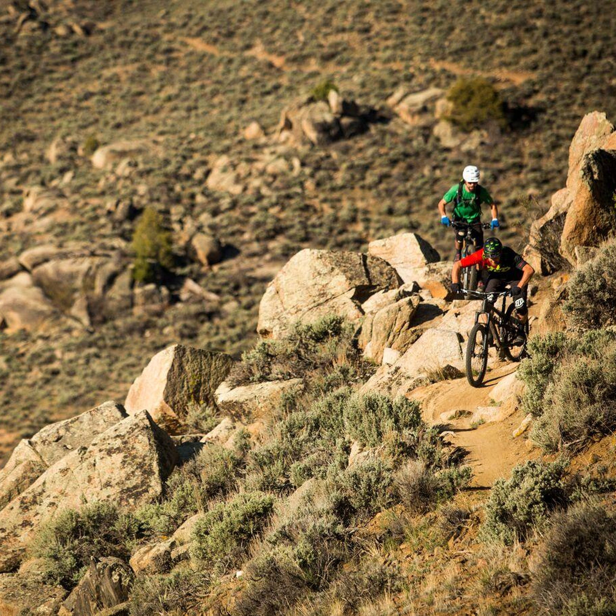
Get ready for a dynamic mountain biking experience on the Technical Loop, a difficult route spanning 12.9 miles (20.7 km). You'll navigate varied terrain, including rocky climbs and fast flow sections, as you gain 1289 feet (393 metres) of elevation. The trail features tight bermed switchbacks and a challenging Free Fall section, promising an engaging ride for experienced riders. Expect to spend around 2 hours and 51 minutes on this loop, with some parts offering beautiful, green scenery to enjoy between the technical challenges.

The Technical Loop is located within the Hartman Rocks Recreation Area, close to Gunnison, Colorado. You'll find parking generally available at the designated trailheads throughout the recreation area. Before heading out, it's always a good idea to check local conditions. Weather can significantly impact trail access and riding conditions, especially during the shoulder seasons, so plan your visit accordingly to ensure a safe and enjoyable ride.

This route is specifically designed for experienced riders looking to test their skills on two wheels. It incorporates sections like Ridge Trail and Rattlesnake Trail, both known for their technical demands. The varied landscape and challenging features make the Technical Loop a notable option for mountain bikers seeking an adrenaline-pumping adventure in the Hartman Rocks area.

Hard

35

riders

The Baxter Gulch Green Lake Loop offers a demanding mountain biking adventure for riders seeking a significant challenge in Colorado's Gunnison County. This difficult 14.0-mile (22.5 km) route features a substantial 2244 feet (684 metres) of elevation gain, promising a rigorous workout over an estimated 2 hours and 29 minutes. Expect a ride that tests your endurance and technical skills, making it a rewarding option for experienced mountain bikers.

Planning your visit to the Baxter Gulch Green Lake Loop requires careful consideration of your gear and physical readiness. While specific trailhead parking details are not available, it's always wise to arrive early, especially during peak season, to ensure a spot. Carry ample water and nutrition, and be prepared for changing weather conditions typical of mountain environments. Always check local trail conditions before you go.

This loop, incorporating the Baxter Gulch Trail and Green Lake Trail, stands out as a robust option for advanced riders in the region. Its significant elevation profile and difficult rating suggest a route that will push your limits and offer a true sense of accomplishment. For those familiar with mountain biking in Colorado, it provides a solid, challenging experience within the diverse landscape of Gunnison County.

Hard

5.0

(1)

28

riders

The Reno/Flag/Bear/Deadman's Gulch loop is a demanding mountain biking route that will push your limits in Gunnison County. This difficult 19.4-mile (31.2 km) loop features a significant 3281 feet (1000 metres) of elevation gain, making it a true test of endurance and skill. Expect a varied landscape as you traverse gulches and potentially open areas, with sections along Cement Creek Road. This ride is best suited for experienced riders seeking a substantial challenge that typically takes around 3 hours and 34 minutes to complete.

To make the most of your ride on the Reno/Flag/Bear/Deadman's Gulch loop, plan to start early in the morning, especially if you're tackling it during warmer seasons. This helps you avoid the heat and allows plenty of time to navigate the entire route. Always pack ample water, snacks, and a repair kit, as services are not readily available on the trail. Check the weather forecast before you go, as conditions in the mountains can shift quickly.

This loop is known for its challenging profile, combining distance with considerable climbing, which sets it apart as one of the more strenuous mountain biking trails in the region. While specific natural features beyond the gulches and the mention of Cement Creek Road are not detailed, the sheer physical demand and the journey through diverse high-country terrain are its defining characteristics. It's a route that rewards strong riders with a sense of accomplishment.

Hard

20

riders

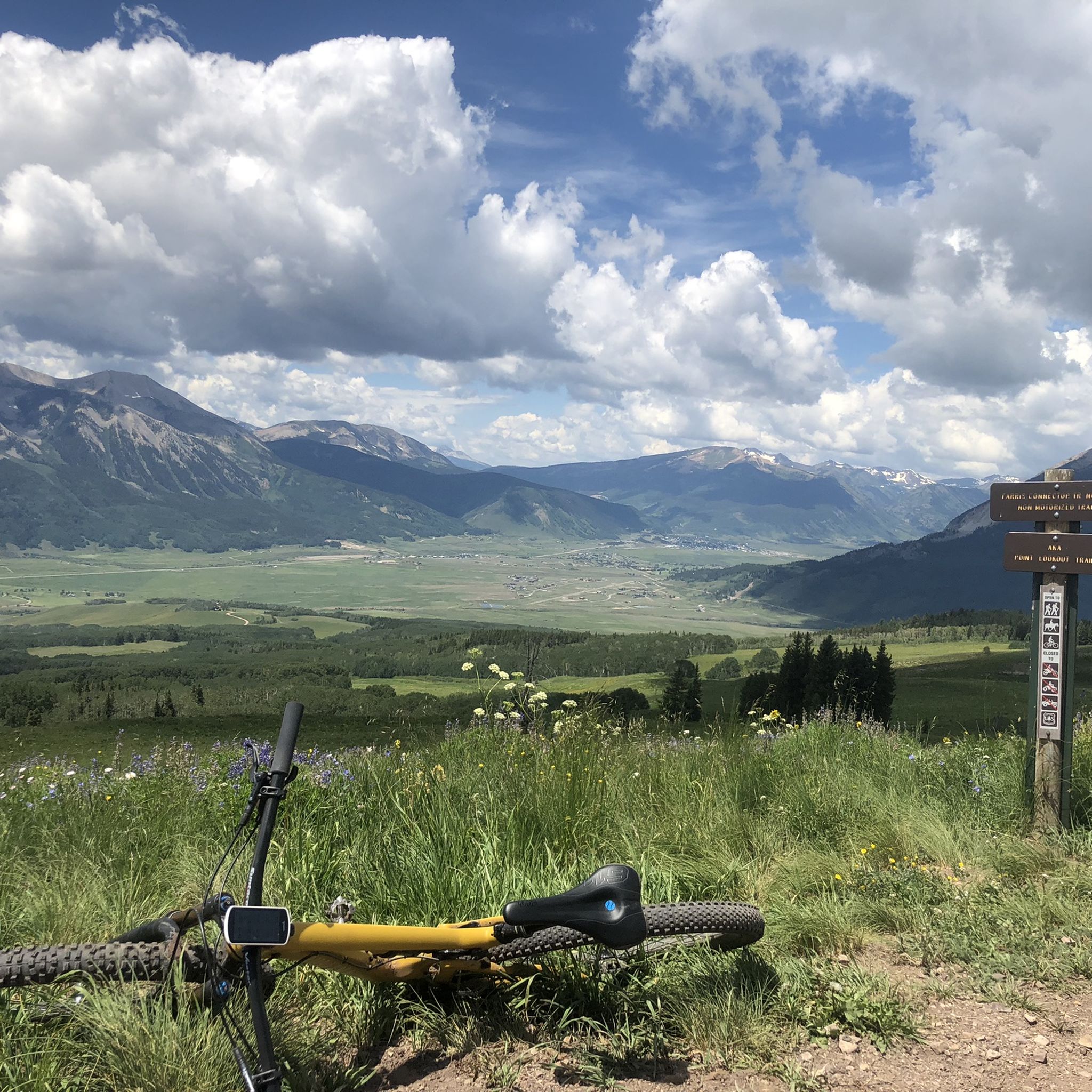
Prepare for a challenging mountain biking experience on the 409 and Point Lookout Loop, a difficult route spanning 15.5 miles (24.9 km). You will encounter smooth singletrack and sweeping valley views as you climb. The trail gains a significant 2434 feet (742 metres) in elevation, particularly through fields of wildflowers on the Point Lookout Trail section. This ride typically takes around 3 hours and 9 minutes to complete, offering a rewarding workout for experienced riders.

Access to the 409 and Point Lookout Loop is straightforward, starting from a common access point in the Cement Creek area. You should plan your visit carefully, as mountain weather can change rapidly. Always check local conditions before heading out to ensure a safe and enjoyable ride. Consider starting early in the day to make the most of your time on the trail and avoid afternoon storms. Parking is generally available at the trailhead, but it's wise to arrive early during peak season.

This loop is a popular choice within Gunnison National Forest, known for its diverse terrain. It offers a distinct experience from other trails in the region, often used to connect with the 409.5 trail for extended adventures. The route's combination of challenging climbs and scenic descents makes it a standout option for mountain bikers seeking a substantial ride.

Hard
Sign up for free to see 95 more rides in Gunnison County.

Get access to more routes and recommendations from other explorers.

Sign up for free

Already have an account?

Our route recommendations are based on thousands of hikes, rides, and runs completed by other people on komoot.

Start today with a free account

Your next adventure awaits.

Login or Signup

Popular around Gunnison County

MTB Trails in the Elk Mountains
MTB Trails in Raggeds Wilderness
MTB Trails around Gunnison
MTB Trails in Curecanti National Recreation Area

MTB Trails around Crested Butte

MTB Trails around Mount Crested Butte

MTB Trails in the West Elk Mountains

MTB Trails around Blue Mesa Reservoir
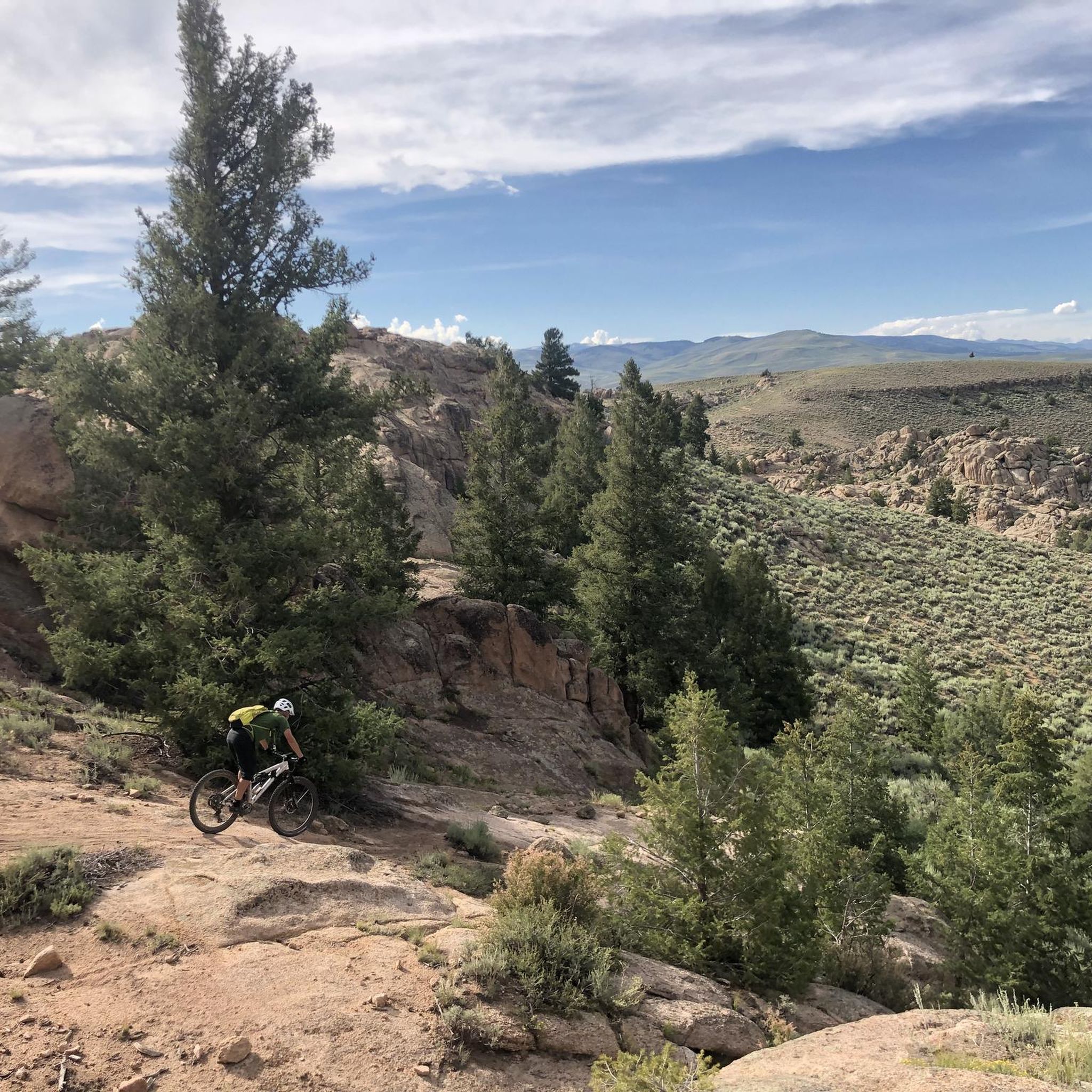
Hartman Rocks – rocky desert trails in Gunnison, Colorado

Mountain bike paradise around Salida in Colorado

Other adventures in Gunnison County

Hartman Rocks – rocky desert trails in Gunnison, Colorado

Mountain Biking Collection by

LadyDi

Tips from the Community

AaronLavanchy
October 26, 2023, Cement Creek Road

Cement Creek Road is located just outside Crested Butte South and provides access to several trails. There is also many dispersed camping options along Cement Creek Road, which makes a good basecamp for a couple days of riding.

0

0

Matthew
October 21, 2023, Monarch Pass

At an elevation of 11,312 feet, Monarch Pass features a gift shop, parking, restrooms, and acts as a trailhead for a number of trails. Mountain bikes frequent the trails from the pass, but they are also great trails for running and hiking.

0

0

LadyDi
September 21, 2022, 409 Trail

409 is hard uphill trail: rocky, but fun! Expect exceptional views and not a lot of shade.

1

0

LadyDi
September 21, 2022, Point Lookout Trail

Point Lookout Trail connects the trails 409 and 409.5. You can ride this trail in both directions. But don't forget to stop from time to time to soak in the excellent views.

1

0

LadyDi
September 21, 2022, Brush Creek Trailhead

During wildflower season this is a great spot for a hike or a mountain bike ride in between the colourful wildflowers. In addition, you will be rewarded with expansive and stunning views.

2

0

LadyDi
September 20, 2022, Deer Creek Trail

This is a popular mountain bike trail in a wonderful setting. Deer Creek Trail can be ridden as part of huge loop from town.

2

0

LadyDi
September 20, 2022, Crested Butte Downtown

Crested Butte is so pretty! It's easy to fall in love with that small mountain town. A cute and relaxed dowtown, various hiking and mountain biking opportunities and lots of dispersed camping spots around town make Crested Butte a favorite summer holiday destination for outdoor lovers.

2

0

Henrik
July 27, 2022, Schofield Pass

A very nice and hard climb from Marble

0

0

Frequently Asked Questions

How many mountain bike trails are available in Gunnison County?

Gunnison County offers a vast network of mountain biking opportunities, with over 100 routes available on komoot. This includes a diverse range of trails from high desert to high alpine environments, catering to various skill levels.

What is the best time of year to mountain bike in Gunnison County?

Gunnison County boasts a long riding season due to its varied elevations. Lower-elevation desert trails, like those at Hartman Rocks, are accessible during early spring and late autumn. The high-alpine trails, particularly around Crested Butte, are best enjoyed during the summer months when wildflowers are in bloom and temperatures are comfortable, typically in the 80s in July.

Are there mountain bike trails suitable for beginners in Gunnison County?

Yes, Gunnison County has options for beginners. While many trails are challenging, there are 6 easy routes listed on komoot. Areas like Signal Peak offer more mellow, scenic, and beginner-friendly trails with high-speed sections through sagebrush, providing a good starting point for those new to mountain biking.

What kind of terrain can I expect on mountain bike trails in Gunnison County?

The terrain in Gunnison County is incredibly diverse. You'll find technical high desert trails with slickrock features at places like Hartman Rocks, reminiscent of Moab. In contrast, areas around Crested Butte offer high-alpine singletrack winding through wildflower meadows and aspen groves. You can expect everything from challenging technical descents to flowy, scenic rides.

Are there any loop mountain bike trails in Gunnison County?

Yes, many of the best mountain biking experiences in Gunnison County are loop trails. Popular options include the challenging 401 Trail Loop, known for its high-alpine singletrack, and the Doctor Park Loop, which features technical terrain and flowy sections. Another great choice is the Teocalli Ridge Loop, offering a moderate challenge.

What do other mountain bikers enjoy most about the trails in Gunnison County?

The mountain biking trails in Gunnison County are highly rated by the komoot community, with an average score of 5.0 stars from over 20 reviews. Riders frequently praise the diverse terrain, from technical desert rides to stunning high-alpine singletrack, and the breathtaking views of the Rocky Mountains and wildflower meadows.

Are there any family-friendly mountain bike trails in Gunnison County?

While many trails are geared towards experienced riders, some areas offer more accessible options. For family-friendly rides, look for trails described as beginner-friendly or those with less technical terrain, often found in areas like Signal Peak. Always check individual route descriptions for suitability for younger riders or those with less experience.

Can I bring my dog on the mountain bike trails in Gunnison County?

Gunnison County is generally dog-friendly, but regulations vary by trail and land management agency. It's crucial to check specific trail rules before heading out, as some areas may require dogs to be on a leash or may restrict access to protect wildlife or sensitive ecosystems. Always practice Leave No Trace principles and clean up after your pet.

What notable landmarks or natural features can I see while mountain biking in Gunnison County?

Gunnison County is rich in natural beauty. While riding, you might encounter majestic mountain ranges like the West Elk Mountains. Nearby attractions include Monarch Pass, offering panoramic views, and the charming Crested Butte Downtown. The region is also home to picturesque alpine lakes such as Beaver Lake and Lake Irwin, which are great for scenic stops.

Where can I find parking at mountain bike trailheads in Gunnison County?

Most popular mountain bike trailheads in Gunnison County, especially in renowned areas like Hartman Rocks and around Crested Butte, typically offer designated parking facilities. It's advisable to arrive early during peak season to secure a spot, particularly for well-known routes such as the Snodgrass, Lupine, Lower Loop.

Are there any permits required for mountain biking in Gunnison County?

Generally, permits are not required for day-use mountain biking on most trails in Gunnison County's national forests or BLM lands. However, specific areas or events might have special regulations or fees. Always check with the local land management office or trailhead signage for the most current information before your ride.

What are some challenging mountain bike trails for advanced riders in Gunnison County?

Gunnison County is a haven for advanced riders, with 77 difficult routes listed on komoot. Highly technical and demanding trails include Monarch Crest to Rainbow Trail, a long and difficult backcountry path, and the Reno/Flag/Bear/Deadman's Gulch loop, known for its significant elevation changes. The Technical Loop also lives up to its name, offering a rigorous experience.

Most popular routes in Gunnison County

Hiking in Gunnison County

Most popular attractions in Gunnison County

Bike Parks

Store rating

Get inspired with the komoot mobile app

With a free komoot account, you can easily find, customize, and navigate endless outdoor adventures.

or

Join komoot Now

Store rating

Didn’t find what you were looking for?

Check out more MTB trails throughout Gunnison County below and find the perfect route in your destination.

Curecanti National Recreation AreaRaggeds WildernessBlue Mesa ReservoirWest Elk MountainsCrested ButteElk MountainsMount Crested ButteGunnison

Nearby adventure guides

Things to Do around Gunnison

background

Get ready to conquer new peaks

Sign up for Free

Explore
RoutesRoute plannerFeaturesHikesMTB TrailsRoad cycling routesBikepackingSitemap
Download the app
Follow Us on Socials

© komoot GmbH

Privacy Policy