The best MTB trails around Frøylandsvatnet
4.3
(3)
44
riders
4
rides
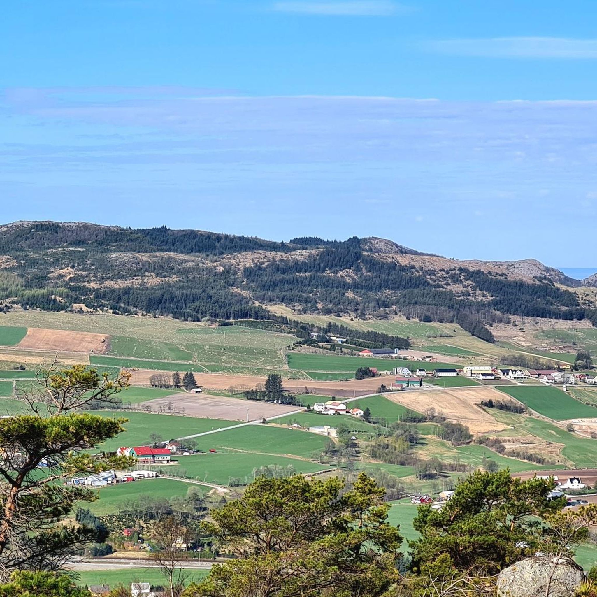
Mountain biking around Frøylandsvatnet offers diverse terrain in Rogaland, Norway, characterized by its picturesque lake and surrounding landscapes. The area transitions from open grazing lands to dense spruce forests, providing varied backdrops for rides. Trails often feature well-maintained gravel paths and natural surfaces, catering to different skill levels. The region's topography includes gentle undulations suitable for accessible routes, alongside more challenging sections.
Best mountain bike trails around Frøylandsvatnet
- The most popular mountain bike trail is Skreå – Picnic Spot by…
Last updated: June 28, 2026
5.0
(1)
3
riders
Moderate mountain bike ride. Good fitness required. Suitable for all skill levels.
5
riders
36.0km
02:28
500m
500m
Hard mountain bike ride. Good fitness required. Advanced riding skills necessary. Some portions of the route may require you to push your bike.

Sign up for free
45.6km
02:31
280m
280m
Moderate mountain bike ride. Good fitness required. Suitable for all skill levels.
12
riders
16.7km
01:28
330m
330m
Moderate mountain bike ride. Good fitness required. Advanced riding skills necessary.
3.0
(1)
5
riders
39.2km
02:22
360m
360m
Moderate mountain bike ride. Good fitness required. Suitable for all skill levels.
Our route recommendations are based on thousands of hikes, rides, and runs completed by other people on komoot.
Start today with a free account
Your next adventure awaits.
Login or Signup
Tips from the Community

Eikeberget is a wooded hill in Stavanger, which is mainly used for short hikes and walks. From the higher parts, there are views over the surrounding neighbourhoods and the region’s characteristic coastal landscape.
0
0

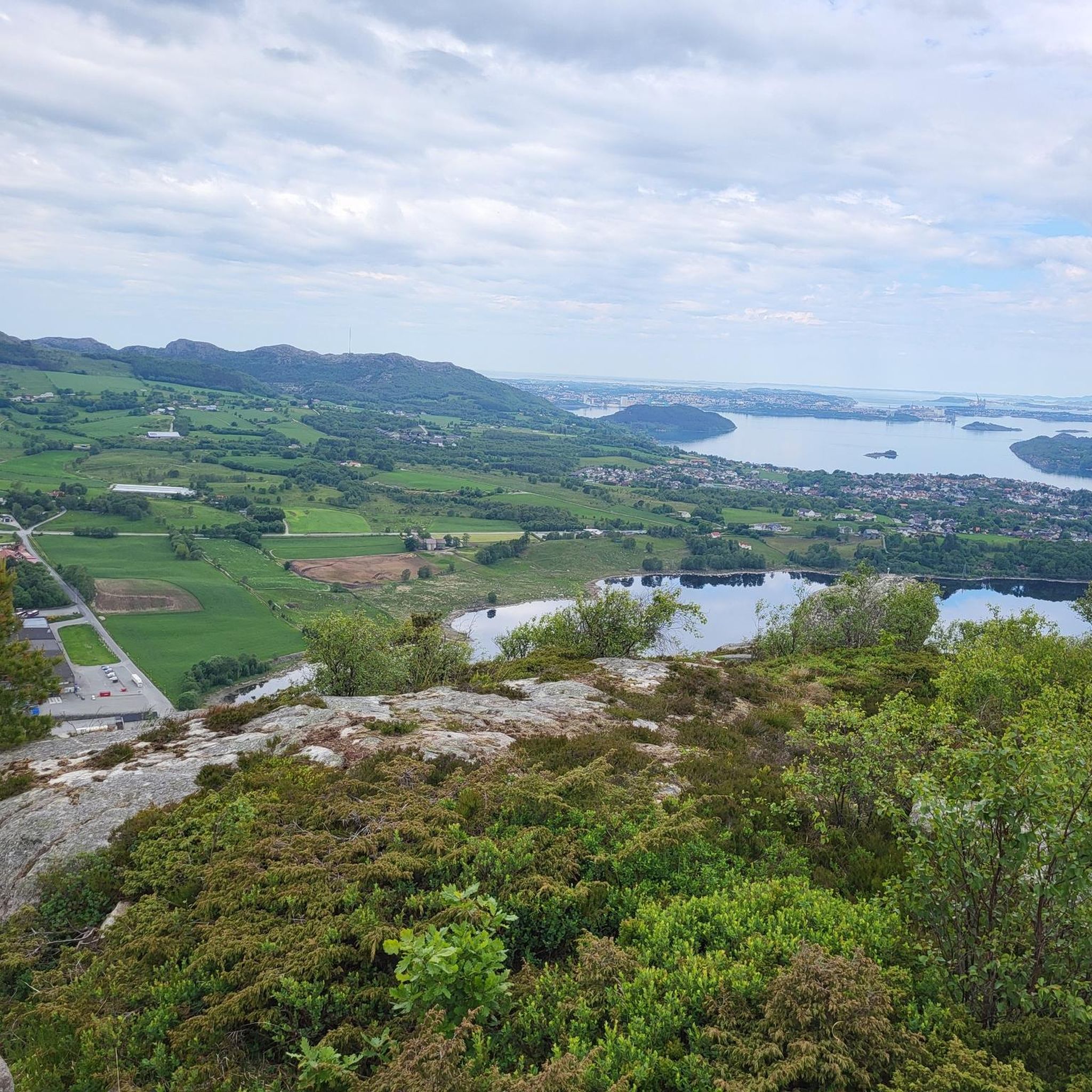
From here, you have a breathtaking view of Stavanger, the surrounding islands, and mountains. Urban life and wide open spaces blend together in a magnificent panorama.
0
0

Planetstien turns your hike through Sandvedparken into a journey through the solar system. Stretching along the Storåna river, this 1:1 billion scale model starts with the Sun near Sandnes center and ends with Pluto towards Ganddal. It is a flat, easy gravel path suitable for cycling and walking. As you travel the green corridor, you pass sculptures representing each planet at their relative distances.
0
0
Here, you can take a break on a bench. Wander between the trees to admire the lake up close.
0
0

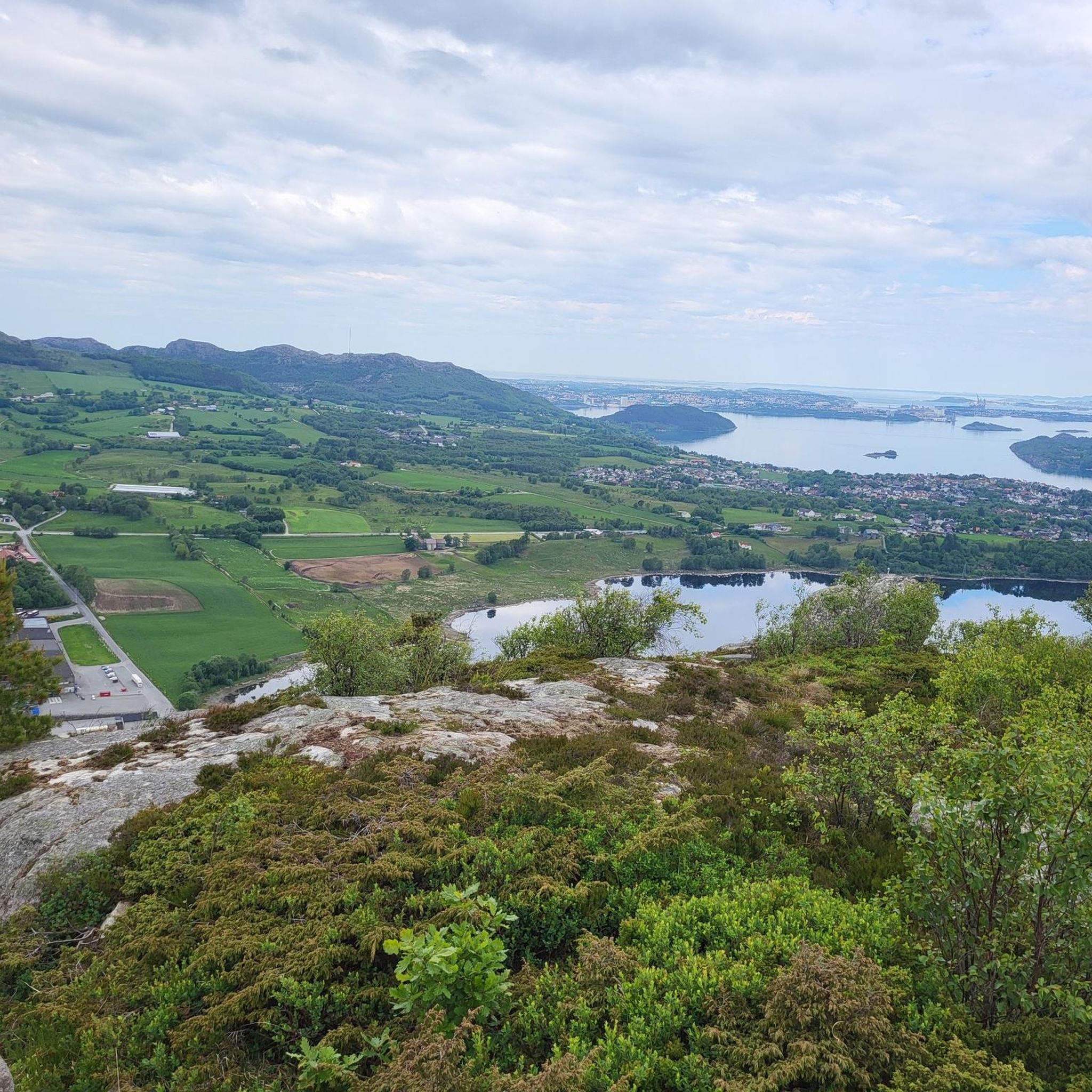
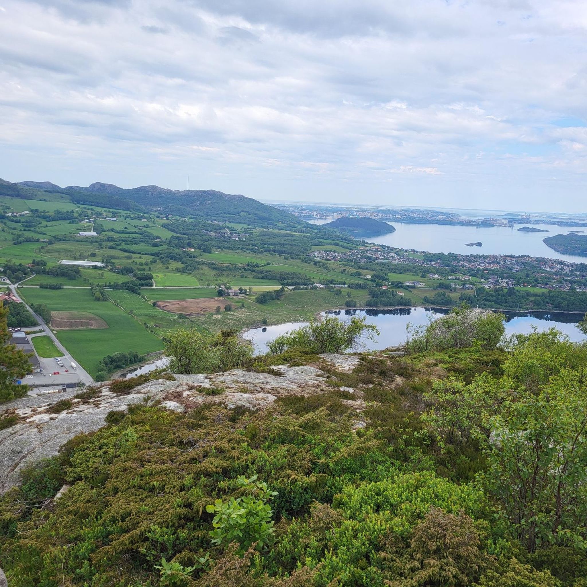
A perfect picnic spot by the lake where you can enjoy peaceful tranquility and natural beauty. The view is dominated by the calm, shimmering lake surface and framed by mature trees or gentle shoreline vegetation, creating a sheltered environment ideal for relaxation.
0
0
Sørmark is the largest continuous recreational area in the Stavanger city, situated about 5 km south of the center. It hosts the Sørmarka Arena, a major multi-purpose facility that includes a speed skating oval, an ice hockey rink, curling rinks, and one of Norway's tallest indoor climbing walls.
0
0

A very beautiful harbor with lots of flair
0
0

Frequently Asked Questions
How many mountain bike trails are available around Frøylandsvatnet?
There are 4 mountain bike trails documented around Frøylandsvatnet on komoot, offering a range of experiences for different skill levels.
What kind of terrain can I expect on mountain bike trails around Frøylandsvatnet?
The terrain around Frøylandsvatnet is diverse, transitioning from open grazing lands to dense spruce forests. You'll encounter a mix of well-maintained gravel paths and natural surfaces. The area features gentle undulations suitable for accessible routes, alongside more challenging sections with varied topography.
Are there easy mountain bike trails suitable for beginners or families?
Yes, the area offers trails categorized as Easy (STS S0-S1), which are generally up to 2 hours long with up to 1,000 feet of elevation gain. These are ideal for all fitness and skill levels, including families. While komoot currently lists mostly moderate routes, the region research indicates such trails exist, like the Tormodsteinen loop from Stangaland.
Can you recommend a challenging mountain bike trail for experienced riders?
For experienced riders seeking a challenge, the Planetstien loop from Gausel is a difficult 21.5 miles (34.6 km) path. This route provides a more demanding experience through varied terrain, including forested sections, and involves significant elevation changes.
Are there any notable natural features or landmarks to see while mountain biking?
Yes, the trails often pass by several interesting features. You might encounter the distinctive wooden bridge called Midgardsormen winding across the lake, or explore Sandtangen, a wooded recreational area with walking trails and picnic spots. The routes also offer glimpses of nearby lakes like Stokkelandsvatnet and Grindavatnet, and agricultural areas.
Are the mountain bike trails around Frøylandsvatnet dog-friendly?
Generally, trails in natural areas like Frøylandsvatnet are dog-friendly, especially if dogs are kept on a leash to protect wildlife and respect other users. Always check local signage for specific restrictions, particularly in protected areas or during certain seasons.
Are there circular mountain bike routes available?
Yes, many of the mountain bike routes around Frøylandsvatnet are designed as loops. For example, the Skreå – Picnic Spot by the Lake loop from Dueberget is a moderate 16.9-mile circular trail that offers great views.
What is the best season for mountain biking around Frøylandsvatnet?
The best season for mountain biking around Frøylandsvatnet is typically from spring to autumn. During these months, the weather is generally milder, and trails are less likely to be affected by snow or ice, providing optimal riding conditions. The varied landscapes are particularly beautiful during these seasons.
What do other mountain bikers enjoy the most about mountain biking in Frøylandsvatnet?
The area is highly rated by the komoot community, with an average score of 4.3 stars. Reviewers often praise the diverse terrain, which includes open grazing lands and spruce forests, and the picturesque lakeside paths. The variety of routes catering to different ability levels is also a frequently mentioned positive aspect.
Where can I park when visiting the mountain bike trails?
While specific parking locations for each trail are best checked on individual route pages, the region generally offers accessible parking near popular recreational areas and trailheads. For instance, areas like Sandtangen near Bryne or Njåskogen between Bryne and Kvernaland are known for their accessibility and likely have parking facilities.
Are there any routes that pass through urban or mixed landscapes?
Yes, some routes offer a blend of urban and natural scenery. The Stavanger Old Town loop from Gausel is a 28.2-mile trail that leads through both urban and natural landscapes, providing a unique riding experience.
How long do mountain bike trails around Frøylandsvatnet typically take to complete?
The duration of mountain bike trails around Frøylandsvatnet varies significantly depending on the route's length and difficulty. For example, a moderate trail like Skreå – Picnic Spot by the Lake loop from Dueberget takes approximately 1 hour 48 minutes, while longer, more challenging routes can take over 5 hours.
Most popular routes around Frøylandsvatnet

Get inspired with the komoot mobile app


Explore more
Browse the best MTB trails in other regions.
