The best walks and hikes around Refvikvatnet
4.5
(513)
2,018
hikers
41
hikes
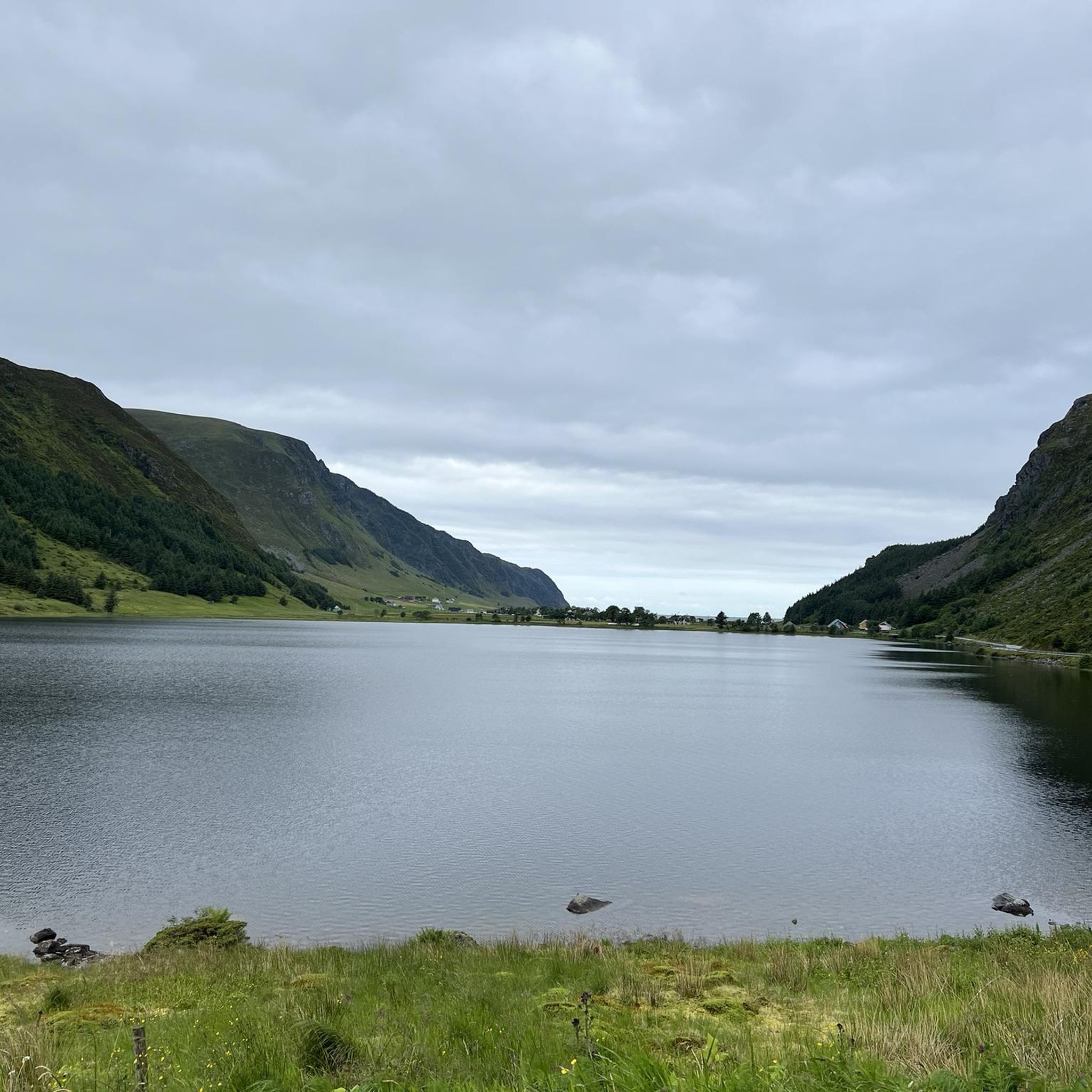
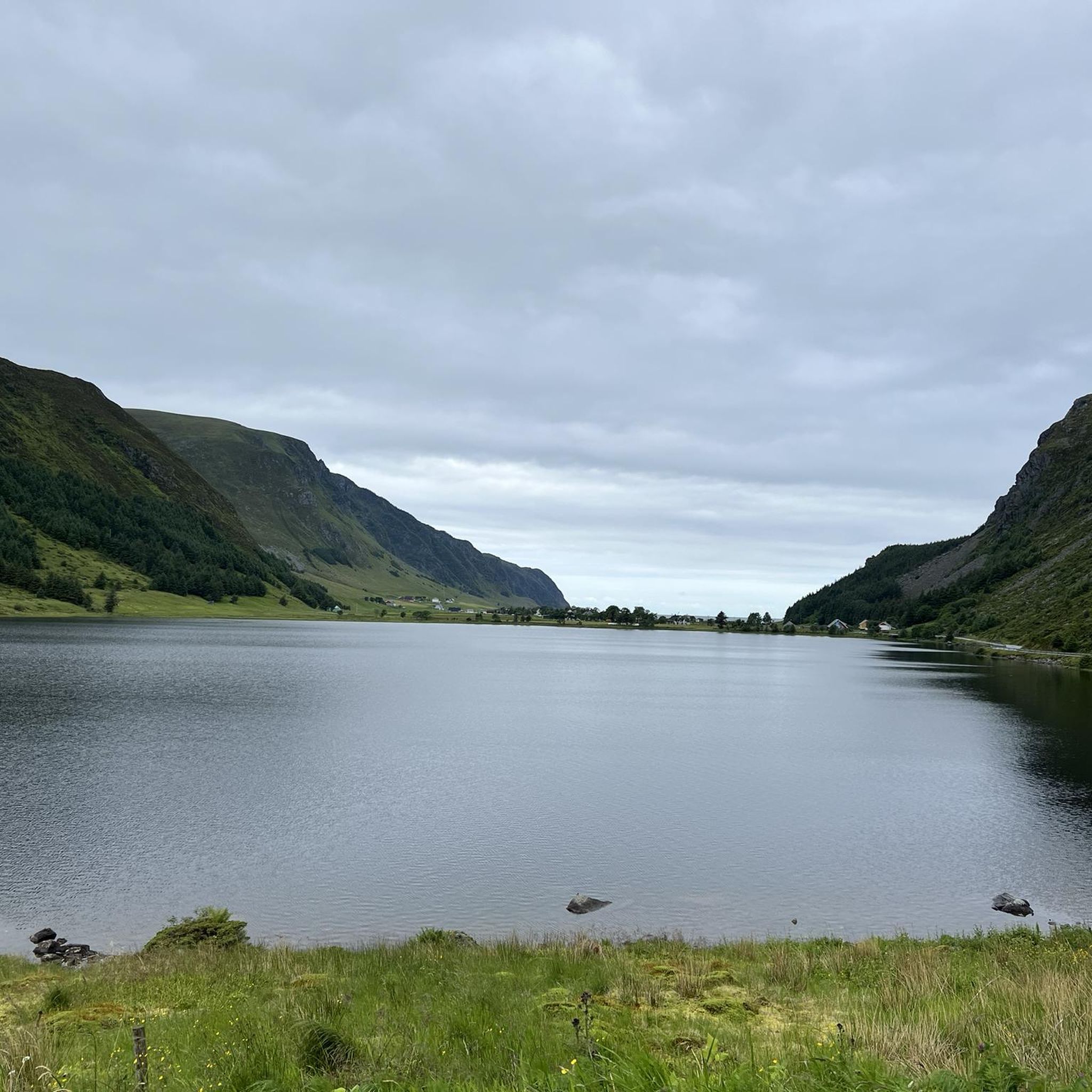
Hiking around Refvikvatnet offers diverse landscapes in Kinn, Western Norway, a region characterized by its significant lake, varied terrain, and coastal proximity. As a nature reserve, it provides a preserved environment for exploration. The area features both accessible paths around water bodies and more challenging ascents to hills and summits. Hikers can expect a mix of serene lake views, hilly trails, and glimpses of the surrounding archipelago.
Best hiking trails around Refvikvatnet
- The most popular hiking route is Nibbehaugen –…
Last updated: October 13, 2026
5.0
(1)
1
hikers
13.7km
03:48
250m
250m
Moderate hike. Good fitness required. Easily-accessible paths. Suitable for all skill levels.
5
hikers
4.79km
01:43
290m
290m
Easy hike. Great for any fitness level. Easily-accessible paths. Suitable for all skill levels.

4.5
(2)
15
hikers
14.3km
04:17
430m
430m
Moderate hike. Good fitness required. Easily-accessible paths. Suitable for all skill levels.
4.5
(31)
115
hikers
5.47km
01:48
250m
250m
Easy hike. Great for any fitness level. Easily-accessible paths. Suitable for all skill levels.
4.8
(12)
45
hikers
8.18km
03:24
670m
670m
Moderate hike. Good fitness required. Easily-accessible paths. Suitable for all skill levels.
Get access to more routes and recommendations from other explorers.
Already have an account?
Our route recommendations are based on thousands of hikes, rides, and runs completed by other people on komoot.
Start today with a free account
Your next adventure awaits.
Popular around Refvikvatnet
Tips from the Community

Here, you will find a viewpoint cairn. At the viewpoint, you are rewarded with a nice view towards Måløy.
0
0
This rock formation forms a natural shelter you pass on your mountain hike.
0
0

The climb from the parking lot to Kjeretoppane is no problem. After that, the trail to the summit of Veten is very challenging. It climbs steeply and exposed, with no trail visible anywhere. There are good markers (red posts). Recommended only for experienced hikers.
0
0

My tip would be to bring your swimsuit and enjoy the white sand. The waves are wonderful, and the beach has a beautiful bottom. Highly recommended, and in my opinion, one of Norway's best.
1
0

The hike is challenging, slippery and muddy. Do not underestimate it. Not for kids!
3
1


Fantastically beautifully located small lighthouse. A marked hiking trail leads here. There is a picnic area at the lighthouse.
1
0
A wonderfully beautiful sandy beach straight out of a picture book. There is a small campsite near the beach and there is also a beach volleyball net on the beach. Access to the car park/campsite is subject to a fee (barrier). A ticket must be purchased at the machine.
2
0
Frequently Asked Questions
How many hiking trails are there around Refvikvatnet?
Refvikvatnet offers a diverse network of over 40 hiking trails. These range from easy walks to more challenging ascents, catering to various fitness levels.
What kind of terrain can I expect on hikes around Refvikvatnet?
The terrain around Refvikvatnet is varied, featuring serene lake views, hilly paths, and mountainous sections. As a nature reserve, you'll find a preserved environment with trails that can traverse over stones, rocks, and roots, especially on more demanding routes.
Are there easy hiking options suitable for beginners or casual walkers?
Yes, Refvikvatnet has plenty of easy hikes. There are 17 easy routes available, many of which are accessible paths around water bodies. An example is the Nibbehaugen – Børahornet loop from Nord-Vågsøy kyrkje, which is an easy 3.0-mile trail.
Are there challenging hikes for experienced hikers in the Refvikvatnet area?
For experienced hikers, there are challenging options that require good fitness and sure-footedness. While there is 1 officially difficult route, 22 moderate routes also offer significant elevation gain and can last up to five hours. Some trails, like the ascent to Hatlesetnipa (583 m) mentioned in regional research, are described as very demanding.
Can I find hikes with lake views or water features?
Absolutely. Refvikvatnet itself is a prominent lake, and many routes incorporate water elements. For instance, the Small Lake with Water Lilies – Skongsneset Lighthouse loop from Setra features serene water bodies and coastal views.
Are there trails that offer coastal views or lead to lighthouses?
Yes, the coastal proximity of Refvikvatnet means you can find trails with sea views. The Small Lake with Water Lilies – Skongsneset Lighthouse loop from Setra is a great option for experiencing coastal scenery and views towards a lighthouse.
What kind of viewpoints can I expect on the trails around Refvikvatnet?
Many trails offer expansive vistas, especially from higher elevations. You can expect breathtaking views of the surrounding archipelago, the reservoir, and panoramic outlooks over Måløy and Måløy Bridge from various points.
Are there any circular hiking routes available?
Yes, many of the trails around Refvikvatnet are circular, allowing you to start and end at the same point. Examples include the Hammarskaret – Skarråsa loop from Sanden and the Veten, Brurahornet and Gottrøysa — triple summit loop.
What do other hikers enjoy the most about hiking in Refvikvatnet?
The area is highly rated by the komoot community, with an average score of 4.4 stars from over 390 reviews. Hikers often praise the diverse landscapes, from serene lake paths to challenging summit ascents, and the stunning views of the archipelago.
Is Refvikvatnet a good destination for family-friendly hikes?
Yes, Refvikvatnet offers several family-friendly options. Many easy trails are suitable for all ages, providing accessible paths and shorter durations, making them ideal for a family outing.
Can I bring my dog on the hiking trails in Refvikvatnet?
While specific regulations for dogs on every trail are not detailed, generally, dogs are welcome on hiking trails in Norway, often on a leash. As Refvikvatnet is a nature reserve, it's always best to check local signage or specific trail guidelines for any restrictions to ensure a pleasant experience for everyone.
What is the best time of year to go hiking around Refvikvatnet?
The best time to hike around Refvikvatnet is typically during the warmer months, from late spring to early autumn (May to September), when the weather is milder and trails are clear of snow and ice. This period offers the most pleasant conditions for enjoying the diverse landscapes.

Get inspired with the komoot mobile app


Explore more
Browse the best Hikes in other regions.
