The best walks and hikes around Nevelvatnet
4.4
(475)
2,649
hikers
118
hikes
Hiking around Nevelvatnet offers diverse trails through forests, along mountain ridges, and across scenic plateaus. The region is characterized by gentle mountain slopes, rounded hills, and expansive mountain plateaus, providing varied terrain for walking. Nevelvatnet itself is a charming lake, and the area includes Nevelfjell, the highest point in the Lillehammer municipality at 1,089 meters (3,573 ft). This landscape provides an authentic outdoor experience with natural paths and panoramic views.
Best hiking trails around Nevelvatnet
- The most popular hiking route…
Last updated: October 13, 2026
5.0
(5)
20
hikers
5.94km
01:34
50m
50m
Easy hike. Great for any fitness level. Easily-accessible paths. Suitable for all skill levels.
5.0
(3)
72
hikers
7.02km
02:01
170m
170m
Moderate hike. Good fitness required. Easily-accessible paths. Suitable for all skill levels.

4
hikers
Easy hike. Great for any fitness level. Easily-accessible paths. Suitable for all skill levels.
4.7
(71)
228
hikers
Moderate hike. Good fitness required. Easily-accessible paths. Suitable for all skill levels.
4.7
(20)
72
hikers
20.7km
06:13
540m
540m
Hard hike. Very good fitness required. Mostly accessible paths. Sure-footedness required.
Get access to more routes and recommendations from other explorers.
Already have an account?
Our route recommendations are based on thousands of hikes, rides, and runs completed by other people on komoot.
Start today with a free account
Your next adventure awaits.

Tips from the Community

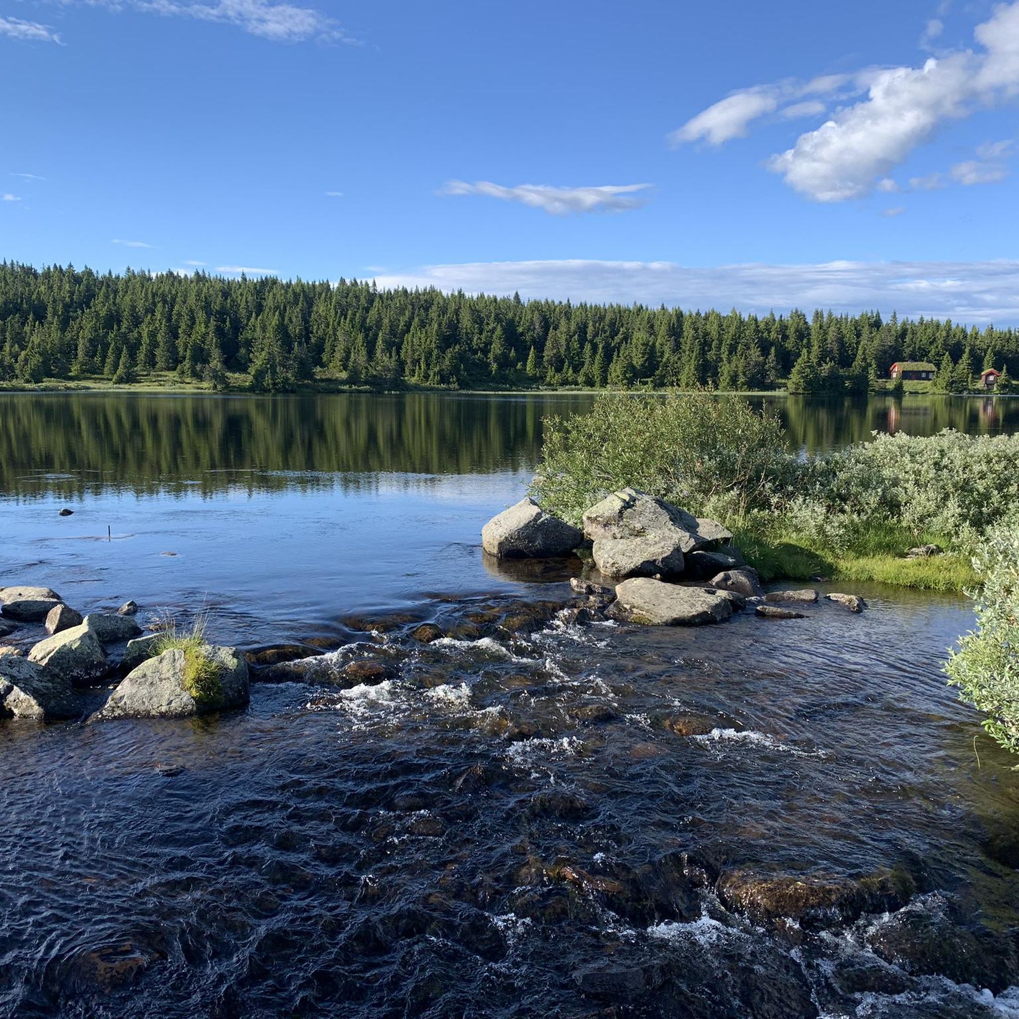
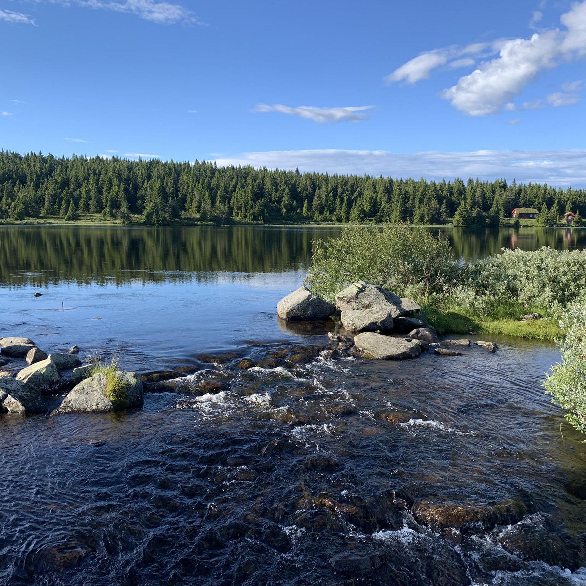
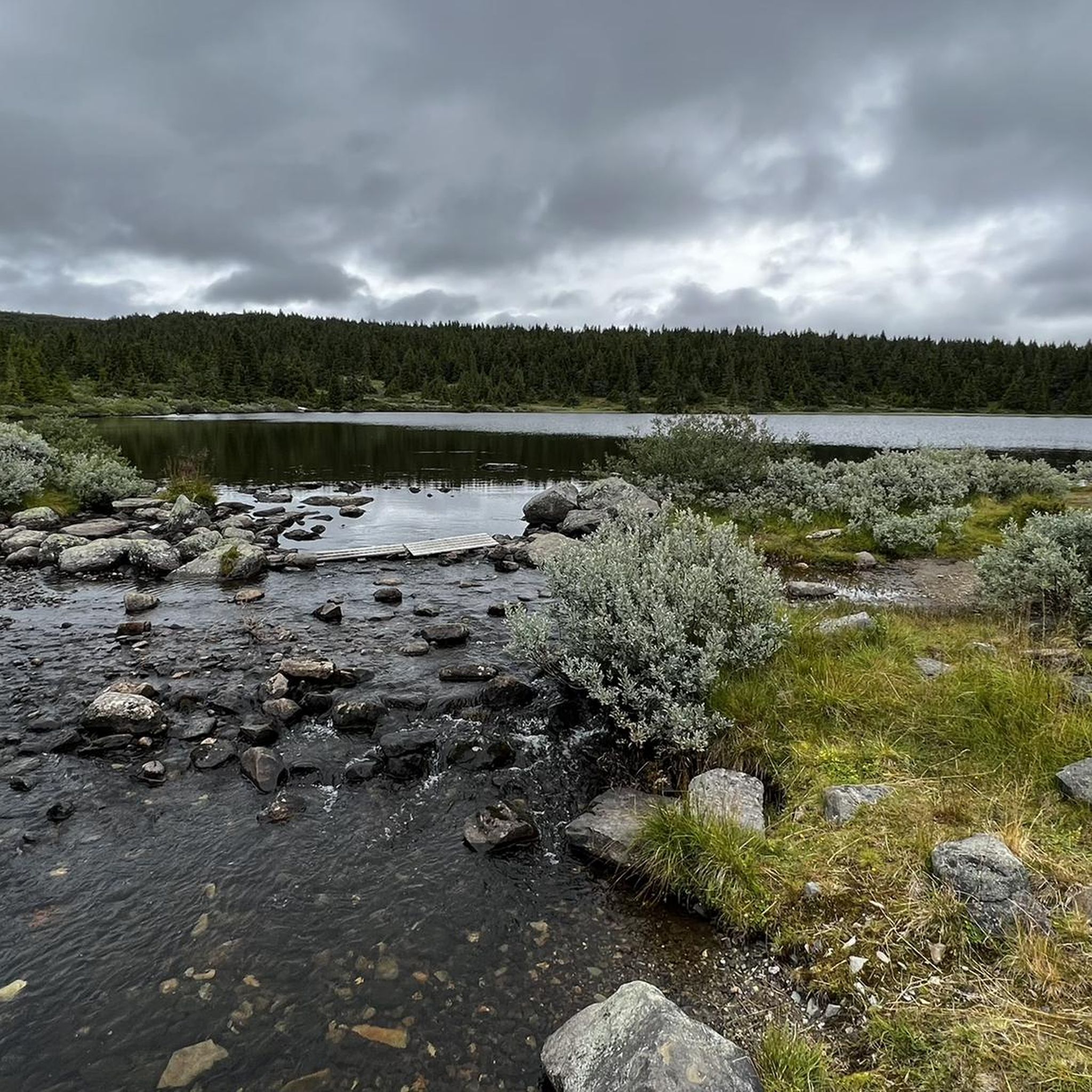
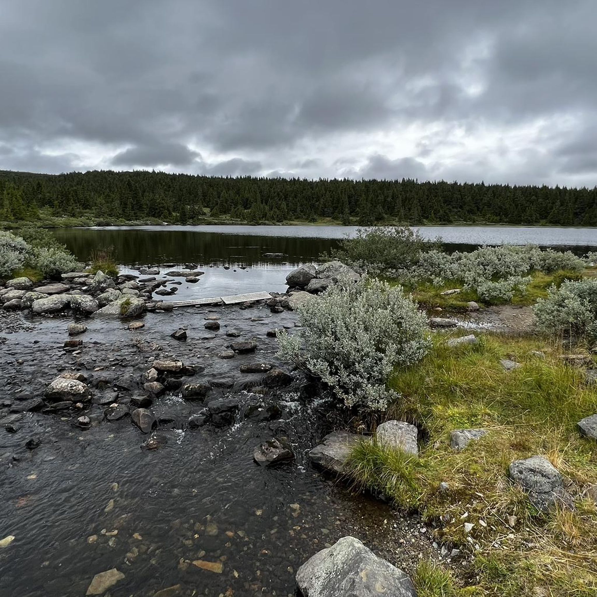
This picturesque upland lake lies just a short walk from Pellestova on the flanks of the popular Hafjell. It's reached via a good trail and boardwalks for the boggier sections.
0
0
This is a charming picnic area on the shores of Nevelvatnet. There's a fine loop around the lake, the Nevelvatnet Rundt, while a hike up neighbouring Nevelfjell takes you to the highest point in the Lillehammer municipality, at 1,089 metres (3,573 ft).
0
0
Reinsfjellet can be combined with Kriksfjell and Hitfjell to create a hugely satifying Øyerfjellet round. The plateau here is not too far from Lillehammer and makes for some great adventures.
0
1

The shelter, which was lovingly restored in 2021, offers wonderful protection from the rigors of nature in icy winds ;-).
0
0

Small hut on the windy summit. There's a very good view from the summit.
0
0
Small rest area with bench and table. There is also a large board with a hiking map.
1
0

This small shelter is located a little way from the summit. Perfect for cold, windy, or rainy days.
1
0
Frequently Asked Questions
What kind of terrain can I expect when hiking around Nevelvatnet?
The hiking trails around Nevelvatnet offer diverse terrain, winding through forests, along mountain ridges, and across scenic plateaus. You'll find gentle mountain slopes, rounded hills, and expansive plateaus, providing an authentic outdoor experience with natural, unconstructed paths.
What are the difficulty levels of hikes in Nevelvatnet?
Nevelvatnet and the surrounding Nordseter area provide trails for all fitness levels. There are over 60 easy hikes, around 50 moderate routes, and a dozen more challenging trails. Easy hikes, like the Nevelvatnet loop - Nordseter, are suitable for families, while moderate trails, such as the Nevelfjellhytta – Neveltoppen loop from Ytre Nysæterhøgda, require good fitness. Longer, more demanding routes lead to higher peaks for experienced hikers.
Are there any notable landmarks or viewpoints along the trails in Nevelvatnet?
Yes, a key attraction is Nevelfjell, the highest point in the Lillehammer municipality at 1,089 meters (3,573 ft). A hike to its summit offers spectacular panoramic views, and on clear days, you can see as far as the mountain ranges of Jotunheimen and Rondane. Other notable peaks like Lunkefjell, Hafjell, and Slåseterfjell also offer magnificent vistas. The charming Nevelvatnet lake itself has a pleasant picnic area on its shores.
Is there parking available for hikers in Nevelvatnet?
Yes, the idyllic mountain village of Nordseter serves as a perfect starting point for many trails, and parking facilities are available there. For example, the Nevelvatnet picnic area – Parking lot, toilet & shelter loop from Nordseter starts near a parking area.
How can I reach the Nevelvatnet hiking trails by public transport?
The Nordseter area, which is a common starting point for many trails around Nevelvatnet, is generally accessible by public transport from Lillehammer. It's advisable to check local bus schedules for the most current information on routes and timings to Nordseter.
When is the best time of year to go hiking in Nevelvatnet?
The summer months are ideal for hiking in Nevelvatnet, offering pleasant temperatures and full access to all trails. The area is also a popular destination in winter for cross-country skiing and snowshoeing, but hiking conditions will vary significantly with snow cover.
Are there any family-friendly hiking options around Nevelvatnet?
Absolutely. Many easy hikes are suitable for families, offering easily accessible paths with minimal elevation gain. The Nevelvatnet loop - Nordseter is a great example, providing an easy circuit around the lake. The well-marked trails and charming picnic areas make it enjoyable for all ages.
Are dogs allowed on the hiking trails in Nevelvatnet?
Generally, dogs are welcome on hiking trails in Norway, including around Nevelvatnet, but they must be kept on a leash, especially during certain periods to protect wildlife. Always ensure your dog is under control and follow local regulations regarding pets in natural areas.
Are there any circular hiking routes in Nevelvatnet?
Yes, Nevelvatnet offers several excellent circular routes. A popular choice is the Nevelvatnet loop - Nordseter, which is an easy 5.9 km circuit. Another option is the Nevelfjellhytta – Neveltoppen loop from Ytre Nysæterhøgda, a moderate 7.5 km path that takes you to the summit of Nevelfjell.
What do other hikers enjoy the most about hiking in Nevelvatnet?
The area is highly rated by the komoot community, with an average score of 4.5 stars from over 370 reviews. Hikers often praise the diverse terrain, from forests to mountain plateaus, the stunning panoramic views from peaks like Nevelfjell, and the well-marked trails that cater to various skill levels. The natural, untouched setting and the presence of charming lakes are also frequently highlighted.
Are there any unique natural features to explore, like boardwalks or specific water features?
Yes, the area features unique ecological elements such as a 'Boardwalk through swampland' near Nevelfjellhytta. Additionally, beyond Nevelvatnet itself, other lakes like Reinsvatnet offer opportunities for refreshing swims on warm summer days, with some even featuring sandy beaches.
How many hiking trails are available in the Nevelvatnet area?
There are over 120 hiking trails available in the Nevelvatnet area, offering a wide range of options for different abilities and preferences. This includes a mix of easy, moderate, and challenging routes through varied landscapes.
Most popular routes around Nevelvatnet

Get inspired with the komoot mobile app


Explore more
Browse the best Hikes in other regions.
