The best walks and hikes in LaSalle County
4.8
(123)
1,483
hikers
53
hikes
Hikes in LaSalle County explore a landscape shaped by the Illinois and Vermilion Rivers. The region is characterized by numerous sandstone canyons, bluffs, and seasonal waterfalls, which contrast with the surrounding prairie terrain. Most trails are located within state parks like Starved Rock and Matthiessen, offering routes through forests and along river overlooks.
Best hiking trails in LaSalle County
- The most popular hiking route is French Canyon, Lover's Leap, & Wildcat Canyon loop — Starved Rock State Park, a 3.1 mile (5.0 km) trail that takes about 1 hour 23 minutes to complete. This route connects several of the park's well-known canyons and viewpoints.
- Another top favourite among local hiking enthusiasts is East Canyons loop — Starved Rock State Park, a moderate 5.0 mile (8.1 km) path. The trail navigates the eastern section of the park, featuring multiple canyon overlooks.
- Local hiking enthusiasts also love the Matthiessen State Park loop, a 2.5 mile (4.0 km) trail leading through the park's Upper and Lower Dells, often completed in about 1 hour 3 minutes.
- Hiking in LaSalle County is defined by sandstone canyons, river bluffs, and woodland paths. The trail network provides options for different ability levels, from short, easy walks to longer, more challenging hikes.
- The routes in Lasalle County are highly rated by the komoot community with an average score of 4.6 stars from over 100 reviews. More than 1,300 hikers have used komoot to explore Lasalle County's varied terrain.
Last updated: October 11, 2026
4.8
(4)
55
hikers
10.7km
02:52
140m
120m
The River Trail, Bluff Trail, and Illinois Canyon Loop offers a fantastic cross-section of Starved Rock State Park's natural beauty. You'll traverse along the Illinois River with views of the dam and Eagle Cliff, then climb to elevated perspectives on the Bluff Trail, taking in sweeping vistas from overlooks like Beehive Overlook. The route then dips into the lush Illinois Canyon, where you'll find striking sandstone formations, moss-covered cliffs, and potentially several intermittent waterfalls after a good rain, along with vibrant Virginia bluebells in spring. Be ready for some muddy spots and creek crossings, especially in the canyon sections. This moderate hike covers 6.6 miles (10.7 km) with 451 feet (138 metres) of elevation gain, typically taking just under three hours.
Planning your visit means being prepared for varied conditions; the River Trail can be muddy or flooded, and Illinois Canyon involves multiple creek crossings that can be challenging with high water. For the best experience, consider hiking after rainfall to witness the waterfalls in full flow, or during spring to see the canyon floor carpeted in bluebells. Parking is generally available at Starved Rock State Park, but an early start is always recommended to secure a spot and enjoy the trails before crowds gather.
This loop is a popular choice for good reason, combining the best of the park's riverine and canyon environments. Starved Rock is renowned for its sandstone canyons, and this route showcases them beautifully, particularly the
18
hikers
12.5km
03:22
160m
180m
Embark on the Dells Area to Vermillion River Area Loop, a moderate hiking route that guides you through the striking landscapes of Matthiessen State Park. This trail offers a diverse experience, winding through dramatic sandstone canyons in the Dells Area where you will encounter towering bluffs and winding paths. A highlight is Cascade Falls, a beautiful waterfall that adds to the park's natural charm. The entire loop covers 7.7 miles (12.5 km) with an elevation gain of 533 feet (162 metres), typically taking around 3 hours and 22 minutes to complete.
When planning your visit, be aware that trail conditions can vary, especially during spring and early summer. Higher water levels might lead to muddy sections, requiring you to navigate across stones or logs. It is essential to wear appropriate footwear to ensure a comfortable and safe hike. Parking is generally available within Matthiessen State Park, providing convenient access to the trailheads for this loop.
This route is notable for its unique geological features, transitioning from the rugged Dells Area to the scenic Vermillion River Area. As you move towards the river, the scenery shifts to wooded bluffs, offering expansive panoramic views above the Vermillion River. The combination of deep canyons and river overlooks makes this loop a distinctive and rewarding experience within the region.

5.0
(2)
10
hikers
1.67km
00:27
30m
20m
The Ottawa Canyon Trail offers a delightful, accessible hike through Starved Rock State Park, showcasing impressive sandstone canyon walls that can tower up to 50 feet high. You'll navigate natural surfaces, including exposed tree roots and several creek crossings that might be muddy or even calf-high after rain. The highlight is undoubtedly the 45-foot Ottawa Canyon Waterfall, where you can often walk behind the cascading water for a unique perspective, making this an easy 1.0-mile (1.7 km) route with a big payoff.
This family-friendly hike, with minimal elevation gain of just 91 feet (28 metres) and an estimated duration of 27 minutes, is perfect for a quick outing. While generally less crowded than other parts of the park, it can still be moderately busy, so consider an early start. Dogs are permitted on the trail, but remember to keep them on a leash. The trail's conditions, especially creek levels, can vary significantly after rainfall, so be prepared for potentially wet feet.
What truly sets this trail apart is the combination of its easy accessibility and stunning geological features, including the unique waterfall and the nearby Council Overhang. The lush scenery in spring and summer makes it ideal for wildlife viewing and birdwatching, while winter offers the dramatic spectacle of a frozen waterfall. This Ottawa Canyon Trail hiking overview confirms it's a fantastic option for those seeking natural beauty without a strenuous effort.
2
hikers
1.91km
00:32
20m
50m
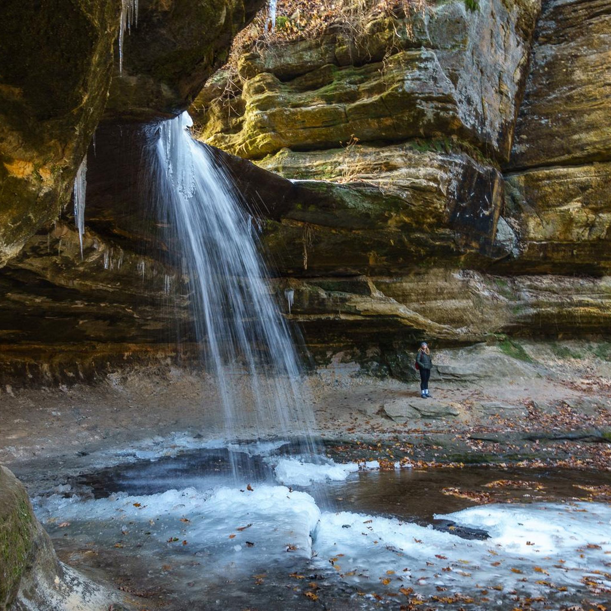
The La Salle Canyon trail offers a captivating journey into a dramatic landscape, where towering sandstone walls give way to lush greenery and the sound of falling water. You'll navigate varied terrain, from paved sections to sandy paths, leading you to the impressive 25-foot waterfall. The true highlight is the chance to walk behind the cascade, a unique experience that makes this easy 1.2-mile (1.9 km) hike, with just 73 feet (22 metres) of elevation gain, feel like a grand adventure.
Planning your visit to La Salle Canyon is straightforward, though you should be prepared for potentially muddy and slippery conditions, especially near the waterfall. The trail is generally accessible for most, taking about 31 minutes to complete, but sure-footedness is a must on uneven surfaces. The waterfall flows nearly year-round, and in winter, it transforms into a beautiful ice fall, offering stunning seasonal hiking conditions.
What sets La Salle Canyon apart is its reliable, year-round waterfall and the unique opportunity to walk behind its curtain of water, making it a premier photo destination within Starved Rock State Park. Unlike many other seasonal falls, La Salle Canyon's consistent flow ensures a rewarding experience. The dramatic sandstone overhangs and deep canyon environment create a sense of stepping into another world, making it one of the most popular trails for natural features in the park.
1.41km
00:23
10m
30m
Discover the Saint Louis Canyon Trail, an easy hike that leads you through shaded woodlands and alongside a tranquil creek. You will be surrounded by impressive towering sandstone cliffs as you make your way to the main attraction. The route culminates at the magnificent 40-foot Saint Louis Canyon Waterfall, which flows reliably year-round thanks to its spring-fed source. This accessible trail covers 0.9 miles (1.4 km) with a gentle elevation gain of 46 feet (14 metres), typically taking about 23 minutes to complete.
When planning your visit, remember that while the trail is generally easy, certain sections require attention. Rocks near the waterfall can be slippery, and wooden boards along the path may become slick after rain. Always wear appropriate footwear to ensure a safe and enjoyable experience as you explore the canyon. This short journey is ideal for a quick nature break, offering a refreshing escape into the park's natural beauty.
What makes this trail particularly special is the unique opportunity to walk directly behind the cascading waters of the Saint Louis Canyon Waterfall. This provides an immersive perspective of the canyon's geological formations and the power of the falling water. The trail offers a distinct experience within Starved Rock State Park, showcasing its dramatic sandstone canyons and lush environment in a compact and rewarding adventure.
1
hikers
598m
00:10
10m
0m
Explore the Starved Rock Trail, an easy hike that takes you through a landscape of dramatic sandstone bluffs and lush forest, a unique sight in Illinois. You will gain 41 feet (13 metres) in elevation over its 0.4 miles (0.6 km) length, making it a quick 9-minute journey. As you walk, keep an eye out for the moss-covered rock ledges and narrow passageways that define this area. The route offers scenic views of the Illinois River, particularly from overlooks like Starved Rock itself. This short path is perfect for a refreshing outdoor escape.
Before you head out, be aware that Starved Rock State Park is currently undergoing a trail improvement project. This work is expected to continue through most of 2026. While the park remains open, some areas may be temporarily closed, so it is wise to check for updates at the visitor center before your visit. Parking is generally available at the park's main lots, providing convenient access to the trailhead. Plan your visit during daylight hours to fully enjoy the scenery.
This trail is a prime example of the distinctive geological features found within Starved Rock State Park. The dramatic sandstone bluffs and lush forest create an environment unlike much of Illinois. It offers a chance to experience the natural beauty of the region in a compact and accessible format. Consider combining this short hike with other nearby attractions to make the most of your time in the park.
2.02km
00:32
10m
40m
The Cave of the Winds trail is a wonderfully accessible and easy hiking route, perfect for a quick breath of fresh air. This short path, spanning 1.3 miles (2.0 km) with a gentle 43 feet (13 metres) of elevation gain, guides you to scenic spots like the Owl Canyon Overlook and Hennepin Canyon Overlook. It's an ideal choice for a relaxed outing, offering pleasant views without demanding much effort, and can be completed in about 32 minutes.
Planning your visit to this easy trail is straightforward; it's suitable for all ages and skill levels. Parking is generally available near the trailhead, but consider an early start on weekends to secure a convenient spot. The trail is enjoyable throughout the year, with spring and autumn providing particularly comfortable conditions for your walk.
This trail stands out as a great option for those seeking a brief, low-impact outdoor experience in the region. Its easy difficulty and short duration make it a fantastic introduction to hiking for beginners or a convenient way to enjoy nature when time is limited. It's a local gem for a quick dose of fresh air and scenic overlooks.
105km
26:31
130m
120m
The Illinois & Michigan Canal State Trail is a difficult, long-distance hike spanning 65.4 miles (105.3 km), with a modest 441 feet (134 metres) of elevation gain. You can expect to spend around 26 hours and 31 minutes completing this route, which follows the historic canal, offering continuous views of the waterway and surrounding natural areas. The path is predominantly flat, made of crushed limestone, and you'll encounter diverse scenery from bluffs to rolling hills, with opportunities to spot wildlife; look out for the impressive Aux Sable Creek Aqueduct along the way.
Accessing the trail is straightforward, with multiple entry points available along its extensive length. You'll find amenities like picnicking areas and camping options within the state parks it connects, making it suitable for multi-day excursions. While the crushed limestone surface is generally smooth, be aware that some sections might have exposed areas or require detours due to ongoing maintenance; always check local conditions before you head out, especially for such a significant undertaking.
This trail winds through the historic Illinois and Michigan Canal National Heritage Area, offering a unique blend of natural beauty and historical intrigue. As you hike, you'll follow the Des Plaines and Illinois Rivers, passing through state parks and restored historical sites that tell the story of the canal's engineering marvel. It's a journey through a significant part of Illinois's past, connecting various communities and natural landscapes, and played a crucial role in linking the Great Lakes to the Mississippi River system.
4.9
(27)
273
hikers
8.12km
02:12
110m
110m
Embark on a moderate hike through the Starved Rock, Wildcat Canyon, and French Canyon Loop, a 5.0-mile (8.1 km) journey that takes about 2 hours and 11 minutes to complete. You'll gain 355 feet (108 metres) in elevation as you explore the unique sandstone formations and lush canyon environments. Imagine walking through the cool, shaded depths of Wildcat Canyon, where seasonal waterfalls might greet you. Further along, French Canyon offers its own distinct beauty with towering rock walls. This route provides a refreshing escape into nature, showcasing the park's geological wonders.
Accessing the trail is straightforward, with ample parking available at Starved Rock State Park. Before you head out, it's always a good idea to check the park's official website for any current alerts or important seasonal considerations. This includes information on trail conditions or potential closures, which can change depending on weather or maintenance. Planning ahead ensures you have the best possible experience on your hike.
This loop is a fantastic way to experience some of Starved Rock State Park's most iconic natural features. The area is renowned for its impressive sandstone formations, carved by ancient waters, creating a dramatic landscape. You'll find yourself immersed in a unique ecosystem, distinct from the surrounding plains. It's a prime example of the geological history that shaped this region, offering a memorable outdoor adventure.
5.0
(5)
93
hikers
5.01km
01:23
90m
90m
The French Canyon, Lover's Leap, & Wildcat Canyon loop offers a captivating journey through Starved Rock State Park's unique sandstone canyons and scenic overlooks. You'll navigate varied terrain, from natural sand and dirt paths to numerous stone steps, as you explore the towering walls of French Canyon and Wildcat Canyon, both featuring impressive seasonal waterfalls. From Lover's Leap Overlook, you'll be rewarded with expansive views of the Illinois River, making this easy 3.1-mile (5.0 km) hike, with 301 feet (92 metres) of elevation gain, a visually rich experience that takes about 1 hour and 23 minutes.
Given its popularity, planning an early start is a good idea to enjoy the trail with fewer crowds. While rated easy, the frequent stairs and potentially muddy canyon floors, especially after rain, mean you should wear appropriate footwear. The trail is well-marked, but be ready for frequent ascents and descents that might feel more moderate if you're not accustomed to them.
This loop is a fantastic way to experience the geological wonders of Starved Rock State Park, a region famous for its 18 sandstone canyons carved by glacial meltwater. Wildcat Canyon is particularly notable for its 70-foot waterfall, the tallest in the park, and its impressive 90-foot depth. The park also holds historical significance related to Native American tribes, adding another layer of interest to your visit.
Get access to more routes and recommendations from other explorers.
Already have an account?
Our route recommendations are based on thousands of hikes, rides, and runs completed by other people on komoot.
Start today with a free account
Your next adventure awaits.



Other adventures in LaSalle County

Tips from the Community


A beautiful view, but the number of locks is still very limited today
0
0
Wildcat Canyon is one of the most impressive and popular canyons in Starved Rock State Park. It is known for: • The highest waterfall in the park: approximately 70 feet (21 meters) high • The deepest canyon: up to 90 feet (27 meters) deep • Two overlooks at the top of the canyon
1
0
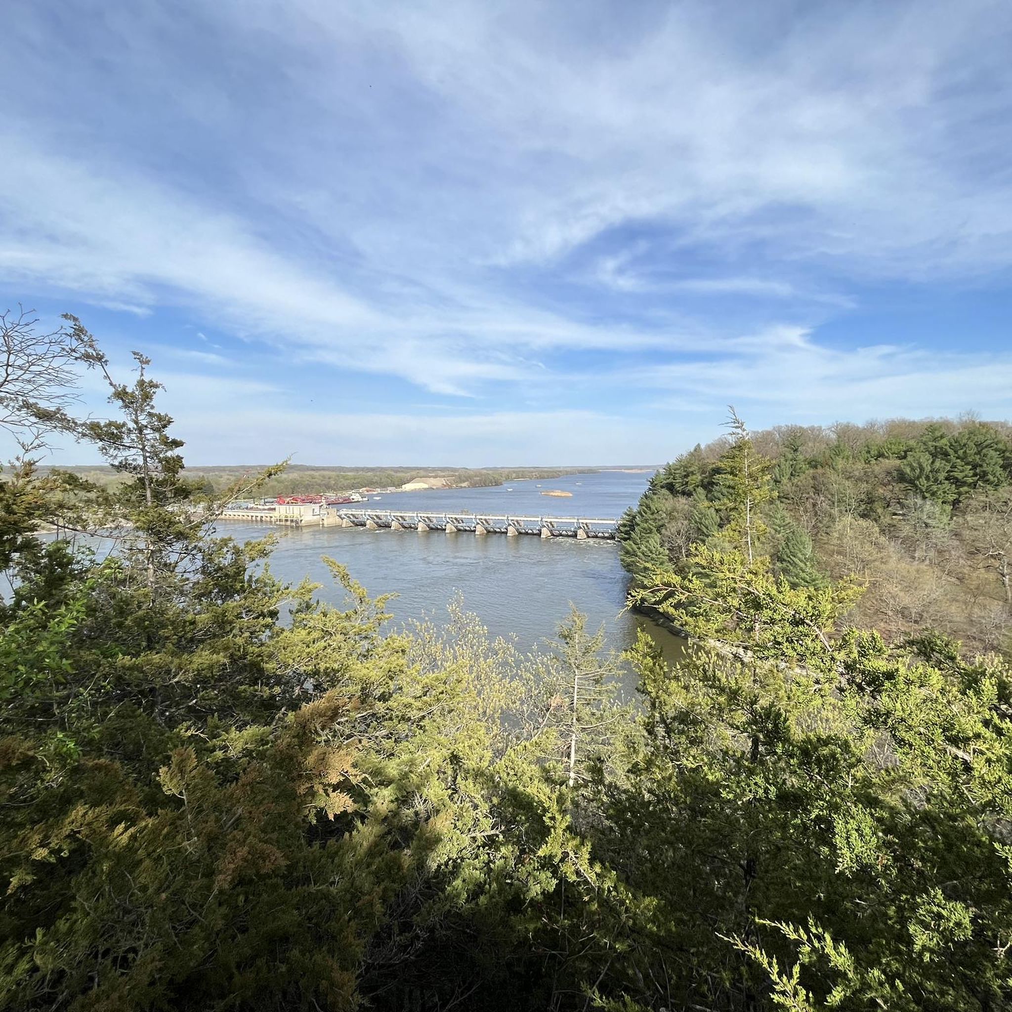
Dam Technical Specifications • Type: Gravity dam • Length: 400 meters • Height: Up to 10 meters • Spillway: Controlled, for regulating water discharge • Lock: Navigation lock measuring 110 x 600 feet for shipping
2
0
According to local legend, the Ottawa leader Pontiac was assassinated by a Peoria warrior in 1769. • In retaliation, the Ottawa and Potawatomi besieged a group of Illiniwek (Illinois Confederacy) entrenched on the rock. • The besieged starved to death, and thus the rock became known as "Starved Rock."
1
0

The cycleway only cruises past the DuPage River briefly, so enjoy the view while you have it! The trail will spend more time along the canal that shoots off from the river.
1
0
This spot looks like a bridge for people, and I suppose it does serve that purpose. But it's actually an aqueduct that was built to let the I&M Canal flow over Sable Creek. So basically, it's a bridge for the canal to flow over the creek.
0
0

One of the historic locks on the Illinois & Michigan Canal. There are 15 in total on the canal, but this is one of the most well-kept on the canal.
0
0
Frequently Asked Questions
Are there any easy, family-friendly hikes in LaSalle County?
Yes, the region has many trails suitable for families. A great option is the Saint Louis Canyon trail in Starved Rock State Park. It's a relatively short and easy walk leading to a beautiful canyon and waterfall, making it a rewarding experience for hikers of all ages.
Can I bring my dog on the hiking trails?
Dogs are generally permitted on-leash in most of LaSalle County's state parks, but it's always best to check specific park regulations before you go. The Buffalo Loop at Buffalo Rock State Park is a pleasant walk where you can enjoy views of the Illinois River and see the park's resident bison.
Where can I find the best waterfalls?
LaSalle County is famous for its seasonal waterfalls, especially within its canyons. While many trails feature them, the hike to LaSalle Canyon is a local favorite, known for its picturesque waterfall. Keep in mind that the flow is best after recent rainfall or during the spring melt.
What is the best time of year to hike in LaSalle County?
Spring is a fantastic time to visit, as melting snow and rainfall create active waterfalls throughout the parks. Autumn is also popular for its spectacular fall foliage and pleasant hiking temperatures. Summer can be beautiful but also hot and humid, while winter offers a unique experience with frozen waterfalls and fewer crowds.
Are there any challenging hikes in the area?
Yes, for those seeking a more strenuous adventure, the Starved Rock State Park full loop offers a significant challenge. This extensive trail covers nearly 12 miles (19 km) and includes considerable elevation changes as it connects many of the park's canyons and bluffs.
How many hiking trails are available in LaSalle County?
There are over 45 curated hiking routes in LaSalle County available on komoot. The trails range from short, easy walks under an hour to long, challenging treks, with the majority being easy or moderate, ensuring options for every skill level.
What do other hikers think of the trails in LaSalle County?
The trails are highly regarded by the komoot community, with an average rating of 4.6 out of 5 stars. Hikers frequently praise the unique landscape of sandstone canyons, scenic river overlooks, and well-maintained paths through the state parks.
Are there any short hikes that are less than 2 miles long?
Certainly. For a quick but scenic hike, consider the trail to Ottawa and Kaskaskia Canyons. This easy route is just over a mile long and provides a great taste of the area's natural beauty without a major time commitment.
Which trails offer the best views of the Illinois River?
Many trails in Starved Rock State Park feature stunning overlooks. The Starved Rock & Lover's Leap loops trail is particularly known for its panoramic views of the Illinois River valley from high atop the sandstone bluffs.
Can I see multiple canyons on a single moderate hike?
Yes, several routes are designed to connect multiple canyons. The Illinois, Kaskaskia, & La Salle Canyons hike is a moderately difficult trail that takes you through three of the park's distinct and beautiful canyons in one comprehensive loop.
What are some of the most popular natural spots to see while hiking?
Hikers in LaSalle County are drawn to its dramatic canyons. Among the most popular and highly-rated spots are LaSalle Canyon and Wildcat Canyon, both celebrated for their impressive rock formations and seasonal waterfalls. St. Louis Canyon and Illinois Canyon are also local favorites worth exploring.
Most popular routes in LaSalle County
Most popular attractions in LaSalle County

Get inspired with the komoot mobile app


Didn’t find what you were looking for?
Check out more Hikes throughout Lasalle County below and find the perfect route in your destination.
Explore more
Browse the best Hikes in other regions.
