The best walks and hikes around Waterleidingplas
4.4
(5617)
31,860
hikers
522
hikes
Hiking around Waterleidingplas offers diverse landscapes within the Amsterdamse Waterleidingduinen nature reserve. The terrain features a unique sandy dune landscape, essential for water filtration, alongside extensive forests and water channels. Various lakes and ponds, including the Loenderveense Plas, are integrated into the routes, providing varied scenery. This area is characterized by its combination of woodlands, open dunes, and water bodies, creating a tranquil environment for outdoor activities.
Best hiking trails around Waterleidingplas
- The most popular hiking route is View of the Loenderveense Plas loop from Wijdemeren, a 3.2 miles (5.2 km) trail that takes 1 hour 18 minutes to complete. This easy route offers views of the Loenderveense Plas.
- Another top favourite among local hikers is The Vecht – View of the Loenderveense Plas loop from Oud-Loosdrecht, a difficult 15.0 miles (24.1 km) path. This route follows the Vecht river and circles the Loenderveense Plas, showcasing diverse waterways and landscapes.
- Local hikers also love the Kromme Rade Nature Reserve – View of the Loenderveense Plas loop from Wijdemeren, a 3.1 miles (4.9 km) trail leading through the Kromme Rade Nature Reserve, often completed in about 1 hour 15 minutes.
- Hiking around Waterleidingplas is defined by sandy dune landscapes, dense forests, and serene water channels. The network offers options for various ability levels, from easy loops to more challenging long-distance paths.
- The routes in Waterleidingplas are highly rated by the komoot community with an average score of 4.4 stars from over 5,000 reviews. More than 30,000 hikers have used komoot to explore Waterleidingplas's varied terrain.
Last updated: June 25, 2026
4.5
(22)
100
hikers
Hard hike. Very good fitness required. Easily-accessible paths. Suitable for all skill levels.
4.5
(4)
52
hikers
5.17km
01:18
0m
0m
Easy hike. Great for any fitness level. Easily-accessible paths. Suitable for all skill levels.

Sign up for free
19
hikers
Easy hike. Great for any fitness level. Easily-accessible paths. Suitable for all skill levels.
4.3
(39)
226
hikers
10.5km
02:38
10m
10m
Moderate hike. Good fitness required. Easily-accessible paths. Suitable for all skill levels.
4.0
(145)
535
hikers
Moderate hike. Good fitness required. Easily-accessible paths. Suitable for all skill levels.
Get access to more routes and recommendations from other explorers.
Sign up for free
Already have an account?
Our route recommendations are based on thousands of hikes, rides, and runs completed by other people on komoot.
Start today with a free account
Your next adventure awaits.
Login or Signup
Tips from the Community

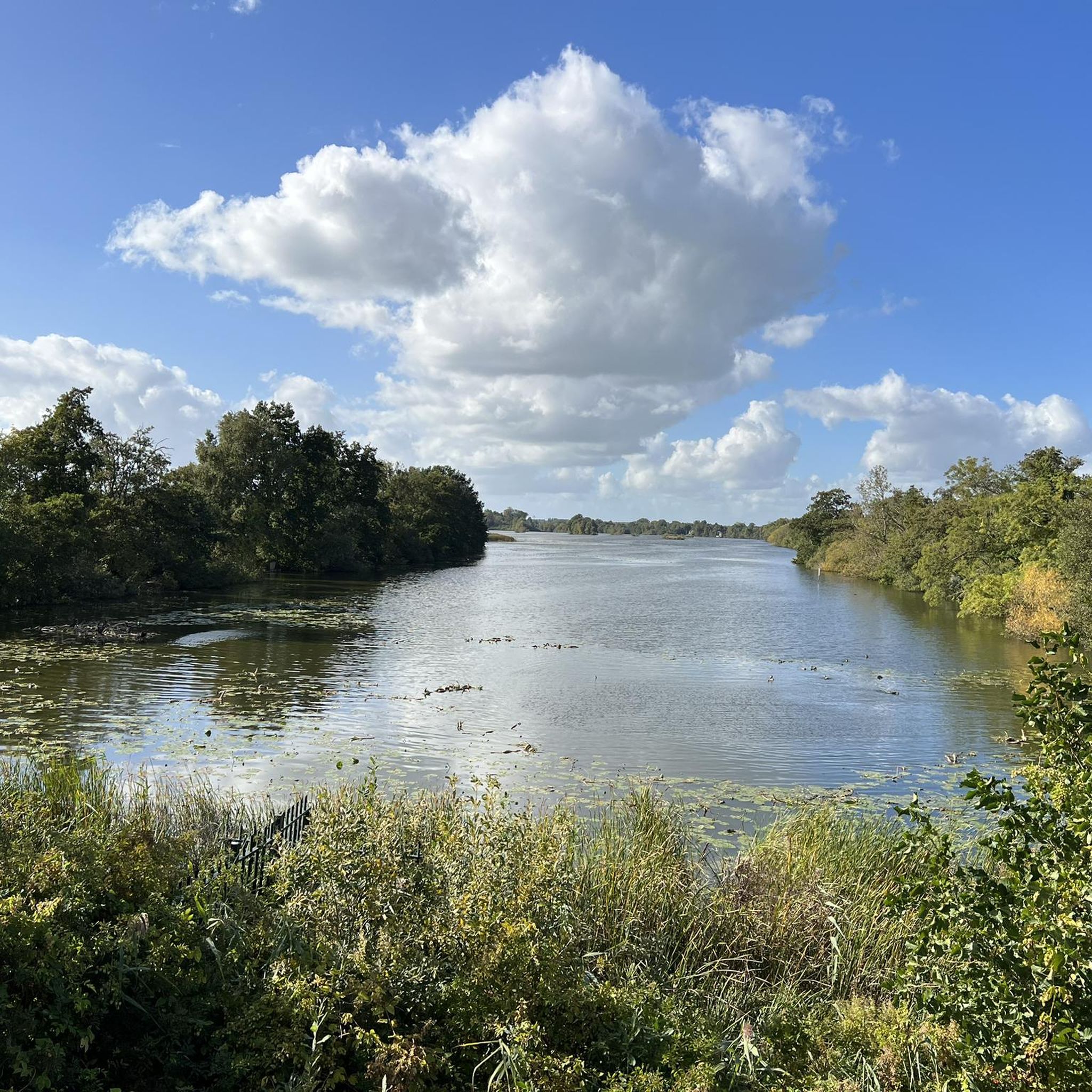
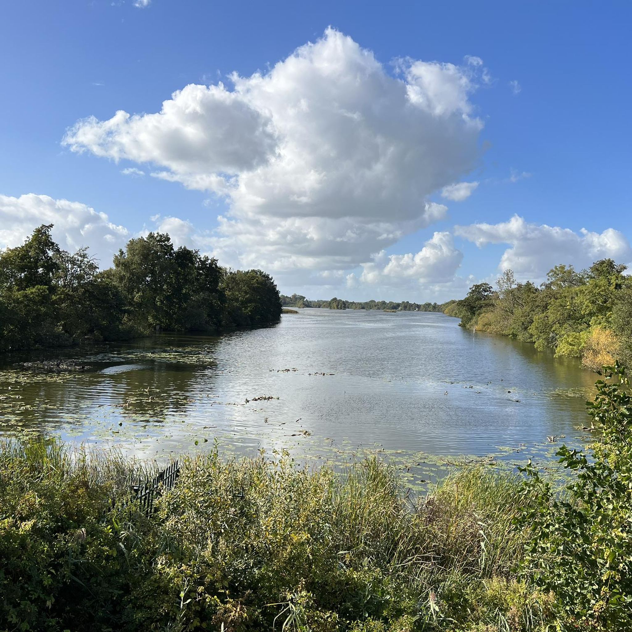
From this spot you have a great view over the Loenderveense Plas. The water of this lake is crystal clear. In the distance you can see the church tower of Loenen aan de Vecht
0
0

There are multiple studies on this, if interested: see the document about the Wapen van Vreeland, downloadable via this link: https://dspace.library.uu.nl/bitstream/handle/1874/210767/VECH_2007-02_3.pdf.
1
0

nice place to take a break.
0
0
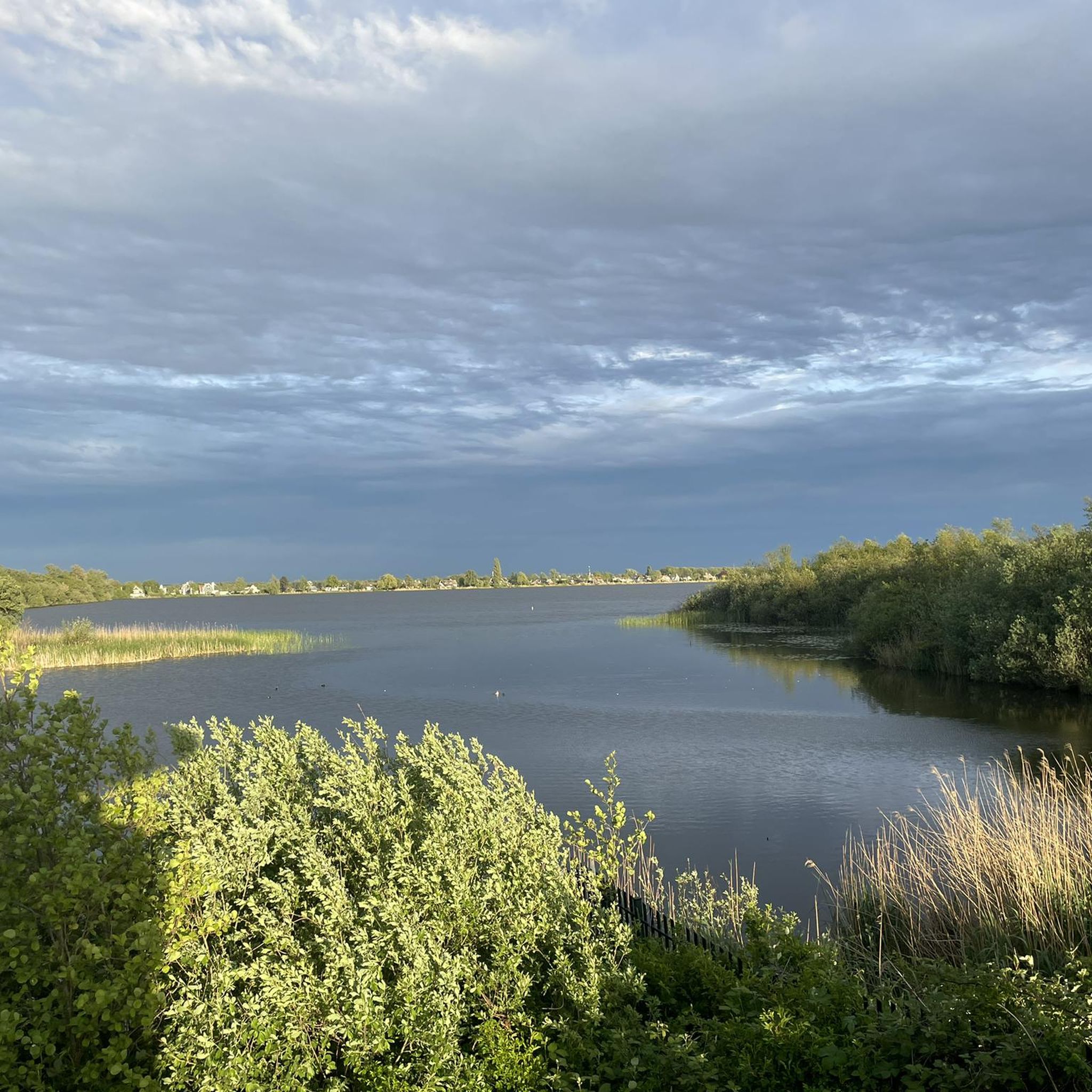
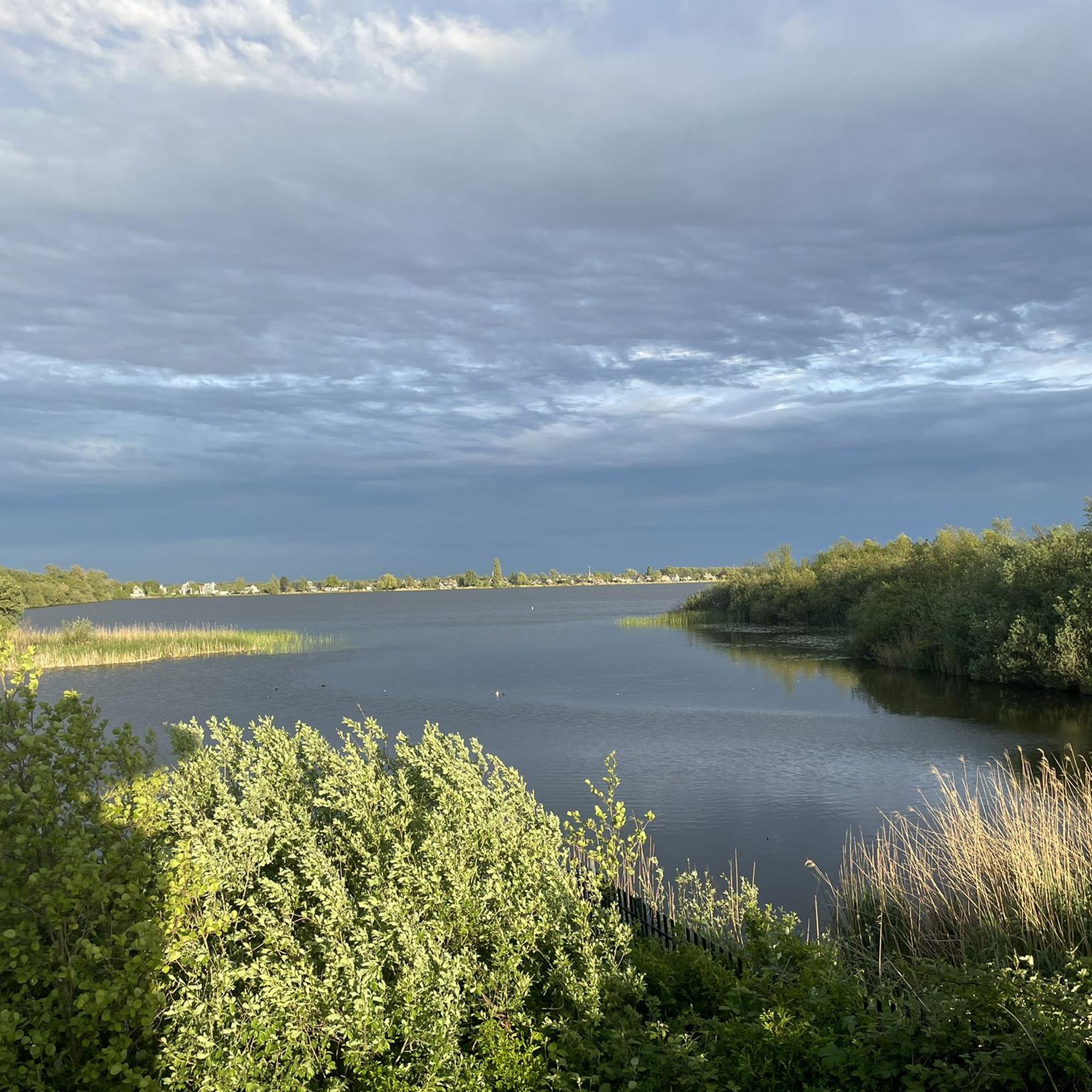
The entire area is rich in lakes and is recommended to visit during all seasons. My preference is shortly after sunrise or just before sunset. The colors are then most spectacular.
1
0
Beautiful path that takes you through meadows and past ponds. In winter and autumn it can be very swampy. It's teeming with birds here
3
0

Path is open and easily accessible
0
0

You follow this idyllic path along the river Vecht. Stroll along the water, stroll past Dutch windmills and enjoy the views. Please note that part of this trail may be closed during breeding season (March 15 - June 15).
0
0

Nature.. Steppenl.. a beautiful idyllic landscape
1
0
Frequently Asked Questions
How many hiking trails are available around Waterleidingplas?
The Waterleidingplas area, part of the Amsterdamse Waterleidingduinen, offers a vast network of over 500 hiking trails. These range from easy strolls to more challenging long-distance paths, catering to various fitness levels.
What kind of terrain can I expect when hiking in Waterleidingplas?
Hikers in Waterleidingplas will encounter a diverse landscape. The area is characterized by unique sandy dunes, extensive forests, and serene water channels. Trails weave through woodlands and along various lakes and ponds, including the Loenderveense Plas, providing varied scenery and a tranquil atmosphere.
Are there family-friendly hiking options around Waterleidingplas?
Yes, Waterleidingplas is an excellent destination for families. Many easy routes are available, perfect for shorter excursions. For example, the View of the Loenderveense Plas loop from Wijdemeren is an easy 3.2-mile (5.2 km) trail suitable for all ages.
Can I bring my dog on the hiking trails in Waterleidingplas?
The Amsterdamse Waterleidingduinen, which encompasses Waterleidingplas, has specific rules regarding dogs to protect its abundant wildlife. Dogs are generally allowed on leash in designated areas, but it's important to check local signage for specific restrictions, especially during nesting seasons or in sensitive wildlife zones.
What kind of wildlife can I see while hiking in Waterleidingplas?
Waterleidingplas is renowned for its rich wildlife. It hosts the largest population of fallow deer in the Netherlands, which are frequently seen. You might also spot foxes, and the area is a haven for birdwatchers, with various species like woodpeckers and owls. Konik horses, Scottish Highland cattle, and even bison can be found in the wider region.
Are there any circular hiking routes in the area?
Yes, many routes around Waterleidingplas are circular, offering convenient starting and ending points. A popular easy option is the Kromme Rade Nature Reserve – View of the Loenderveense Plas loop from Wijdemeren, which is about 3.1 miles (4.9 km) long.
What are some notable natural features or landmarks to look out for?
The area's primary natural features are its unique sandy dune landscape, dense forests, and numerous water bodies, including the prominent Loenderveense Plas. The reserve itself is historically significant as Amsterdam's oldest water catchment area since 1853. You'll also find picturesque views along the Vecht river, as seen on routes like View of the Loenderveense Plas – Scenic stretch along the Vecht loop from Loosdrecht.
What is the best time of year to go hiking in Waterleidingplas?
Waterleidingplas offers beautiful hiking experiences year-round. Spring brings blooming flora and active wildlife, while summer provides lush greenery. Autumn showcases vibrant fall colors, and even winter offers a serene, tranquil atmosphere, especially when the landscape is dusted with frost. The diverse terrain ensures pleasant walks in most conditions.
Are there any challenging hikes for experienced trekkers?
While many trails are easy to moderate, there are options for more experienced hikers. For instance, The Vecht – View of the Loenderveense Plas loop from Oud-Loosdrecht is a difficult 15.0-mile (24.1 km) path that follows the Vecht river and circles the Loenderveense Plas, offering a longer and more demanding adventure.
How do other hikers rate the trails in Waterleidingplas?
The routes in Waterleidingplas are highly regarded by the komoot community, with an average score of 4.4 stars from over 5,000 reviews. Hikers often praise the diverse landscapes, the abundance of wildlife, and the well-maintained paths that make for an immersive outdoor experience.
Is there parking available for hikers?
Yes, there are several designated parking areas around the Amsterdamse Waterleidingduinen, which provide access to the Waterleidingplas hiking trails. Specific parking locations can be found at the various entrances to the nature reserve.
Can I reach Waterleidingplas by public transport?
Yes, the Amsterdamse Waterleidingduinen is accessible by public transport. Various bus routes connect nearby towns and train stations to the entrances of the reserve, making it possible to reach the hiking areas without a car.
Most popular routes around Waterleidingplas

Get inspired with the komoot mobile app


Explore more
Browse the best Hikes in other regions.
