The best running trails in Sullivan County
84
runners
23
runs
Jogging routes in Sullivan County traverse a landscape characterized by diverse natural features, including state parks, dense woodlands, and extensive rail trails. The region offers varied terrain, from the rugged trails of state parks like Worlds End and Ricketts Glen to the more accessible, flatter surfaces of linear parks and rail trails. These natural settings provide a range of running experiences amidst forests, lakes, and historical pathways.
Best jogging routes in Sullivan County
- The most popular jogging route is Verkeerderkill Falls and High Point Loop, an 8.6 miles (13.8 km) trail that takes 1 hour 30 minutes to complete, offering scenic views and diverse terrain.
- Another top favourite among local runners is Red Hill Fire Tower Trail, a difficult 3.5 miles (5.7 km) path. This route provides a challenging ascent through woodlands to a fire tower with panoramic views.
- Local runners also love the Ice Caves and Lake Maratanza Loop, a 4.3 miles (6.9 km) trail leading through unique ice caves and past Lake Maratanza, often completed in about 50 minutes.
- Jogging in Sullivan County is defined by dense woodlands, tranquil lakes, and historic rail trails. The network offers options for easy, moderate, and difficult routes, catering to various ability levels.
- The guide includes highly-rated routes that showcase the best of the region's landscape. More than 70 runners have used komoot to explore Sullivan County's varied terrain.
Last updated: October 15, 2026
5
runners
13.8km
01:30
260m
260m
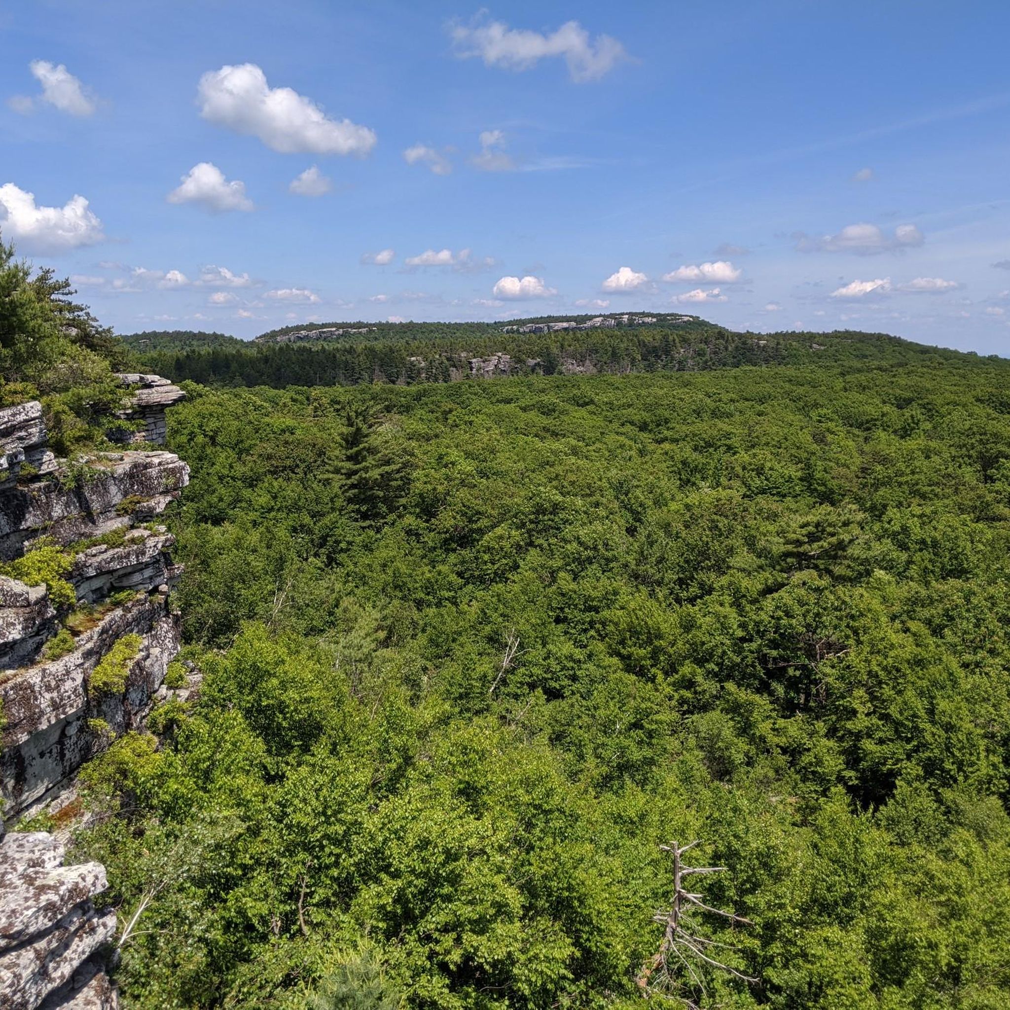
The Verkeerderkill Falls and High Point Loop offers a truly dynamic jogging experience, winding through a unique dwarf pitch pine barrens ecosystem. You'll traverse everything from smooth carriage roads to rocky, technical sections, especially as you approach the stunning 187-foot Verkeerderkill Falls and the panoramic vistas from High Point. The route provides expansive views of the Shawangunk Mountains and the Hudson Valley, making for a visually rewarding 8.6-mile (13.8 km) journey.
This moderate route, with 842 feet (257 metres) of elevation gain, typically takes around 1 hour and 29 minutes to complete. Located in the Sam's Point Area of Minnewaska State Park Preserve, parking can fill up quickly, so plan an early start, especially on busy days. Keep in mind that the impressive waterfall's flow is best outside of dry summer months.
Beyond the falls and views, the trail is notable for its passage through one of the world's few remaining dwarf pine barrens, a fragile and unique habitat. You'll also encounter interesting geological features like the Ellenville Fault Ice Caves, which retain ice for much of the year, adding another layer of intrigue to this diverse loop.
3
runners
5.68km
00:53
330m
330m
If you are looking for a challenging jogging route, the Red Hill Fire Tower Trail offers a rewarding experience. This difficult 3.5-mile (5.7 km) route will have you gaining 1076 feet (328 metres) in elevation, typically completed in about 53 minutes. As you jog, you will move through pristine woods, encountering some steep sections and well-maintained paths, sometimes featuring stone staircases. The real highlight is the 60-foot Red Hill Fire Tower at the summit, which you can climb for expansive views.
Planning your visit is straightforward, as parking is generally available right at the trailhead. Be aware that the fire tower's cab, which provides the best vantage point, is usually only open on weekends and holidays from Memorial Day through Columbus Day. You might also encounter a small stream crossing early on, which could be more challenging if water levels are high. It is a good idea to check conditions before you go.
This trail is notable for its journey through the Sundown Wild Forest, providing a true immersion in nature. From the top of the Red Hill Fire Tower, you are treated to unobstructed 360-degree views that sweep across the Catskill High Peaks and the sparkling Rondout Reservoir. It is a fantastic way to experience the region's natural beauty and get a great workout at the same time.

2
runners
11.6km
01:55
750m
750m
Jog the difficult 7.2-mile Peekamoose-Table Trail in Catskill Park, gaining 2460 feet with rewarding views from Peekamoose Mountain.
2
runners
6.85km
00:49
180m
180m
The Ice Caves and Lake Maratanza Loop offers a truly distinctive jogging experience in the Sam's Point Area, blending smooth carriage roads with rugged, crevice-filled paths. You'll navigate the unique Ice Caves, where boardwalks and steps lead through cool, dark passages, before emerging to panoramic views from Sam's Point. This moderate 4.3-mile (6.9 km) route, with 604 feet (184 metres) of elevation gain, takes about 48 minutes to complete, but be ready to walk through the technical cave sections.
Planning your visit requires a bit of foresight, as the Ice Caves are only open from April to October, and reservations might be needed on busy weekends. The trailhead is easily accessible within Minnewaska State Park Preserve. While much of the route is runnable, the Ice Caves section demands careful navigation on foot, so don't expect to jog the entire 4.3 miles (6.9 km).
This trail is notable for its globally rare dwarf pitch pine barrens and the stunning Lake Maratanza, the highest of the Shawangunk Mountains' Sky Lakes. The dramatic cliffs of Shawangunk Conglomerate and expansive views from Sam's Point, potentially spanning five states on a clear day, make this a visually rewarding route for those who appreciate unique geological and ecological features.
10
runners
23.5km
02:28
220m
220m
Hard run. Very good fitness required. Mostly paved surfaces. Suitable for all skill levels.
7
runners
11.1km
01:10
150m
150m
Moderate run. Good fitness required. Mostly paved surfaces. Suitable for all skill levels.
6
runners
7.06km
00:44
70m
70m
Moderate run. Good fitness required. Mostly paved surfaces. Suitable for all skill levels.
Get access to more routes and recommendations from other explorers.
Already have an account?
Our route recommendations are based on thousands of hikes, rides, and runs completed by other people on komoot.
Start today with a free account
Your next adventure awaits.


Other adventures in Sullivan County

Tips from the Community

Verkeerder Kill Falls is the 180-foot (about 57 meters) waterfall you're referring to. It's the highest waterfall in the Shawangunk Mountains of New York State. Located in Sam's Point Preserve, it's only accessible via a hiking trail that leads to the top of the falls. https://www.nelnet.it.com
0
0

The Ice Caves in Minnewaska State Park are a cool collection of quartz caves and cliffs known as the Ice Caves. Most caves aren't made of rocks that are as hard as quartz (most cave systems are limestone and consist of the soft mineral calcite). There are some tight trails that make a fun loop through the caves.
0
0
The Ice Caves in Minnewaska State Park are a cool collection of quartz caves and cliffs known as the Ice Caves. Most caves aren't made of rocks that are as hard as quartz (most cave systems are limestone and consist of the soft mineral calcite). There are some tight trails that make a fun loop through the caves.
0
0
Peekamoose Mountain reaches up to an elevation of 3,845 feet and offers sweeping views of the Hudson River and surrounding mountains. This is one of a few peaks along this wide ridgeline.
0
0

At 3,845 Peekamoose Mountain offers stunning views of the surrounding landscape. On a clear day, you can even see the Hudson River. This peak is an excellent spot to have your lunch or simply take a break.
0
0
This historic 60-foot fire tower, built in 1921 and listed on the National Historic Lookout Register, provides unparalleled panoramic views of the Catskill High Peaks and Roundout Reservoir from its lofty vantage point.
0
0

Frequently Asked Questions
How many running routes are available in Sullivan County?
Sullivan County offers a wide selection of running routes, with over 20 trails available on komoot. These routes cater to various fitness levels, including easy, moderate, and difficult options.
What types of terrain can I expect on jogging trails in Sullivan County?
You'll find a diverse range of terrains. Many routes traverse dense woodlands and offer varied surfaces, from rugged trails in state parks like Worlds End and Ricketts Glen to the flatter, more accessible surfaces of linear parks and rail trails such as the Sullivan O&W Rail Trail. Expect a mix of natural paths, gravel, and some paved sections.
Are there easy running routes suitable for beginners in Sullivan County?
Yes, Sullivan County has several easy running routes perfect for beginners. There are 4 easy routes listed in this guide, providing gentle terrain and shorter distances. Look for trails in areas like the Sullivan County Parks & Recreation in Wurtsboro or sections of the D&H Canal Linear Park for a comfortable experience.
Can I find longer distance running trails in Sullivan County?
Absolutely. For longer runs, consider routes like the Wolf Lake – Wolf Lake Inc loop from Rock Hill, which spans over 11 miles. The extensive Sullivan O&W Rail Trail also offers multiple sections that can be combined for significant mileage on relatively flat surfaces.
Are there any running routes with waterfalls or scenic views?
Yes, Sullivan County is known for its natural beauty. While some areas are more suited for hiking, you can find breathtaking scenery. Ricketts Glen State Park is famous for its 21 waterfalls, and Worlds End State Park offers rugged trails with scenic vistas. The Verkeerderkill Falls and High Point Loop is a popular route featuring scenic views, and the Red Hill Fire Tower Trail provides panoramic views after a challenging ascent.
Are there family-friendly jogging trails in Sullivan County?
Many trails in Sullivan County are suitable for families. The D&H Canal Linear Park and sections of the Sullivan O&W Rail Trail offer flat, accessible surfaces ideal for a family jog. Lake Superior State Park also provides trails in its Dam Area that are generally easy and enjoyable for all ages.
Are dog-friendly running routes available in Sullivan County?
Many outdoor areas in Sullivan County welcome dogs, though specific rules may apply in state parks or on certain trails. Generally, rail trails and forest roads within Loyalsock State Forest are good options for running with your dog. Always ensure your dog is on a leash and check local regulations before heading out.
What interesting landmarks or attractions can I see along the jogging routes?
Beyond the natural beauty, you can encounter several points of interest. The D&H Canal Linear Park features remnants of original locks and interpretive signs. You might also pass by Walnut Mountain, the Bashakill Trail, or the Mongaup Pond. The Ice Caves and Lake Maratanza Loop offers unique geological formations.
When is the best time of year for running in Sullivan County?
Sullivan County offers excellent running conditions throughout much of the year. Spring and fall provide pleasant temperatures and beautiful scenery, with vibrant foliage in autumn. Summer is also popular, but it's advisable to run in the mornings or evenings to avoid the midday heat. Winter running is possible on cleared paths, but some trails may be snowy or icy.
Are there any circular running routes in Sullivan County?
Yes, many of the running routes in Sullivan County are designed as loops, offering a varied experience without retracing your steps. Examples include the Verkeerderkill Falls and High Point Loop, the Ice Caves and Lake Maratanza Loop, and the Wolf Lake – Wolf Lake Inc loop.
Where can I find information about parking for running trails?
Parking availability varies by trail. Most state parks and designated trailheads, such as those for the Sullivan O&W Rail Trail or Lake Superior State Park, offer dedicated parking areas. It's always recommended to check specific trail information or park websites for detailed parking instructions before your visit.
Are there any running routes accessible by public transport in Sullivan County?
While many trails in Sullivan County are best accessed by car, some areas might have limited public transport options. For specific routes, it's best to consult local public transportation schedules and maps, or consider ride-sharing services to reach trailheads.
Most popular routes in Sullivan County
Most popular attractions in Sullivan County

Get inspired with the komoot mobile app


Didn’t find what you were looking for?
Check out more Running Trails & Routes throughout Sullivan County below and find the perfect route in your destination.
Explore more
Browse the best Running Trails & Routes in other regions.
