Routes

Planner

Features

Updates

App

Login or Signup

Get the App

Login or Signup

Routes
Hikes
United States
Utah

Washington County

The best walks and hikes in Washington County

4.7

(2824)

36,214

hikers

341

hikes

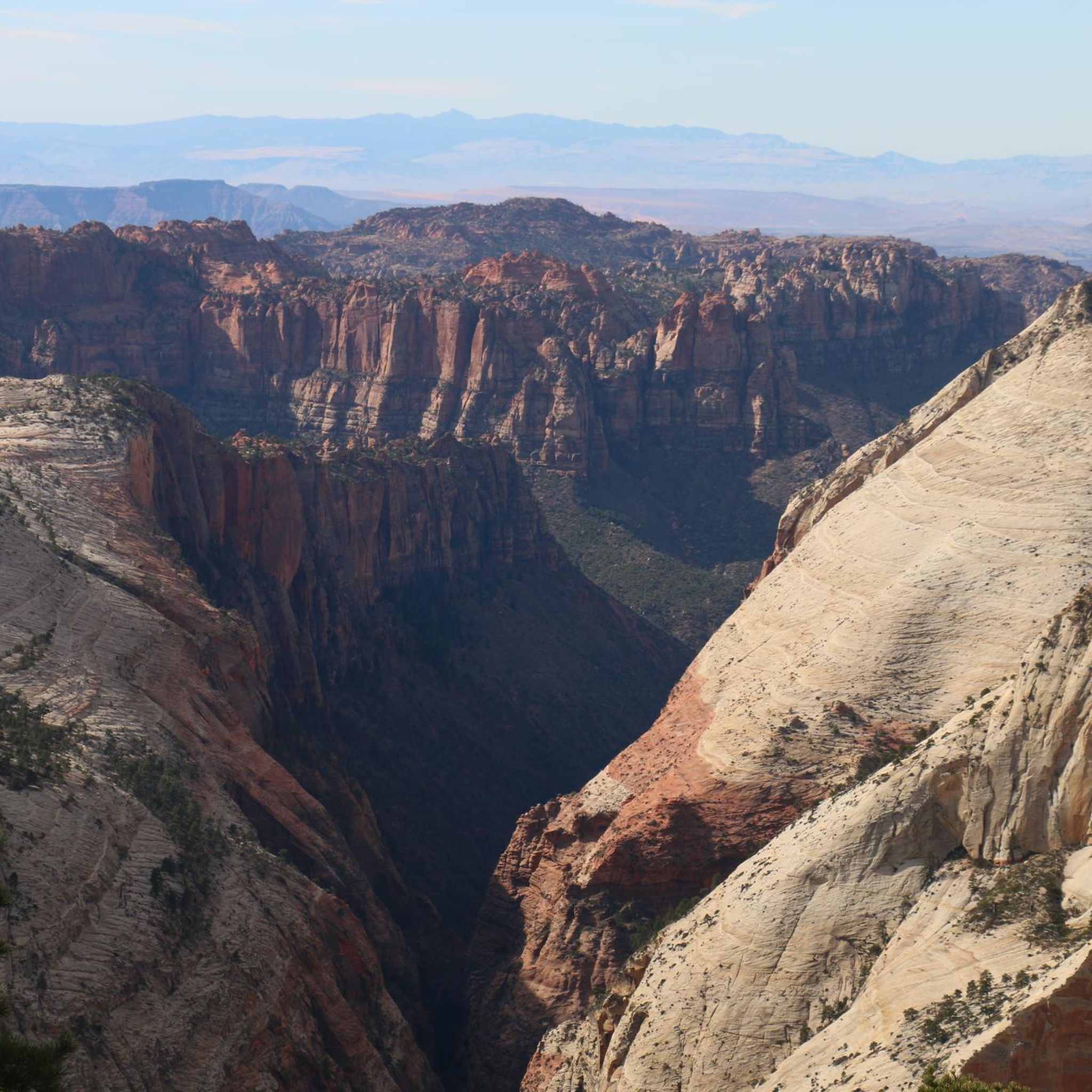
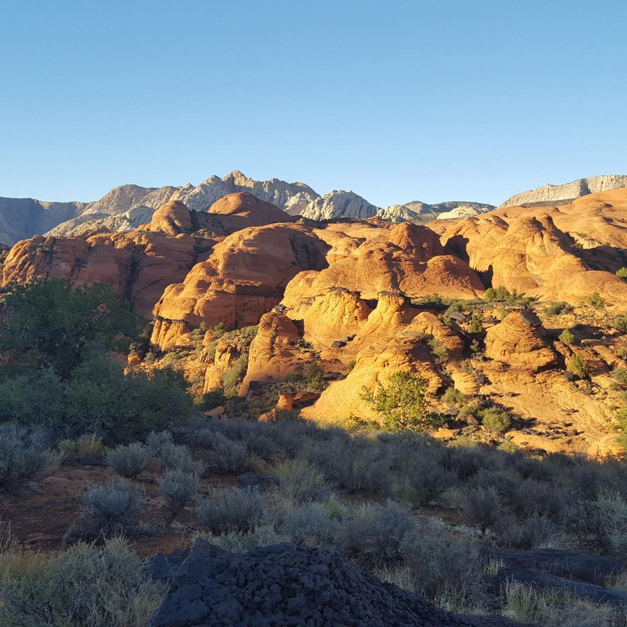
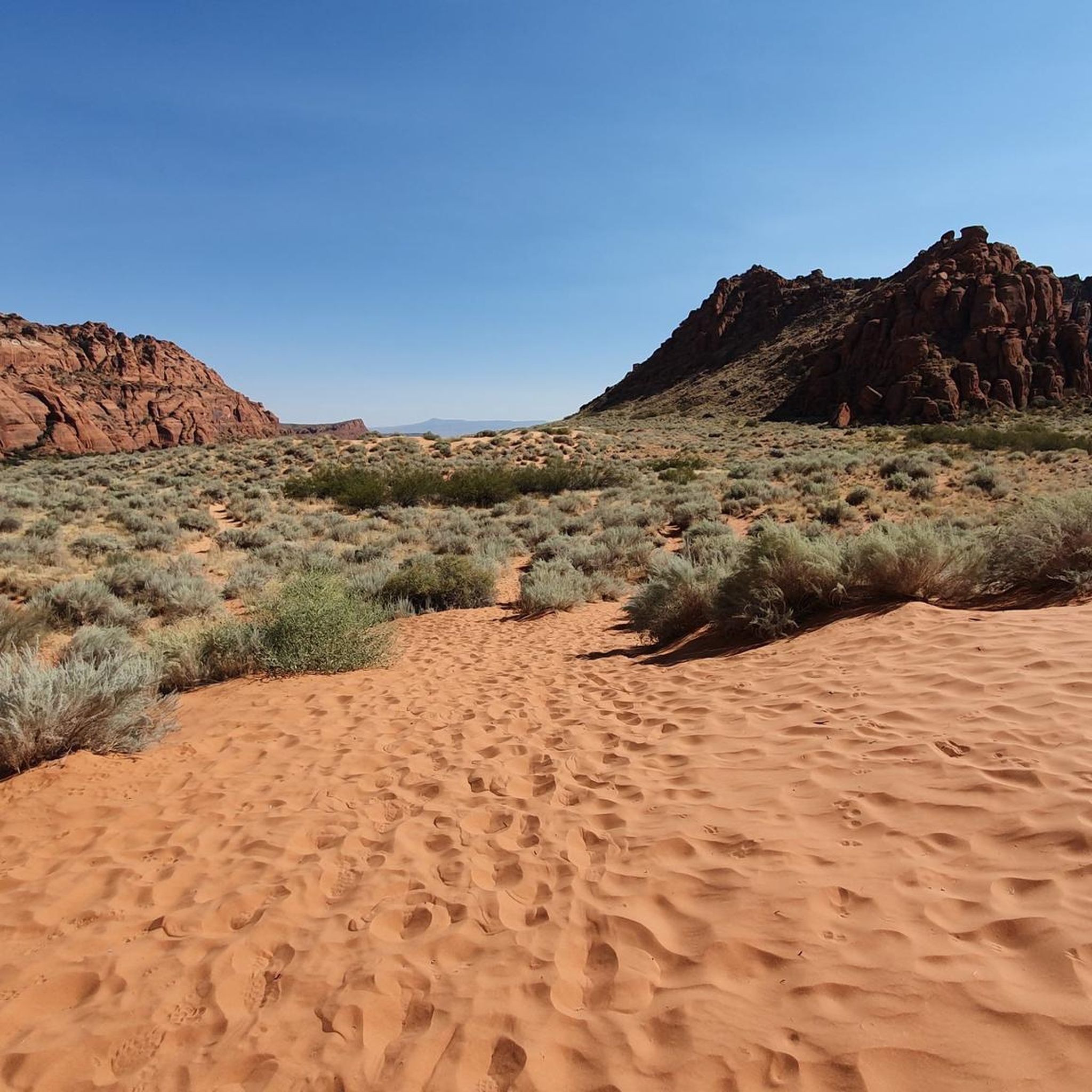
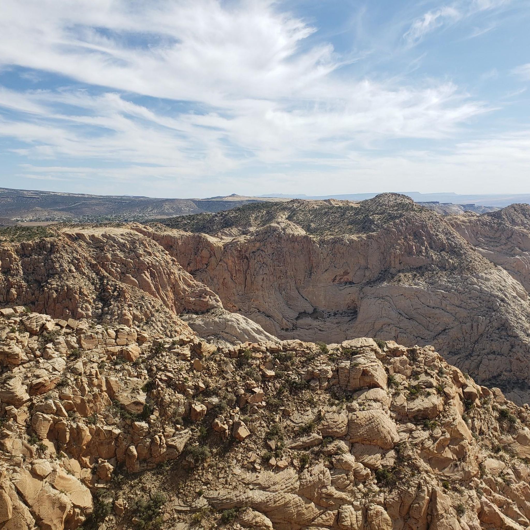
Hiking in Washington County provides access to the landscapes of southwestern Utah, an area defined by the convergence of the Mojave Desert, Great Basin, and Colorado Plateau. The region is characterized by towering sandstone cliffs, narrow canyons, and the Virgin River. Many of the area's most frequented trails are located within Zion National Park, offering a range of routes through this distinct terrain.

Best hiking trails in Washington County

  • The most popular hiking route is West Rim Trail to Angels Landing — Zion National Park, a 4.5 mile (7.2 km) trail that takes about 3 hours 40 minutes to complete. This is a difficult hike with significant elevation gain leading to wide views across the canyon.
  • Another top favourite among local hiking enthusiasts is East Mesa Trail to Observation Point — Zion National Park, a moderate 6.9 mile (11.2 km) path. The route leads to a viewpoint looking over the main canyon.
  • Local hiking enthusiasts also love the Emerald Pools loop — Zion National Park, a 3.0 mile (4.9 km) trail leading through a side canyon to a series of pools, often completed in about 1 hour 25 minutes.
  • Hiking in Washington County is defined by its sandstone canyons, riverside paths, and high-elevation plateaus. The network of Washington County Utah hiking trails includes accessible paved paths as well as more challenging routes with steep ascents.
  • The routes in Washington County are highly rated by the komoot community with an average score of 4.7 stars from over 2,300 reviews. More than 30,000 hikers have used komoot to explore Washington County's varied terrain.

Last updated: August 18, 2026

4.9

(369)

4,897

hikers

#1.

Angels Landing Trail

7.20km

03:41

530m

530m

The Angels Landing Trail is a truly unique and difficult hike in Zion National Park, offering an exhilarating journey to one of the park's most spectacular viewpoints. This 4.5-mile (7.2 km) route involves a significant 1737 feet (530 metres) of elevation gain, typically taking about 3 hours and 41 minutes. You'll navigate challenging terrain, including the famous Walter's Wiggles switchbacks and an exposed final ascent to the Angels Landing summit, where chains are bolted into the rock to assist hikers.

Planning your visit requires careful attention to the Angels Landing Trail permit system; permits are mandatory to hike past Scout Lookout and are secured through a lottery on Recreation.gov. Given the extreme exposure and narrow path, avoid hiking during wet weather, storms, or high winds, as conditions can become very dangerous. The trail is not suitable for those with a fear of heights or young children, and it's best to start early from the Grotto trailhead.

What makes Angels Landing so notable is its iconic chain section, an impressive engineering feat first installed in 1926, providing stability on the final, thrilling push to the 5,790-foot (1,760 m) summit. From the top, you're rewarded with a breathtaking 360-degree panorama of Zion Canyon's rugged spires and ancient rock layers. This hike is a true test of physical and mental fortitude, offering an unparalleled adventure for experienced hikers.

Navigate with device

Send to Phone

Save

Hard

4.9

(49)

953

hikers

1.71km

00:29

30m

30m

The Canyon Overlook Trail offers an incredible effort-to-reward ratio, guiding you through diverse terrain carved into sandstone walls. You will encounter rocky sections, slickrock, and even a hidden alcove with ferns, all leading to the breathtaking Canyon Overlook Viewpoint. This easy 1.1-mile (1.7 km) hike, with just 108 feet (33 metres) of elevation gain, takes around 28 minutes, providing panoramic views of Zion Canyon's iconic formations like the Towers of the Virgin and West Temple.

Planning your visit is straightforward, as the trailhead is accessible by private vehicle on Highway 9, just east of the Zion-Mount Carmel Tunnel, meaning no shuttle is required. While it is a family-friendly route, be mindful of some exposed drop-offs, though many are protected by railings. For the best experience and photography, aim to hike during sunrise or sunset, and wear appropriate footwear for the varied terrain.

This trail is celebrated for its spectacular views without requiring an arduous climb, making it one of the most popular trails and routes in Zion. Keep an eye out for bighorn sheep along the way, and enjoy unique features like boardwalks and a narrow bridge suspended over the Pine Creek Narrows. The viewpoint also offers a unique perspective of the historic Zion-Mt. Carmel Highway and tunnel below.

Easy
guide_signup
Let us show you the way with the komoot mobile app
With a free komoot account, you can easily find, customize, and navigate endless outdoor adventures.

Sign up for free

4.6

(66)

1,154

hikers

3.18km

01:06

150m

160m

If you're seeking a truly immersive experience into Zion's lush canyon environment, the Riverside Walk delivers. This moderate 2.0-mile (3.2 km) hike, with just 484 feet (147 metres) of elevation gain, guides you along the Virgin River, surrounded by towering red rock mountains and vibrant hanging gardens. Expect to spend about 1 hour and 5 minutes soaking in the dramatic scenery, where the canyon walls seem to close in around you, creating a unique, verdant corridor.

Accessing the Riverside Walk is straightforward, as its trailhead is at the Temple of Sinawava, the last stop on the park shuttle, where you'll also find restrooms and water. The path is mostly paved and flat, making it a fantastic family hiking trail suitable for strollers and wheelchairs, though some sections can be uneven or sandy. For a quieter experience, consider visiting in the late afternoon or early evening, and remember that warmer months are perfect for dipping your toes in the river.

This trail is not just a scenic stroll; it's also the famous gateway to The Narrows, offering a glimpse into one of Zion's most iconic adventures. Along the route, interpretive exhibits explain the canyon's geology and ecology, and you might even spot wildlife like mule deer or wild turkeys. It's a highly accessible and rewarding way to experience the natural features and unique ecosystem of Zion National Park.

Moderate

4.7

(161)

2,293

hikers

5.89km

01:53

240m

240m

The Watchman Trail offers a fantastic journey through Zion's diverse landscape, starting with lush vegetation along the Virgin River before ascending into desert terrain. As you climb, you'll encounter a mix of sandy, rocky, and firm paths, with switchbacks leading to breathtaking panoramic views of the iconic Watchman Peak, Temples and Towers, and the winding Virgin River. The trail culminates at a superb viewpoint, providing an excellent perspective of the canyon's geological wonders without reaching the spire's summit.

This easy 3.7-mile (5.9 km) hiking route, with 795 feet (242 metres) of elevation gain, typically takes about 1 hour and 52 minutes to complete. Its convenient location near the Zion Canyon Visitor Center means no shuttle is required, making access straightforward. Due to significant sun exposure, especially in summer, it's best to start your hike in the early morning or late afternoon, and always carry ample water.

Often overlooked in favor of more famous trails, the Watchman Trail provides a less crowded alternative for experiencing Zion's grandeur. It's particularly well-suited for first-time visitors or those with limited time, offering a rewarding experience that showcases the lower Zion Canyon and the town of Springdale from above. This trail is a great way to get a taste of the park's stunning vistas and unique desert flora.

Easy

4.8

(71)

728

hikers

4.26km

01:14

60m

190m

The Watchman Trail offers a classic Zion experience, winding through desert scrub and rocky terrain to reveal breathtaking canyon views. You'll traverse unpaved paths, encountering firm soil and some moderate steps as you climb, with prickly pear cactus and hardy shrubs lining the way. The route culminates in a spectacular overlook, providing sweeping vistas of Zion Canyon, the Virgin River, and the iconic Watchman Peak, making it a truly rewarding journey.

This easy 2.6-mile (4.3 km) out-and-back hike involves a manageable 183 feet (56 metres) of elevation gain, typically taking about 1 hour and 14 minutes. The trailhead is conveniently located right by the Zion Canyon Visitor Center, meaning no shuttle is required to access it, which is a huge plus for planning. It's a family-friendly option, though the trail is exposed to the sun, so plan for an early start or late afternoon hike to avoid the midday heat and enjoy the best light.

What makes the Watchman Trail particularly notable is its ability to deliver stunning Zion panoramas without the crowds often found on more strenuous trails. It's an excellent introduction to the park's grandeur, perfect for those with limited time or seeking a less demanding adventure. Keep an eye out for the elusive Crawford Arch high on a remote cliffside, a hidden gem that adds another layer of interest to this already scenic route.

Easy

5.0

(32)

448

hikers

3.60km

01:51

390m

50m

The Angels Landing Trail is a truly unique experience, taking you from the lush Virgin River banks through the cool confines of Refrigerator Canyon, then up the ingeniously carved Walter's Wiggles. The final push along the narrow, chain-assisted Angels Landing Spine offers an exhilarating, exposed scramble to a summit with unmatched panoramic views of Zion Canyon. It's a difficult 2.2-mile (3.6 km) hike with 1274 feet (388 metres) of elevation gain, typically completed in about 1 hour and 51 minutes, best suited for experienced hikers without a fear of heights.

Planning your visit requires careful attention to the Angels Landing permit system; you'll need to secure a permit through an online lottery to access the chains section beyond Scout Lookout. The trail is accessed via the Zion National Park shuttle, which drops you at The Grotto (Shuttle Stop #6). Be aware that slippery conditions can make this already challenging route even more dangerous, so check the weather before you go.

What makes Angels Landing so notable is its blend of historical engineering, like the 1926 trail construction, and the sheer mental and physical challenge it presents. The iconic final half-mile along the knife-edge ridge, holding onto fixed chains, provides an unparalleled sense of adventure and exposure, making it a true bucket-list hike for many visitors to Zion National Park.

Hard

4.7

(112)

964

hikers

The Emerald Pools and Kayenta Trail Loop offers a captivating journey through Zion's diverse landscapes, transitioning from expansive canyon views to lush, water-fed oases. You'll experience the unique sensation of walking behind waterfalls at the Lower Emerald Pool and discover serene reflection pools on your way to the dramatic Upper Emerald Pool, all while enjoying panoramic vistas of Zion Canyon from the Kayenta Trail. This easy 3.0-mile (4.9 km) hike, with 354 feet (108 metres) of elevation gain, typically takes around 1 hours and 23 minutes, making it an accessible option for experiencing some of the park's most iconic natural features.

To access this popular route, you'll typically start from the Grotto shuttle stop (Stop 6) and connect to the Kayenta Trail. Be aware that a bridge closure as of May 2023 means the Kayenta Trail is currently the main way to reach the pools, so expect it to be busy, especially during peak times. Planning your visit for spring or after a good rain can offer the most spectacular views of the waterfalls and lush greenery.

This trail system is notable for showcasing three distinct desert oases, each with its own character, from the vibrant Lower Pool to the cliff-framed Upper Pool. The opportunity to walk under a weeping rock wall at the Lower Emerald Pool is a particularly memorable feature. Keep an eye out for maidenhair ferns clinging to the red rock walls and the chance to spot local wildlife like deer, adding to the immersive natural experience.

Easy

4.6

(36)

367

hikers

The Sand Bench and Kayenta Trail offers an easy 3.0-mile (4.8 km) hiking experience in Zion National Park, featuring diverse terrain and rewarding views with just 223 feet (68 metres) of elevation gain, typically completed in about 1 hour and 17 minutes. You'll traverse the unique, sandy Sand Bench Trail, which provides panoramic vistas of the "Court of the Patriarchs" and the Virgin River, before connecting to the firmer Kayenta Trail with its rock stairs and continuous canyon views. It's a fantastic option for families or anyone looking for a less strenuous way to explore Zion's iconic scenery.

When planning your visit, be aware that the Sand Bench Trail is shared with horseback riders, so you might encounter horses and their waste. The route is largely exposed, so pack ample water, especially during summer. The Kayenta Trail is a popular connector to the Emerald Pools, offering a scenic and often less crowded alternative, but remember that dogs are not allowed on this section.

This trail is notable for its geological significance, particularly the Sand Bench section which sits atop ancient landslide debris from The Sentinel mountain. It provides a different perspective of Zion Canyon compared to more direct routes, blending the unique sandy environment with the more traditional rocky paths. It's a great choice if you're seeking less crowded hikes while still experiencing some of Zion's most beloved viewpoints.

Easy

4.8

(98)

875

hikers

11.2km

03:09

220m

220m

The East Mesa Trail offers a unique journey through a quiet, forested mesa, leading to one of Zion's most spectacular overlooks. You'll traverse a well-worn old jeep trail, meandering through a mixed forest of Juniper, Piñon, and Ponderosa Pine, enjoying a subtle and peaceful atmosphere. The true highlight is the panoramic Observation Point View of Zion Canyon, where you'll gaze upon Angels Landing, Cable Mountain, and The Great White Throne from thousands of feet above.

Accessing the trailhead can be a bit of an adventure, as it requires driving on remote dirt roads that are often rough and can become muddy or icy after rain or snow; a high-clearance or 4WD vehicle is frequently needed. This moderate hike covers 6.9 miles (11.2 km) with 707 feet (215 metres) of elevation gain, typically taking about 3 hours and 8 minutes. It's considered suitable for families comfortable with longer distances, as the difficulty stems more from length than steepness.

This trail is particularly notable as the primary route to Observation Point since the closure of the original trail from Weeping Rock. It often sees fewer visitors than other popular Zion trails, providing a more solitary experience. The trail's location on the upper east side of the park also means temperatures can be cooler than in the main canyon during hotter months, making it a pleasant escape.

Moderate

4.9

(30)

426

hikers

1.46km

00:25

30m

30m

The Canyon Overlook Trail offers a spectacular journey through Zion National Park's unique geology, winding over rocky terrain and slickrock with sections carved directly into sandstone walls. You'll pass a cool, fern-filled alcove before reaching the grand finale: the Canyon Overlook Viewpoint, where you can gaze upon the majestic Towers of the Virgin and Bridge Mountain. This easy 0.9-mile (1.5 km) hike, with only 95 feet (29 metres) of elevation gain, is a fantastic option for a quick, rewarding adventure, typically taking just 24 minutes.

Planning your visit to this popular trail requires a bit of strategy, as parking is very limited and fills up fast, especially if you're hoping to catch a sunrise or sunset. Unlike many other Zion trails, you can drive directly to the trailhead, bypassing the shuttle system. While short, the trail's rocky and uneven surfaces mean sturdy footwear is recommended, and always bring water, particularly in the warmer months.

This trail is renowned for its exceptional "effort-to-reward" ratio, delivering some of Zion's most iconic views without the strenuous climb of longer routes. Keep an eye out for local wildlife like bighorn sheep and chipmunks along the way. The route also offers unique perspectives of Highway 9 winding below and the windows carved into the Mount Carmel Tunnel, making it a standout experience on the park's east side.

Easy
Sign up for free to see 332 more hikes in Washington County.

Get access to more routes and recommendations from other explorers.

Sign up for free

Already have an account?

Our route recommendations are based on thousands of hikes, rides, and runs completed by other people on komoot.

Start today with a free account

Your next adventure awaits.
Login or Signup

Popular around Washington County

Hiking in Zion National Park

Hiking in Zion Wilderness

Hiking in the Harmonie Mountains

Hiking in Snow Canyon State Park

Hiking around St. George

Hiking in Red Mountain Wilderness

Hiking around Washington

Hiking around Hurricane

Hiking around Ivins

Hiking around Virgin

Other adventures in Washington County

Canyons, Plateaus and Hoodoos – discover Southwest USA

Hiking Collection by

VisitTheUSA

Tips from the Community

mountainharry
July 18, 2026, Observation Point View of Zion Canyon

This outlook is worth it. Very nice view and not many people.

0

1

The site is very good, but get there early. Early is before 8, otherwise, you might struggle with parking. The view is open and with the sunrise, the light drop on the canyon and the mountains make it a good view point.

0

0

Beautiful!!

0

0

It's usually quite crowded here

Translated by Google

0

0

Works great with the shuttle bus

Translated by Google

0

0

Best frog concert ever. Great acoustics!

0

0

The Virgin River flows through the park, creating a unique riparian ecosystem filled with marshes, natural pools and even swamps! Plus, hundreds of seeps and springs feed into our river and creeks, supporting all kinds of unique wildlife and vegetation. The information board reads: "A swamp in the desert? Strange but true. You can see the water source that is feeding the swamp on the wet cliff face above. The underlying rock in this area cannot absorb all of the water runoff. Consequently the thin layer of soil covering the rock remains continually saturated. The unique assemblage of plants you see here has adapted to this special environment. Help protect this wetland by staying on the trail."

1

0

Easy walk. Very nice

0

0

Frequently Asked Questions

How many hiking trails are there in Washington County?

There are over 250 hiking routes to explore in Washington County. These range from easy, paved paths suitable for all fitness levels to strenuous climbs in the region's iconic canyons. The area offers a great mix, with over 100 easy trails, more than 100 moderate ones, and around 30 difficult hikes for those seeking a challenge.

Are there any easy, beginner-friendly hikes in the area?

Yes, Washington County has many options for beginners. A great choice is the Watchman Trail — Zion National Park. It's a relatively short trail that offers fantastic views of the surrounding landscape without a strenuous climb, making it perfect for those new to hiking in the region.

Can I bring my dog on the hiking trails?

While many trails within Zion National Park have strict regulations prohibiting dogs, the Pa'rus Trail — Zion National Park is a notable exception. This paved path is the only trail in Zion that allows pets, making it a great option for a relaxed walk with your dog amidst stunning canyon scenery.

What are some good hikes for families with children?

For a family-friendly outing, consider the Kayenta Trail to Upper Emerald Pool — Zion National Park. It leads to a series of lush pools and provides a cool, scenic destination that is often a hit with younger hikers. For something even easier and stroller-friendly, the paved Pa'rus Trail is an excellent choice.

Are there any challenging hikes for experienced hikers?

Absolutely. For a strenuous but rewarding experience, the Walter's Wiggle loop from Zion Canyon is a fantastic option. This route involves significant elevation gain with a series of tight switchbacks, testing your endurance while providing incredible views as you ascend.

Which trail offers the best views?

For a spectacular panoramic view without an overly strenuous hike, the Canyon Overlook Trail — Zion National Park is a top choice. It's a relatively short trail that leads to a breathtaking viewpoint looking down into the main Zion Canyon.

What should I know before hiking in Washington County?

The climate is predominantly desert, so it's crucial to carry plenty of water, especially during warmer months. Sun protection, including a hat, sunscreen, and sunglasses, is essential. Trails can be rocky and uneven, so sturdy hiking shoes are recommended. Always check the weather forecast before you go, as flash floods can be a risk in the canyons.

What do other hikers think of the trails in Washington County?

The region is highly regarded by the komoot community, with trails earning an average rating of 4.7 out of 5 stars from thousands of reviews. Hikers frequently praise the unique sandstone landscapes, the variety of trails, and the world-class scenery found within Zion National Park and the surrounding areas.

Are there any hikes that go through slot canyons?

Yes, the region is famous for its slot canyons. A classic experience is hiking The Narrows in Zion National Park, where you walk directly in the Virgin River with towering canyon walls on either side. A good introduction is the paved riverside walk from the Temple of Sinawava to beginning of The Narrows, which takes you to the point where the water-based part of the hike begins.

Where can I find a good hike outside of the main Zion Canyon?

The Kolob Canyons section of Zion National Park offers fantastic, less-crowded trails. The Taylor Creek Trail to Double Arch Alcove is a moderate hike in this area that follows a creek bed to a large, impressive rock alcove.

Do I need a permit to hike in this area?

Most trails in Washington County do not require a permit. However, some of the most famous and high-demand hikes, such as Angels Landing in Zion National Park, operate on a permit system to manage crowds. Always check the official Zion National Park website for the most current permit information before planning your trip for specific, popular routes.

Most popular routes in Washington County

Family-friendly hikes in Washington County

Most popular attractions in Washington County

Places to see

Store rating

Get inspired with the komoot mobile app

With a free komoot account, you can easily find, customize, and navigate endless outdoor adventures.

or

Join komoot Now

Store rating

Didn’t find what you were looking for?

Check out more Hikes throughout Washington County below and find the perfect route in your destination.

St. GeorgeHildaleIvinsSanta ClaraSpringdaleZion WildernessCanaan Mountain WildernessSand Hollow State ParkPine Valley Mountain WildernessRockvilleVirginSnow Canyon State ParkCottonwood Canyon WildernessGoose Creek WildernessHarmonie MountainsZion National ParkLa VerkinPine ValleyLaverkin Creek WildernessRed Butte WildernessRed Mountain WildernessHurricaneDammeron ValleyLeedsToquervilleWashingtonDeep Creek WildernessBlackridge WildernessTaylor Creek WildernessCottonwood Forest WildernessApple ValleyBeartrap Canyon WildernessGunlock State Park

Nearby adventure guides

Things to Do in Cottonwood Canyon Wilderness

Things to Do in Pine Valley Mountain Wilderness

background

Get ready to conquer new peaks

Sign up for Free

Explore
RoutesRoute plannerFeaturesRedeem a voucherHikesMTB TrailsRoad cycling routesBikepackingSitemap
Download the app
Follow Us on Socials

© komoot GmbH

Privacy Policy