The best walks and hikes in Caldwell County
4.7
(130)
1,965
hikers
97
hikes
Hiking in Caldwell County offers access to diverse landscapes within the Blue Ridge Mountains foothills of North Carolina. The region features significant elevation changes, ranging from 900 feet to nearly 6,000 feet above sea level, providing varied terrain for hikers. Key natural features include the federally designated Wild and Scenic Wilson Creek, known for its rugged gorges and waterfalls, and portions of the Pisgah National Forest. The county's geography is characterized by mountainous areas, river valleys, and extensive forest cover.
Best hiking trails in Caldwell County
- The most popular hiking route is Calloway Peak via Nuwati & Daniel Boone Scout Trail loop — Grandfather Mountain State Park, a 7.5 miles (12.1 km) trail that takes 4 hours 58 minutes to complete. This challenging route ascends to Calloway Peak, offering panoramic views of the surrounding Blue Ridge Mountains.
- Another top favourite among local hikers is Rough Ridge Overlook to Linn Cove Viaduct – Blue Ridge Parkway, a moderate 4.0 miles (6.5 km) path. This trail provides scenic vistas along the iconic Blue Ridge Parkway, including the Linn Cove Viaduct.
- Local hikers also love the Harper Creek Falls Trail — Wilson Creek Wild and Scenic River Area, a 2.9 miles (4.7 km) trail leading through the rugged Wilson Creek area to impressive double waterfalls, often completed in about 1 hour 23 minutes.
- Hiking in Caldwell County is defined by mountain trails, river gorges, and forested paths, with options ranging from easy walks to challenging ascents. The network offers options for different ability levels, from leisurely strolls to strenuous climbs.
- The routes in Caldwell County are highly rated by the komoot community with an average score of 4.7 stars from over 130 reviews. More than 1,900 hikers have used komoot to explore Caldwell County's varied terrain.
Last updated: June 23, 2026
14
hikers
4.67km
01:56
240m
250m
The Cragway Loop offers a concentrated dose of challenge and reward, leading you through varied terrain to a standout viewpoint. As you ascend, the trail demands your attention, but the effort is well worth it when you reach the View from Top Crag, Grandfather Mountain State Park, which provides expansive vistas. This route is a great option for those who appreciate a strenuous climb packed into a shorter distance.
To make the most of your visit, plan to arrive early, especially if you're tackling this popular trail on a weekend. While specific parking details aren't provided, early birds often get the best spots. Always ensure you have adequate water and appropriate footwear for the difficult terrain and 789 feet (241 metres) of elevation gain.
This difficult 2.9-mile (4.7 km) loop, typically completed in about 1 hour and 56 minutes, is a fantastic way to experience the rugged beauty of Watauga County. It's a solid choice for hikers looking for a significant workout without committing to an all-day excursion, offering a memorable experience in a relatively compact timeframe.
3
hikers
951m
00:25
90m
0m
The Rough Ridge Overlook Trail offers a quick, satisfying ascent to a stunning viewpoint. This moderate hike, spanning 0.6 miles (1.0 km) with 305 feet (93 metres) of elevation gain, is designed for those seeking panoramic vistas without a full-day commitment. You can reach the Rough Ridge Lookout in about 24 minutes, making it an ideal choice for a short, impactful outdoor experience.
To make the most of your visit, plan to arrive early in the morning or later in the afternoon. This timing often provides softer light for photography and helps avoid the busiest times, ensuring a more peaceful experience at the overlook. Parking is generally available at the trailhead, but it can fill up quickly during peak seasons.
This trail is a popular option for hikers in Avery County who appreciate a high reward-to-effort ratio. Its accessibility and relatively short duration make it a great choice for families or those looking for a scenic stop without a lengthy commitment. The focus here is squarely on the expansive views from the overlook.

Sign up for free
1
hikers
4.62km
02:09
520m
0m
The Daniel Boone Scout Trail offers a truly immersive mountain experience, quickly ascending through varied forest terrain that gradually opens up to expansive views. This difficult 2.9-mile (4.6 km) hike is a relentless uphill battle, gaining 1693 feet (516 metres) of elevation, but the payoff is worth every step as you approach the stunning vistas from Watauga Viewpoint and the exposed summit of Calloway Peak. It's a challenging route that rewards persistent hikers with dramatic mountain scenery.
To tackle this demanding trail, plan to arrive early at the trailhead, especially on busy days, to ensure you find parking. The estimated duration is around 2 hours and 8 minutes, but allow extra time for breaks and enjoying the views. Always check the weather forecast before heading out, as conditions in the mountains can change rapidly, and carry plenty of water for the continuous climb.
Located in Watauga County, this trail is a popular choice for those seeking a strenuous workout and panoramic views without committing to an all-day epic. While it's a tough climb, the relatively short distance makes it an excellent option for experienced hikers looking for a high-intensity, rewarding adventure.
1.28km
00:20
10m
10m
The Boardwalk Trail offers a wonderfully straightforward and relaxing experience, perfect for a quick escape into nature. As its name suggests, the entire route is a well-maintained boardwalk, providing an exceptionally smooth and even surface underfoot. This makes it an ideal choice for families, those with strollers, or anyone seeking a gentle, accessible walk without the challenges of uneven terrain. It's a truly easy hike, designed for enjoyment and ease.
Planning your visit to the Boardwalk Trail is simple. The route is a short 0.8 miles (1.3 km) with only 37 feet (11 metres) of elevation gain, taking about 20 minutes to complete. Parking at the trailhead is generally available, but it's always a good idea to arrive earlier during busy periods to secure a spot. No special permits are needed, making it a hassle-free outing.
This trail stands out as a top-rated boardwalk trail for its simplicity and accessibility, offering a peaceful environment for a brief walk. Its easy difficulty makes it a great option for all ages and fitness levels, ensuring everyone can enjoy the natural surroundings. It's a perfect choice when you're looking for a short, low-impact activity to stretch your legs.
649m
00:13
0m
20m
The Asutsi Trail offers a delightful, accessible hike through the serene forest of Grandfather Mountain State Park. You'll follow a singletrack path that meanders under a parkway bridge and through lush rhododendron thickets, providing a peaceful immersion in nature. It's a gentle experience, perfect for a quick escape into the woods, and its bi-directional nature makes it easy to navigate.
This trail is particularly important for planning your visit during the colder months, as it often serves as the only access point to the east side of Grandfather Mountain State Park when parts of the Blue Ridge Parkway are closed. Dogs are welcome on the trail, provided they are kept on a leash. The trail is rated moderate, covers 0.4 miles (0.6 km) with 10 feet (3 metres) of elevation gain, and takes about 13 minutes to complete.
Its name, "Asutsi," meaning "bridge" in the Cherokee language, perfectly describes its role as a vital connector. This short route is not just a pleasant walk; it's a crucial link to longer adventures like the Nuwati and Daniel Boone Scout Trails, making it a strategic starting point for exploring the area further. It's an excellent choice for beginners or families seeking an easy, yet significant, trail experience.
5.0
(9)
90
hikers
12.1km
04:59
600m
600m
The Calloway Peak via Daniel Boone and Cragway Trail Loop offers a rugged and rewarding journey through Grandfather Mountain's high country. You'll traverse diverse forest environments, with the terrain gradually becoming more challenging as you ascend. The highlight is undoubtedly the panoramic views from the View from Top Crag and the summit of Calloway Peak, where the landscape opens up dramatically.
This is a difficult 7.5-mile (12.1 km) hike with a substantial 1974 feet (602 metres) of elevation gain, typically requiring around 4 hours and 58 minutes to complete. Parking at the trailhead can fill up quickly, especially on busy days, so plan to arrive early. The trail is best enjoyed during the spring and fall for optimal weather conditions and vibrant foliage.
This loop is a prime example of the challenging yet incredibly scenic hiking routes available in Grandfather Mountain State Park. It provides a fantastic opportunity to experience the park's highest points and offers a true wilderness feel, making it a standout option for those seeking a strenuous and memorable day on the trails.
3.7
(3)
24
hikers
6.53km
02:29
220m
220m
The Tanawha Trail offers a delightful journey through the scenic landscapes of Avery County, providing a perfect blend of forest tranquility and expansive vistas. As you traverse the path, you'll find yourself immersed in lush greenery, with the highlight being the stunning Rough Ridge Lookout, which provides panoramic views that make every step worthwhile. This route is a great option for those seeking a moderate challenge with high visual payoff, showcasing some of the region's best natural features.
For planning your visit, the Tanawha Trail is generally accessible, but parking can fill up quickly, especially during peak season or on weekends. It's always a good idea to arrive early to ensure a spot. The trail is rated as moderate, covering 4.1 miles (6.5 km) with an elevation gain of 735 feet (224 metres), and typically takes around 2 hours and 28 minutes to complete. Consider visiting in the spring for wildflowers or in the fall for spectacular autumn colors.
This section of the Tanawha Trail is particularly notable for its proximity to the iconic Linn Cove Viaduct, an engineering marvel that gracefully hugs the mountainside. The trail provides unique perspectives of this structure, blending natural beauty with human ingenuity. It's a popular choice for hikers looking for a well-maintained path that delivers both a good workout and memorable photographic opportunities, making it one of the popular trails and routes in the area.
4.5
(2)
15
hikers
6.75km
01:46
50m
50m
The Valdese Greenway offers a wonderfully accessible and scenic hiking experience, perfect for a relaxed outing. You'll follow a smooth, crushed cinder path that meanders alongside the tranquil waters of Lake Rhodhiss and McGalliard Creek. Expect lush vegetation, interesting rock formations, and the chance to spot local wildlife like great blue herons, all while enjoying expansive water views. The highlight for many is crossing the impressive 160-foot suspension bridge over McGalliard Creek, connecting two beautiful parks.
This easy 4.2-mile (6.8 km) hike features a gentle 177 feet (54 metres) of elevation gain, making it suitable for all skill levels and typically taking around 1 hour and 46 minutes. The trail is part of the larger Valdese Lakeside Park, which provides convenient amenities like parking, restrooms, a dog park, and even a kayak launch. You can easily combine your outdoor adventure with a visit to the shops and restaurants in downtown Valdese, just a short distance away.
As a designated section of both the Burke River Trail and the Wilderness Gateway State Trail, the Valdese Greenway is a significant recreational asset in the region. Its well-maintained, multi-use path is ideal for those seeking a family-friendly or dog-friendly trail without challenging terrain. The greenway's design ensures a pleasant journey, with benches and viewpoints strategically placed for you to pause and soak in the natural beauty of the area.
10
hikers
4.66km
01:23
140m
140m
The Harper Creek Trail offers a delightful escape into nature, guiding you along a scenic path to the beautiful Harper Creek Falls. This easy hiking route is perfect for a refreshing walk, with the sounds of the creek accompanying you through the natural landscape. It's a great way to experience the outdoors without a strenuous climb, making it a popular choice for many.
Planning your trip to the Harper Creek Trail is simple, with trailhead access and parking typically available for visitors. To make the most of your time and ensure a smooth start, consider arriving earlier in the morning, especially during peak seasons. This helps secure a parking spot and allows you to enjoy the tranquility before larger crowds arrive.
As a family-friendly option in Caldwell County, the Harper Creek Trail provides a rewarding experience for all ages. The 2.9-mile (4.7 km) journey involves a gentle 451 feet (137 metres) of elevation gain, taking approximately 1 hour and 22 minutes. It's an ideal choice for those seeking a relatively short and accessible hike to a picturesque waterfall.
3
hikers
14.5km
04:13
380m
380m
The Harper Creek Loop offers a genuine immersion into the rugged beauty of Caldwell County, North Carolina. This moderate 9.0-mile (14.5 km) hiking route takes you through varied forest terrain, culminating in the impressive Harper Creek Falls. You'll experience a mix of steady climbs and descents, with a total elevation gain of 1247 feet (380 metres), making it a fulfilling adventure for those ready for a good workout. Expect to spend around 4 hours and 13 minutes exploring this scenic loop.
To tackle the Harper Creek Loop, plan to arrive early at the trailhead, especially on busy days, as parking can fill up. The trail is accessible for most of the year, with spring and autumn providing particularly pleasant conditions for hiking. There are no permits required for this popular trail, making it a straightforward option for a spontaneous day trip.
This loop is a fantastic way to experience the natural grandeur of the region, offering not just the waterfall but also a viewpoint with expansive vistas of South Harper Creek Falls and Grandfather Mountain. It's a great choice for hikers who appreciate a blend of challenging terrain and rewarding natural landmarks, providing a true sense of escape into the wilderness.
Get access to more routes and recommendations from other explorers.
Sign up for free
Already have an account?
Our route recommendations are based on thousands of hikes, rides, and runs completed by other people on komoot.
Start today with a free account
Your next adventure awaits.
Login or Signup







Tips from the Community

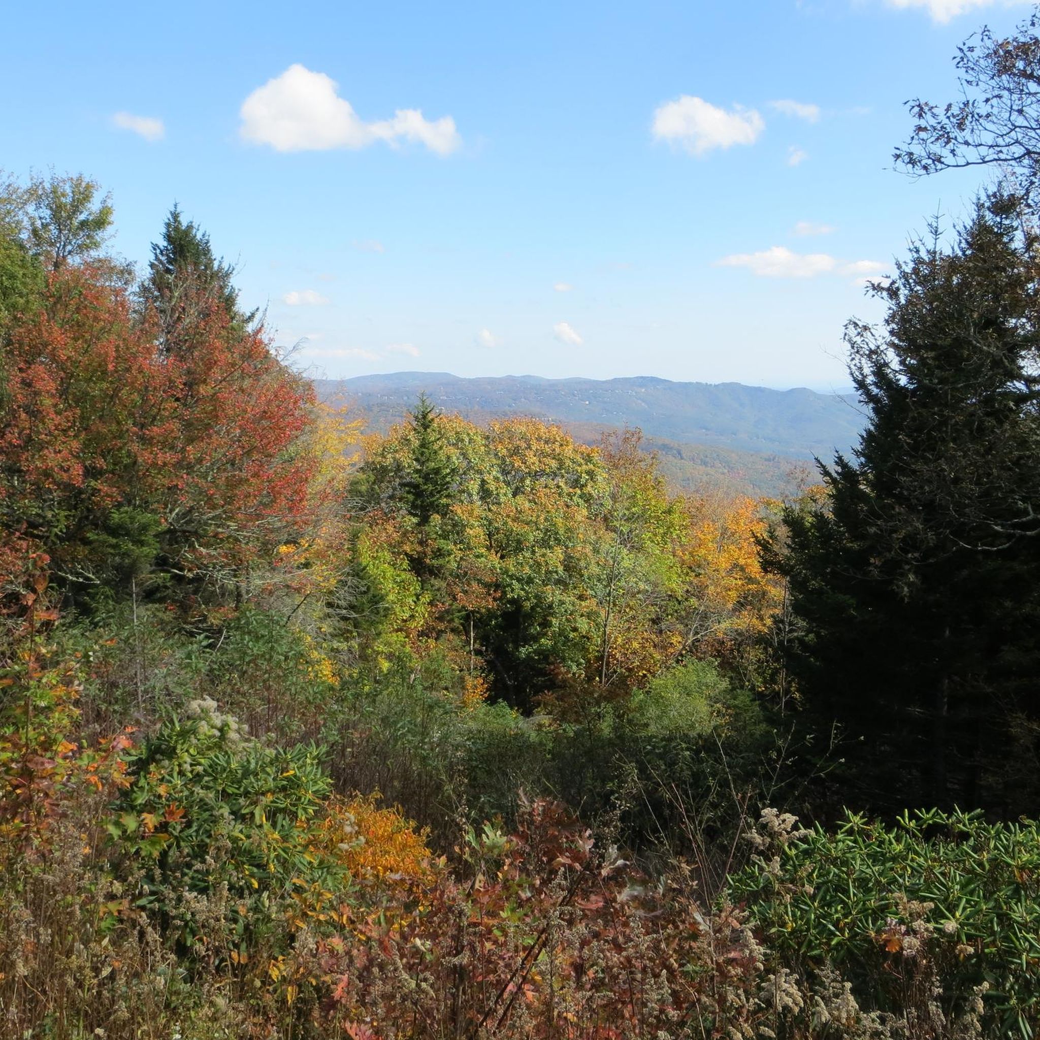
This lookout point is just a short hike from the Blue Ridge Parkway but oh my, the views! Getting to the very summit of the lookout point requires scaling a large boulder; there are fixed cables to make it easier.
0
0

Calloway Peak is a 5,919-foot peak in the heart of the Blue Ridge Mountains. It is most commonly reached via the challenging, steep, and sometimes exposed Grandfather Trail. This is a proud summit with open views of the surrounding area.
0
0
Down a short, out-and-back spur trail off of the main Grandfather Trail and just below Calloway Peak, is an amazing overlook. From here you get great views over the mountains. This is a great detour before or after you summit.
0
0

The Valdese Greenway offers a scenic pathway along the Catawba River and McGalliard Creek. It provides a great environment for hiking, running, and biking and is lined with lush vegetation. The trail features benches, bridges, and various viewpoints.
0
0
The McGalliard Falls is a picturesque waterfall situated in the park of the same name. The falls cascade gracefully over rocks, creating a serene and natural setting. To reach the falls, the Valdese Greenway is the most popular route, but they can be reached by car as well.
1
0

The South Harper Creek Falls Overlook has tremendous views of not only South Harper Creek Falls but also Grandfather Mountain. These falls can be accessed by scrambling down to the swimming pool at the base, but most decide to stick to the safe route and just view the falls from a distance.
0
0
Harper Creek Falls is built by two large rock slides being stacked one behind the other. The rock slides create a sort of two step cascade into a deep pool of water deep enough to wade in. These falls are very popular despite how badly washed out the trail is to get to them.
0
0

The Linn Cove Viaduct is a 1,243 foot (379 m) long concrete bridge that wraps around Grandfather Mountain. It was designed with protection of the mountain's habitat in mind, and is the most famous bridge on the Blue Ridge Parkway. The viaduct was opened to the public in 1987, therefore completing the Blue Ridge Parkway.
0
0
Frequently Asked Questions
How many hiking trails are available in Caldwell County?
Caldwell County offers a wide selection of hiking opportunities, with over 70 trails recorded on komoot. These routes cater to various skill levels, from leisurely strolls to strenuous climbs, ensuring there's a path for every hiker.
Are there easy hiking trails suitable for beginners or families?
Yes, Caldwell County has over 25 easy hiking trails perfect for beginners or families. For a gentle walk with scenic views, consider the McGalliard Falls via Valdese Greenway, which is just over 4 miles. Another excellent option is the Lakeside Loop & Meditation Point at Valdese Lakeside Park, offering a shorter, peaceful experience.
Can I find challenging hikes in Caldwell County?
Absolutely. For experienced hikers seeking a challenge, Caldwell County and its immediate surroundings offer several difficult routes. The Calloway Peak via Nuwati & Daniel Boone Scout Trail loop is a demanding 7.5-mile trail ascending to Calloway Peak, providing panoramic views. Another strenuous option is the Calloway Peak – Watauga Viewpoint loop from Grandfather, which is even longer and features significant elevation gain.
Are there any trails with waterfalls in Caldwell County?
Yes, the Wilson Creek Wild and Scenic River Area, located in Caldwell County, is renowned for its waterfalls. A popular choice is the Harper Creek Falls Trail, which leads to impressive double waterfalls. Other notable waterfalls in the area include those on Thorpe's Creek and Hunt Fish Falls, offering diverse options for waterfall enthusiasts.
Are the hiking trails in Caldwell County dog-friendly?
Many trails in Caldwell County, particularly those within the Pisgah National Forest and local parks, are dog-friendly, typically requiring dogs to be on a leash. It's always a good idea to check specific trail regulations before heading out, but generally, you'll find plenty of options to explore with your canine companion.
What kind of natural features or viewpoints can I expect to see?
Caldwell County, nestled in the Blue Ridge Mountains foothills, offers dramatic scenery. You can expect stunning mountain vistas, especially from higher elevation trails like those near Grandfather Mountain. The federally designated Wild and Scenic Wilson Creek provides rugged gorges and numerous waterfalls. Additionally, trails along Lake Rhodhiss and Lake Hickory offer serene lakeside views.
Are there circular hiking routes in the area?
Yes, Caldwell County features several circular hiking routes. For a moderate loop, consider the Harper Creek Trail & Raider Camp Creek Trail loop in the Wilson Creek area. Another option is the Valdese Lakeside Park loop, which offers an easy, scenic walk around the lake.
What is the best time of year to go hiking in Caldwell County?
The spring and fall seasons are generally ideal for hiking in Caldwell County. Spring brings blooming wildflowers and pleasant temperatures, while autumn offers spectacular fall foliage. Summer can be warm and humid, but higher elevation trails provide cooler conditions. Winter hiking is possible, especially on lower elevation trails, but requires appropriate gear for colder temperatures.
Is parking available at the trailheads?
Parking is generally available at most established trailheads and parks throughout Caldwell County. Popular areas like the Wilson Creek Wild and Scenic River Area and local parks such as Valdese Lakeside Park typically have designated parking lots. For specific routes, it's advisable to check the route details on komoot for parking information.
Do I need a permit to hike in Caldwell County?
For most general hiking trails in Caldwell County, including those in the Pisgah National Forest and local parks, a permit is not required. However, certain areas or activities might have specific regulations or require permits, so it's always best to check with the relevant land management agency if you plan to visit a less common area or engage in specific activities.
What do other hikers say about the trails in Caldwell County?
The hiking trails in Caldwell County are highly regarded by the komoot community, holding an average rating of 4.7 stars from over 130 reviews. Hikers frequently praise the diverse terrain, from rugged mountain paths to serene lakeside walks, and the stunning natural beauty, particularly the waterfalls and mountain views in the Blue Ridge foothills.
Are there any moderate hiking trails for a good workout?
Yes, Caldwell County offers over 30 moderate trails for those looking for a good workout without extreme difficulty. The Rough Ridge Overlook to Linn Cove Viaduct – Blue Ridge Parkway trail is a popular 4-mile option with scenic vistas. Another moderate choice is the Rough Ridge Lookout loop from Pilot Knob, offering a shorter but rewarding climb.
Most popular routes in Caldwell County

Get inspired with the komoot mobile app


Didn’t find what you were looking for?
Check out more Hikes throughout Caldwell County below and find the perfect route in your destination.
Explore more
Browse the best Hikes in other regions.
