The best walks and hikes around Norte O Antequera
4.3
(5624)
36,389
hikers
338
hikes
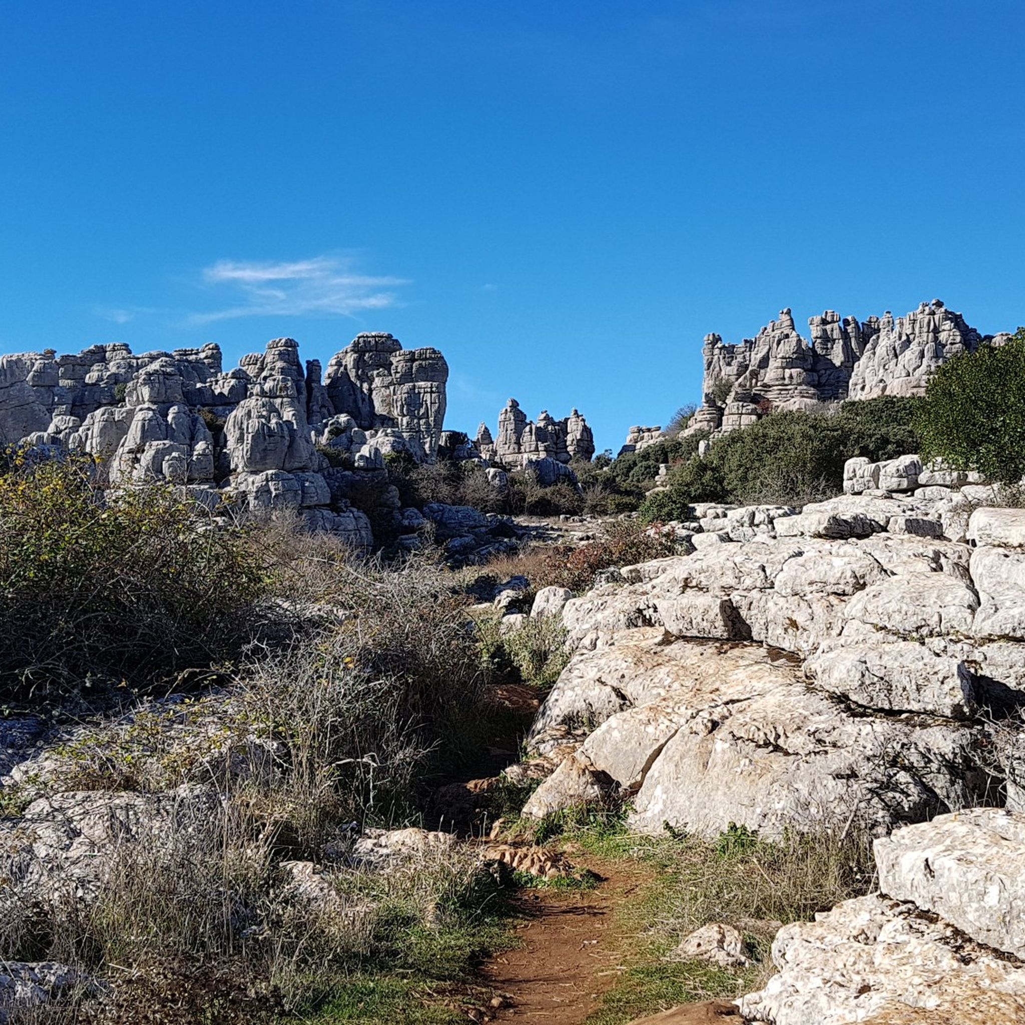
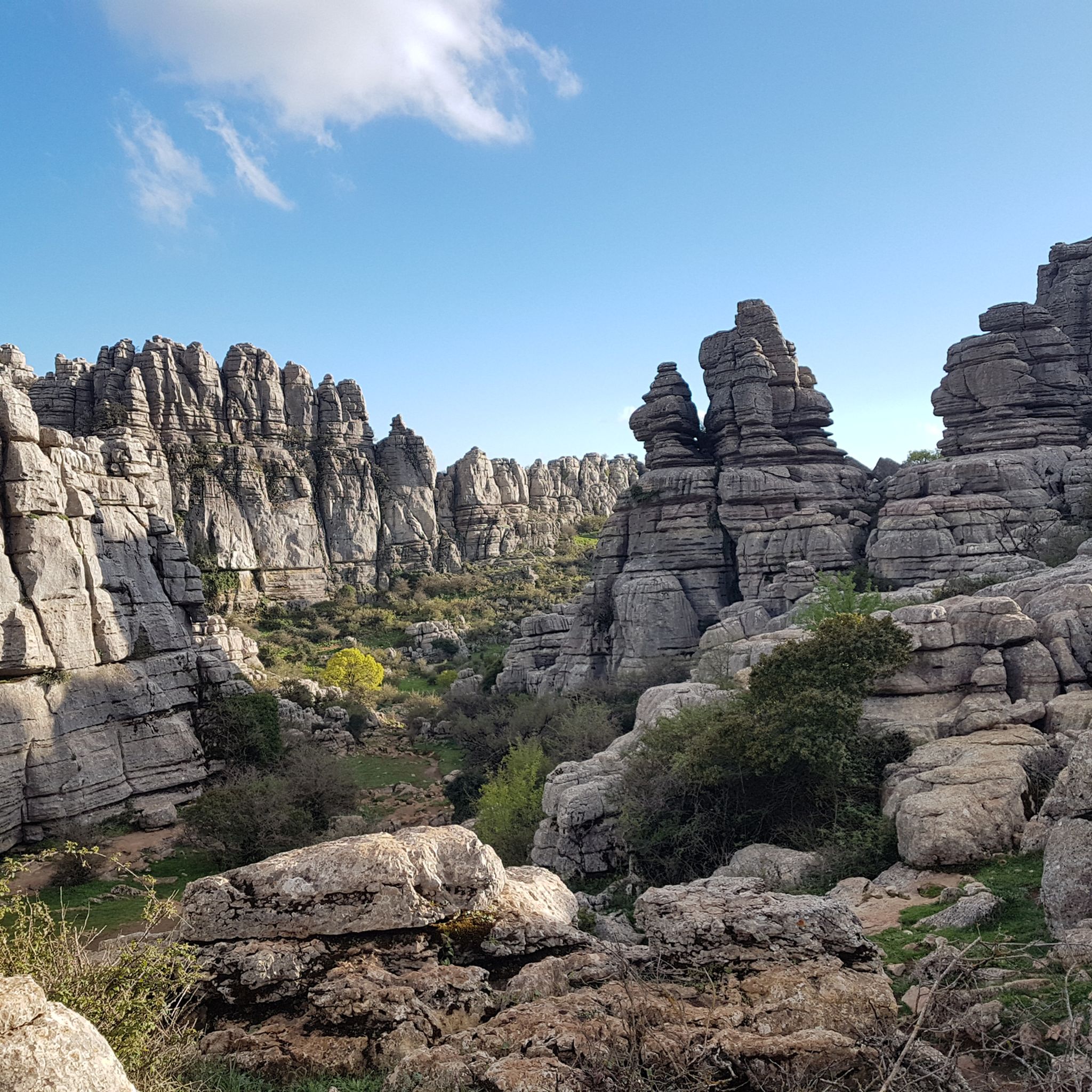
Hiking around Norte O Antequera offers diverse terrain, primarily characterized by the unique karst landscapes and dramatic limestone formations of El Torcal de Antequera Natural Park. This region features ancient seabeds uplifted by tectonic activity, creating a "museum of natural sculptures" with distinctive rock formations. The area also includes Mediterranean forests and offers panoramic views, sometimes extending to the Sierra Nevada.
Best hiking trails around Norte O Antequera
- The most popular hiking route is Natural Site Torcal de Antequera via…
Last updated: October 10, 2026
4.7
(171)
833
hikers
10.3km
03:17
340m
340m
Hard hike. Good fitness required. Sure-footedness, sturdy shoes and alpine experience required.
4.7
(61)
455
hikers
4.25km
01:15
90m
90m
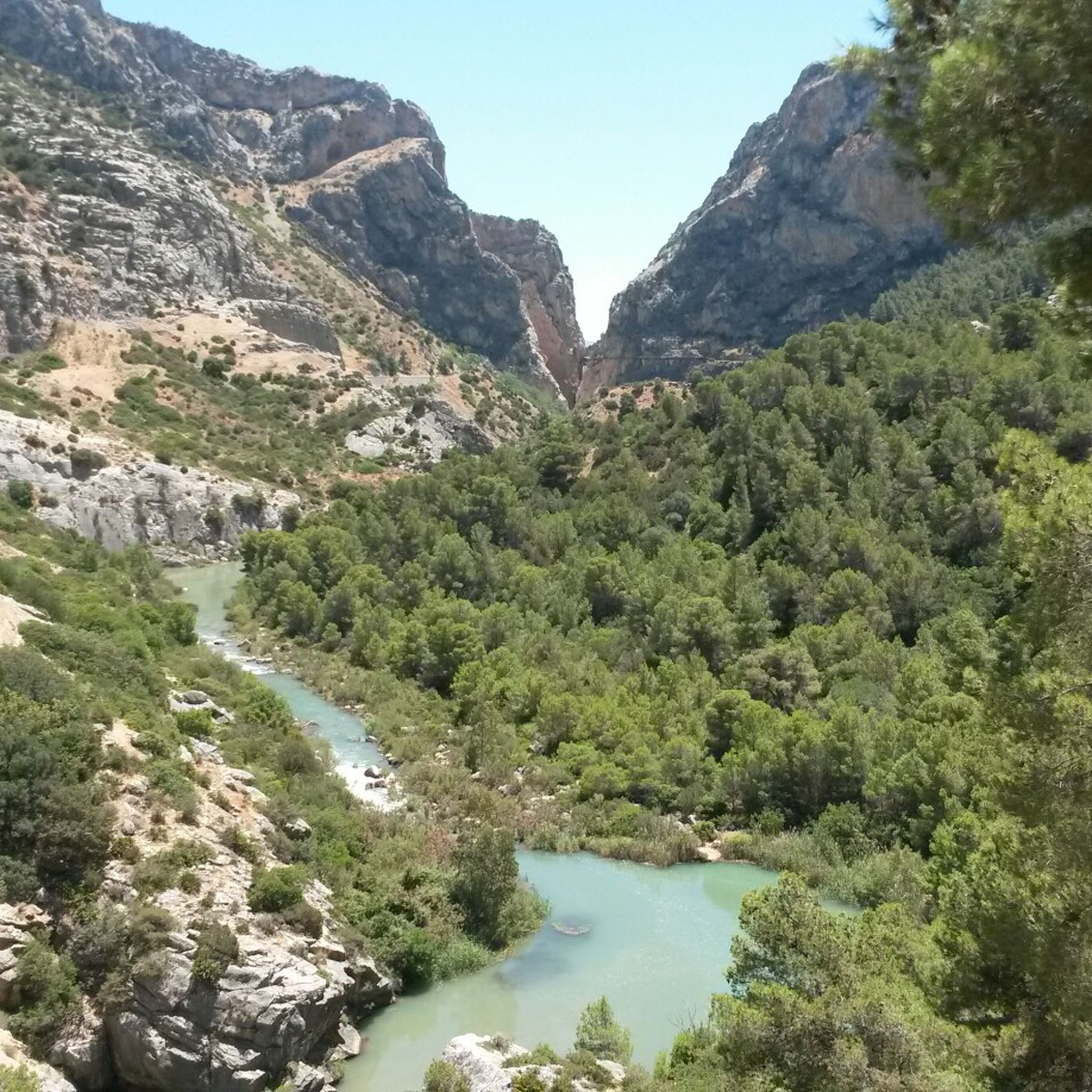
Hike the difficult 2.6-mile Gaitanejo Trail in Desfiladero de los Gaitanes Natural Park, featuring reservoir views and geological formations

4.6
(18)
68
hikers
Moderate hike. Great for any fitness level. Mostly accessible paths. Sure-footedness required.
4.5
(11)
53
hikers
4.65km
01:20
110m
110m
Easy hike. Great for any fitness level. Easily-accessible paths. Suitable for all skill levels.
4.8
(218)
1,989
hikers
15.8km
05:23
560m
560m
Hard hike. Very good fitness required. Mostly accessible paths. Sure-footedness required.
4.8
(17)
51
hikers
5.51km
01:42
200m
210m
Easy hike. Great for any fitness level. Easily-accessible paths. Suitable for all skill levels.
4.8
(9)
47
hikers
12.5km
04:01
540m
540m
Moderate hike. Good fitness required. Easily-accessible paths. Suitable for all skill levels.
4.7
(10)
28
hikers
13.3km
03:51
340m
340m
Hike the moderate 8.3-mile Los Jiménez - Fuente Garzón Trail (PR-A 91) near Ardales, featuring a Roman bridge, castle ruins, and panoramic v
2.6
(5)
19
hikers
Moderate hike. Good fitness required. Mostly accessible paths. Sure-footedness required.
4.6
(5)
13
hikers
7.82km
02:08
120m
120m
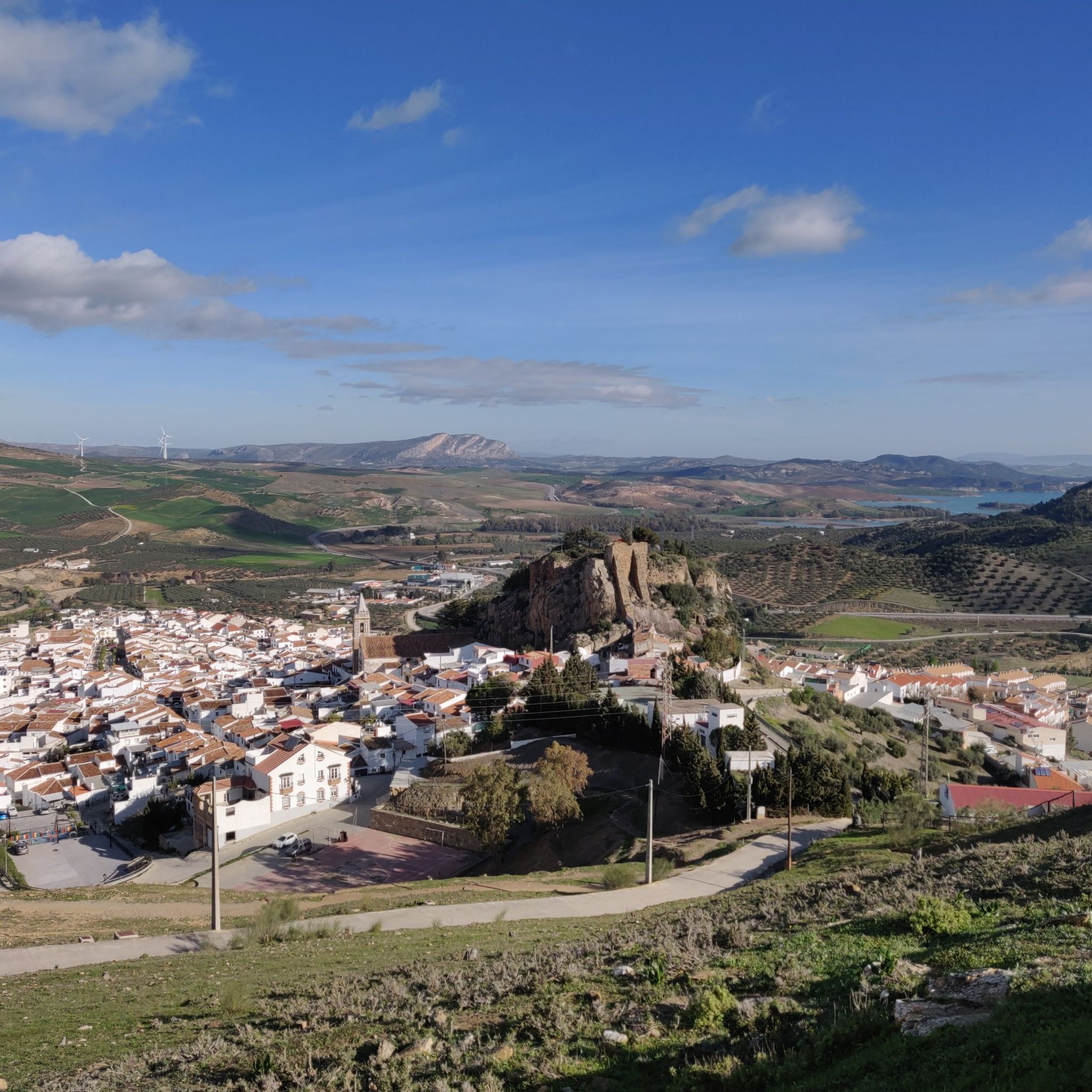
Hike through Antequera's historic city center and explore the ancient, UNESCO-listed Dolmens of Antequera on this 4.9-mile route.
Get access to more routes and recommendations from other explorers.
Already have an account?
Our route recommendations are based on thousands of hikes, rides, and runs completed by other people on komoot.
Start today with a free account
Your next adventure awaits.
Popular around Norte O Antequera

Other adventures around Norte O Antequera


Tips from the Community

Caminito del Rey is a breathtaking trail in Andalusia that runs high above the Guadalhorce River canyon. It offers an adrenaline-pumping experience, magnificent views, and a safe passage through the rocks. Ideal for nature and adventure lovers. Children from 8 years old are allowed, the route is not suitable for people who suffer from fear of heights.
1
0

As you cross the suspension bridge made of steel cables and steel grating, which is just over 30m long, you must secure your helmet well, as the wind blows strongest here. Additionally, the bridge wobbles a bit.
4
1
It's quite amazing what efforts were made for this railway line. The supporting pillars are very nicely worked out.
5
0
In the second section of the Caminito del Rey, the valley opens up and you can see carob trees everywhere, which have spread here.
4
0
At this point, King Alfonso XIII had the opportunity to leave the Caminito and return to civilization by train.
1
0
Here, the amount of water flowing through the canyon is regulated. The water is controlled via a funnel-shaped outlet.
2
0
From here, you may only proceed with a helmet, which is distributed beforehand along with a hairnet. As access is limited, be sure to reserve in advance.
2
0

The Mirador Niña de Antequera offers excellent views over the eastern part of the old town of Antequera and the surrounding mountains.
0
0
Frequently Asked Questions
How many hiking trails are available in Norte O Antequera?
Norte O Antequera offers a wide variety of hiking experiences, with over 280 routes available. These range from easy strolls to more challenging ascents, catering to different fitness levels.
What makes the hiking landscape in Norte O Antequera unique?
The region is primarily characterized by the surreal karst landscapes and dramatic limestone formations of El Torcal de Antequera Natural Park. These formations, sculpted by millions of years of natural processes, originated from a seabed over 150 million years ago, creating a "museum of natural sculptures." You'll find unique rock formations, diverse flora, and panoramic views, sometimes extending to the Sierra Nevada.
Are there easy hiking trails suitable for beginners or families in Norte O Antequera?
Yes, there are over 100 easy routes in the region. For a family-friendly option, the Green Route in El Torcal de Antequera is an easier, shorter circular trail perfect for all skill levels and an excellent introduction to the park's geological wonders. Another easy option is the Forest of Las Morillas – circular from Alfarnate (PR-A 268).
Are there challenging hikes for experienced hikers in Norte O Antequera?
Absolutely. The region features nearly 30 difficult routes. A notable challenging option is the Natural Site Torcal de Antequera via Green and Yellow routes (SL-A 295), which is over 10 km long and explores the impressive geological features of El Torcal. The Orange Route in El Torcal is also a steeper and more challenging ascent, connecting the lower parking lot to the Visitor Center with a significant elevation gain.
What is the best time of year to go hiking in Norte O Antequera?
The region experiences a microclimate, and the terrain can be very rocky and irregular, potentially slippery after rain. Clear days offer panoramic views extending to the Sierra Nevada. It's generally recommended to hike during spring and autumn for milder temperatures and more stable conditions, though winter can also offer crisp, clear days. Always check local weather forecasts before heading out.
Can I find circular hiking routes in the region?
Yes, many routes in Norte O Antequera are circular. Within El Torcal, both the Green Route and the Yellow Route are circular trails. Another option is the Paraje Natural Torcal de Antequera – circular to Camorro de Siete Mesas via the Cornisa del Diablo. The broader Antequera region also offers the 8 Bridges Route, a circular trail traversing Mediterranean forests.
What are the parking options for trailheads in El Torcal de Antequera?
For El Torcal de Antequera, there is a lower parking lot and an upper parking lot located near the Visitor Center. During peak times, the upper parking lot may fill up, and visitors might need to park lower and take a shuttle or walk up the Orange Route.
Are there any interesting landmarks or attractions to see along the hiking trails?
Beyond the stunning karst formations of El Torcal, the region offers historical and natural points of interest. You can explore ancient Roman water routes like the Sendero Las Arquillas. For historical sites, consider visiting The Alcazaba of Antequera or Castillo de la Peña de Ardales. Hikers can also reach summits like Pico de Vilo or Camorro Alto for rewarding views.
What kind of wildlife can I expect to see while hiking in Norte O Antequera?
While large predators are absent, El Torcal is home to various invertebrate species. Hikers frequently spot mountain goats, which are accustomed to human presence, and vultures circling overhead. The diverse flora also supports a rich ecosystem.
What do other hikers enjoy most about hiking in Norte O Antequera?
The area is highly rated by the komoot community, with an average score of 4.2 stars from over 1650 reviews. Reviewers often praise the surreal karst landscapes, the unique geological formations of El Torcal, and the diverse options available for various ability levels.
Are there any specific recommendations for footwear when hiking in this region?
Due to the very rocky and irregular terrain, especially within El Torcal, it is highly recommended to wear proper hiking boots. This will provide better grip and ankle support, particularly important as surfaces can be slippery after rain.
Are dogs allowed on hiking trails in Norte O Antequera?
While many natural areas in Spain are dog-friendly, specific rules can vary by park or protected area. For El Torcal de Antequera Natural Park, it's advisable to check the official park regulations regarding dogs, especially concerning leash requirements and restricted areas, to ensure a pleasant and compliant visit.
Most popular routes around Norte O Antequera
Most popular attractions around Norte O Antequera

Get inspired with the komoot mobile app


Didn’t find what you were looking for?
Check out more Hikes throughout Norte O Antequera below and find the perfect route in your destination.
Explore more
Browse the best Hikes in other regions.
