The best walks and hikes around Étang De Lanos
4.6
(1471)
14,299
hikers
111
hikes
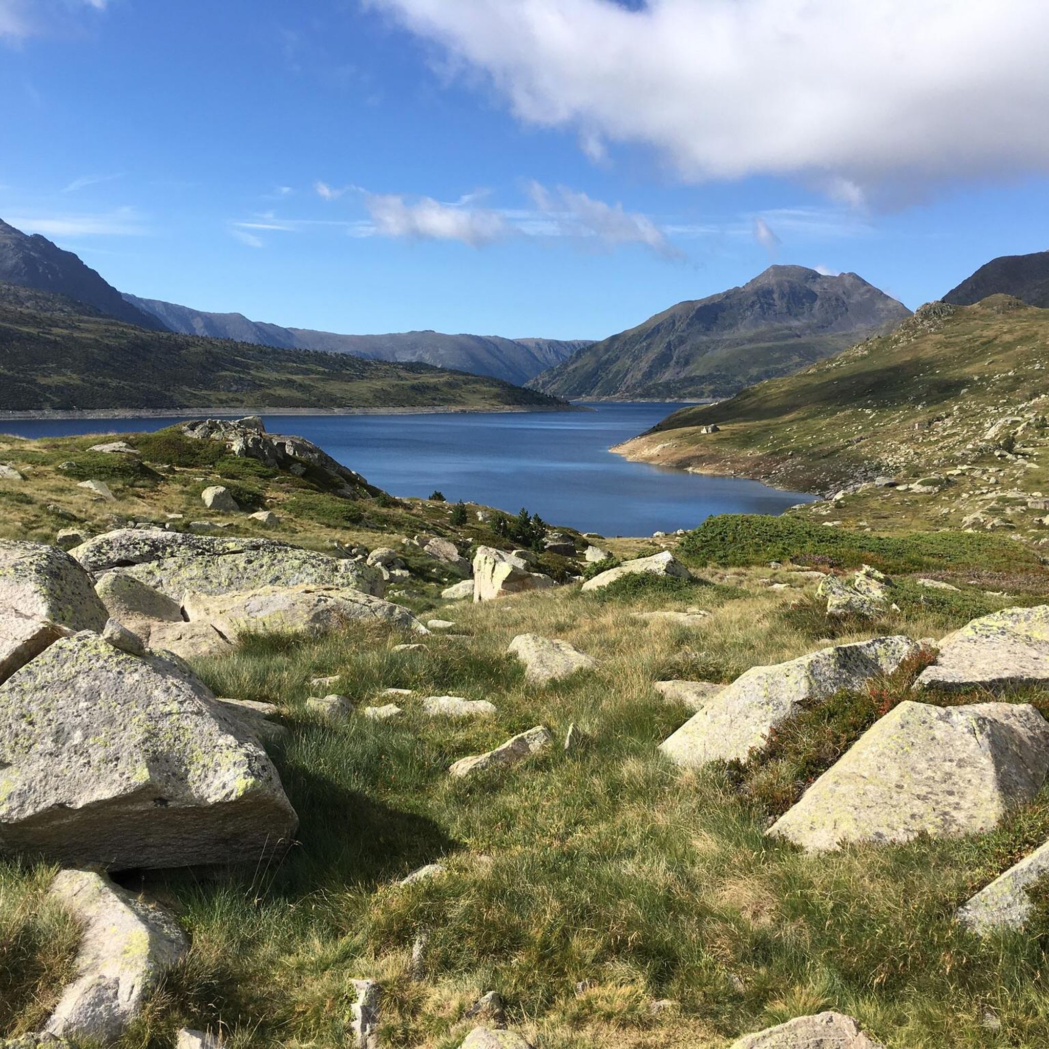
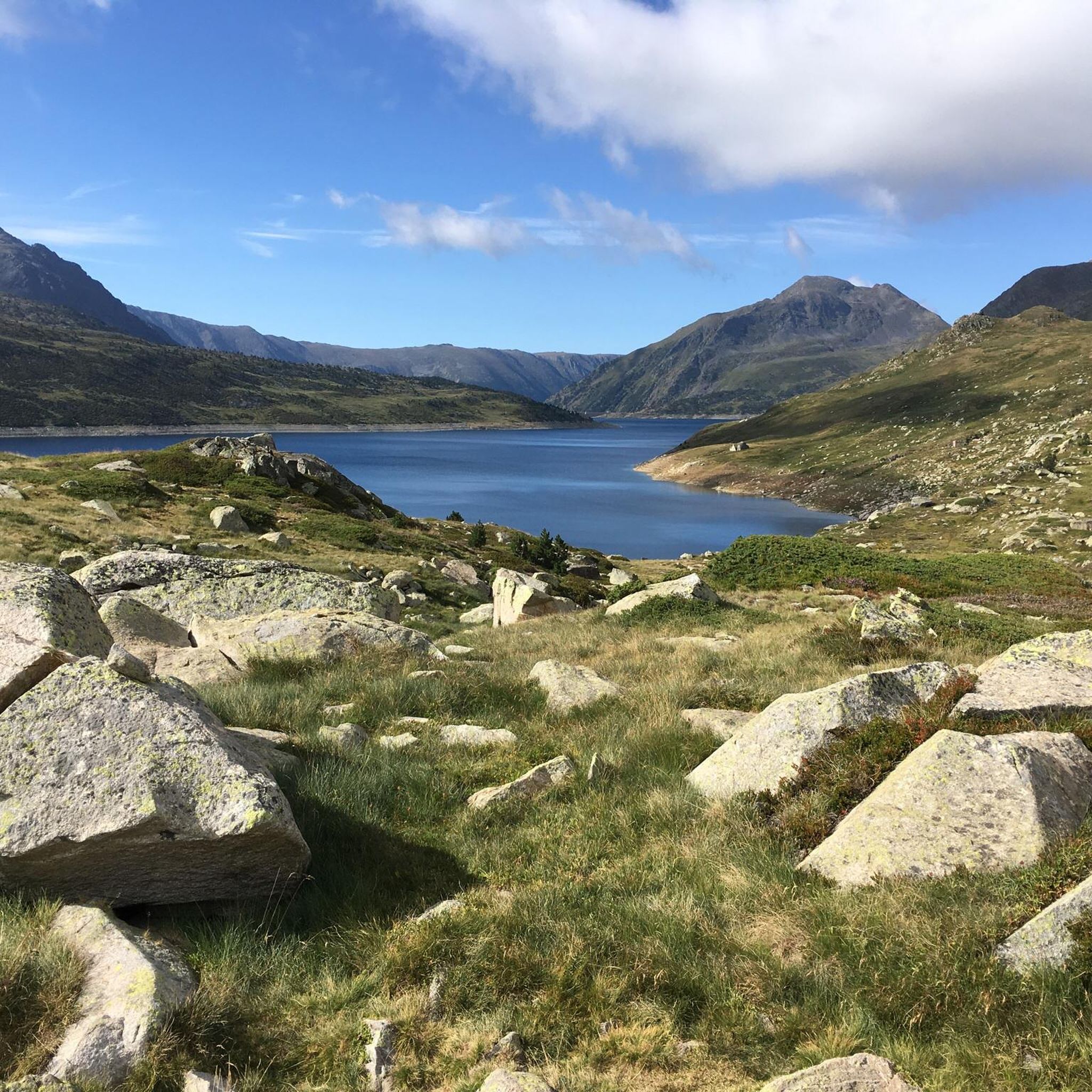
Hiking around Étang De Lanos provides access to high-mountain landscapes in the French Pyrenees, centered around Lac de Lanoux, the largest natural lake in the region, situated at an altitude of 2,213 meters. The area is characterized by a spectacular mountain cirque, framed by prominent peaks such as the Carlit massif and Puig de la Grava. Trails often feature streams, cascades, and an alpine environment, with the historic "Chemin des Ingénieurs" offering views of the Rec de Lanós valley.
Best…
Last updated: June 25, 2026
4.7
(3)
72
hikers
16.6km
06:23
590m
590m
Hard hike. Very good fitness required. Mostly accessible paths. Sure-footedness required.
5.0
(1)
9
hikers
7.04km
03:58
670m
670m
Hard hike. Good fitness required. Sure-footedness, sturdy shoes and alpine experience required.

Sign up for free
6
hikers
16.7km
07:02
950m
950m
Hard hike. Very good fitness required. Mostly accessible paths. Sure-footedness required.
5.0
(1)
25
hikers
8.20km
03:11
380m
380m
Moderate hike. Good fitness required. Mostly accessible paths. Sure-footedness required.
5.0
(1)
18
hikers
2.72km
00:57
140m
140m
Easy hike. Great for any fitness level. Easily-accessible paths. Suitable for all skill levels.
Get access to more routes and recommendations from other explorers.
Sign up for free
Already have an account?
Our route recommendations are based on thousands of hikes, rides, and runs completed by other people on komoot.
Start today with a free account
Your next adventure awaits.
Login or Signup



Tips from the Community

Grandiose pass, mid-June with many snowfields for running up and sliding down. Wonderful views all around, to Pic Carlit, Puig Péric and many other peaks, to Lac de Lanoux and Lac d'En Beys (on the mountainside just before the pass) and into the valley towards Hospitalet-près-l'Andorre.
0
0

Last stage before the final climb. Ideal spot for a bivouac.
1
0

The ascent via the "chimney" requires handholding, but it's very gradual and features easy holds. The one-way descent is much simpler.
0
0


Can be dangerous, proceed with caution and preferably with light equipment
1
0

Carlit Peak is part of the Capcir granite massif, which is dotted with 27 lakes and small lakes in the Occitanie region, northwest of Font-Romeu. Its summit is located at 2921 meters, allowing you to observe an immense panorama (from Canigó to the Central Pyrenees).
1
2

The upper Têt valley occupies the bed of an ancient glacier which covered the entire surface between the Carlit and Péric puigs. Today, it forms a vast preserved natural area with superb views of the mountains that protect it. In addition to offering a wonderful setting for hiking, it constitutes an absolutely magical bivouac place.
2
0
Frequently Asked Questions
How many hiking trails are available around Étang de Lanos?
There are over 110 hiking trails around Étang de Lanos, offering a wide range of options from easy walks to challenging high-mountain treks. The komoot community has explored these routes over 11,000 times.
What kind of terrain can I expect when hiking around Étang de Lanos?
The terrain around Étang de Lanos is characterized by stunning high-mountain landscapes and an alpine environment. You'll encounter a spectacular mountain cirque, impressive peaks like the Carlit massif, and the expansive lake itself. Trails often feature streams, cascades, and rocky paths, with patches of snow persisting into early summer at higher altitudes.
Are there any easy or beginner-friendly hikes in the area?
Yes, Étang de Lanos offers several easy walks suitable for beginners or those looking for a less strenuous experience. For example, the Font Vive Lake loop from Lac de Font Vive is an easy 2.7 km trail that can be completed in just over an hour, offering pleasant views with minimal elevation gain.
What are some notable natural features or landmarks to see while hiking?
The most prominent feature is the Étang de Lanos itself, the largest natural lake in the French Pyrenees. You can also explore the historic "Chemin des Ingénieurs" (Engineers' Path), which offers excellent views of the Rec de Lanós valley and the nearby Estany du Font Viva. The Barrage du Lanoux, a significant dam, is another common hiking objective, providing panoramic views.
Are there any circular hiking routes around Étang de Lanos?
Yes, the area is known for several popular circular routes. A moderate option is the Lac de Font Vive – Loop – Pyrénées Catalanes Regional Natural Park, which is a 9.5 km path. For a more challenging loop, consider the En Beys Lakes – En Beys Refuge loop from Étang Faury, which takes you through the scenic En Beys Lakes area.
What is the best time of year to go hiking in Étang de Lanos?
The best time to hike around Étang de Lanos is typically from late spring to early autumn (June to September) when the weather is most favorable and the trails are generally clear of snow. Due to its high altitude, snow can persist into early summer, so checking conditions before you go is always recommended.
Are there any family-friendly hiking options?
While many routes are challenging, there are options suitable for families. The easier trails, such as the Font Vive Lake loop from Lac de Font Vive, are generally well-suited for families looking for a pleasant walk without significant elevation. Always consider the fitness level of all family members when choosing a route.
Can I bring my dog on the hiking trails around Étang de Lanos?
Many trails in the Pyrenees are dog-friendly, but it's always advisable to check specific regulations for the area you plan to visit, especially concerning nature reserves or protected zones. Keep your dog on a leash to protect wildlife and ensure their safety in the high-mountain environment.
Where can I park when accessing the hiking trails?
Access to the hiking trails around Étang de Lanos is typically from Porté-Puymorens. Designated parking areas, such as the one at Lac du Passet, serve as convenient starting points for various excursions into the area.
What do other hikers enjoy most about hiking in Étang de Lanos?
The area is highly rated by the komoot community, with an average score of 4.7 stars from over 1100 reviews. Reviewers often praise the breathtaking high-mountain scenery, the expansive views of the largest natural lake in the French Pyrenees, and the diverse network of trails catering to different skill levels.
Are there any refuges or shelters available along the trails?
Yes, for longer expeditions, there are non-guarded but accessible refuges in the area, such as the Refuge du chemin de Coume Joan, which can provide shelter along the way. It's always wise to research the specific refuge and its facilities before relying on it for an overnight stay.
Are there any long-distance hiking trails that pass through Étang de Lanos?
Yes, the long-distance hiking trail GR7, which is part of the European E4 path, passes through the Étang de Lanos area. This allows hikers to connect to other extensive routes and embark on multi-day adventures across the Pyrenees.
Most popular routes around Étang De Lanos

Get inspired with the komoot mobile app


Explore more
Browse the best Hikes in other regions.
