The best walks and hikes around Alexandria
4.5
(131)
3,670
hikers
73
hikes
Hiking trails around Alexandria, Virginia, offer a diverse range of outdoor experiences, primarily characterized by their proximity to the Potomac River and extensive multi-use trail networks. The region features a mix of riverside green spaces, swampy lowlands, and dense woodlands, providing varied terrain for hikers. These trails often connect to larger regional systems, allowing for exploration of both urban and natural environments. The landscape includes flat pathways along the riverfront and routes with gentle elevation changes through parks and preserves.
…Last updated: October 10, 2026
15
hikers
6.47km
01:39
20m
30m
Embark on an easy hike along the Mount Vernon Trail, stretching 4.0 miles (6.5 km) from Daingerfield Island to Oronoco Bay Park. This paved, multi-use path offers continuous scenic views…
5
hikers
11.0km
02:48
30m
40m
This segment of the Mount Vernon Trail offers a delightful escape along the Potomac River, blending natural beauty with historic charm. You'll enjoy continuous river views, passing through the wetlands…

3
hikers
5.40km
01:25
60m
10m
The Woodrow Wilson Bridge Trail offers a surprisingly engaging urban hike, connecting Alexandria, Virginia, and National Harbor, Maryland, across the Potomac River. This easy 3.4-mile (5.4 km) route, with a…
1.89km
00:29
0m
0m
Hike the easy 1.2-mile Cameron Run Loop in Ben Brenman Park, offering urban and natural scenery along waterways.
5.0
(1)
18
hikers
5.87km
01:29
10m
10m
Explore the easy 3.6-mile Mount Vernon Trail: Daingerfield Island Loop, offering Potomac River views, wildlife, and plane spotting.
Get access to more routes and recommendations from other explorers.
Already have an account?
Our route recommendations are based on thousands of hikes, rides, and runs completed by other people on komoot.
Start today with a free account
Your next adventure awaits.



Tips from the Community

Shipyard Park is a great, small park along the Potomac River. It has a walking path, seating and picnic areas, and great views of the water.
0
0

Rosalie Island Community Park beckons cyclists with its enchanting blend of nature and community charm. Nestled along scenic pathways, cyclists enjoy lush landscapes, serene river views, and recreational amenities. The park's tranquility and recreational offerings make it a captivating destination, inviting cyclists to unwind and savor the natural beauty.
0
0

A paved trail goes right through the middle of Oronoco Bay Park and is popular for running, walking, and commuting to and from Alexandria. There are great views of the bay from the path, and there are even a couple small piers within the boundaries of the park.
0
0

The Lyceum, built in 1838, has served many purposes for the city of Alexandria. It was originally built to be a local hub for education, hosting lectures, debates, and entertainment events. It was a military hospital, troop quarters, and meeting space during the Civil War. At various times afterward, it was a private residence, home of the Chamber of Commerce, and the first U.S. Bicentennial Center. Today, it is a history museum with exhibitions, public programs, a museum store, and facility rentals.
0
0
The Stabler-Leadbeater Apothecary was founded in 1792 by a local family and continued in business at this location from 1805 to 1933. This building is now a museum based on the practice of Alexandria's oldest continuously run businesses that combined retailing, wholesaling, and manufacturing.
0
0
The Historic Ice Well at Gadsby’s Tavern Museum has been around since the early days of the city of Alexandria. It is an example of a commercial well used to provide ice to the tavern for cold beverages and ice cream making.
0
0
Belle Haven Park is a small park along the banks of Cameron Run. This park is operated by the National Park Service and houses sections of the Mount Vernon Trail and the Dyke Marsh Trail.
0
0
A paved trail goes right through the middle of Oronoco Bay Park and is popular for running, walking, and commuting to and from Alexandria. There are great views of the bay from the path, and there are even a couple small piers within the boundaries of the park that you can run out on.
0
0
Frequently Asked Questions
How many hiking trails are available around Alexandria?
There are over 60 hiking routes around Alexandria, offering a variety of experiences from easy strolls to moderate hikes. The komoot community has explored these trails over 700 times, providing an average rating of 4.3 stars.
What kind of terrain can I expect on hiking trails in Alexandria?
Hiking trails in Alexandria primarily feature riverside paths, multi-use trails, and urban green spaces. You'll find a mix of flat pathways along the Potomac River, as well as routes with gentle elevation changes through parks and preserves, including swampy lowlands and dense woodlands.
Are there any easy or beginner-friendly hikes in Alexandria?
Yes, Alexandria offers many easy trails perfect for beginners or a relaxed outing. For example, the Oronoco Bay Park Loop — Daingerfield Island is an easy 3.6-mile route offering views of the Potomac River. Another accessible option is the Holmes Run Trail loop — Falls Church, which is 2.5 miles long and winds through pleasant wooded areas.
What are some notable natural features or landmarks I might see while hiking?
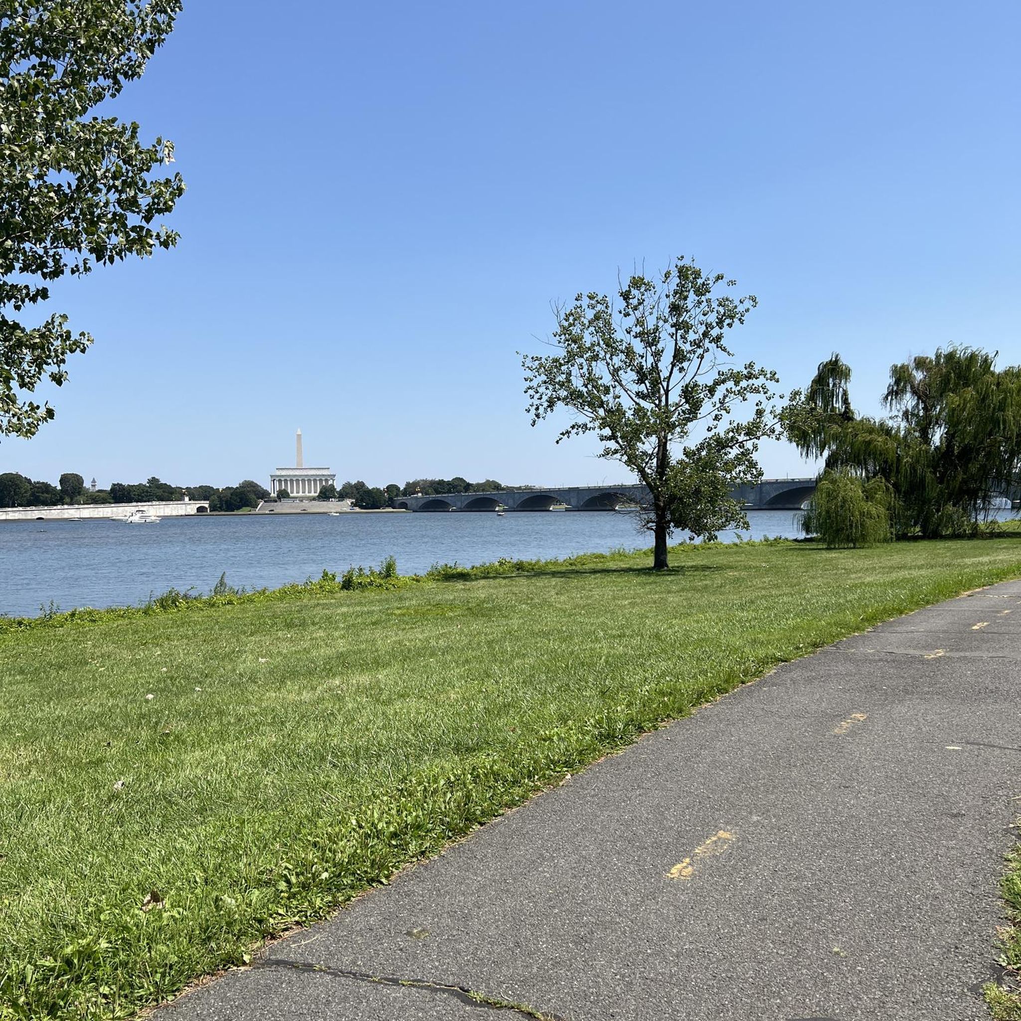
Many trails offer views of the Potomac River and connect various waterfront parks. You might also encounter diverse landscapes like the wetlands and woodlands along the Mount Vernon Trail. While hiking, you could also visit nearby attractions such as the Lincoln Memorial or the Washington Monument, which are accessible from some trail systems.
Are there any loop hikes available in Alexandria?
Yes, several trails in Alexandria are designed as loops, providing a convenient way to explore without retracing your steps. The Oronoco Bay Park Loop — Daingerfield Island is a popular easy loop. For a moderate option, consider the Mount Vernon Trail Loop — Dyke Marsh Wildlife Preserve, which offers diverse scenery.
Are the hiking trails in Alexandria family-friendly?
Many trails in Alexandria are suitable for families, especially the easier, flatter routes along the waterfront and through local parks. Huntley Meadows Park, located near Alexandria, is particularly popular with families due to its flat trails and abundant wildlife viewing opportunities. The multi-use trails are generally well-maintained and offer a safe environment for all ages.
Are dogs allowed on hiking trails in Alexandria?
Alexandria is a dog-friendly city, and many of its multi-use trails and parks welcome dogs, typically requiring them to be on a leash. Always check specific park regulations before heading out, but generally, you'll find plenty of options for hiking with your canine companion.
What is the best time of year to go hiking in Alexandria?
Spring and fall generally offer the most pleasant hiking conditions in Alexandria, with mild temperatures and beautiful foliage. Summer can be hot and humid, while winter can bring cold temperatures, though trails remain accessible for those prepared for the weather. The region's trails are enjoyable year-round, depending on your preference for weather.
How can I access hiking trails using public transport?
Alexandria has a good public transportation network, and many trails are accessible via bus or metro. The city is crisscrossed with multi-use trails that often connect to urban areas. For detailed information on public transport options to specific trailheads, you can consult the official Alexandria public transportation website: alexandriava.gov.
Is parking available at trailheads?
Parking is generally available at many of the larger parks and trailheads throughout Alexandria. Given the city's focus on outdoor activities, efforts are made to provide access. However, for popular spots, especially on weekends, it's advisable to arrive early or consider public transport. Specific parking details can often be found on individual park websites or komoot tour descriptions.
What do other hikers enjoy most about hiking in Alexandria?
The area is highly rated by the komoot community, with an average score of 4.3 stars. Reviewers often praise the accessibility of the trails, the scenic views along the Potomac River, and the variety of experiences from urban strolls to more natural park settings. The well-maintained multi-use paths and the opportunity to connect with nature close to the city are frequently highlighted.
Are there any trails that offer views of Washington D.C.?
Yes, the Mount Vernon Trail, which runs alongside the Potomac River, offers stunning views of Washington D.C.'s skyline. This scenic pathway connects George Washington's Mount Vernon Estate to Theodore Roosevelt Island, providing numerous vantage points to see the capital's iconic landmarks.
Most popular routes around Alexandria
Most popular attractions around Alexandria

Get inspired with the komoot mobile app


