The best walks and hikes around Bonnanaboigh
4.3
(18)
230
hikers
9
hikes
Hikes around Bonnanaboigh are centered on the nearby Roe Valley Country Park and Banagher Glen. The landscape is defined by riverside paths along the River Roe and woodland trails through forested glens. The routes feature a mix of gentle river walks and steeper climbs on forest tracks, with elevation gains generally remaining below 300 meters.
Best hiking trails around Bonnanaboigh
- The most popular hiking route is Banagher Glen Forest Trail — Sperrins, an 8.2 mile (13.3 km) trail that…
Last updated: June 25, 2026
4.6
(9)
57
hikers
13.3km
03:45
280m
280m
Moderate hike. Good fitness required. Easily-accessible paths. Suitable for all skill levels.
4.8
(4)
80
hikers
4.02km
01:02
20m
20m
Easy hike. Great for any fitness level. Easily-accessible paths. Suitable for all skill levels.

Sign up for free
4.5
(2)
32
hikers
8.83km
02:18
60m
60m
Moderate hike. Good fitness required. Easily-accessible paths. Suitable for all skill levels.
4.0
(1)
31
hikers
4.99km
01:20
50m
50m
Easy hike. Great for any fitness level. Easily-accessible paths. Suitable for all skill levels.
15
hikers
3.65km
00:58
30m
30m
Easy hike. Great for any fitness level. Easily-accessible paths. Suitable for all skill levels.
Get access to more routes and recommendations from other explorers.
Sign up for free
Already have an account?
Our route recommendations are based on thousands of hikes, rides, and runs completed by other people on komoot.
Start today with a free account
Your next adventure awaits.
Login or Signup
Popular around Bonnanaboigh


Tips from the Community

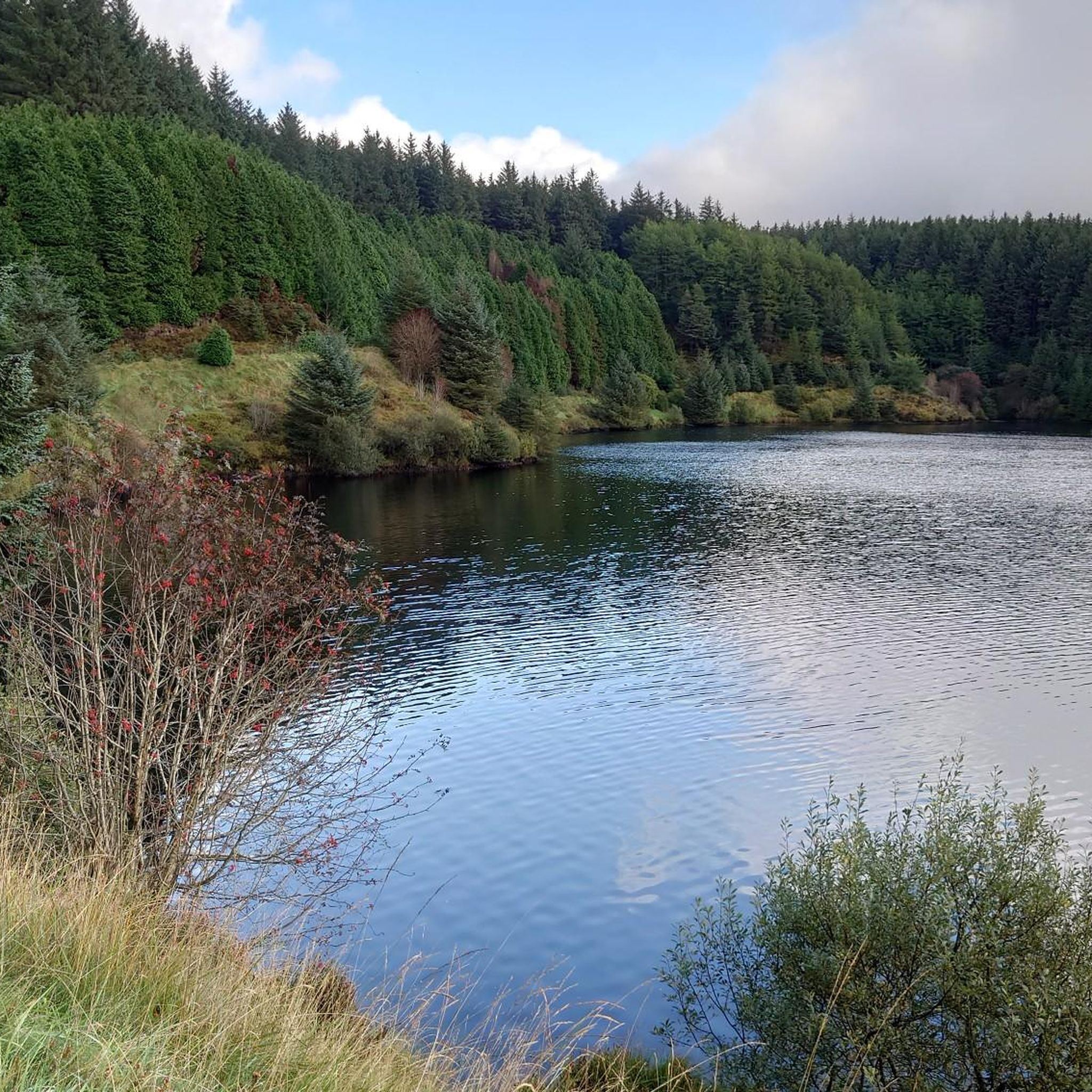
Enjoy some peace and serenity as you jog along the shores of the beautiful and calm Altnaheglish Reservoir, situated in the Sperring Area of Natural Beauty. The reservoir is located in the Banagher Forest, which is home to some of the oldest ancient oak woodlands in Ireland. It's a true place of beauty!
1
0
Enjoy tremendous views across Altnaheglish Reservoir from the Banagher Dam wall.
2
0
Enjoy some peace and serenity as you walk along the shores of the beautiful and calm Altnaheglish Reservoir, situated in the Sperring Area of Natural Beauty. The reservoir is located in the Banagher Forest, which is home to some of the oldest ancient oak woodlands in Ireland. It's a true place of beauty!
2
0

Banagher Dam was built in the 1930's, is 42m high and spans a gap of 110m. It is NI's highest dam with a capacity of 2270 million litres of water! On the banks of the reservoir sits some of Irelands most ancient oak woodland with plenty of footpaths to explore it.
1
0
Frequently Asked Questions
Where exactly is the hiking around Bonnanaboigh?
The main hiking areas are not in Bonnanaboigh itself, which is a small townland, but in the nearby Roe Valley Country Park and Banagher Glen. These parks offer a variety of trails through woodlands and along the River Roe.
What is the terrain like on the trails?
You can expect a mix of gentle riverside paths and steeper climbs on well-defined forest tracks. Most routes feature elevation gains of less than 300 meters, making the area accessible for many fitness levels. The trails are primarily through sheltered woodlands and glens.
Are there any easy, family-friendly walks?
Yes, there are several easier options. The River Walk loop from Whitehill is a gentle 4-kilometer walk through Roe Valley Country Park that is well-suited for families and casual strolls.
Can I find a longer, more challenging hike?
For a more substantial hike, consider the Banagher Glen Forest Trail — Sperrins. It's a 13.3-kilometer route that takes nearly four hours, involving some steeper sections through the forest.
Are there any circular or loop walks available?
Many of the trails are loops, allowing you to start and finish in the same place without retracing your steps. A great example is the River Walk loop from Limavady, an 8.6-kilometer circular route that follows the scenic River Roe.
What do other hikers think of the trails in this area?
The trails are well-regarded by the komoot community, with an average rating of over 4 stars. Hikers often praise the beautiful woodland scenery and the peaceful riverside paths, particularly within Roe Valley Country Park and Banagher Glen.
How many hiking trails are there near Bonnanaboigh?
There are just under 10 curated hiking routes available on komoot for the area. These range from easy short walks to more demanding trails, with a balanced mix of easy, moderate, and difficult options.
Are there any historical points of interest on the hikes?
Yes, some trails pass by significant historical sites. The O Cahan's Rock loop from Whitehill takes you to a viewpoint named after the O'Cahan clan, who once ruled the area. Roe Valley Country Park also contains ruins from the linen industry.
Where can I park to access the trails?
The main access points for these hikes have dedicated parking. Roe Valley Country Park has multiple car parks, including one near the Dogleap Centre. For hikes in Banagher Glen, you can use the car park at Banagher Glen Forest Park.
What are some popular places for hiking in the wider area?
While the immediate hikes are in Roe Valley and Banagher Glen, there are other highly-regarded spots nearby:
- Banagher Glen Forest Park: A local favorite known for its steep, beautiful woodland walks leading up to the dam.
- Binevenagh: Offers stunning hikes with dramatic cliff-top views and a scenic lake. It's a very popular spot for its breathtaking scenery.
- Lough Foyle Trail: Provides a lovely coastal walking experience with flat paths along the lough shore, ideal for a gentler day out.
What should I wear for hiking in this region?
Sturdy, waterproof walking shoes or boots are recommended as woodland paths can be muddy and uneven, especially after rain. Layered clothing is also a good idea, as the weather can change quickly. Always bring a waterproof jacket.
Most popular routes around Bonnanaboigh

Get inspired with the komoot mobile app


Explore more
Browse the best Hikes in other regions.
