The best road cycling routes around Lake del Zött
4.4
(8)
218
riders
7
rides
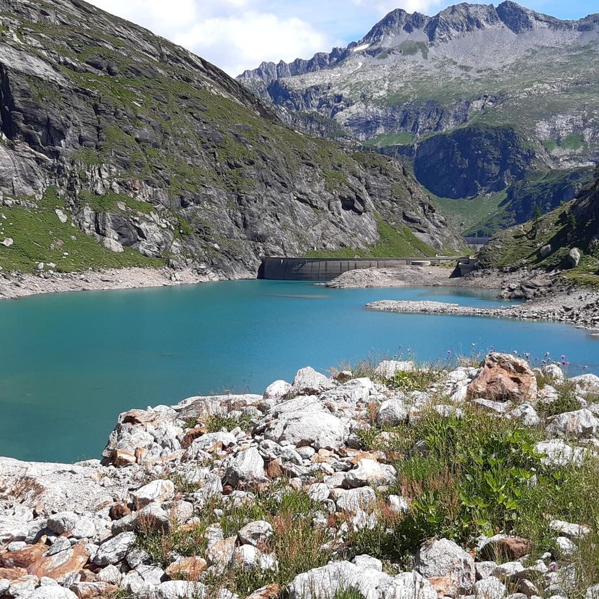
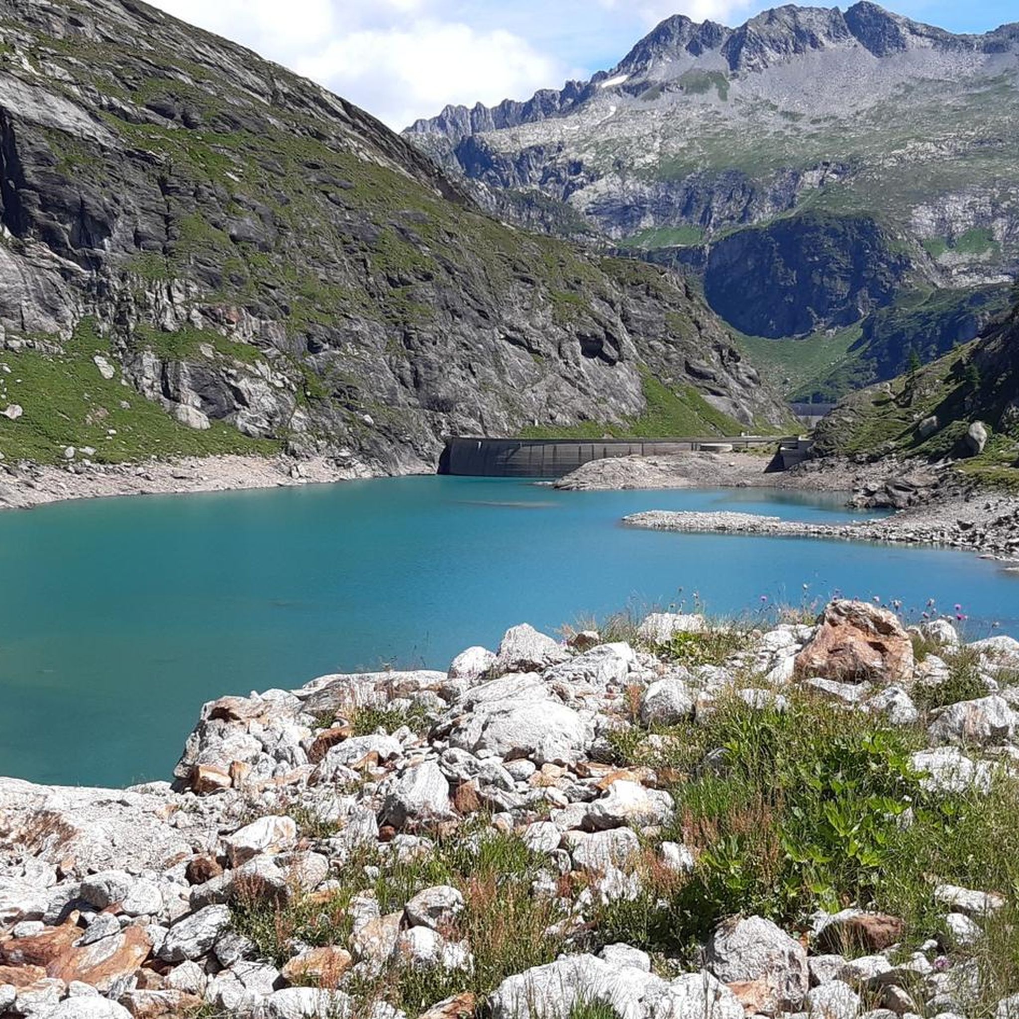
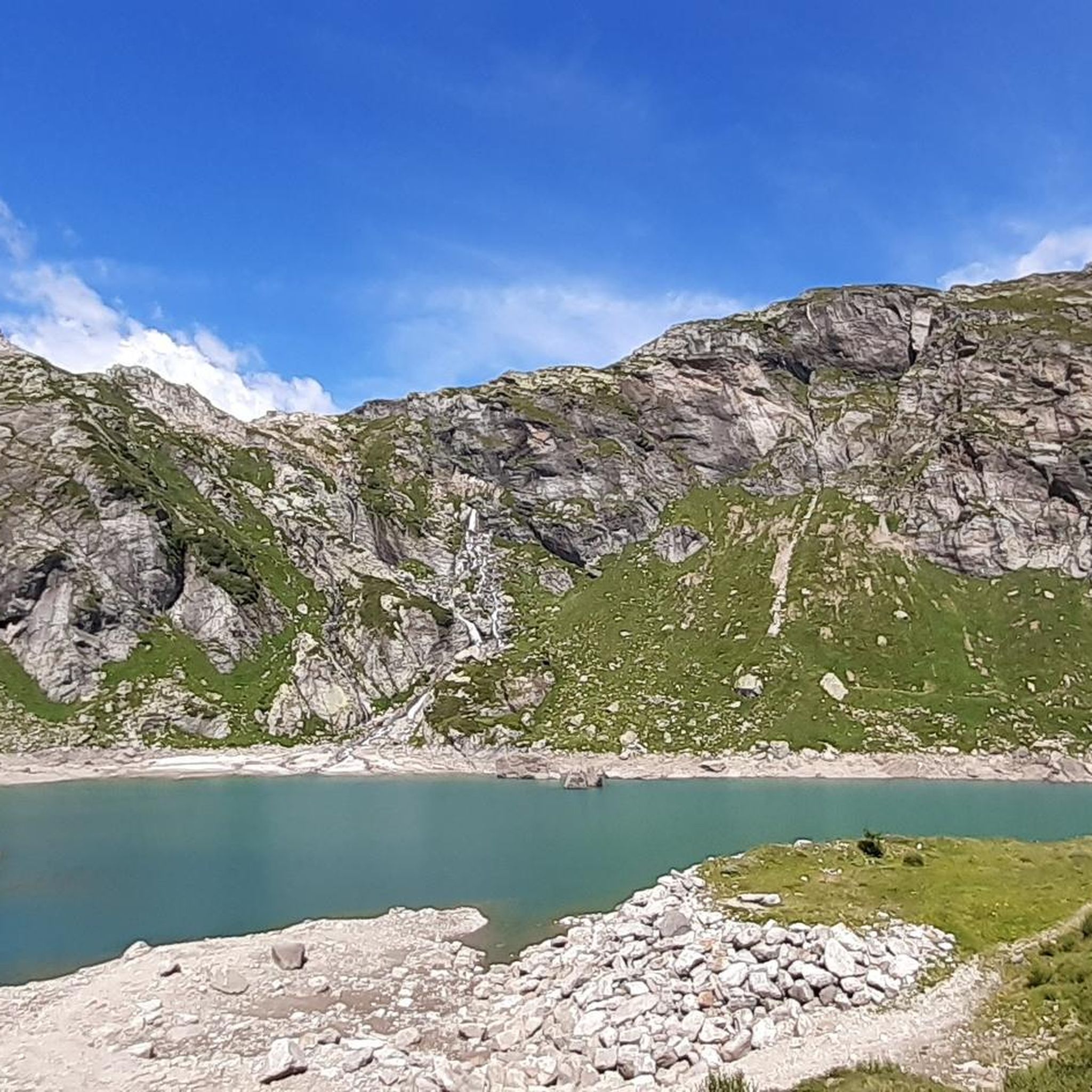
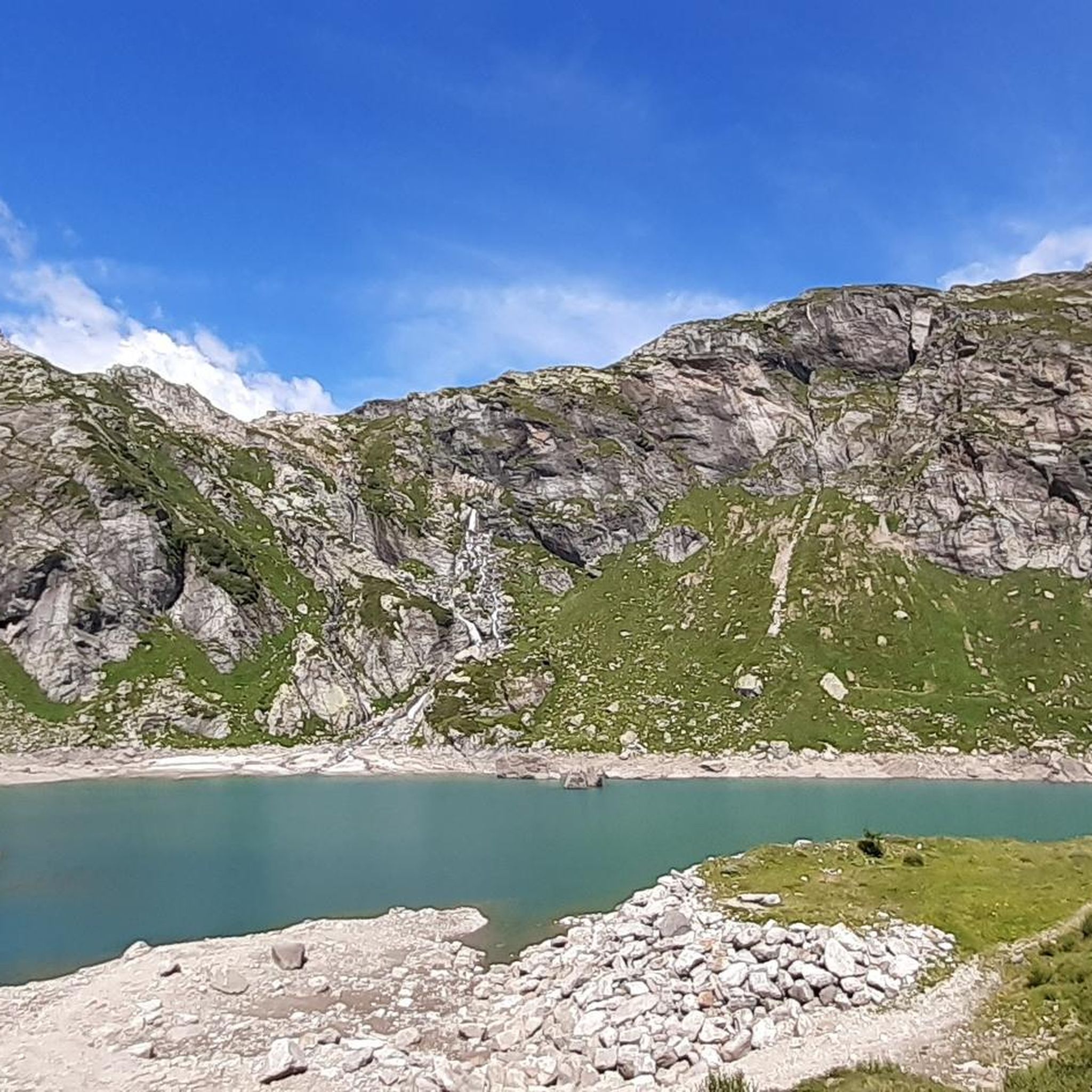
Road cycling around Lake del Zött, located at an elevation of 1,940 meters in Switzerland's Ticino canton, provides routes through impressive alpine landscapes within the Lepontine Alps and Bavona Valley. The region is characterized by rugged mountains, glacier-carved plateaus, and interconnected lakes, offering diverse terrain for road cyclists. Routes feature significant elevation gains and varied surfaces, from mostly paved roads to challenging unpaved segments.
Best road cycling routes around Lake del Zött
- The most popular road cycling route is Foroglio…
Last updated: July 18, 2026
4.5
(2)
29
riders
20.4km
01:09
460m
460m
Moderate road ride. Good fitness required. Some segments of this route may be unpaved and difficult to ride.
24
riders
60.4km
03:43
1,660m
1,660m
Hard road ride. Very good fitness required. Mostly well-paved surfaces and easy to ride.

Sign up for free
38
riders
40.3km
03:04
1,680m
1,680m
Hard road ride. Very good fitness required. Mostly well-paved surfaces and easy to ride.
22
riders
23.8km
01:45
940m
940m
Hard road ride. Very good fitness required. Mostly well-paved surfaces and easy to ride.
4.0
(2)
14
riders
39.7km
02:18
920m
920m
Hard road ride. Very good fitness required. Mostly well-paved surfaces and easy to ride.
Get access to more routes and recommendations from other explorers.
Sign up for free
Already have an account?
Our route recommendations are based on thousands of hikes, rides, and runs completed by other people on komoot.
Start today with a free account
Your next adventure awaits.
Login or Signup
Tips from the Community

The Tremola San Gottardo is your accommodation at the foot of the Tremola in Airolo. The house on the old Gotthard Pass road is perfectly located at the beginning of what is probably the most bike-romantic alpine road in Ticino (or Switzerland?). Cycling enthusiasts will find a workshop with small parts and spares, a locked bike storage room, an information point offering maps and bikes for rent, as well as a laundry service for sportswear and a charging station for e-bikes at Bed&Bike. After your bike tour, you can refresh yourself with a drink at the bar or enjoy one of the simple dishes made with local ingredients. More info: https://www.bellinzonaevalli.ch/de/hotels/details/Bed-Bike-Tremola-San-Gottardo/110242.html.
0
0

Village with magnificent views of the Gotthard Massif
0
0

At 2,478 meters above sea level, the Nufenen Pass (Nufenenpass in German) connects the Goms Valley in the upper Valais with the Bedretto Valley in the upper Ticino. From Airolo, the climb is approximately 22 kilometers (average gradient 5.6%), while from Ulrichen it is shorter but more challenging: 14 kilometers at an average gradient of approximately 7.9%.
0
0

A municipality of about 1,500 inhabitants in the Canton of Ticino, Airolo is located at the foot of the Gotthard Pass. It is well-known among cyclists as the starting point of the famous Tremola panoramic road.
0
0


Old Walser village with museum and original Walser houses to visit.
0
0

If you're driving up from Cevio, Cerentino is a good first stop. After a few nasty climbs, you can decide which valley end you'd like to head to: Cimalmotto in the Valle di Campo or Bosco Gurin in the Valle di Bosco Gurin. Both valleys are beautiful!
0
0
Frequently Asked Questions
What are the typical difficulty levels for road cycling routes around Lake del Zött?
The road cycling routes in the Lake del Zött area cater to various fitness levels. While there are no easy routes, you'll find a mix of moderate and difficult options. Out of the 7 available routes, 2 are classified as moderate and 5 are difficult, often featuring significant elevation gains and challenging mountain passes.
Are there any family-friendly road cycling routes near Lake del Zött?
The road cycling routes directly around Lake del Zött are generally challenging, with moderate to difficult classifications and significant elevation changes. These are typically better suited for experienced cyclists. For family-friendly options, you might need to explore less demanding routes in the broader Ticino canton or consider other activities like hiking around the lake.
What kind of terrain and elevation can I expect on road cycling routes in this region?
Road cycling around Lake del Zött is characterized by impressive alpine landscapes and diverse terrain. You can expect rugged mountains, glacier-carved plateaus, and picturesque valleys like Val Bavona and Val Bedretto. Routes often feature significant elevation gains, with some segments potentially unpaved, though the majority are on paved roads.
What are some notable natural features or landmarks to see while cycling?
The region offers breathtaking panoramic views of the Swiss Alps. You can witness the majestic Basòdino glacier and explore other significant alpine lakes like Lago di Robièi and Lago dei Cavagnöö. Many routes pass through scenic valleys, such as the Val Bavona, where you can see the Foroglio Waterfall.
When is the best time of year for road cycling around Lake del Zött?
The best time to visit and road cycle around Lake del Zött is generally during the warmer months. This is when the alpine passes are clear of snow, and the aerial cableway to the reservoir area is operational, making access easier. Always check local weather and road conditions before planning your trip.
Are there any circular road cycling routes available?
Yes, several routes are designed as loops. For example, the Foroglio Waterfall – Sabbione loop from Val Bavona is a moderate 20.4 km route. Another option is the more challenging Foroglio Waterfall – Bosco Gurin Village loop from Val Bavona, which covers 60.4 km with substantial elevation gain.
What do other road cyclists think about the routes in Lake del Zött?
The road cycling routes in Lake del Zött are highly rated by the komoot community, with an average score of 4.5 stars from over 10 reviews. Cyclists often praise the stunning alpine scenery, the challenge of the mountain passes, and the picturesque valleys.
How can I access the Lake del Zött area, especially with a bike?
Access to the Lake del Zött area typically involves a scenic journey through the Maggia Valley to Bignasco, then to San Carlo in the Bavona Valley. From San Carlo, an aerial cableway ascends directly to the reservoir area. It's advisable to check the cableway's operating schedule and bike transport policies in advance.
Are there any routes that offer views of glaciers or high mountain passes?
Absolutely. The region is known for its impressive alpine vistas. The View of Gries Glacier – View of Nufenen Pass loop from Val Bedretto is a difficult 23.7 km route that provides stunning views of both the Gries Glacier and the Nufenen Pass. Another route, Descent Towards Ulrichen – View of Nufenen Pass loop from Val Bedretto, also offers views of the Nufenen Pass.
Are there places to eat or stay near the road cycling routes?
While Lake del Zött itself is a high-alpine reservoir, the surrounding areas, particularly in the Bavona Valley and near San Carlo, offer options for cafes, pubs, and accommodation. The Robiei area, accessible by cableway, also has facilities. It's recommended to check for specific establishments and their operating hours, especially during the cycling season.
What is the longest road cycling route available in the area?
The longest road cycling route listed is the Foroglio Waterfall – Bosco Gurin Village loop from Val Bavona. This difficult route spans 60.4 km (37.6 miles) and features significant elevation gain, making it a substantial challenge for experienced cyclists.
Most popular routes around Lake del Zött

Get inspired with the komoot mobile app


Explore more
Browse the best Road cycling routes in other regions.
