The best MTB trails around Lake Lucendro
4.7
(331)
3,612
riders
41
rides
Mountain biking around Lake Lucendro offers a diverse range of trails set within the high alpine landscape of the Swiss Alps. The region is characterized by challenging mountain passes, high-altitude lakes, and historic roads, providing varied terrain for mountain bikers. Trails often feature significant elevation changes, traversing rocky paths and open alpine meadows. This area provides a robust network of routes suitable for experienced riders seeking demanding climbs and descents.
Best mountain bike trails around Lake Lucendro
- The most popular…
Last updated: June 24, 2026
5.0
(2)
15
riders
12.4km
01:18
420m
420m
Moderate mountain bike ride. Good fitness required. Suitable for all skill levels.
4.5
(10)
76
riders
59.6km
07:11
2,170m
2,170m
Hard mountain bike ride. Very good fitness required. Advanced riding skills necessary. Some portions of the route may require you to push your bike.

Sign up for free
4.6
(13)
80
riders
18.7km
01:10
130m
130m
Easy mountain bike ride. Great for any fitness level. Suitable for all skill levels.
5.0
(2)
44
riders
45.0km
05:16
1,900m
1,900m
Hard mountain bike ride. Very good fitness required. Advanced riding skills necessary. Some portions of the route may require you to push your bike.
4.2
(5)
41
riders
50.4km
04:45
1,340m
1,340m
Hard mountain bike ride. Very good fitness required. Advanced riding skills necessary. Some portions of the route may require you to push your bike.
Get access to more routes and recommendations from other explorers.
Sign up for free
Already have an account?
Our route recommendations are based on thousands of hikes, rides, and runs completed by other people on komoot.
Start today with a free account
Your next adventure awaits.
Login or Signup


Tips from the Community

On the Obergoms side of the Nufenen Pass, the road winds its way up and down the slope over ten hairpin bends. From the second-to-last bend before the pass, a gravel road leads across to the Griessee reservoir. From here you can enjoy a last view of the valley before dropping into the S2 trail. This zigzags down a mountain ridge quite steeply, requiring maximum concentration, good skills, and a focus on the front wheel!
1
0

pretty here, very pretty
2
0

The view from the top is worth the effort to reach it.
0
0

The name Goms for the upper Rhone Valley comes from the Latin concha = shell, because the valley is shell-shaped (due to the glaciers of the Ice Age).
0
0

Insight: Andermatt Trilogy. The Tame One. Vorder Seeplangg. Andermatt, Switzerland, Uri. https://youtu.be/cAKV9pObeJQ
1
0

This stone man is very beautiful, which you can see when you cycle from the Schöllenen Gorge to Andermatt
1
0
very idyllic view, the smallest village in Switzerland on the Furkastrasse
1
0
beautiful the path the landscape, simply a dream
1
0
Frequently Asked Questions
How many mountain bike trails are available around Lake Lucendro?
There are over 40 mountain bike trails around Lake Lucendro, offering a wide range of options for different skill levels and preferences. The region is known for its high alpine landscape, challenging passes, and scenic routes.
What is the typical difficulty of mountain bike trails in the Lake Lucendro area?
The mountain bike trails around Lake Lucendro are predominantly challenging, with 30 out of 42 routes rated as difficult. There are also 11 moderate trails and 1 easy route available, ensuring options for various experience levels. Expect significant elevation changes and varied terrain.
Are there any family-friendly mountain bike trails around Lake Lucendro?
While many trails are challenging, there is at least one easy route suitable for less experienced riders or families. The Andermatt–Hospental Cycle Path – Kapelle Lieg loop from Realp is an easy 18.7 km trail with minimal elevation gain, offering a more relaxed experience.
When is the best time of year to go mountain biking around Lake Lucendro?
The best time for mountain biking around Lake Lucendro is typically during the summer months, from late June to September. This period offers the most favorable weather conditions, with less snow at higher elevations and generally stable temperatures for exploring the alpine terrain.
What are the typical lengths and durations of mountain bike trails in this region?
Trail lengths vary significantly. Shorter routes like Lake Sella from the St. Gotthard Pass are around 12.4 km and take about 1 hour 18 minutes. Longer, more demanding routes, such as the Kapelle Lieg – Urschner High Trail loop from Realp DFB, can be up to 59.6 km and take over 7 hours to complete.
Are there any loop mountain bike trails around Lake Lucendro?
Yes, many trails in the area are designed as loops. For example, the Guex Monument at Gotthard Pass – View of the Tremola Road loop from Passo del San Gottardo is a difficult 11.2 km loop that explores the historic Tremola Road. Another option is the View of Val Maighels – Lake Oberalp loop from Realp, a challenging 50.4 km route.
What kind of views or viewpoints can I expect on the mountain bike routes?
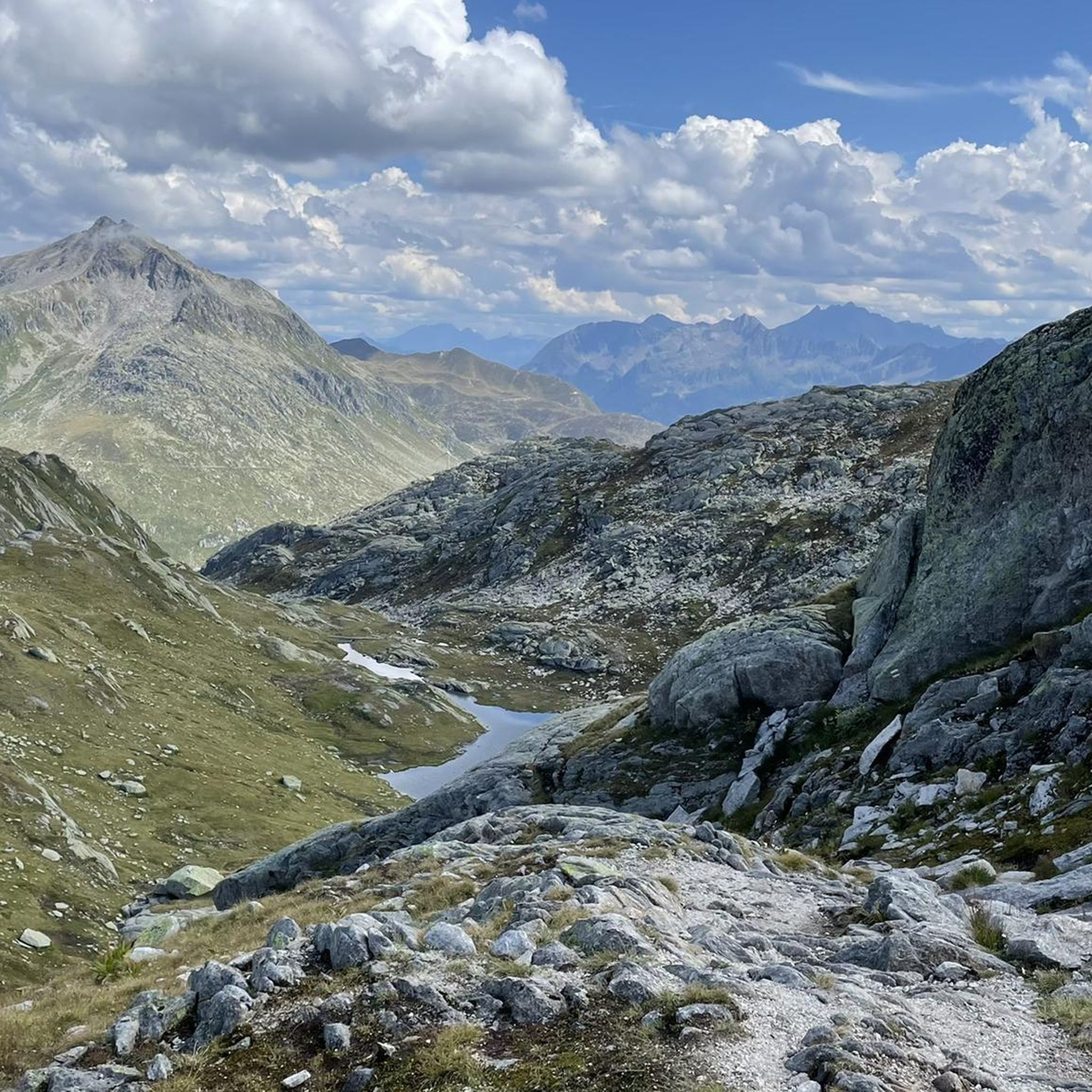
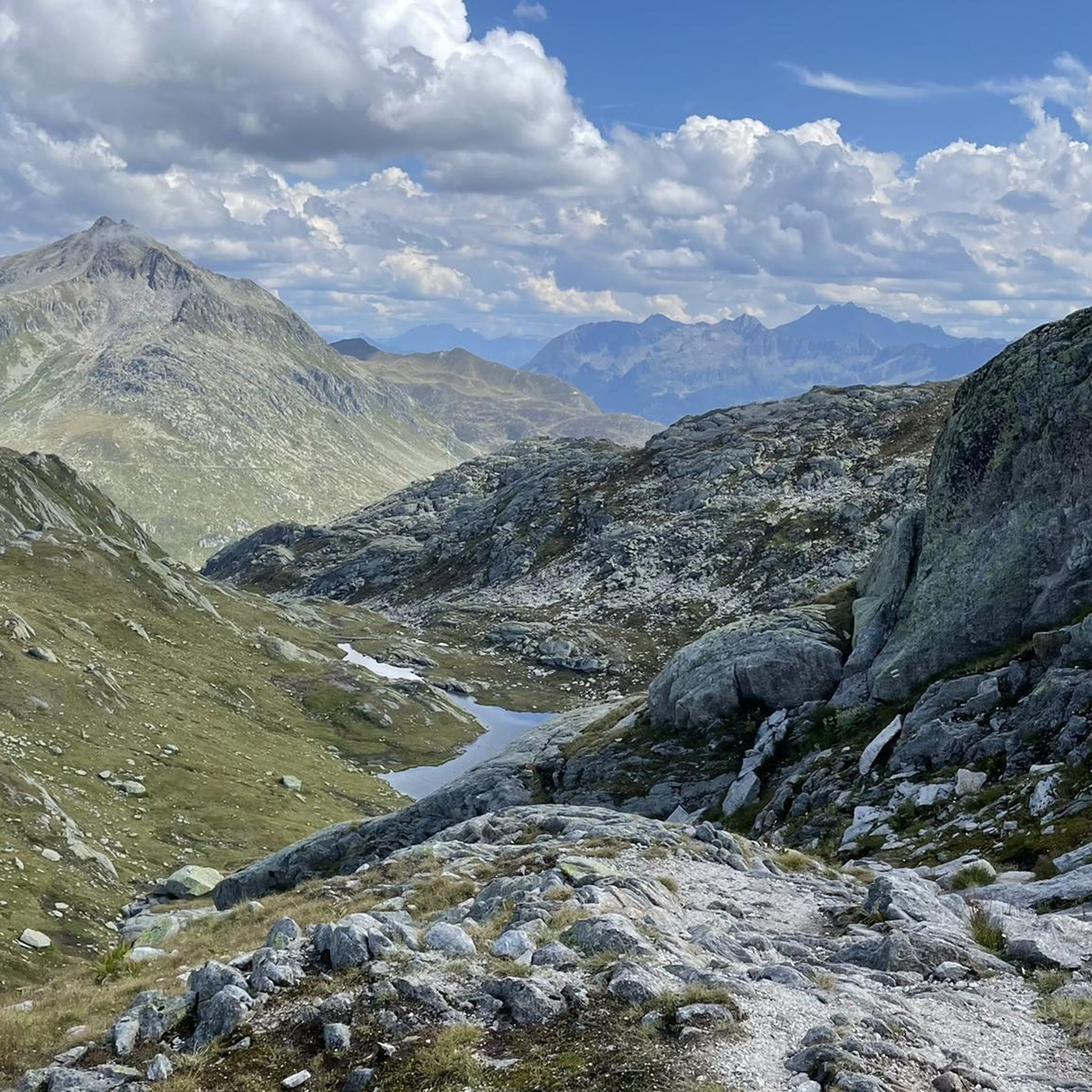
The routes around Lake Lucendro offer spectacular high alpine views. You can expect panoramic vistas of mountain passes, pristine mountain lakes like Lake Sella and Lake Oberalp, and historic features such as the Tremola Road. Many trails traverse open alpine meadows, providing expansive scenery.
What do other mountain bikers enjoy most about mountain biking in Lake Lucendro?
The area is highly rated by the komoot community, with an average score of 4.7 stars from over 300 reviews. Riders often praise the challenging nature of the trails, the stunning high alpine scenery, and the diverse terrain that includes rocky paths and historic roads.
Are there options for advanced mountain bikers seeking a challenge?
Absolutely. The Lake Lucendro region is ideal for advanced mountain bikers, with 30 out of 42 routes classified as difficult. These trails feature significant elevation gains, technical descents, and long distances, such as the 50.4 km View of Val Maighels – Lake Oberalp loop from Realp, which includes over 1300 meters of climbing.
Can I reach the mountain bike trailheads around Lake Lucendro using public transport?
Many trailheads in the region, particularly those starting from villages like Realp or near the Gotthard Pass, are accessible by public transport. Swiss public transport is generally excellent, with train and bus services connecting to many alpine areas, though some remote starting points might require a short ride or walk.
Are there any facilities like cafes or restaurants near the mountain bike trails?
While the high alpine environment means facilities are not as frequent as in lower valleys, you can often find cafes or restaurants in villages like Realp or near major passes like the Gotthard Pass. It's always advisable to carry sufficient water and snacks, especially on longer routes, as services can be sparse between settlements.
Most popular routes around Lake Lucendro

Get inspired with the komoot mobile app


Explore more
Browse the best MTB trails in other regions.
