The best running trails around Ballykeel
315
runners
30
runs
Jogging routes around Ballykeel offer a diverse range of landscapes, from tranquil country lanes to challenging mountain trails, primarily within the scenic Ring of Gullion. The region features varied terrain suitable for different fitness levels, including routes around lakes, through historic areas, and up hills. These running routes provide opportunities to explore natural features and cultural landmarks, making Ballykeel a compelling destination for outdoor activity.
Best jogging routes around Ballykeel
- The most popular jogging route is The Poets Trails: Ballykeel…
Last updated: November 15, 2026
58
runners
10.5km
01:08
130m
130m
Lace up for the Camlough Lake running loop, a scenic and moderately challenging jog through Northern Ireland's Ring of Gullion Area of Outstanding Natural Beauty. This popular route circles the…
21
runners
13.6km
01:44
450m
450m
2
runners
10.9km
01:22
330m
330m
Hard run. Very good fitness required. Mostly paved surfaces.
1
runners
10.9km
01:13
160m
160m
1
runners
13.0km
01:23
160m
160m
Moderate run. Good fitness required. Mostly paved surfaces.
Get access to more routes and recommendations from other explorers.
Already have an account?
Our route recommendations are based on thousands of hikes, rides, and runs completed by other people on komoot.
Tips from the Community

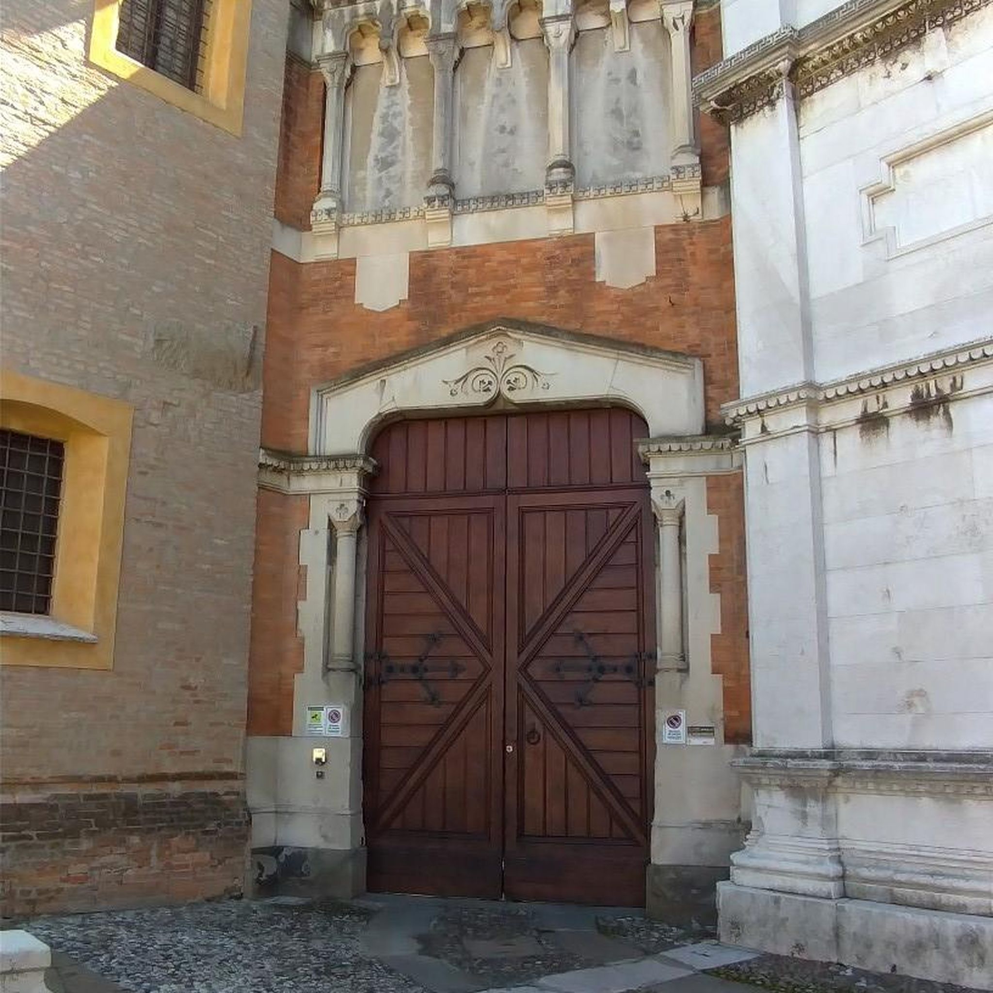
Two joined medieval churches under Slieve Gullion. On our Ring Dyke climbing loop: cyclesoutharmagh.com/routes/the-ring-dyke
0
0
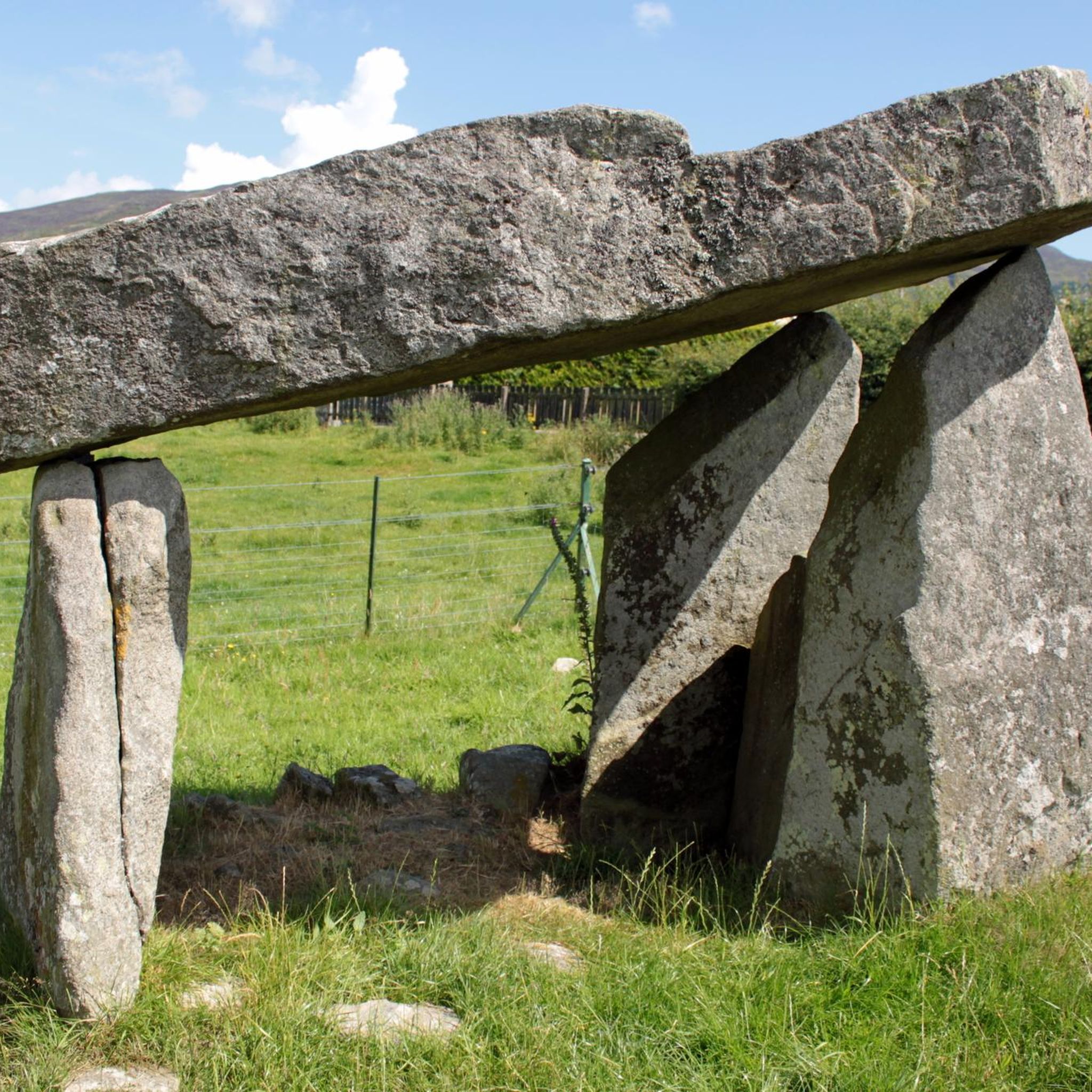
A Neolithic portal tomb, its huge capstone balanced on three stones at the end of a long cairn. A short spur off the road on our Poets' Trail and Ring Dyke rides: cyclesoutharmagh.com/routes/the-poets-trail
0
0

The Ballykeel Dolmen, also known as the "Witch's Chair", stands alone on the edge of a green river terrace and invites you to take a look back into the past. With its three supporting stones and the imposing capstone, over three metres long, the dolmen looks like a stone sculpture left behind by a long-forgotten culture. The simple but distinctive tripod shape is a testament to the archaic construction that attracted people to this place over 4000 years ago. Excavations around the dolmen have uncovered the remains of a stone mound and Neolithic pottery that tell of the rites and customs of this early community. When you stand among the stones, you feel the mystique of the place - a place that inspires the imagination then and now. Nearby you will find other megalithic structures such as the Portal Tomb of Aughadanove, which together reflect the rich archaeological heritage of the region.
1
0
Camlough Lake is a peaceful place where time seems to pass more slowly. As you stroll along the path, the sparkling water stretches out before you, framed by rolling hills and the shade of the surrounding forests. A few curious goats watch you from a meadow, their gaze almost as interested as yours as you enjoy the view. There is not only nature to experience here, but also small amenities - a car park and a picnic area invite you to take a break. The view of the lake, which once served as a reservoir, is a wonderful way to relax. The lake is also a popular destination for anglers who wait patiently for their catch here. A walk around Camlough Lake is a welcome break that simply does you good.
1
0
Gordon's Lane, just a stone's throw south of Camlough, invites you to a quiet journey of discovery. The narrow lane winds gently through the hills and takes you right into the green of the fields. Old stone walls and thorny hedges line the path on either side, while behind every bend you catch a new view of the valley. From up here, Camlough seems almost like a silent model, spreading out in the distance while nature maintains its own rhythm. The path leads you past pastures and you notice how the noise of everyday life quietly fades away. Especially after a rain shower, the asphalt sparkles and the fresh scent of grass is in the air - a little adventure off the beaten track.
1
0


To be able to see the Ballykeel dolmen, you'll need to take a small detour from Mill Road onto Ballykeel Road. Here, you can view the Ballykeel dolmen and cairn, which is dated between 4000 and 2500 BC
0
0
This section of Lough Road crosses the Cloverhill Golf Course, which you can catch glimpses of at certain points above the side bushes, with Slieve Gullion in the background.
0
0
Frequently Asked Questions
How many running routes are available around Ballykeel?
There are over 30 dedicated running routes around Ballykeel, catering to various fitness levels. These include easy, moderate, and difficult trails, with the majority being moderate.
Are there any easy or beginner-friendly jogging routes in the Ballykeel area?
Yes, while many routes are moderate, there are options suitable for beginners. For instance, the region offers tranquil country lanes and well-maintained parkland trails, such as those found in Redburn Country Park, which provide a gentler experience. Look for routes marked as 'easy' on komoot.
What kind of scenery can I expect on the jogging trails around Ballykeel?
The Ballykeel area boasts diverse scenery for runners. You can experience tranquil country lanes, scenic lake views like those on the Camlough Lake running loop, and challenging mountainous terrain on routes such as the Slieve Gullion running loop. The broader region also features coastal paths, wooded parklands, and historic sites.
Are there any running routes that pass by historical landmarks or points of interest?
Absolutely! The The Poets Trails: Ballykeel running loop follows quiet country lanes, passing cultural points of interest like the birthplace of poet Art Bennett and the Mullach Ban Folk Museum. Additionally, the The Giant's Lair & Killeavy Castle route takes you past the enchanting Giant's Lair.
Can I find circular running routes in Ballykeel?
Yes, many of the running routes in the Ballykeel area are circular, offering convenient starting and ending points. Examples include the Camlough Lake running loop and the Camlough Mountain loop, both within the scenic Ring of Gullion.
What are some notable natural attractions to see while running in Ballykeel?
Runners can enjoy several natural attractions. The Camlough Lake is a prominent feature, offering scenic views. For those seeking more challenging terrain, the Slieve Gullion Summit provides breathtaking vistas. The broader region also includes the dramatic Gobbins Cliff Path and the Murlough Nature Reserve with its unique sand dunes.
Are the jogging routes around Ballykeel suitable for families?
Many routes are suitable for families, especially those on quieter country lanes or within well-maintained parks like Redburn Country Park. The The Giant's Lair & Killeavy Castle route is particularly family-friendly, offering an engaging experience with its mythical-themed attractions.
Are dogs allowed on the running trails in the Ballykeel area?
While specific regulations can vary by location, many outdoor trails in the Ballykeel region, especially those in forest parks and country lanes, are generally dog-friendly. It's always recommended to keep dogs on a leash and check local signage for any specific restrictions in nature reserves or private lands.
What is the typical length and duration of running routes in Ballykeel?
Running routes in Ballykeel vary significantly in length and duration. You can find shorter routes like The Giant's Lair & Killeavy Castle at around 4.1 km (2.5 miles) taking about 30 minutes, to longer, more challenging trails such as the Slieve Gullion running loop, which is 13.6 km (8.5 miles) and can take over 1 hour 40 minutes.
Are there any facilities like cafes or pubs near the running routes in Ballykeel?
The Ballykeel area and its surrounding towns offer various amenities. While specific routes might not have facilities directly on the trail, you can often find cafes, pubs, and accommodation in nearby villages and towns, especially around popular starting points or attractions like Carrickfergus Castle or Hillsborough.
What do other runners say about the jogging experience in Ballykeel?
Over 280 runners have used komoot to explore Ballykeel's varied terrain. They often praise the diverse landscapes, from tranquil country lanes to challenging mountain trails, and the opportunities to combine physical activity with exploring natural features and cultural landmarks.
Are there any challenging mountain running routes in the region?
Yes, for those seeking a challenge, Ballykeel offers several mountain running routes. The Slieve Gullion running loop and the Camlough Mountain loop are both classified as difficult, featuring significant elevation gains and mountainous terrain within the Ring of Gullion.
Most popular routes around Ballykeel
Most popular attractions around Ballykeel
Get inspired with the komoot mobile app


Explore more
Browse the best Running Trails & Routes in other regions.