The best road cycling routes around Embalse de Orellana
71
riders
11
rides
Road cycling routes around Embalse de Orellana traverse a diverse landscape characterized by a vast man-made reservoir, often called Extremadura's "inland sea." The region features varied terrains, from well-paved surfaces winding through dehesas and woodlands to routes offering views of the Sierra de Pela's rugged quartzite cliffs. Cyclists can expect a mix of flat sections along the reservoir's "Costa Dulce" and challenging climbs into the surrounding hills. This area, situated on the Guadiana River, provides a rich tapestry of scenery…
Last updated: June 29, 2026
25
riders
71.9km
03:34
830m
840m
Moderate road ride. Good fitness required. Some segments of this route may be unpaved and difficult to ride.
120km
05:43
1,430m
1,430m
Hard road ride. Very good fitness required. Some segments of this route may be unpaved and difficult to ride.

Sign up for free
18
riders
106km
04:55
1,200m
1,200m
Hard road ride. Very good fitness required. Mostly well-paved surfaces and easy to ride.
7
riders
Moderate road ride. Good fitness required. Some segments of this route may be unpaved and difficult to ride.
12
riders
18.5km
00:49
160m
160m
Moderate road ride. Great for any fitness level. Some segments of this route may be unpaved and difficult to ride.
Get access to more routes and recommendations from other explorers.
Sign up for free
Already have an account?
Our route recommendations are based on thousands of hikes, rides, and runs completed by other people on komoot.
Start today with a free account
Your next adventure awaits.
Login or Signup
Popular around Embalse de Orellana
Tips from the Community

The best views in the La Siberia Extremeña region
0
0

The castle sits atop a hill in Puebla de Alcocer (Badajoz, Extremadura), approximately 550 meters above sea level. Its origins date back to the 12th and 13th centuries, possibly built upon the site of an earlier Mudéjar fortress. It was remodeled in 1445 after being donated to Don Gutierre de Sotomayor, Master of the Order of Alcántara, by King John II of Castile. At the end of the 15th century, it passed to Doña Elvira de Zúñiga, as reflected in the coat of arms on the keep.
2
0
Villanueva de la Serena (Badajoz, Extremadura) is a dynamic city with much to offer in terms of both history and leisure. Heritage and Culture Plaza de España: the city's central square, with historic buildings and a lively atmosphere. Church of the Assumption: an 18th-century Baroque church, one of the most representative in the area. Ethnographic Museum: showcases traditional life and local history. Las Vegas Theatre: a cultural venue with a diverse program.
3
0
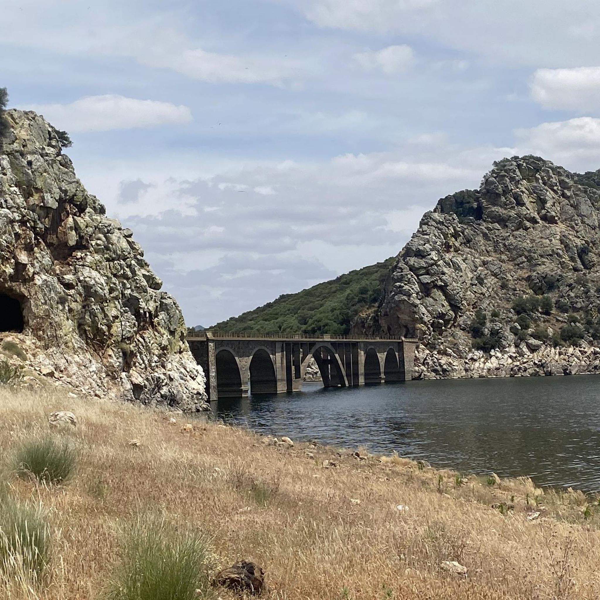
The García de Sola Reservoir, also known as Puerto Peña, is located on the Guadiana River, in the La Siberia Extremeña region (Badajoz). It was built in 1962 as part of the Badajoz Plan and has a capacity of 554 hm³. It is an emblematic site for its natural, scenic, and recreational value.
5
0
Cerro Masatrigo is a hill located in the municipality of Esparragosa de Lares. This hill is known for its almost perfect conical shape, which has earned it the nickname "the magic mountain." It rises 501 meters above sea level and 161 meters above the surrounding terrain. After the construction of the La Serena Dam, Cerro Masatrigo became a peninsula surrounded by the waters of the reservoir.
1
0
Cerro Masatrigo is a hill located in the municipality of Esparragosa de Lares. This hill is known for its almost perfect conical shape, which has earned it the nickname "the magic mountain." It rises 501 meters above sea level and 161 meters above the surrounding terrain. After the construction of the La Serena Dam, Cerro Masatrigo became a peninsula surrounded by the waters of the reservoir.
6
0

This spectacular reservoir was built during the 1960s. The reflection of the sunsets in the water and the surrounding landscape make it a must-see if you're exploring the Guadiana Nature Trail.
0
1
The García de Sola Reservoir is an impressive work of engineering located in the Extremadura region, near Talarrubias, in the province of Badajoz. The reservoir is located in an environment of great beauty, surrounded by imposing rock formations and dense vegetation composed of Mediterranean forests, pine forests and eucalyptus trees. It is a place of great value for birdlife, with species such as the griffon vulture, black vulture, black stork, golden eagle and peregrine falcon.
5
0
Frequently Asked Questions
How many road cycling routes are available around Embalse de Orellana?
There are over 10 dedicated road cycling routes around Embalse de Orellana, offering a variety of distances and difficulty levels to explore the region's diverse landscapes.
What kind of terrain can I expect on road cycling routes in Embalse de Orellana?
The region offers a diverse range of terrains, from well-paved surfaces winding through Mediterranean dehesas and woodlands to routes that provide views of the rugged quartzite cliffs of the Sierra de Pela. You'll find a mix of flat sections along the reservoir's 'Costa Dulce' and challenging climbs into the surrounding hills.
Are there any challenging road cycling routes for experienced cyclists?
Yes, Embalse de Orellana features several challenging routes. For instance, the Orellana la Vieja and Castillo de Puebla de Alcocer Loop is a difficult 120 km trail that includes a significant climb to the Castle of Puebla de Alcocer, offering panoramic views. Another demanding option is the Orellana de la Sierra – Villanueva de la Serena loop from Navalvillar de Pela, a 106 km path mostly on well-paved surfaces.
What are some scenic viewpoints or landmarks I can see while cycling?
Many routes offer stunning views of the Embalse de Orellana, often referred to as Extremadura's 'inland sea.' You can cycle past the Playa de Orellana, Spain's first inland Blue Flag beach, or the impressive Orellana Dam. The climb to the Castle of Puebla de Alcocer also provides exceptional panoramic vistas over the reservoir and surrounding landscapes.
Are there any circular road cycling routes around the reservoirs?
Yes, there are excellent circular routes. The Surround the Garcia de Sola Reservoir — circular via Herrera del Duque is a popular 72 km trail that takes you through varied terrain around the reservoir. While not listed in the guide, the 'Rodeo embalse de orellana' is also known as a 103 km route that circles the Embalse de Orellana itself, offering continuous scenic views.
What is the best time of year for road cycling in Embalse de Orellana?
Spring and autumn generally offer the most pleasant temperatures for road cycling in Embalse de Orellana. During these seasons, the weather is ideal for exploring the extensive routes without the extreme heat of summer.
Are there any family-friendly road cycling options in the area?
While many routes cater to moderate to difficult levels, the 'Costa Dulce' Blue Trail, which guides visitors through cultural points, offers sections that could be suitable for families looking for less strenuous rides. The flat sections along the reservoir's edge also provide easier cycling opportunities.
Can I find cafes or pubs along the road cycling routes?
The towns and villages surrounding Embalse de Orellana, such as Orellana la Vieja, Puebla de Alcocer, and Herrera del Duque, offer various amenities including cafes and pubs where cyclists can refuel and rest. Planning your route to pass through these settlements will ensure access to refreshments.
What do other road cyclists enjoy most about cycling in Embalse de Orellana?
Road cyclists frequently praise the expansive reservoir views, the unique Mediterranean dehesas, and the rolling hills that define the region. The variety of routes, catering to different ability levels, is also a highlight, allowing many to explore the area's rich tapestry of scenery.
Are there any historical or cultural sites accessible by road bike?
Yes, cycling routes can incorporate cultural and historical elements. For example, the 'Costa Dulce' Blue Trail guides visitors through points of cultural interest like the Orellana Palace Castle and the Church of the Immaculate Conception. The area also features ancient historical sites in nearby towns, including the ruins of the Roman city of Lacimurga.
Where can I park my car to start a road cycling route?
Parking is generally available in the towns and villages around Embalse de Orellana, such as Orellana la Vieja, Puebla de Alcocer, and Navalvillar de Pela, which serve as common starting points for many routes. Look for designated parking areas within these communities.
Most popular attractions around Embalse de Orellana

Get inspired with the komoot mobile app


Explore more
Browse the best Road cycling routes in other regions.
