The best road cycling routes around Garvagh
30
riders
2
rides
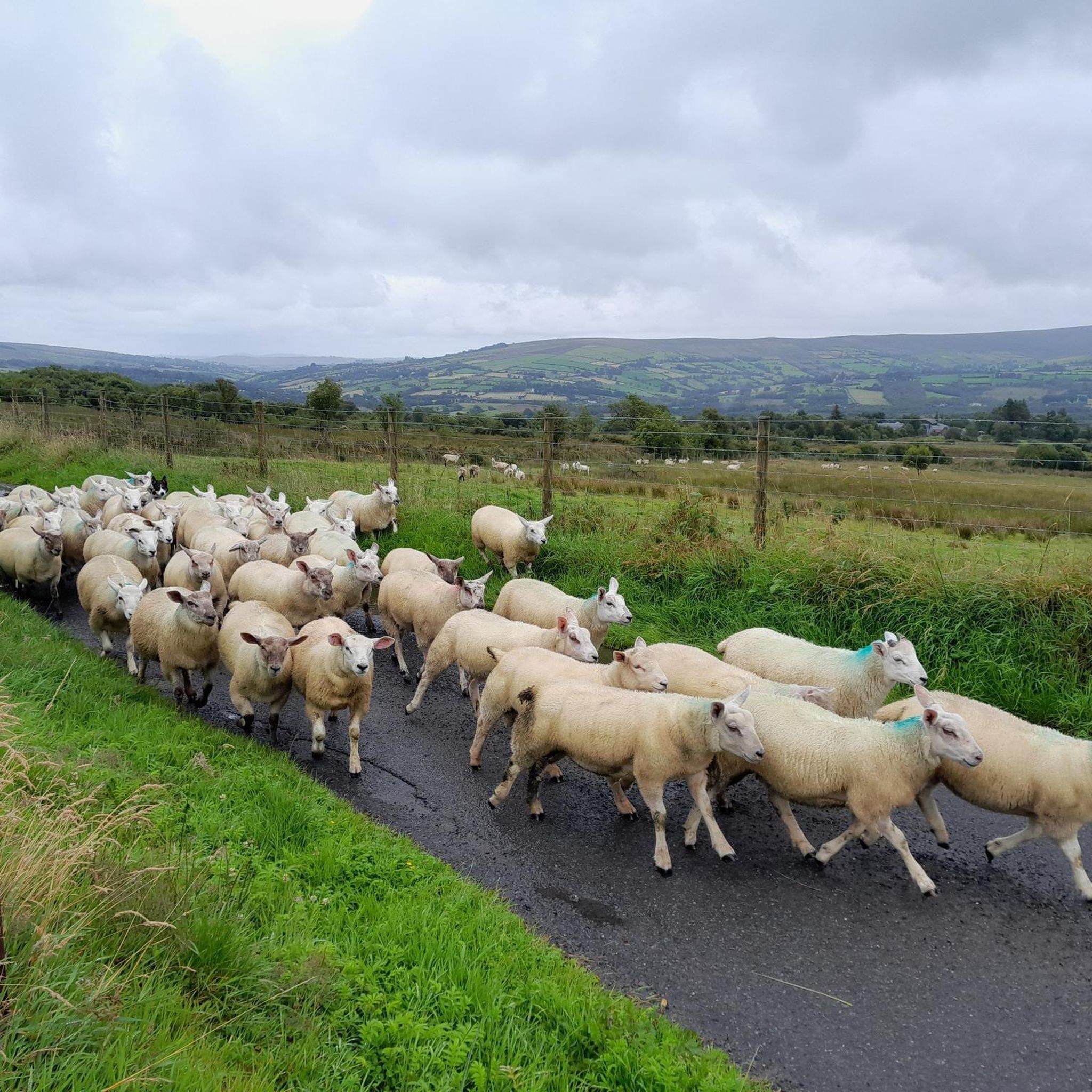
Road cycling routes around Garvagh traverse the tranquil Bann Valley, characterized by its lush countryside and scenic rural views. The area features diverse landscapes, including the extensive Garvagh Forest with its network of paths and forest roads. Riders can expect varied terrain, with routes often following the course of local waterways like the Agivey River. This region offers a mix of well-paved surfaces and undulating roads suitable for road cycling.
Best road cycling routes around Garvagh
- The most popular road…
Last updated: October 17, 2026
11
riders
54.6km
02:27
500m
500m
Moderate road ride. Good fitness required. Mostly well-paved surfaces and easy to ride.
4
riders
93.7km
04:07
640m
640m
Moderate road ride. Good fitness required. Mostly well-paved surfaces and easy to ride.

7
riders
116km
05:06
870m
870m
Hard road ride. Very good fitness required. Some segments of this route may be unpaved and difficult to ride.
4
riders
56.3km
02:48
800m
800m
Moderate road ride. Good fitness required. Mostly well-paved surfaces and easy to ride.
4
riders
85.7km
04:05
1,020m
1,020m
Hard road ride. Very good fitness required. Some segments of this route may be unpaved and difficult to ride.
Our route recommendations are based on thousands of hikes, rides, and runs completed by other people on komoot.
Start today with a free account
Your next adventure awaits.


Tips from the Community

Small, cozy coffeeshop in the center of Beltrim, housed in an old bank building. Known as a quiet stopover for cyclists in the Sperrin region, with good coffee, cakes, and a friendly atmosphere. Located close to the river, it forms a logical break point on routes between Omagh, Gortin, and the Sperrins hills.
8
0

Gortin is a great place to begin and end a run. You could visit The Auld Bank Coffee Shop for delicious breakfast, lunch, coffee and snacks, or, if it's a cold pint a pub lunch you'd prefer, you could check out Mossey's Bar.
1
0
Gortin is a pleasant town situated in the heart of the Sperrins in County Tyrone. The town is nearby to a number of wonderful walks including Gortin Glen Forest Park, Mullaghcarn & Craignamaddy. There are also a few pubs in the town, such as Mossey's Bar and O'Neills.
1
0
Learmount Wood is located at the foothills of the northern face of the Sperrins in Northern Ireland. The forest features a wonderful diversity of tree species, including some that have been there for over 100 years. It's a beautiful place for a stroll, featuring a stream and an abandoned mansion dating back to the 1830s.
1
0

Omagh is the county town of County Tyrone which plays host to a number of festivals and events throughout the year. A market town, there are plenty of places to stop to eat or drink and you can't fail to notice the twin spires of Sacred Heart Church.
2
0
Part of the Sawel Cycle Route, Corramore Road boasts fine views over the Glenelly Valley. A patchwork of fields and rolling hills stretch out beneath you.
0
0
With Barnes Top and Knockanbane Mountain to the east and Sawel Mountain to the south east, Sperrins Road carves through the landscape with cracking views all around. There is some descent climbing to get here but it's worth it.
0
0
Gortin Glen Forest Park is full of good trails and beautiful trees. There is a 5 mile scenic forest drive which is signposted and takes in all of the best views. With waterfalls, resident sika deer and a cafe at the centre of the park it makes an ideal detour from the road.
2
1
Frequently Asked Questions
How many road cycling routes are available around Garvagh?
Komoot features several road cycling routes around Garvagh, catering to various skill levels. Our guide highlights 9 of the most beautiful routes, ranging from moderate to difficult, allowing you to explore the diverse landscapes of the Bann Valley and surrounding areas.
What kind of terrain can I expect on road cycling routes near Garvagh?
Road cycling routes around Garvagh primarily traverse the tranquil Bann Valley, offering lush countryside and scenic rural views. You'll find a mix of well-paved surfaces and undulating roads, often following waterways like the Agivey River. The area includes diverse landscapes, from open fields to sections near the extensive Garvagh Forest.
Are there any challenging road cycling routes in the Garvagh area?
Yes, for cyclists seeking a challenge, Garvagh offers routes with significant elevation changes. For instance, the Ballysaggart Lough – Parkanaur House loop from Mountfield is a difficult 73.3-mile (117.9 km) path featuring over 3,011 feet (918 meters) of ascent. Another demanding option is the Gortin Town Centre – Learmount Wood loop from Gortin, which covers 85.7 km with over 1,000 meters of climbing.
Are there any moderate road cycling routes suitable for intermediate riders?
Absolutely. Intermediate riders will find several suitable options. The Gortin – Gortin Town Centre loop from Mountfield is a popular moderate route, spanning 33.9 miles (54.6 km) with over 1,641 feet (500 meters) of elevation gain. Another great choice is the Goles Stone Row loop from Glenelly, a 33.2-mile (53.4 km) trail with over 2,382 feet (726 meters) of climbing.
What are some scenic viewpoints or landmarks I can see while cycling around Garvagh?
The Garvagh area offers several points of interest. While cycling, you might encounter natural features like the tranquil Agivey River or the unique Garvagh Lough. For specific viewpoints, consider routes that pass near Mullaghcarn Summit or Mullaghcarn Viewpoint. The Gortin Town Centre – Fairy Trail in Sperrins AONB loop from Mountfield offers a scenic journey through the Sperrins Area of Outstanding Natural Beauty.
Is Garvagh Forest suitable for road cycling?
While Garvagh Forest is known for its dedicated cycling trails, including mountain bike routes and a skills course, the surrounding area offers numerous road cycling routes that often skirt the forest's edges or traverse the broader Bann Valley. The forest itself has a network of paths and forest roads, but for pure road cycling, the well-paved surfaces outside the forest are generally preferred.
Are there any loop trails for road cycling near Garvagh?
Yes, many of the road cycling routes around Garvagh are designed as loops, allowing you to start and finish at the same point. Examples include the Gortin – Gortin Town Centre loop from Mountfield and the Ballysaggart Lough – Parkanaur House loop from Mountfield, providing convenient circular journeys.
What is the best time of year for road cycling in Garvagh?
The best time for road cycling in Garvagh is generally during the spring, summer, and early autumn months. These seasons offer more favorable weather conditions, with spring bringing vibrant displays of bluebells in areas like Garvagh Forest. While winter cycling is possible, be prepared for colder temperatures and potentially wet conditions.
Are there options for food and drink stops along road cycling routes in Garvagh?
Garvagh village itself offers amenities like cafes and pubs where you can refuel. While specific routes may not have cafes directly on the path, planning your ride to pass through Garvagh or other nearby villages will provide opportunities for refreshment stops.
Where can I find parking for road cycling routes around Garvagh?
Parking is typically available in Garvagh village or at designated car parks near popular starting points for routes. For example, if you're exploring routes that venture into the Garvagh Forest area, there are facilities there. Always check local signage for parking regulations and availability.
What makes the Garvagh area unique for road cycling?
Garvagh's unique appeal for road cycling lies in its combination of the tranquil Bann Valley's lush countryside, the extensive Garvagh Forest, and the presence of scenic rivers like the Agivey. The varied terrain, from gentle rural roads to challenging climbs, offers a diverse experience, complemented by historical curiosities like the Garvagh Pyramid.
Most popular routes around Garvagh
Most popular attractions around Garvagh

Get inspired with the komoot mobile app


Explore more
Browse the best Road cycling routes in other regions.
