The best road cycling routes around Embalse Rosarito
5.0
(1)
273
riders
18
rides
Road cycling routes around Embalse Rosarito are situated in a region characterized by the Tiétar River valley and the foothills of the Sierra de Gredos mountain range in Spain. The landscape features a mix of riverine paths and ascents into the surrounding hills. Road cyclists can expect varied terrain, from flatter sections along the river to more challenging climbs. The area offers a diverse environment for road cycling, with routes often passing through rural countryside and near the reservoir itself.
…Last updated: July 10, 2026
14
riders
35.6km
01:46
430m
430m
Moderate road ride. Good fitness required. Some segments of this route may be unpaved and difficult to ride.
67
riders
53.2km
02:33
720m
720m
Moderate road ride. Good fitness required. Mostly well-paved surfaces and easy to ride.

Sign up for free
5.0
(1)
13
riders
54.3km
02:25
520m
520m
Moderate road ride. Good fitness required. Some segments of this route may be unpaved and difficult to ride.
23
riders
76.9km
03:26
780m
780m
Moderate road ride. Good fitness required. Mostly well-paved surfaces and easy to ride.
18
riders
36.5km
01:37
350m
350m
Moderate road ride. Good fitness required. Mostly well-paved surfaces and easy to ride.
Get access to more routes and recommendations from other explorers.
Sign up for free
Already have an account?
Our route recommendations are based on thousands of hikes, rides, and runs completed by other people on komoot.
Start today with a free account
Your next adventure awaits.
Login or Signup
Tips from the Community

The Pelayos River, in Arenas de San Pedro (Ávila), is a popular spot for hiking and swimming in the summer, located in the Tiétar Valley on the southern slopes of the Sierra de Gredos mountain range. It's a river with clear water that forms natural pools ideal for swimming, such as the Charco Verde (Green Pool), a popular spot in the summer. The Pelayos River recreation area has a kiosk, picnic area, and parking, making it a perfect starting point for hiking trails.
8
0
This village is located in the Sierra de Gredos mountains (Ávila) and is famous for its natural surroundings, the Castle of Constable Dávalos, the Mosquera Palace, and the Eagle Caves. It is also ideal for hiking and rural tourism.
7
0
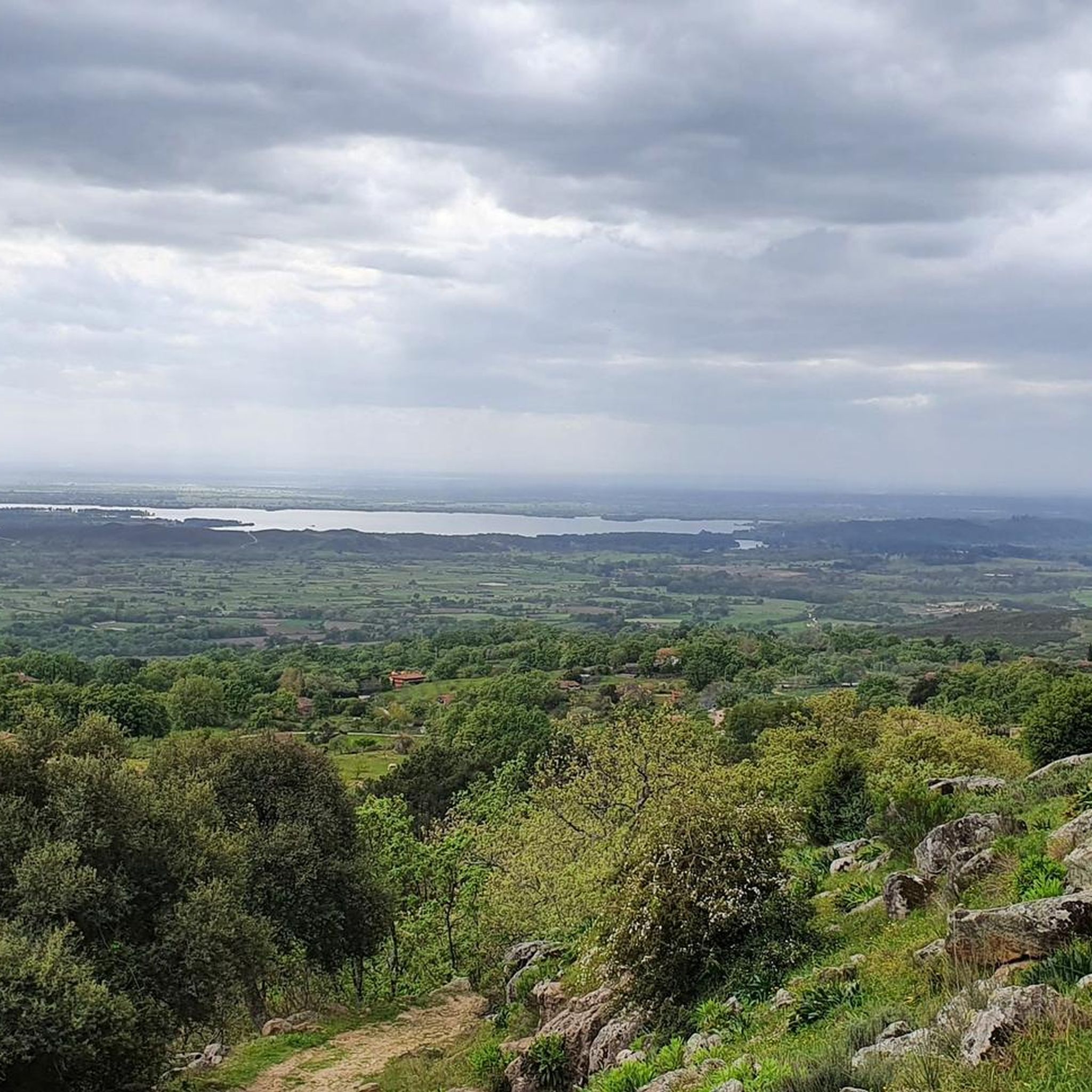
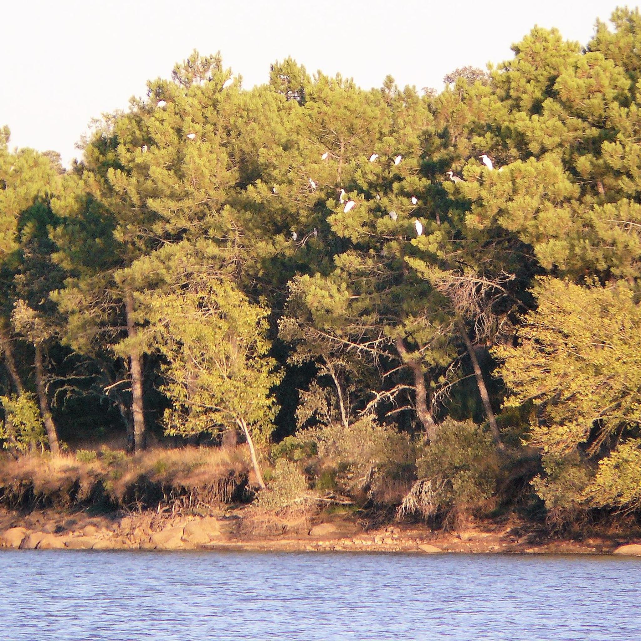
The Rosarito Reservoir, located between the provinces of Ávila and Toledo, near Oropesa, is an ideal natural setting for outdoor activities, birdwatching, and rural tourism. Hiking and cycling: There are peaceful routes like the CM-5150 and trails overlooking the reservoir.
5
0

At this point on the GR-111, you can enjoy a panoramic view of the beautiful peaks of the Gredos mountain range.
1
0

A pretty town worth a stroll through.
0
0

El Raso is a place steeped in ancient history, lush natural surroundings, and rural charm, ideal for those seeking a unique getaway. If you're passing through, take the opportunity to grab a drink in the village and take a stroll to see what it has to offer.
0
1

Beautiful area with steep slopes
1
1

Frequently Asked Questions
What kind of terrain can I expect on road cycling routes around Embalse Rosarito?
The region around Embalse Rosarito, situated in the Tiétar River valley and the foothills of the Sierra de Gredos mountain range in Spain, offers varied terrain. You'll find a mix of riverine paths along the Tiétar River and ascents into the surrounding hills, providing both flatter sections and more challenging climbs through rural countryside.
Are there road cycling routes suitable for different skill levels?
Yes, the area caters to various abilities. While there are 2 difficult routes for experienced cyclists, the majority, 16 out of 20, are rated as moderate. There are also 2 easy routes available, ensuring options for most road cyclists.
What are some notable landmarks or scenic points along the road cycling routes?
Many routes offer views of the Rosarito Reservoir itself. You might also encounter the Birdwatching Hide at Tiétar River and Reservoir, offering a chance to observe local wildlife. The routes often pass through quiet, scenic areas, including a quiet and wild road that is popular with cyclists.
Are there any circular road cycling routes in the area?
Yes, several routes offer scenic loops. For example, the Rosarito Reservoir – Rosarito Reservoir loop from Camping Candeleda is a moderate 33.7-mile (54.3 km) trail that circles the reservoir. Another option is the Aquelcabos Medieval Bridge – Ramacastañas loop from Camping Candeleda, a 33.1-mile (53.2 km) moderate path with significant elevation gain.
What is the typical elevation gain on road cycling routes around Embalse Rosarito?
Elevation gain varies significantly by route. Moderate routes like the Rosarito Reservoir loop feature around 522 meters of ascent, while others, such as the Aquelcabos Medieval Bridge loop, include a notable climb of 722 meters. The most difficult routes, like the Acequia del Tiétar Road loop, can have over 360 meters of elevation gain over longer distances.
What do other road cyclists say about the routes in Embalse Rosarito?
The road cycling routes in Embalse Rosarito are highly regarded by the komoot community, holding an average score of 5.0 stars from over 1 review. Cyclists often appreciate the diverse terrain, from river valleys to the foothills of the Sierra de Gredos, and the options available for different ability levels.
Are there any long-distance road cycling routes for advanced riders?
Yes, for advanced riders seeking a challenge, the Acequia del Tiétar Road – Tiétar River and Sierra de Gredos loop from Madrigal de la Vera is a difficult 61.8-mile (99.5 km) trail. It features significant elevation gain as it traverses the Tiétar River valley and approaches the Sierra de Gredos, taking approximately 9 hours to complete.
Can I find family-friendly road cycling options near Embalse Rosarito?
While specific 'family-friendly' designations are not provided for all routes, the presence of 2 easy routes and 16 moderate routes suggests that some of the less challenging, flatter sections along the river or around the reservoir could be suitable for families with varying cycling experience. Always check the route details for distance and elevation before setting out.
What is the best time of year for road cycling in this region?
Given its location in Spain, the spring and autumn months typically offer the most pleasant weather for road cycling, with milder temperatures and less extreme heat than summer. Winter conditions might involve cooler temperatures, especially in the foothills of the Sierra de Gredos, so checking local weather forecasts is always recommended.
Are there any facilities like cafes or accommodation along the road cycling routes?
The routes often pass through rural countryside and near small towns. While specific cafes or accommodations are not detailed for every route, starting points like 'Camping Candeleda' suggest that amenities are available in nearby villages. It's advisable to plan your route and check for facilities in towns you'll pass through.
How long do road cycling routes typically take to complete?
The duration varies significantly based on distance and difficulty. A moderate route like the Rosarito Reservoir loop can be completed in about 2 hours 25 minutes. Longer, more difficult routes, such as the Acequia del Tiétar Road loop, can take over 9 hours.
Most popular routes around Embalse Rosarito
Most popular attractions around Embalse Rosarito

Get inspired with the komoot mobile app


Explore more
Browse the best Road cycling routes in other regions.
