The best road cycling routes around Embalse del Giribaile
5.0
(2)
146
riders
11
rides
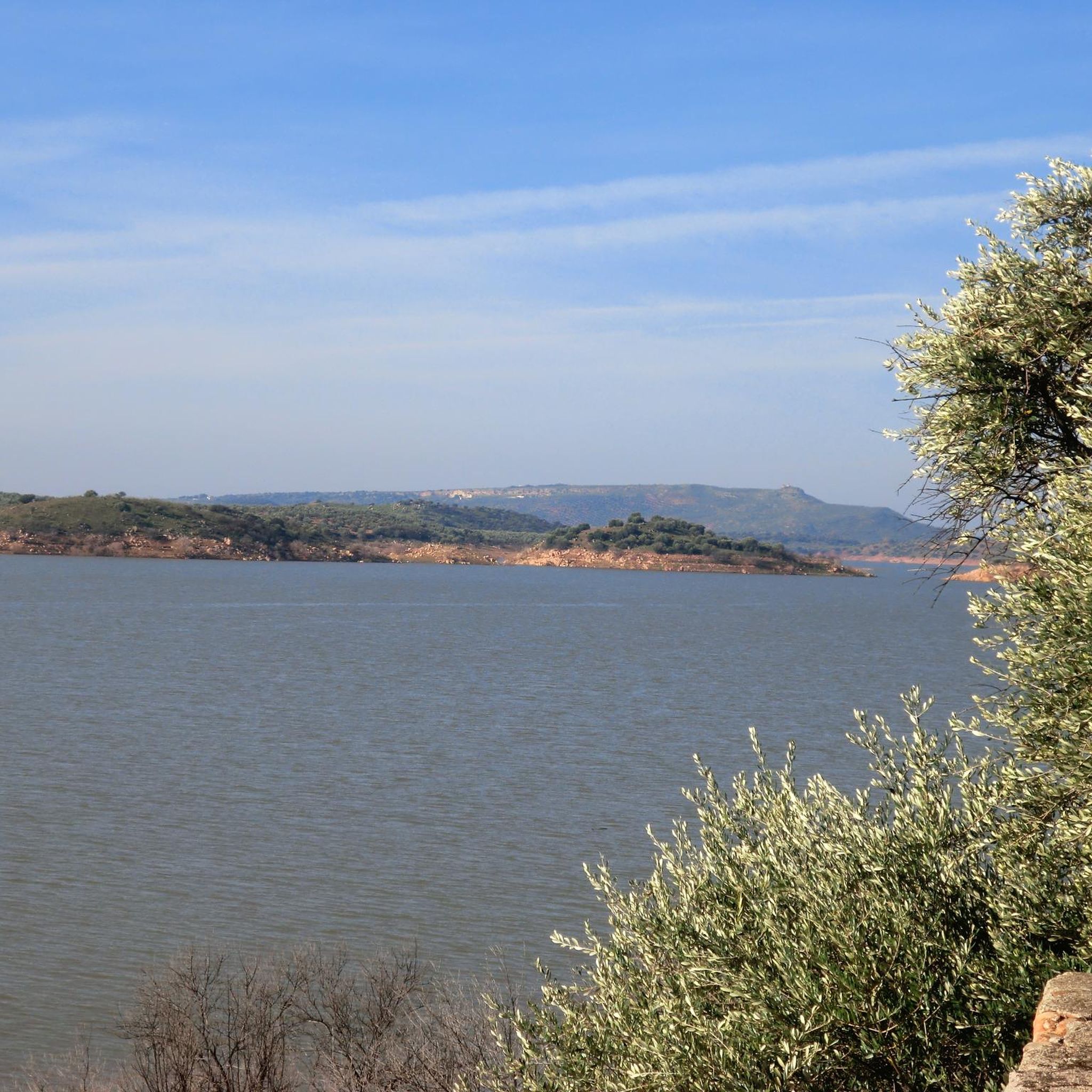
Road cycling around Embalse del Giribaile offers varied terrain characterized by the expansive reservoir, rolling hills, and surrounding countryside. The area features both moderate stretches and significant elevation gains, providing diverse experiences for cyclists. Routes often traverse well-paved surfaces, connecting to nearby towns known for their cultural heritage. The landscape combines water views with agricultural areas and natural features.
Best road cycling routes around Embalse del Giribaile
- The most popular road cycling route is Caño Fountain of Canena – Castillo…
Last updated: July 10, 2026
3
riders
22.2km
01:14
440m
440m
Moderate road ride. Good fitness required. Mostly well-paved surfaces and easy to ride.
6
riders
37.5km
02:06
750m
740m
Moderate road ride. Good fitness required. Mostly well-paved surfaces and easy to ride.

Sign up for free
12
riders
67.6km
03:25
1,130m
1,130m
Hard road ride. Very good fitness required. Some segments of this route may be unpaved and difficult to ride.
2
riders
34.3km
01:39
460m
460m
Moderate road ride. Good fitness required. Some segments of this route may be unpaved and difficult to ride.
5.0
(2)
50
riders
45.8km
02:19
490m
500m
Moderate road ride. Good fitness required. Some segments of this route may be unpaved and difficult to ride.
Get access to more routes and recommendations from other explorers.
Sign up for free
Already have an account?
Our route recommendations are based on thousands of hikes, rides, and runs completed by other people on komoot.
Start today with a free account
Your next adventure awaits.
Login or Signup

Tips from the Community

Opposite the Jabalquinto Palace stands the Church of Santa Cruz, one of the few Romanesque churches in all of Andalusia. Built in the 13th century, after the conquest of the Upper Guadalquivir Valley by Ferdinand III, it preserves remnants of 15th and 16th-century frescoes.
1
0

The Pópulo square, also known as Plaza de los Leones (Lions' square), is one of the most emblematic and picturesque corners of Baeza. This square is part of the monumental Renaissance complex that led to the city being declared a UNESCO World Heritage Site in 2003.
6
0

Jimena is a small town in the south of the province, on the northern side of the Sierra Mágina, located in a landscape of olive groves, fruit trees, allotments and sierra. The town is particularly known for its figs and brebas. The municipality is divided into two very different areas: there is the mountainous south-eastern area that is part of the Sierra Mágina Natural Park, and the rest of the municipality is agricultural land dedicated to olives.
8
0

This square, known as Plaza del Pópulo, houses the Tourist Office, the fountain, and the Jaén gate, attached to part of the old city wall.
16
0
In the Plaza de la Constitución or the Mercado, there is a pavilion or kiosk intended to house the local music band, from where it entertains the summer afternoons of its neighbors.
14
0
This clock tower built between the 13th-16th centuries. It is next to the old butcher shops and the Arab wall. Of Spanish-Muslim and Renaissance architectural style, it was originally a tower belonging to the old medieval wall, although it is currently used as a tourist resource and you can visit the bell tower from which there are wonderful views of part of the city.
13
0
Church and convent of the Santísima Trinidad de Úbeda is one of the few buildings in the baroque style, rather it is a group of several buildings in the center of the city. Inside the church, which is divided into three naves with a semicircular arch, is framed by Corinthian pilasters.
13
0
This monumental bullring was inaugurated in 1857 where there was an old convent known as San Nicasio, founded at the beginning of the 15th century. The inauguration date was that year of 1857 in which the bullfighter "Lagartijo" took the alternative, the same one who later inaugurated the Baeza bullring.
9
0
Frequently Asked Questions
What kind of terrain can I expect on road cycling routes around Embalse del Giribaile?
The region offers varied terrain, characterized by rolling hills and diverse landscapes. You'll find both challenging climbs and more moderate, smoother stretches. Routes often feature well-paved surfaces, especially those connecting to nearby towns, providing a good experience for road bikes. Expect significant elevation gains on some routes, reaching up to 790 meters.
Are there any routes suitable for beginners or those looking for an easier ride?
While many routes feature varied terrain and elevation changes, there are options for different ability levels. For a moderate ride, consider the Caño Fountain of Canena – Castillo De Canena loop from Canena, which is 12.5 miles (20.1 km) long and offers scenic views with manageable elevation.
What are some notable landmarks or viewpoints I can see while road cycling in the area?
Road cycling routes often provide picturesque views of the Embalse del Giribaile itself, known as the 'Mar de La Loma.' You can also see the dramatic dam structure. Some routes pass by historical sites like Castillo De Canena, and you'll be near culturally rich towns such as Úbeda and Baeza, renowned for their Renaissance architecture.
Are there any circular road cycling routes around Embalse del Giribaile?
Yes, many routes are designed as loops. For example, the Plaza del Pópulo, Baeza – bandstand loop from Rus is a moderate 22.6 miles (36.3 km) circular path, and the Plaza de Toros de Úbeda – Jimena loop from Santa Eulalia offers a longer, more challenging 42.1 miles (67.8 km) loop through rolling hills.
What is the best time of year for road cycling in Embalse del Giribaile?
The region generally offers pleasant conditions for cycling outside of the peak summer months when temperatures can be very high. Spring and autumn typically provide mild weather, making them ideal for exploring the routes. Winter can also be suitable, though cooler, with less rainfall than other seasons.
Are there amenities or places to stop for refreshments along the routes?
The area around Embalse del Giribaile has seen investment in tourist infrastructure, including a multi-purpose building with a cafeteria-bar and information point. Additionally, routes often connect to nearby towns like Úbeda, Baeza, and Canena, where you can find cafes, restaurants, and other services.
What do other road cyclists say about the routes in Embalse del Giribaile?
The road cycling routes in Embalse del Giribaile are highly rated by the komoot community, with an average score of 5.0 stars from 2 reviews. Cyclists often praise the varied terrain, the expansive reservoir views, and the opportunity to combine natural beauty with visits to culturally rich towns.
Is it possible to reach the Embalse del Giribaile area by public transport for cycling?
While direct public transport specifically for cyclists to the reservoir might be limited, the region is served by bus routes connecting major towns like Úbeda and Baeza. From these towns, you can often start your cycling routes or arrange local transport to reach specific trailheads. It's advisable to check local bus schedules and policies regarding bicycles.
Where can I park my car when starting a road cycling route?
When starting routes from towns such as Canena, Rus, or Santa Eulalia, you can typically find public parking options within the town centers or near popular starting points. For routes closer to the reservoir, look for designated parking areas associated with the developing tourist infrastructure, which includes amenities for visitors.
Are there any family-friendly road cycling options in the Embalse del Giribaile area?
While some routes feature significant elevation, many sections around the reservoir and connecting towns are well-paved and can be enjoyed by families with older children or those comfortable with moderate distances. It's best to review the elevation profiles and distances of specific routes, such as the Caño Fountain of Canena – Castillo De Canena loop from Canena, to determine suitability for your family.
Can I bring my dog on road cycling routes in Embalse del Giribaile?
Road cycling typically involves paved roads and higher speeds, which are generally not suitable for dogs to run alongside. If you plan to bring your dog, it's recommended to use a specialized dog trailer designed for bicycles and ensure your dog is comfortable with this mode of transport. Always prioritize your pet's safety and comfort, especially on longer rides or in warm weather.
How many road cycling routes are available around Embalse del Giribaile?
There are 18 road cycling routes available for exploration around Embalse del Giribaile, offering a diverse range of experiences from moderate to difficult.
Are there any routes that offer views of the Embalse del Giribaile dam?
Yes, many routes in the area provide excellent views of the Embalse del Giribaile and its impressive dam. The dam, constructed between 1993 and 1997 on the Guadalimar River, is a significant landmark. Routes that traverse the periphery of the reservoir or ascend to viewpoints will offer the best perspectives.
Most popular routes around Embalse del Giribaile

Get inspired with the komoot mobile app


Explore more
Browse the best Road cycling routes in other regions.
