The best walks and hikes around Embalse de Pinilla
4.6
(643)
4,374
hikers
144
hikes
Hiking around Embalse de Pinilla, located in the Sierra Norte de Madrid within the Lozoya Valley, offers diverse landscapes for outdoor activities. The region is characterized by the Embalse de Pinilla reservoir, framed by the Sierra de Guadarrama mountains, including the Cuerda Larga and Peñalara ranges. Hiking paths traverse varied woodlands, featuring oak groves, beech forests, and areas with pines and ashes, alongside the Lozoya River and its tributaries.
Best hiking trails around Embalse de Pinilla
- The most popular hiking route is Embalse de Pinilla – circular from Lozoya, a 9.9 miles (15.9 km) trail that takes 4 hours 8 minutes to complete. This moderate route offers continuous views of the reservoir with minimal elevation gain.
- Another top favourite among local hikers is Chorrera de San Mamés - circular from Lozoya por Navarredonda, a difficult 19.1 miles (30.7 km) path. This route includes significant elevation gain, leading through mountain terrain and offering expansive vistas.
- Local hikers also love the Lozoya loop from Pinilla del Valle, a 6.0 miles (9.6 km) trail leading through the valley and along the reservoir, often completed in about 2 hours 27 minutes.
- Hiking around Embalse de Pinilla is defined by the scenic reservoir, surrounding mountain vistas, and diverse forests. The network offers options for various ability levels, from easy strolls to more challenging treks.
- The routes in Embalse de Pinilla are highly rated by the komoot community with an average score of 4.6 stars from over 500 reviews. More than 4000 hikers have used komoot to explore Embalse de Pinilla's varied terrain.
Last updated: July 1, 2026
4.7
(18)
107
hikers
15.9km
04:08
100m
100m
Moderate hike. Good fitness required. Easily-accessible paths. Suitable for all skill levels.
30.7km
08:34
590m
590m
Hard hike. Very good fitness required. Easily-accessible paths. Suitable for all skill levels.

Sign up for free
4.8
(4)
48
hikers
9.60km
02:27
30m
30m
Moderate hike. Good fitness required. Easily-accessible paths. Suitable for all skill levels.
4.3
(3)
19
hikers
13.8km
04:20
400m
400m
Moderate hike. Good fitness required. Mostly accessible paths. Sure-footedness required.
5.0
(2)
10
hikers
18.1km
07:08
1,100m
1,090m
Hard hike. Very good fitness required. Mostly accessible paths. Sure-footedness required.
Get access to more routes and recommendations from other explorers.
Sign up for free
Already have an account?
Our route recommendations are based on thousands of hikes, rides, and runs completed by other people on komoot.
Start today with a free account
Your next adventure awaits.
Login or Signup

Tips from the Community

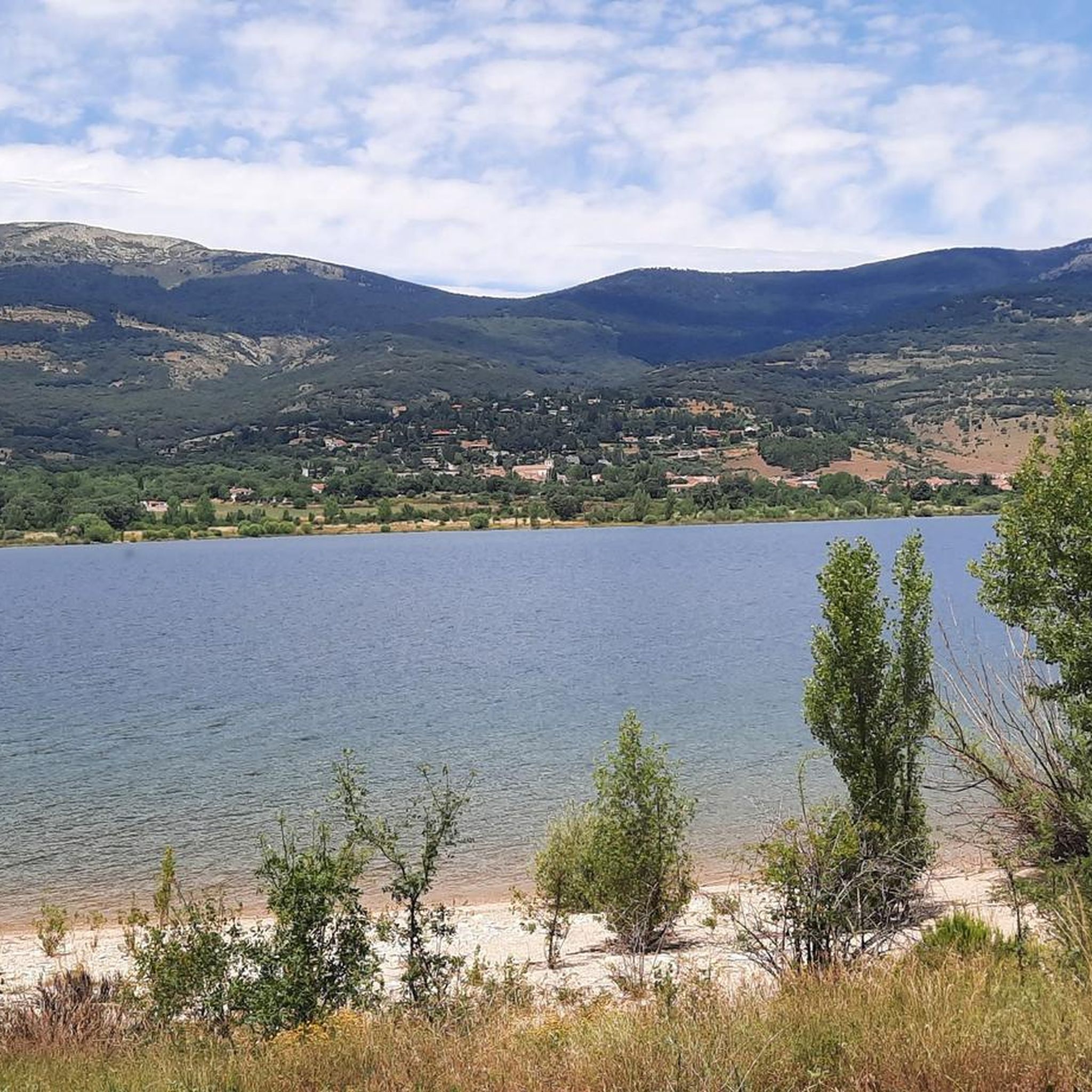
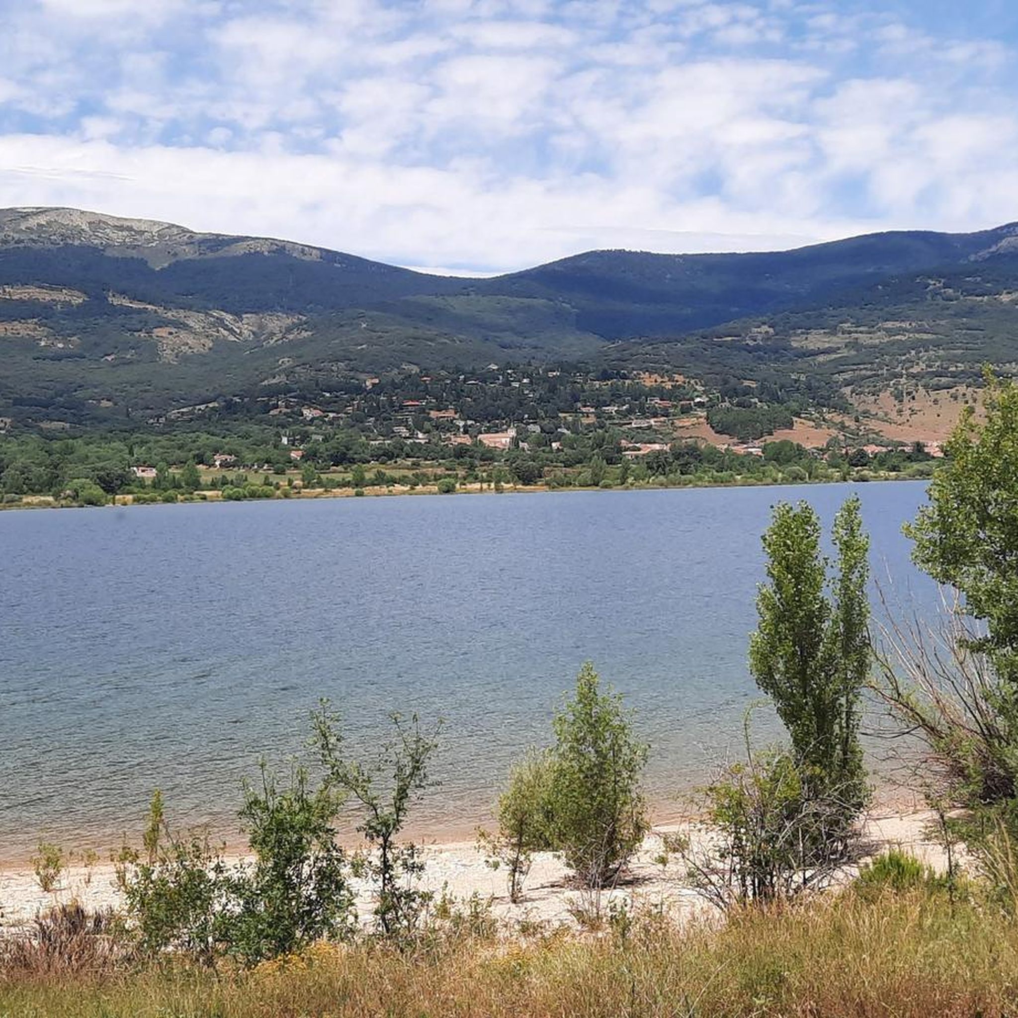
Beautiful viewpoint of the Pinilla reservoir
0
0


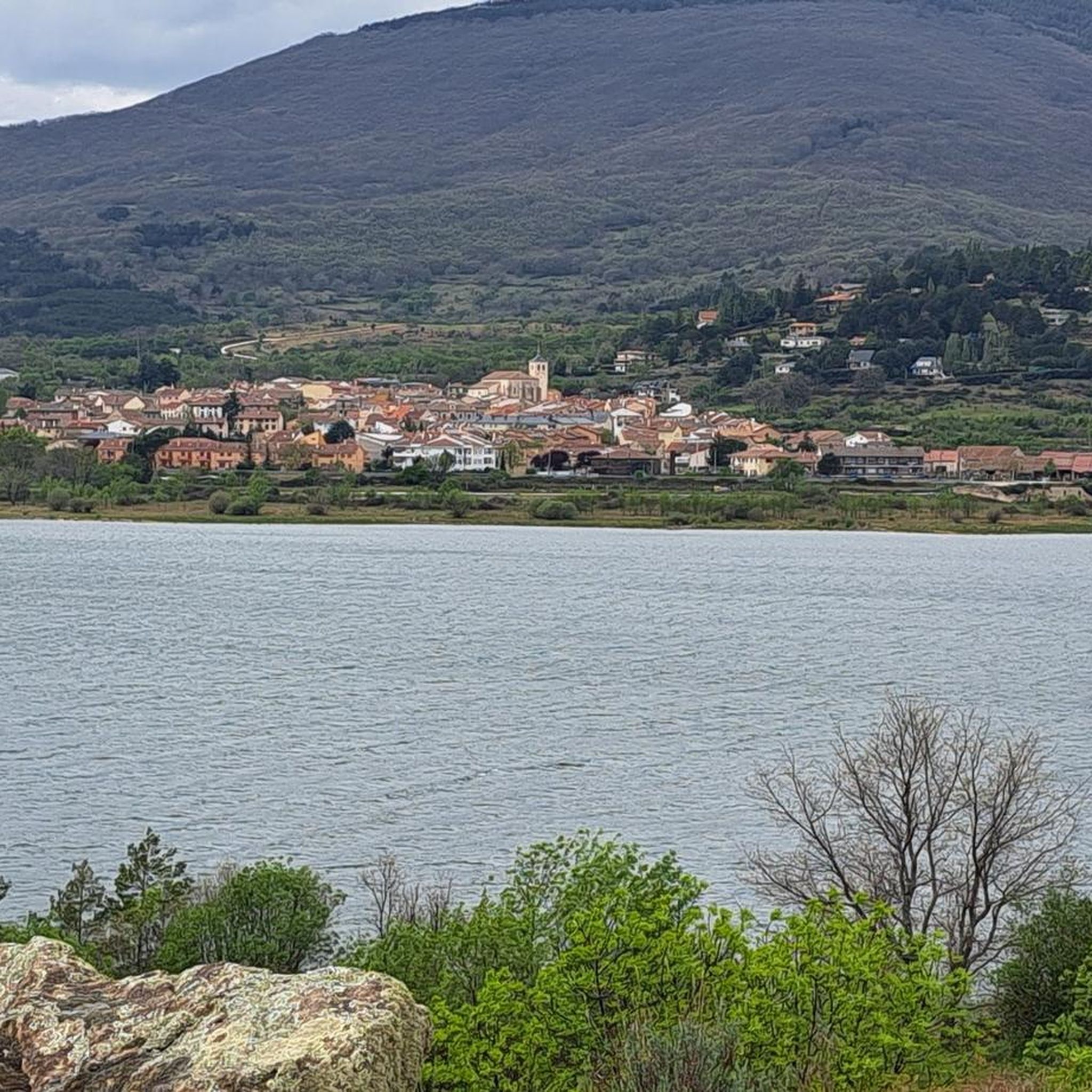
A beautiful town in the Sierra de Madrid, with particularly good water.
0
0
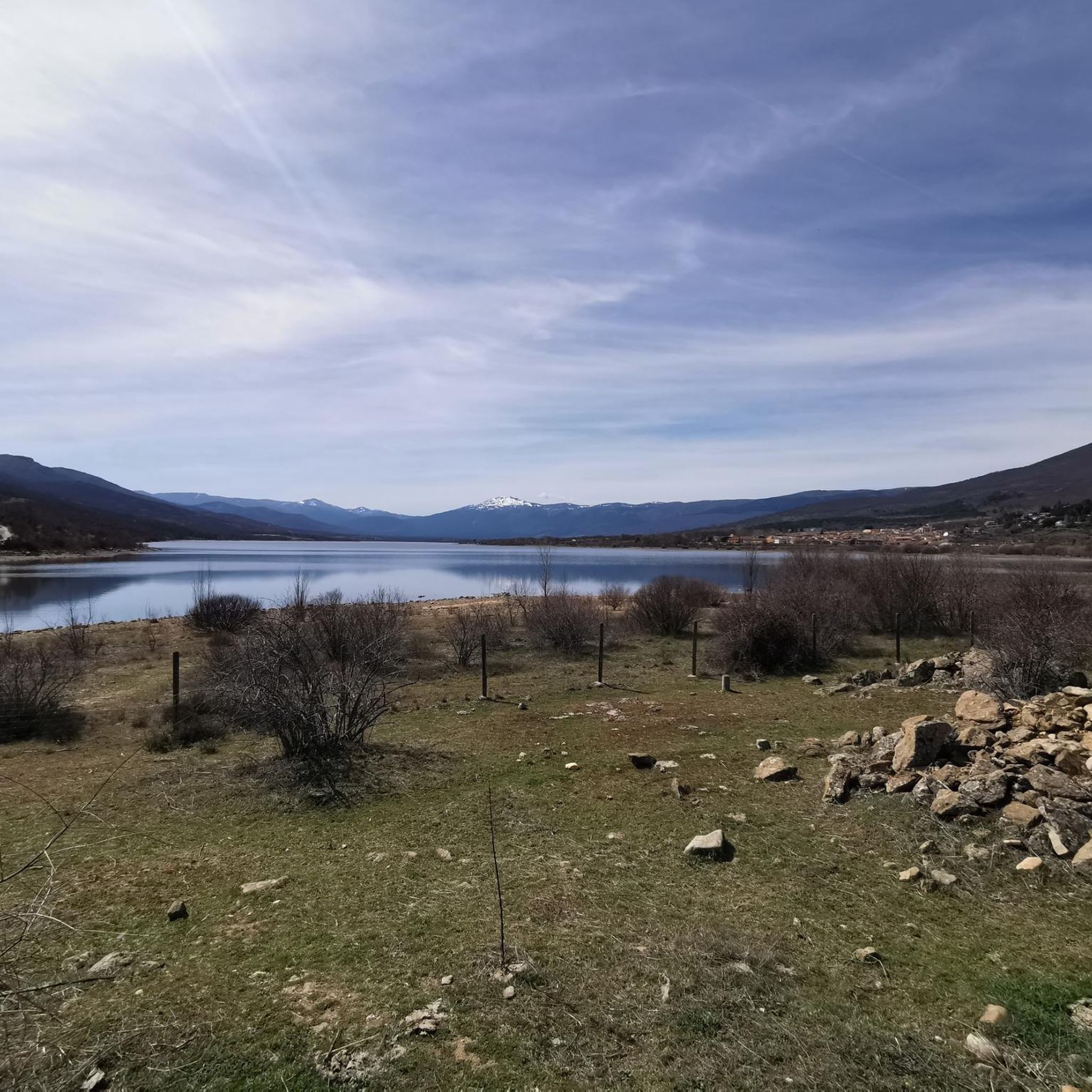
Place of extraordinary beauty, especially in spring with snow and water.
0
0

highest peak of the Carpetanos Mountains, beautiful
0
0
Pico del Nevero, the highest of the Carpetanos Mountains, with beautiful views.
0
0
El Nevero is one of the highest and most important mountains in the Guadarrama Mountains, at 2,209 meters above sea level. It is located on the border between the Community of Madrid and the Province of Segovia. As it forms part of the Guadarrama Mountains National Park, access to it by bicycle is prohibited, as fines may apply.
0
0
Frequently Asked Questions
How many hiking trails are available around Embalse de Pinilla?
Embalse de Pinilla offers a wide network of over 140 hiking trails. These routes cater to various fitness levels, with 21 easy, 91 moderate, and 32 difficult options, ensuring there's a suitable path for everyone.
Are there easy hiking options suitable for families or beginners?
Yes, Embalse de Pinilla has several easy hiking options perfect for families and beginners. Many routes offer minimal elevation gain and follow the reservoir's edge, providing continuous scenic views. For example, the Lozoya loop from Pinilla del Valle is a moderate 6-mile (9.6 km) trail that is relatively flat and takes about 2.5 hours to complete.
What kind of landscapes and natural features can I expect to see while hiking here?
Hikers around Embalse de Pinilla can expect diverse landscapes. You'll enjoy continuous views of the scenic reservoir, framed by the towering peaks of the Sierra de Guadarrama, including the Cuerda Larga and Peñalara ranges. Trails wind through varied woodlands, featuring dense oak groves, beech forests, and areas with poplars, pines, and ashes, alongside the Lozoya River and its tributaries.
Are there any historical or cultural landmarks to explore near the trails?
Yes, the area around Embalse de Pinilla is rich in history. You can visit the significant archaeological site of "Valle de los Neandertales" (Neanderthal Valley) near the reservoir. Additionally, the medieval Puente del Congosto (also known as Puente Canto or Puente de la Horcajada) crosses the Lozoya River downstream from the reservoir, adding a touch of historical charm to your hike.
What are the options for longer or more challenging hikes?
For those seeking a challenge, Embalse de Pinilla offers several difficult routes with significant elevation gain and expansive vistas. A notable option is the Chorrera de San Mamés - circular from Lozoya por Navarredonda, a difficult 19.1-mile (30.7 km) path that leads through mountain terrain. Another challenging route is the Puerto de Navafría – Peña del Cuervo Viewpoint loop from Lozoya, which features over 1000 meters of elevation gain.
Are there circular routes available around the reservoir?
Circular routes are very popular around Embalse de Pinilla. The most popular hiking route is Embalse de Pinilla – circular from Lozoya, a 9.9-mile (15.9 km) trail that offers continuous views of the reservoir with minimal elevation gain, typically taking just over 4 hours to complete.
What do other hikers say about their experience in Embalse de Pinilla?
The hiking trails around Embalse de Pinilla are highly rated by the komoot community, with an average score of 4.6 stars from over 500 reviews. Hikers often praise the serene escape offered by the diverse landscapes, the continuous views of the reservoir, and the variety of trails suitable for different abilities.
When is the best time of year to go hiking around Embalse de Pinilla?
Embalse de Pinilla offers beautiful hiking opportunities throughout the year. Spring brings lush greenery and wildflowers, while autumn transforms the diverse forests into vibrant displays of color. Summer is pleasant, especially in shaded areas, and even winter hiking can be rewarding, offering unique snowy vistas of the Sierra de Guadarrama mountains.
Are there any recreational areas or picnic spots along the trails?
Yes, along some routes, particularly near the Puerto de Navafría, you can find recreational areas like Peña Alta and Las Lagunillas. These spots offer amenities such as picnic areas and natural water sources, perfect for a break during your hike.
What kind of wildlife might I encounter while hiking?
The rich biodiversity of the Sierra de Guadarrama means you might encounter various species. The area is ideal for birdwatching, with possibilities of spotting endangered species like the imperial eagle. Keep an eye out for other local wildlife that thrives in the diverse forest and riverine ecosystems.
Which nearby villages serve as good starting points for hikes?
The charming villages of Lozoya and Pinilla del Valle are excellent starting points for many routes around the reservoir. They also offer local amenities and cultural points of interest, such as the Church of San Miguel Arcángel in Pinilla del Valle, making them convenient bases for your hiking adventures.
Can I bring my dog on the trails around Embalse de Pinilla?
Many trails in the Embalse de Pinilla area are dog-friendly, allowing you to enjoy the natural beauty with your canine companion. However, it's always recommended to check specific trail regulations or local signage, especially within protected areas, and to keep dogs on a leash to protect wildlife and ensure a pleasant experience for all hikers.
Most popular routes around Embalse de Pinilla

Get inspired with the komoot mobile app


Explore more
Browse the best Hikes in other regions.
