The best road cycling routes around Ballylane
261
riders
31
rides
Road cycling routes around Ballylane, located in County Armagh, Northern Ireland, traverse a landscape characterized by rolling terrain and river valleys, such as the Mowhan River to its north and west. The area offers varied road cycling experiences, with routes originating from nearby towns like Armagh and Markethill. While not a prominent tourist destination, the region provides a network of roads suitable for cycling, featuring moderate elevation gains.
Best road cycling routes around Ballylane
- The most popular road cycling route is Lottie's Café – Scarva Village loop from Armagh, a moderate 29.7 miles (47.8 km) trail that takes 2 hours 12 minutes to complete. This route connects local villages and cafes, offering varied scenery.
- Another top favourite among local road cyclists is Gosford Castle – Scarva Village loop from Armagh, a moderate 40.8 miles (65.6 km) path. It features a loop connecting Gosford Castle and Scarva Village, providing a longer ride through the countryside.
- Local road cyclists also love the The Barn Pantry – Gosford Castle loop from Armagh, a 31.1 miles (50.0 km) trail leading through rural landscapes and past Gosford Castle, often completed in about 2 hours 10 minutes.
- Road cycling around Ballylane is defined by rolling hills, rural roads, and river valley views. The network offers options for different ability levels, primarily focusing on moderate routes.
- The routes in Ballylane are highly rated by the komoot community with an average score of 5.0 stars from over 1 review. More than 290 road cyclists have used komoot to explore Ballylane's varied terrain.
Last updated: October 10, 2026
9
riders
47.6km
02:01
370m
370m
Moderate road ride. Good fitness required. Mostly well-paved surfaces and easy to ride.
10
riders
36.3km
01:34
310m
310m
Moderate road ride. Good fitness required. Mostly well-paved surfaces and easy to ride.

5
riders
53.1km
02:23
490m
490m
Moderate road ride. Good fitness required. Mostly well-paved surfaces and easy to ride.
2
riders
47.1km
02:12
620m
620m
Moderate road ride. Good fitness required. Mostly well-paved surfaces and easy to ride.
3
riders
45.9km
02:05
510m
510m
Moderate road ride. Good fitness required. Mostly well-paved surfaces and easy to ride.
Get access to more routes and recommendations from other explorers.
Already have an account?
Our route recommendations are based on thousands of hikes, rides, and runs completed by other people on komoot.
Start today with a free account
Your next adventure awaits.
Tips from the Community


Nice little cafe in the village of Scarva right alongside the Newry canal towpath, great for brekkie, lunch or just topping up the hydration.
1
0

Hollie Berrie is a good place for refreshments on the route at Scarva
0
1

The small town of Scarva, nestled between green meadows and the quiet canal, offers a welcome break on my bike tour through Northern Ireland. Here you cycle on well-maintained paths past historic bridges and small villages that give you the feeling that time has stood still. The British flags fluttering along the side of the road remind you that you are in a culturally special area - a detail that reflects the identity of the region. The route is easy to cycle, the surrounding landscape is gently rolling, which makes for pleasant cycling. The view of wide fields and rolling hills invites you to slow down now and then and take in the peace and quiet. A special feature of Scarva is the annual Orange Order March, which transforms the village into a kind of open-air stage once a year and keeps the traditions of this region alive.
1
0
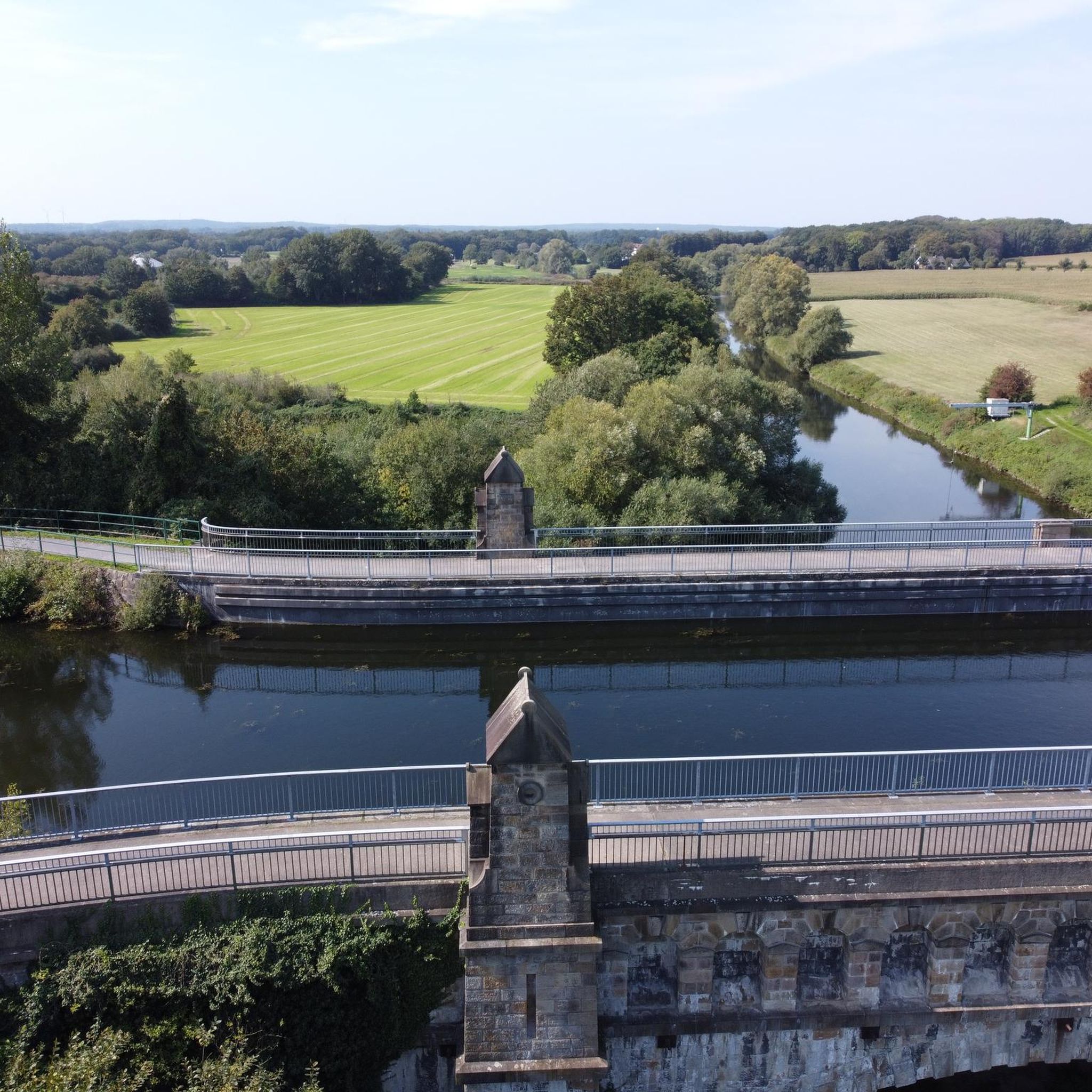
The dam is easy to cross and from there you have a great view over the lake and the rolling hills that surround it. The peaceful atmosphere is only occasionally interrupted by the gentle rippling of the water. The reservoir provides fresh drinking water to the surrounding area and the trout fishery here is controlled by the Armagh Angling Club - so it's an interesting spot for anglers. Even if you're not here to fish, the scenery is simply relaxing and it's worth stopping for a few minutes and looking around. The roads around the lake are easy to drive on but there might be a few potholes in places - nothing that would stop a real cyclist. Overall a nice stop to enjoy nature and take a quick breather before moving on.
2
0

Scarva (from Irish: Scarbhach meaning "shallow place, rough ford" is a small village in the parish of Aghaderg, County Down, Scarva is known as the location of the "Sham Fight" Pageant on 13 July every year. The Pageant attracts thousands of members of the Royal Black Preceptory, who come to act out a symbolic dramatised re-enactment of the Battle of the Boyne.
2
0

A mixture of wooded, paved, and gravel trails will lead you through the wonderful Lough Gall Country Park in Loughgall, County Armagh. There's a wealth of things to discover here such as bluebell and orchid-filled woodlands, a golf and football pitch, an outdoor gym and a coffee shop.
1
0
The Mall is a beautifully-kept recreational area in Armagh. It's tree-lined edges and flat paved paths make it the ideal spot for a jog. Enjoy sights of beautiful georgian buildings and colourful flowerbeds as you pass through.
1
0
Frequently Asked Questions
Where exactly is Ballylane located for road cycling?
Ballylane is a townland situated in County Armagh, Northern Ireland. It is bordered by the Mowhan River to its north and west, offering a landscape of rolling terrain and river valleys for road cycling.
What kind of terrain can I expect on road cycling routes around Ballylane?
The road cycling routes around Ballylane feature rolling hills, rural roads, and views of river valleys, particularly the Mowhan River. The terrain generally involves moderate elevation gains, providing varied experiences for cyclists.
How many road cycling routes are available in the Ballylane area?
There are over 50 road cycling routes available around Ballylane on komoot. These routes cater to various skill levels, with a strong focus on moderate difficulty rides.
Are there any easy or beginner-friendly road cycling routes near Ballylane?
Yes, Ballylane offers several options for less experienced riders. There are 9 easy road cycling routes available, perfect for beginners or those looking for a more relaxed ride.
Are there any challenging road cycling routes for advanced cyclists around Ballylane?
While the majority of routes are moderate, there are 3 difficult road cycling routes around Ballylane for advanced cyclists seeking a greater challenge. These routes will feature more significant elevation changes and longer distances.
What do other cyclists say about road cycling in Ballylane?
The road cycling routes around Ballylane are highly rated by the komoot community, with an average score of 5.0 stars. Cyclists often appreciate the varied terrain, rural roads, and the opportunity to explore the County Armagh countryside.
Are there any circular road cycling routes available?
Many of the road cycling routes around Ballylane are designed as loops, offering circular journeys. For example, the Lottie's Café – Scarva Village loop from Armagh and the Gosford Castle – Scarva Village loop from Armagh are popular circular options.
What interesting places can I see along the road cycling routes near Ballylane?
While cycling, you can pass by several points of interest. Notable attractions include Gosford Castle, a historic site, and the Red Deer Enclosure within Gosford Forest Park. You might also encounter natural features like the Cusher River and the Clare Glen Stone Bridges.
Are there cafes or places to stop for refreshments along the routes?
Yes, some routes are specifically designed to connect local villages and cafes. For instance, the Lottie's Café – Scarva Village loop from Armagh and The Barn Pantry – Gosford Castle loop from Armagh incorporate stops at local establishments, providing opportunities for refreshments.
Is public transport available to access road cycling routes around Ballylane?
While Ballylane itself is a townland, routes often originate from nearby towns like Armagh and Markethill. You would need to check local public transport options to these towns, as direct public transport to Ballylane for cycling access might be limited.
What is the best season for road cycling in Ballylane?
Given the region's climate, spring, summer, and early autumn generally offer the most favorable conditions for road cycling around Ballylane, with milder temperatures and less precipitation. Always check local weather forecasts before heading out.
Are there any specific permits required for road cycling in the Ballylane area?
Generally, no specific permits are required for road cycling on public roads in the Ballylane area of County Armagh. However, if any route passes through private land or specific parks, it's always advisable to check for any local regulations or access requirements.
Most popular routes around Ballylane
Most popular attractions around Ballylane

Get inspired with the komoot mobile app


Explore more
Browse the best Road cycling routes in other regions.
