The best walks and hikes around Embalse de El Grado
4.7
(128)
903
hikers
53
hikes
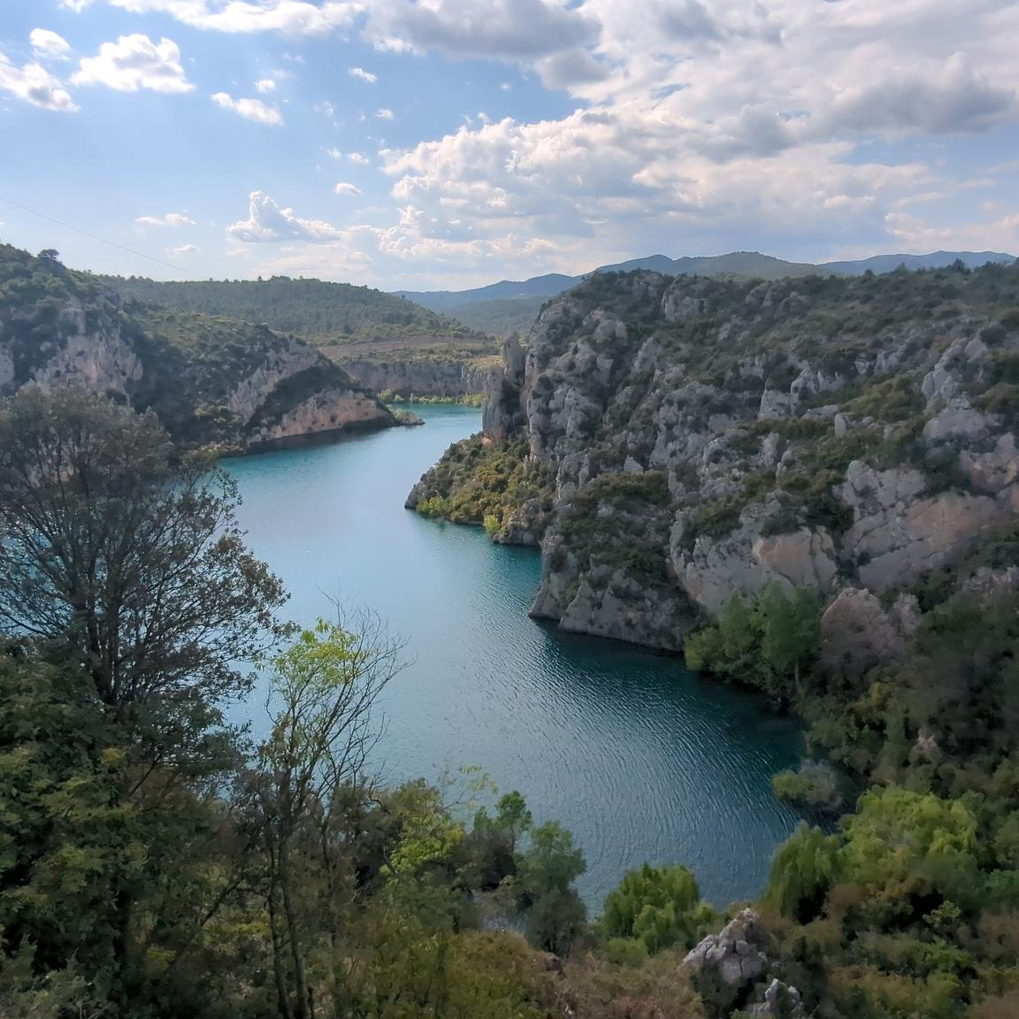
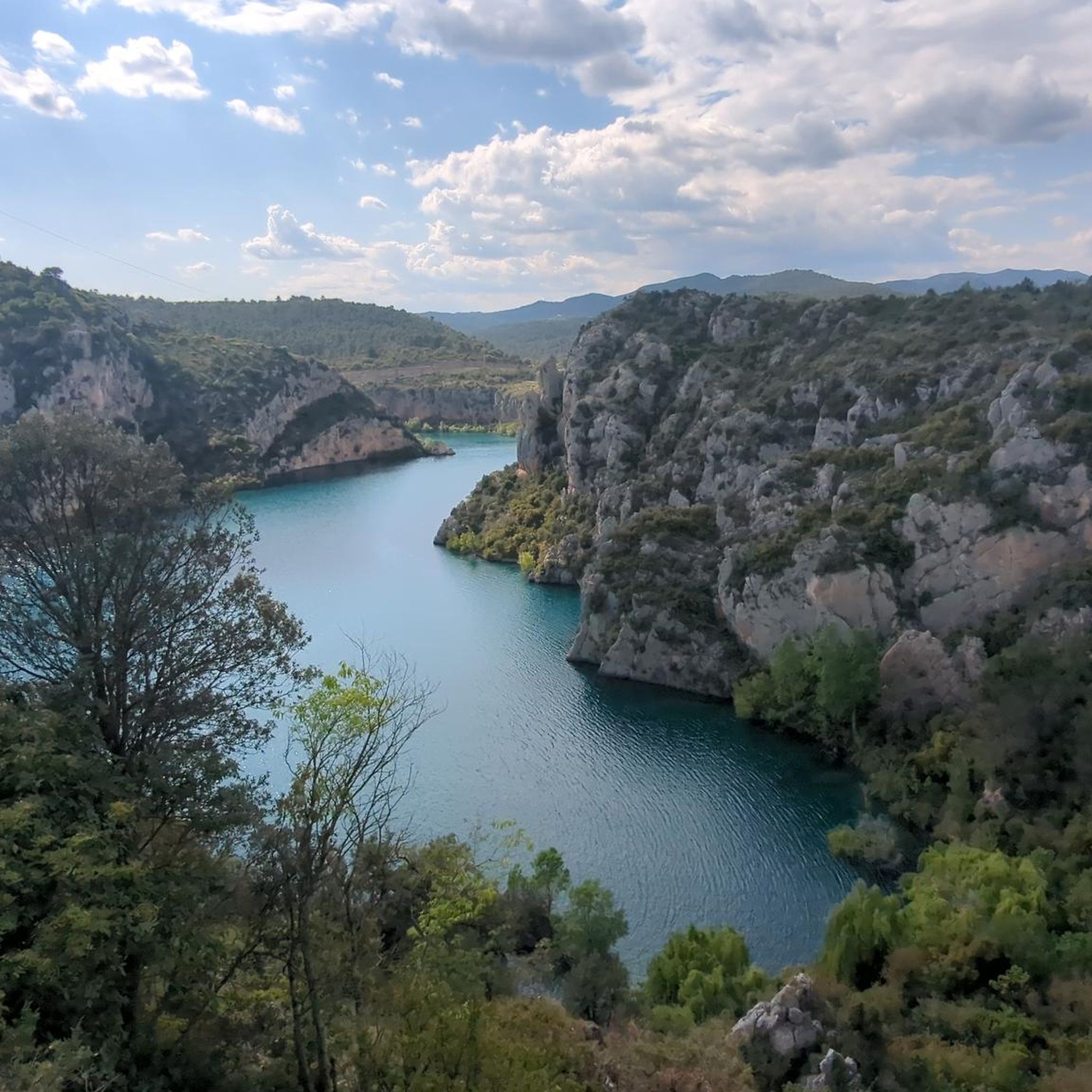
Hiking around Embalse de El Grado offers diverse landscapes within the Aragonese Pre-Pyrenees. The region features the turquoise waters of the reservoir, formed by the Cinca River, contrasting with arid terrain. Hikers can explore gentle hills, extensive pine forests, and dramatic natural formations such as canyons and gorges. Panoramic viewpoints provide vistas of the surrounding area, including distant views of the Pyrenees mountains.
Best hiking trails around Embalse de El Grado
- The most popular hiking route is Entremón Gorge Trail, a 6.0 miles (9.7 km) trail that takes 2 hours 50 minutes to complete. This moderate route leads through a dramatic gorge, offering impressive natural scenery.
- Another top favourite among local hikers is Ligüerre de Cinca – Samitier Castle loop from Picatiecho, a moderate 8.5 miles (13.6 km) path. This route explores historical landmarks and offers views of the reservoir and surrounding hills.
- Local hikers also love the Entremón Gorge loop from Picatiecho, a 3.0 miles (4.9 km) trail leading through the Entremón Gorge, often completed in about 1 hour 28 minutes.
- Hiking around Embalse de El Grado is defined by reservoir views, varied forest paths, and dramatic canyons. The network offers options for different ability levels, from easy strolls to more challenging routes.
- The routes in Embalse de El Grado are highly rated by the komoot community with an average score of 4.7 stars from over 100 reviews. More than 800 hikers have used komoot to explore Embalse de El Grado's varied terrain.
Last updated: July 4, 2026
4.6
(26)
203
hikers
9.66km
02:51
280m
280m
Hike the moderate 6.0-mile Congosto del Entremón trail from Ligüerre de Cinca, featuring a dramatic gorge and the iconic submerged church to
4.6
(15)
96
hikers
4.89km
01:28
160m
160m
Easy hike. Great for any fitness level. Easily-accessible paths. Suitable for all skill levels.

Sign up for free
4.6
(5)
28
hikers
10.6km
03:19
390m
390m
Moderate hike. Good fitness required. Easily-accessible paths. Suitable for all skill levels.
5.0
(1)
13
hikers
11.7km
03:13
200m
200m
Moderate hike. Good fitness required. Easily-accessible paths. Suitable for all skill levels.
5.0
(1)
15
hikers
8.16km
02:14
130m
130m
Moderate hike. Good fitness required. Easily-accessible paths. Suitable for all skill levels.
Get access to more routes and recommendations from other explorers.
Sign up for free
Already have an account?
Our route recommendations are based on thousands of hikes, rides, and runs completed by other people on komoot.
Start today with a free account
Your next adventure awaits.
Login or Signup

Tips from the Community

Mediano Reservoir Dam. It can be accessed on foot or by bicycle. From the west, it can be reached from the new village of Mediano via the Ebro River Basin Authority road. From the east, it can be accessed from the trail that runs through the Entremon Gorge or from the trail that descends to the foot of Palo Peak. During periods of drought, the ruins of the church of the old village of Mediano can be seen.
0
0

Great panoramic view from the Castillo!
0
0

Allow at least 20 minutes to appreciate the entire Ordesa and Monteperdido mountain range
0
0

Ligüerre de Cinca is a town that was abandoned in the sixties due to the construction of the Grado reservoir. However, it was later recovered and restored for tourism and social purposes. Today it is a beautiful town of stone houses on the banks of the reservoir and surrounded by cultivated fields and mountains.
0
0

Also called Mondoto Castle, it is a religious-military complex that stands out for the remains of the hexagonal tower of the castle and the hermitage, good examples of Romanesque architecture. The hermitage is dedicated to San Emeterio and San Celedonio and curiously enough, it was actually designed as the first defense mechanism of the castle, since possible attackers had to first cross the place where the monks slept.
1
0
Also called Mondoto Castle, it is a religious-military complex that stands out for the remains of the castle's hexagonal tower and the church, good examples of Romanesque architecture.
0
0

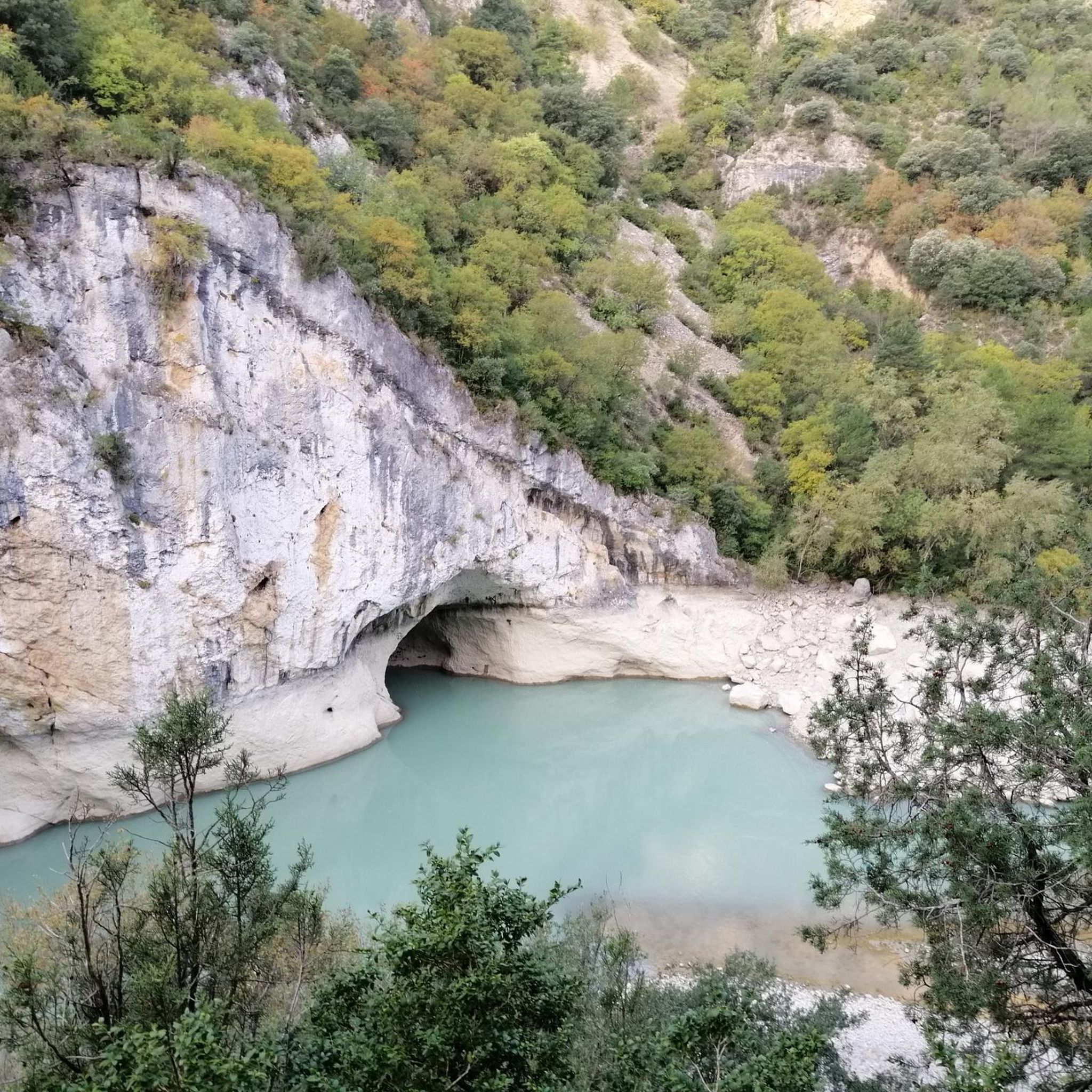
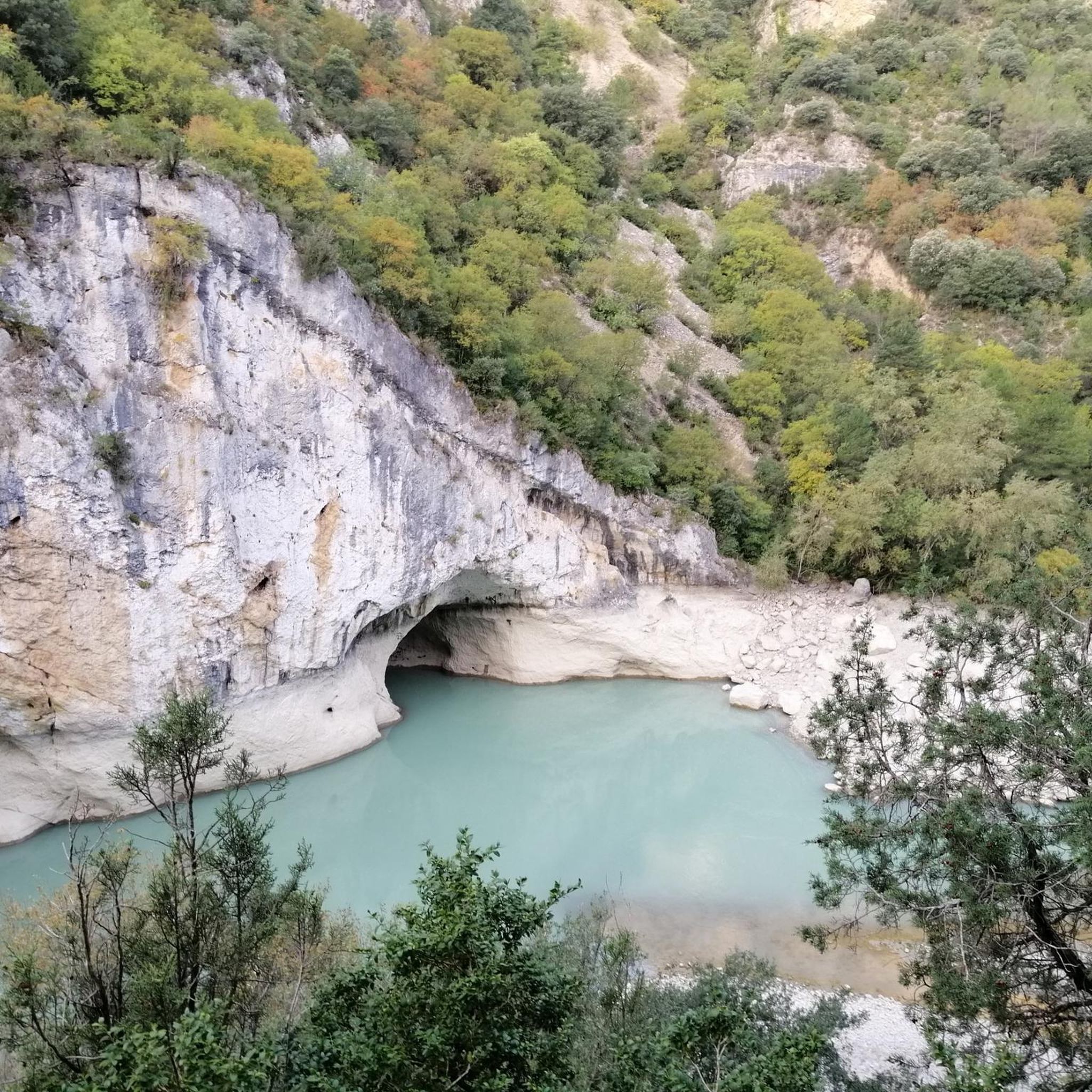
According to our kayak guide, Congostos are canyons of medium width. Smaller canyons are "arroyos", wider ones are "cañones". The Entremón - Entre Montañas - is therefore a gorge of medium width and beautiful. A spur of the Embalse de El Grado stretches through the gorge, which leads to the dam wall of the Embalse de Mediano above. You can go through it with the kaya or take the ornithological trail that goes along the rocks above the river.
1
0
It is interesting here that you have to go through the church to get to the Castillo (or what is left of it). A kayak guide explained to us that the members of the order (similar to the Knights Templar) who lived here at the time were extremely concerned about their safety and designed the buildings in such a way that the only way to get to the castle was through the church where the monks slept.
0
0
Frequently Asked Questions
How many hiking trails are available around Embalse de El Grado?
There are over 50 hiking trails around Embalse de El Grado, catering to various fitness levels. You'll find a good mix of easy strolls, moderate paths, and some more challenging routes to explore the diverse landscapes of the Aragonese Pre-Pyrenees.
What kind of terrain can I expect on hikes around Embalse de El Grado?
The terrain around Embalse de El Grado is quite varied. You can expect to hike through gentle hills, extensive pine forests, and cultivated fields. Dramatic natural formations like canyons and gorges, such as the Entremón Gorge, are also prominent. The trails often offer stunning views of the turquoise reservoir waters contrasting with the arid Somontano region, and distant vistas of the Pyrenees.
Are there easy or family-friendly hiking options in Embalse de El Grado?
Yes, Embalse de El Grado offers many easy and family-friendly hiking options. With 22 easy routes available, you can find paths suitable for all ages. A great choice for a shorter, less strenuous walk is the Entremón Gorge loop from Picatiecho, which is about 3 miles long and takes less than two hours to complete.
What are some notable landmarks or viewpoints to see while hiking?
Hikers can discover several interesting landmarks and enjoy panoramic viewpoints. The Monasterio de Torreciudad, perched overlooking the reservoir, offers magnificent views. You can also explore the medieval town of Ligüerre de Cinca, or visit the hexagonal tower of Samitier Castle. Natural viewpoints, such as those near La Puebla de Castro, provide some of the best perspectives of the reservoir and surrounding mountains.
Are there any circular walks around Embalse de El Grado?
Yes, there are several excellent circular walks. For a moderate loop that combines historical interest with reservoir views, consider the Ligüerre de Cinca – Samitier Castle loop from Picatiecho. This route is about 8.5 miles long and explores both the charming village and the historic castle.
Is Embalse de El Grado a good place for birdwatching while hiking?
Absolutely. The region around Embalse de El Grado is designated as a Special Protection Area for Birds (ZEPA). Hikers often spot various species, including herons, kites, ducks, and sometimes even ospreys, making it a rewarding destination for birdwatching enthusiasts.
What is the best time of year to go hiking in Embalse de El Grado?
The best time to hike in Embalse de El Grado is generally during spring and autumn. The weather is milder, and the natural scenery is particularly vibrant. Summers can be hot, but early mornings or late afternoons are still pleasant. Winters are cooler but can offer crisp, clear days for hiking, especially if you prefer fewer crowds.
What do other hikers enjoy most about the trails in Embalse de El Grado?
The trails in Embalse de El Grado are highly rated by the komoot community, with an average score of 4.7 stars from over 100 reviews. Hikers often praise the stunning reservoir views, the varied forest paths, and the dramatic canyons. The accessibility and well-marked nature of many paths are also frequently highlighted.
Are dogs allowed on the hiking trails around Embalse de El Grado?
Generally, dogs are welcome on the hiking trails around Embalse de El Grado. It's always recommended to keep your dog on a leash, especially in areas with wildlife or near livestock, and to follow local regulations regarding pet waste. The diverse terrain offers plenty of opportunities for you and your canine companion to enjoy the outdoors.
Are there any longer hiking routes for experienced trekkers?
Yes, for those seeking longer treks, the region is crossed by established long-distance routes. The GR45 (Sendero del Somontano) and the GR17 (Sendero Mariano) both pass through the area, offering options for extended hiking adventures beyond the local loops.
Where can I find parking for hiking trailheads?
Parking is generally available near popular trailheads and villages surrounding Embalse de El Grado. For instance, areas like Picatiecho, which serves as a starting point for routes such as the Ligüerre de Cinca loop, typically offer designated parking spots. It's advisable to check specific route details for precise parking information.
Can I reach the hiking areas by public transport?
While public transport options directly to every trailhead might be limited, some of the larger towns and villages around Embalse de El Grado may have bus connections. For more remote starting points, a car is often the most convenient way to access the trails. It's best to research specific bus routes and schedules if you plan to rely on public transport.
Most popular routes around Embalse de El Grado

Get inspired with the komoot mobile app


Explore more
Browse the best Hikes in other regions.
