The best walks and hikes around Claerwen Reservoir
4.6
(436)
3,352
hikers
49
hikes
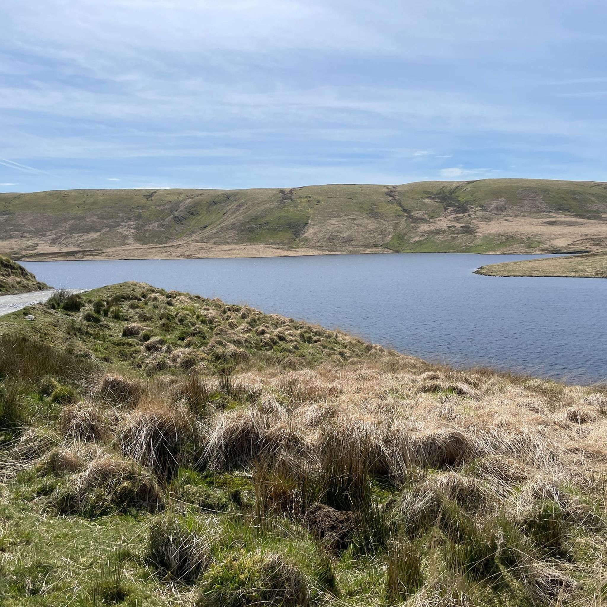
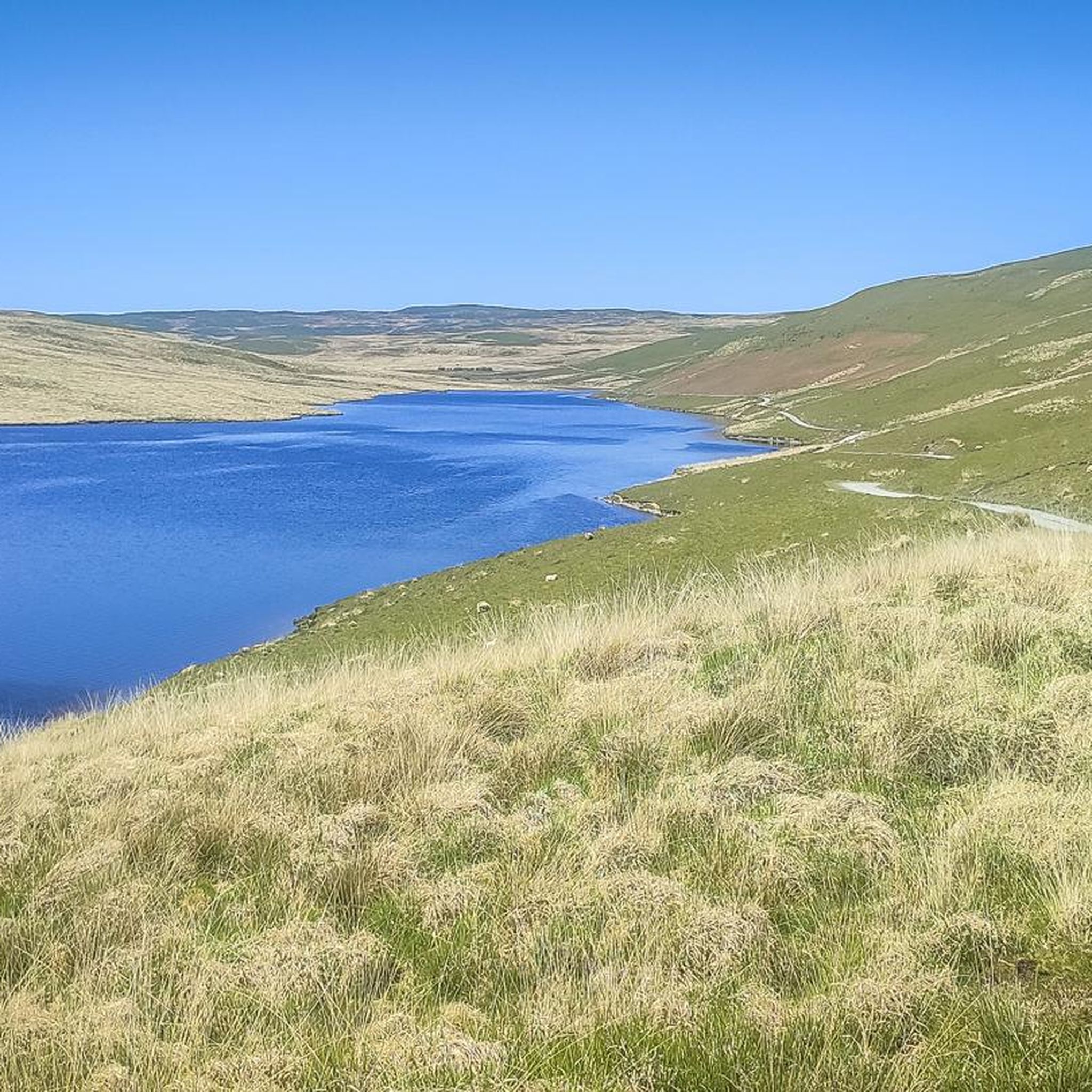
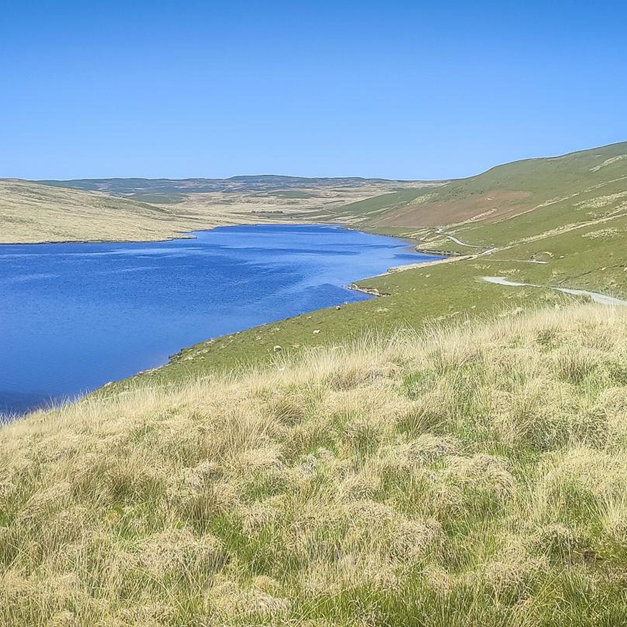
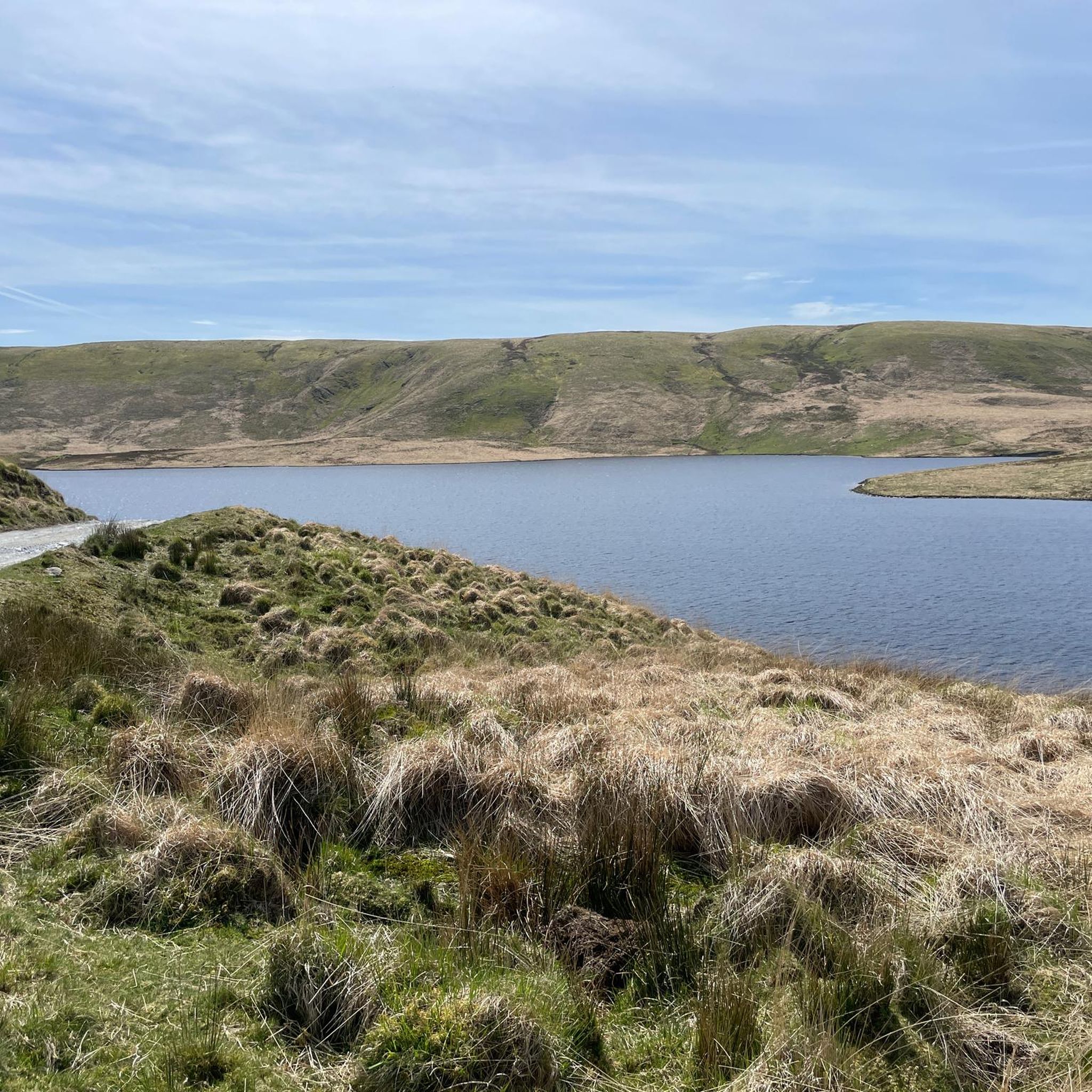
Hikes around Claerwen Reservoir explore the largest of the Elan Valley reservoirs, set within the Cambrian Mountains. The landscape is characterized by vast open moorland, rolling hills, and the impressive Claerwen Dam. Trails in the area often follow reservoir shorelines and pass through sections of woodland and upland bog.
Best hiking trails around Claerwen Reservoir
- The most popular hiking route is the Claerwen Dam – Llanerchi Woods loop from Claewen Dam, a 8.6 mile (13.8 km) trail that takes around 3 hours 55 minutes to complete. This circular walk offers views of the dam and the surrounding reservoir.
- Another top favourite among local hiking enthusiasts is the Elan Valley Visitor Centre – Caban Coch Dam loop from Elan Village, a difficult 12.4 mile (20.0 km) path. The route involves a significant amount of ascent and provides expansive views across the valley.
- Local hiking enthusiasts also love the Elan Valley Bridge – Nantgwyllt Church loop from Elan Village, a 6.3 mile (10.1 km) trail leading through the valley landscape, often completed in about 2 hours 40 minutes.
- Hiking around Claerwen Reservoir is defined by large man-made reservoirs, open moorland, and quiet woodlands. The network of paths provides options for different fitness levels, from gentle reservoir-side walks to more demanding upland hikes.
- The routes in Claerwen Reservoir are highly rated by the komoot community with an average score of 4.6 stars from over 390 reviews. More than 3,000 hikers have used komoot to explore Claerwen Reservoir's varied terrain.
Last updated: July 9, 2026
4.3
(4)
31
hikers
13.8km
03:55
290m
290m
Moderate hike. Good fitness required. Easily-accessible paths. Suitable for all skill levels.
4.7
(20)
191
hikers
10.3km
02:44
110m
110m
Moderate hike. Good fitness required. Easily-accessible paths. Suitable for all skill levels.

Sign up for free
4.3
(3)
33
hikers
9.25km
02:31
130m
130m
Moderate hike. Good fitness required. Easily-accessible paths. Suitable for all skill levels.
4.3
(4)
33
hikers
14.2km
04:09
360m
360m
Moderate hike. Good fitness required. Easily-accessible paths. Suitable for all skill levels.
4.4
(5)
105
hikers
Easy hike. Great for any fitness level. Easily-accessible paths. Suitable for all skill levels.
Get access to more routes and recommendations from other explorers.
Sign up for free
Already have an account?
Our route recommendations are based on thousands of hikes, rides, and runs completed by other people on komoot.
Start today with a free account
Your next adventure awaits.
Login or Signup
Tips from the Community

Beautiful church - well worth exploring
0
0

Excellent cafe here. Ty Penbont.
1
0

Basic gift shop and toilets, along with a cafe.
0
0


a place where you can learn a bit of Elan Valley history
0
0
Frequently Asked Questions
How difficult are the hikes around Claerwen Reservoir?
The area offers a good mix for all fitness levels. You'll find over 50 trails, ranging from easy, gentle walks suitable for most people to challenging, difficult hikes that require good stamina and experience. The majority of the routes are rated as moderate, often involving some elevation gain and mixed terrain.
What kind of terrain should I expect on the trails?
The terrain is classic Welsh uplands. Expect a combination of well-maintained paths along reservoir shorelines, gravel tracks, and grassy paths across open moorland. Some routes will take you through quiet woodlands and across areas of upland bog, which can be wet underfoot, so waterproof footwear is recommended.
Are the trails around Claerwen Reservoir dog-friendly?
Yes, dogs are generally welcome on the trails. However, the area is a working landscape with grazing livestock and is a designated Site of Special Scientific Interest (SSSI) rich in ground-nesting birds. It is essential to keep your dog on a lead and under close control at all times to protect wildlife and farm animals.
Where is the best place to park for hikes?
The main car park at Claerwen Dam is a popular starting point for many walks and offers stunning views right from the outset. Another excellent option is the Elan Valley Visitor Centre, which provides access to trails around the lower reservoirs and has more facilities. Both are well-regarded starting points for exploring the area.
Is there a specific trail to see waterfalls?
Yes, there is a popular walk that leads from the Claerwen Dam to a series of waterfalls. This route is well-known and offers fantastic views of both the reservoir and the cascades. The Elan Valley Waterfall Trail is another highly-rated local spot specifically known for its scenic waterfalls.
Are there any easy, family-friendly walks available?
Absolutely. While the region is known for its challenging hikes, there are plenty of gentler options. For a shorter, more accessible walk, consider the The Devil's Gulch – Pen-y-Garreg Dam loop from Elan Village. Many of the paths directly alongside the reservoirs are relatively flat and offer beautiful scenery without strenuous climbs.
What do other hikers enjoy most about the Claerwen Reservoir area?
The area is highly rated by the komoot community, with an average score of 4.6 stars. Hikers frequently praise the dramatic scenery created by the huge dams and vast reservoirs set against the wild, open moorland. The sense of peace and solitude on the less-travelled upland paths is another commonly highlighted feature.
Can I get to the trailheads using public transport?
Due to its remote location in the Cambrian Mountains, public transport options directly to Claerwen Dam are very limited. The nearest town is Rhayader. From there, you would typically need to use a local taxi service or your own transport to reach the main trailheads. It's best to plan on driving to the area.
Are there any circular walks in the area?
Yes, circular walks are very common here. They allow you to experience a variety of landscapes without retracing your steps. A great example of a moderate circular route is the Nantgwyllt Church – Llanerchi Woods loop from Elan Village, which combines woodland sections with views of the valley.
What is the best time of year to hike here?
Hiking is possible year-round, but each season offers a different experience. Spring and summer bring lush green hills and a wealth of birdlife. Autumn provides stunning colours across the woodlands. Winter can be magical and exceptionally quiet, though you should be prepared for cold, wet, and potentially icy conditions on the trails.
Is the Elan Valley a good place for stargazing?
Yes, it's exceptional. The Elan Valley, including the area around Claerwen Reservoir, is a designated International Dark Sky Park. Its remote location means there is very little light pollution, offering incredible views of the Milky Way and constellations on a clear night. It's a perfect way to end a day of hiking.
Most popular routes around Claerwen Reservoir

Get inspired with the komoot mobile app


Explore more
Browse the best Hikes in other regions.
