The best road cycling routes around Kilmore
4.4
(27)
1,030
riders
155
rides
Road cycling around Kilmore, Victoria, offers varied terrain suitable for cyclists, situated near the Kilmore Gap in the Great Dividing Range. The region is characterized by rich plains, expansive farmland, and bushland, providing scenic routes. Natural features like Monument Hill Reserve and the picturesque countryside contribute to a diverse cycling environment.
Best road cycling routes around Kilmore
- The most popular road cycling route is Gosford Castle – Scarva Village loop from Richhill, a 39.4 miles (63.4 km) trail that…
Last updated: July 11, 2026
19
riders
43.6km
01:47
250m
250m
Easy road ride. Great for any fitness level. Mostly well-paved surfaces and easy to ride.
12
riders
50.1km
02:18
390m
390m
Moderate road ride. Good fitness required. Mostly well-paved surfaces and easy to ride.

Sign up for free
12
riders
63.4km
02:46
510m
510m
Moderate road ride. Good fitness required. Mostly well-paved surfaces and easy to ride.
12
riders
87.8km
03:58
770m
770m
Moderate road ride. Good fitness required. Mostly well-paved surfaces and easy to ride.
6
riders
63.6km
02:44
400m
400m
Moderate road ride. Good fitness required. Mostly well-paved surfaces and easy to ride.
Get access to more routes and recommendations from other explorers.
Sign up for free
Already have an account?
Our route recommendations are based on thousands of hikes, rides, and runs completed by other people on komoot.
Start today with a free account
Your next adventure awaits.
Login or Signup
Popular around Kilmore

Tips from the Community

Small coffeeshop right by the river Bann, directly next to Sustrans Route 9 / Newry Canal Towpath. The cafe is practically on the roadside, making it a logical stop for cyclists following the canal path. The old brick building has a relaxed atmosphere; inside and out it's a place where cyclists and walkers cross paths. Ideal for a coffee, a small snack and a short break before you cycle back into the canal landscape towards Craigavon Lakes. Enjoyed the stop, but forgot the photo.
7
0

Nice little cafe in the village of Scarva right alongside the Newry canal towpath, great for brekkie, lunch or just topping up the hydration.
1
0

Hollie Berrie is a good place for refreshments on the route at Scarva
0
1

The small town of Scarva, nestled between green meadows and the quiet canal, offers a welcome break on my bike tour through Northern Ireland. Here you cycle on well-maintained paths past historic bridges and small villages that give you the feeling that time has stood still. The British flags fluttering along the side of the road remind you that you are in a culturally special area - a detail that reflects the identity of the region. The route is easy to cycle, the surrounding landscape is gently rolling, which makes for pleasant cycling. The view of wide fields and rolling hills invites you to slow down now and then and take in the peace and quiet. A special feature of Scarva is the annual Orange Order March, which transforms the village into a kind of open-air stage once a year and keeps the traditions of this region alive.
1
0
Lough Neagh is a real gem for cyclists, especially if you enjoy pedalling along the water. The paths around the lake offer a varied mix of rolling shoreline landscapes, gravel paths and beautiful viewpoints that give you a different perspective of the water every time. What makes this place special is not just the nature, but also the stories that are in the air here - from sunken kingdoms to legendary giants who are said to have created the lake with a single throw. The atmosphere here changes constantly with the weather: on clear days the water sparkles in the sun, while clouds cast a mystical veil over the lake. The picnic areas along the shore invite you to take a short rest and watch the swans and ducks gliding leisurely across the surface. But not everything is idyllic - recent environmental problems such as the blue-green algae plague are a constant theme. It shows that this magical place needs care and attention to maintain its charm. The best way to do this is on a bike that can handle going off the beaten track. The wind can sometimes blow strongly across the lake, which requires a bit of extra energy, but you will be rewarded with great views. A tour around Lough Neagh combines history, nature and small adventures - an experience that always reveals new facets.
2
0
Located on the southern shore of Lough Neagh, the trail takes you through a tranquil landscape that is home to a diverse range of wildlife. If you're lucky, you might spot a shy badger, a heron on the bank, or even an otter gliding through the water. The sounds of buzzards circling above the treetops add an almost mystical touch to the setting. The Derrytrasna Cycle Route starts and ends right here, taking you on a relaxed loop that's perfectly integrated into the nature reserve. The paved path changes to a natural path that takes you through dense vegetation. The route is not demanding, but offers just the right mix of relaxation and a slight challenge. In the late afternoon, when the sun is lower and casts golden light over the lake, the island unfolds its very special charm. The scenery is almost picturesque - a nice opportunity to stop and simply enjoy the moment.
2
0
Ground Espresso Bars Café is located right on the road, making it an ideal stop for cyclists travelling along the Newry Canal Towpath. Just a stone's throw from the River Bann, the small café offers a welcome place to take a quick breather. Here you can recharge your batteries with a cup of coffee or a small snack before continuing on. The atmosphere around the old, charming brick building is relaxed and inviting. Its proximity to the cycle path makes it a meeting point for cyclists and walkers alike. You can have a good conversation here or just watch the cyclists go by while sitting outside. Those who continue along the river soon find themselves in a rural landscape, accompanied by the Craigavon Lakes in the distance.
2
0
Frequently Asked Questions
How many road cycling routes are available around Kilmore?
There are over 170 road cycling routes around Kilmore, offering a wide variety of options for cyclists. These routes are highly rated by the komoot community, with an average score of 4.36 stars.
What kind of terrain can I expect on road cycling routes near Kilmore?
Road cycling around Kilmore offers varied terrain, situated near the Kilmore Gap in the Great Dividing Range. You can expect rich plains, expansive farmland, and bushland, providing scenic routes with a mix of flat sections and moderate elevation gains. For example, the Gosford Castle – Scarva Village loop from Richhill features moderate elevation gain across varied landscapes.
Are there road cycling routes suitable for beginners in Kilmore?
Yes, Kilmore offers routes suitable for various ability levels, including beginners. Out of the 170 available routes, 41 are classified as easy, providing a gentle introduction to road cycling in the region. You'll find options that allow you to enjoy the picturesque countryside without excessive challenge.
What are some scenic viewpoints or natural features I can see while cycling around Kilmore?
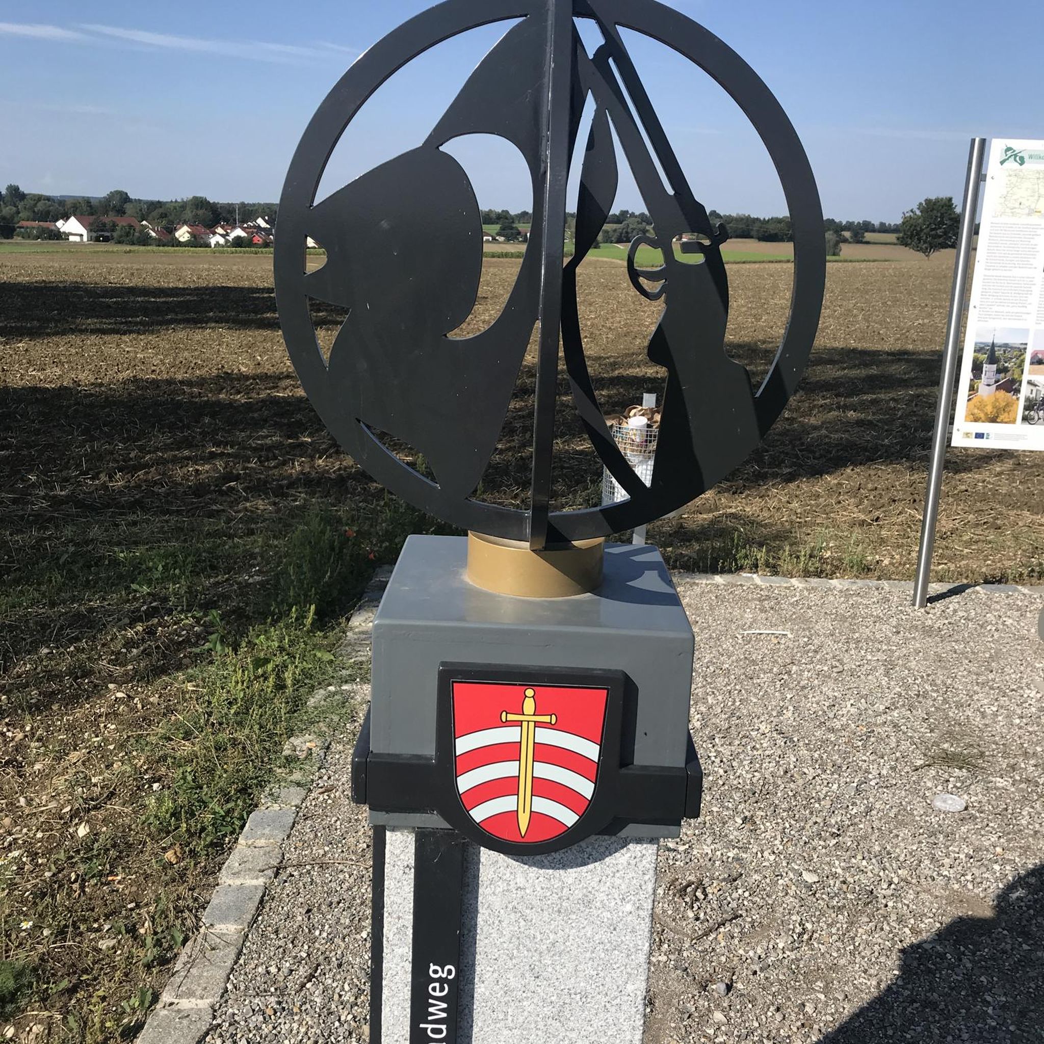
Kilmore's natural beauty offers several scenic spots. You can enjoy views from Monument Hill Reserve, which features a bluestone lookout tower. The surrounding countryside, with its expansive farmland and bushland, provides picturesque vistas. While cycling, you might also encounter areas like the Kilmore Gap and spring-fed creeks. Although not directly on a cycling route, the Directional Sign at the Confluence of the Upper Bann River and Newry Canal is a notable viewpoint in the broader region.
Are there any family-friendly cycling options in Kilmore?
While specific dedicated family cycling paths within the town aren't extensively detailed, the Kilmore Creek Heritage Art Walk is noted as suitable for cycling and prams, offering a gentle experience. For road cycling, consider the easier routes available, as 41 out of 170 routes are classified as easy, which could be suitable for families with older children or those looking for a less strenuous ride.
What historical landmarks can I explore near the road cycling routes?
Kilmore is Victoria's oldest inland settled town, rich in history. While cycling, you might pass by historic bluestone buildings, including the Kilmore Courthouse and the Old Kilmore Gaol. The Hume and Hovell Monument on Monument Hill is another significant historical site. In the wider region, you can find attractions like Gosford Castle and Moneypenny's Lock and Canal Museum.
What is the typical distance and duration for road cycling routes in Kilmore?
The road cycling routes around Kilmore vary significantly in distance and duration. For instance, the Gosford Castle – Scarva Village loop from Richhill is 63.4 km and takes about 2 hours 46 minutes, while the Chicken Fillet Shop – Fruitfield Factory loop from Richhill is 49.7 km and typically takes around 2 hours 6 minutes. There are also longer options, such as the Lottie's Café – Scarva Village loop from Richhill, which is 79.4 km.
Are there options for advanced road cyclists seeking a challenge?
Yes, for advanced road cyclists, Kilmore offers more challenging routes. There are 13 routes classified as difficult, providing greater distances and elevation gains. These routes will allow experienced riders to test their endurance and enjoy the more demanding aspects of the region's varied topography.
What do other road cyclists say about the routes in Kilmore?
The road cycling routes in Kilmore are highly regarded by the komoot community, holding an impressive average rating of 4.36 stars from over 26 reviews. Cyclists often praise the varied terrain, the scenic views of farmland and bushland, and the overall quality of the routes available in the region.
Can I find less crowded road cycling routes near Kilmore?
Kilmore's surrounding countryside, characterized by expansive farmland and bushland, often provides scenic routes with minimal traffic. While specific 'less crowded' routes aren't explicitly named, exploring the numerous options beyond the most popular ones, especially during off-peak times, can lead to a more tranquil cycling experience. The region's 170 routes offer plenty of choices to discover quieter paths.
Is public transport available to reach road cycling trails in Kilmore?
Kilmore is located approximately 60 to 65 kilometers north of Melbourne. While specific public transport links directly to trailheads are not detailed, V/Line train services connect Melbourne to Kilmore East, which is a short distance from Kilmore itself. From there, you would need to cycle or arrange local transport to reach your desired starting point for a road cycling route.
Are there any specific natural reserves or bushland areas accessible by road bike?
Yes, Kilmore is surrounded by natural areas. Monument Hill Reserve offers scenic views and is a fantastic recreational area. The Kilmore East Bushland Reserve also provides opportunities to explore local flora and fauna. While these are primarily walking areas, the roads leading to and around them can be part of a scenic road cycling route, allowing you to appreciate the natural environment.
Most popular routes around Kilmore
Most popular attractions around Kilmore

Get inspired with the komoot mobile app


Explore more
Browse the best Road cycling routes in other regions.
