The best walks and hikes around Lochan na Stainge
4.6
(989)
7,552
hikers
44
hikes
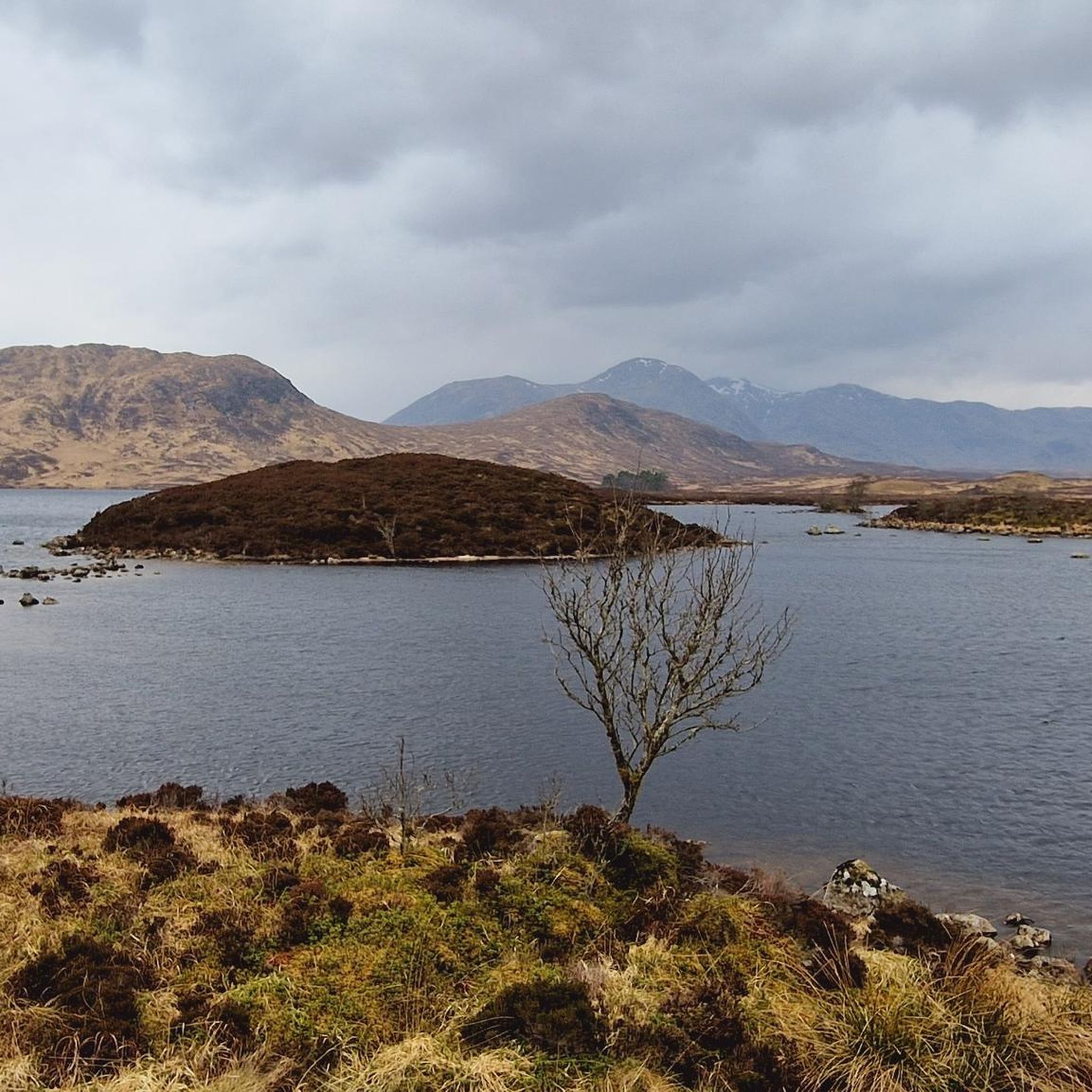
Hikes around Lochan na Stainge explore the expansive and wild landscape of Rannoch Moor in the Scottish Highlands. The region is characterized by a mosaic of boggy moorland, numerous lochs and lochans, and rocky outcrops. Trails here offer views of the Black Mount hills, which provide a backdrop to the water.
Best hiking trails around Lochan na Stainge
- The most popular hiking route is View of Loch Tulla loop from Loch Tulla, a 1.8 mile (2.8 km) trail that takes about 45 minutes to complete. This is a short, accessible walk with views over the nearby loch.
- Another top favourite among local hiking enthusiasts is Gorton Bothy loop from Bridge of Orchy, a moderate 10.4 mile (16.7 km) path. The route follows a section of the West Highland Way across the moor.
- Local hiking enthusiasts also love the Pond on the West Highland Way – Rannoch Moor Wetlands loop from Meall Mòr, a 16.4 mile (26.4 km) trail leading through the Rannoch Moor wetlands, often completed in about 8 hours 45 minutes.
- Hiking around Lochan na Stainge is defined by open moorland, boggy ground, and views of prominent peaks like the Black Mount. The network of paths includes both long-distance sections of the West Highland Way and shorter, more accessible loops.
- The routes in Lochan na Stainge are highly rated by the komoot community with an average score of 4.5 stars from over 880 reviews. More than 6,900 hikers have used komoot to explore Lochan na Stainge's varied terrain.
Last updated: June 24, 2026
4.0
(4)
9
hikers
Hard hike. Very good fitness required. Mostly accessible paths. Sure-footedness required.
4.7
(13)
214
hikers
20.0km
08:02
1,160m
1,160m
Hard hike. Very good fitness required. Mostly accessible paths. Sure-footedness required.

Sign up for free
4.0
(1)
5
hikers
2.82km
00:47
50m
50m
Easy hike. Great for any fitness level. Easily-accessible paths. Suitable for all skill levels.
13
hikers
16.7km
04:24
150m
150m
Moderate hike. Good fitness required. Easily-accessible paths. Suitable for all skill levels.
10
hikers
11.8km
03:07
100m
100m
Moderate hike. Good fitness required. Easily-accessible paths. Suitable for all skill levels.
Get access to more routes and recommendations from other explorers.
Sign up for free
Already have an account?
Our route recommendations are based on thousands of hikes, rides, and runs completed by other people on komoot.
Start today with a free account
Your next adventure awaits.
Login or Signup
Popular around Lochan na Stainge
Tips from the Community

Not as exciting as it's neighbour but still worthwhile.
0
0

The lake is a beautiful spot on the way up the hill to Beinn a'Creachan.
0
0

a landscape almost incomprehensible. Even though it is so alien to life, it has a special charm.
0
0

Stob a' Choire Odhair is just about a Munro, with a summit height of 945 metres. The summit is often over-shadowed by the nearby Stob Ghabhar, but is still a beautiful mountain, and certainly worth an ascent - the two mountains are generally climbed together via their connecting ridge-line.
0
0

Below the West Highland Way is a small ruined church, very romantic.
3
0
An old ruin of a house lies to the left of the path.
4
0
Frequently Asked Questions
How many hiking trails are there around Lochan na Stainge?
There are over 40 marked hiking trails to explore around Lochan na Stainge. These range from short, accessible walks to challenging full-day treks across the moor, with 21 moderate and 15 difficult routes available for more experienced hikers.
What do other hikers enjoy most about the Lochan na Stainge area?
The region is highly regarded by the komoot community, with an average rating of 4.5 stars. Hikers frequently praise the vast, wild feeling of Rannoch Moor, the dramatic views of the Black Mount hills, and the sense of solitude found on the trails.
Are there any easy circular walks on Rannoch Moor?
Yes, there are easier circular routes available. While many trails involve rugged terrain, you can find shorter loops that offer a taste of the moor's unique landscape without requiring a full day's trek. These are often accessible from laybys along the A82 and provide fantastic views.
What are the parking options for hiking near Lochan na Stainge?
Most hikes in this area start from informal laybys along the A82 road, which runs through Rannoch Moor. These spots are the primary access points for trails leading to Lochan na Stainge and Lochan na h-Achlaise. Arrive early, especially on weekends, as spaces can be limited.
Can I hike in the area using public transport?
Accessing the trailheads directly via public transport is challenging due to the remote nature of Rannoch Moor. The nearest transport hubs are at Bridge of Orchy and Glencoe, which are served by buses. From there, you would need to arrange a taxi or face a long walk to the main trail starting points on the A82.
What is the landscape like on the trails across Rannoch Moor?
The landscape is a vast, open expanse of boggy moorland, dotted with countless small lochs (lochans) and rocky outcrops. It's a designated Special Area of Conservation known for its blanket bogs. The ground is often wet and uneven, so waterproof hiking boots are essential. The views are immense, with the Black Mount range dominating the skyline.
Are dogs allowed on the trails around Lochan na Stainge?
Dogs are generally welcome on the trails, but they must be kept on a lead. The area is home to ground-nesting birds and grazing livestock, including red deer. The terrain can also be boggy and challenging for some dogs, so be sure your pet is prepared for the conditions.
What are the hiking conditions like in winter?
Winter hiking on Rannoch Moor is for experienced and well-equipped adventurers only. The area is exposed and subject to severe weather, including high winds, snow, and ice. Daylight hours are short, and navigation can become extremely difficult in poor visibility. Full winter gear, including crampons and an ice axe, is often necessary.
Are there any challenging mountain hikes in the area?
Yes, the region offers several demanding mountain routes for experienced hikers. A significant challenge is the Beinn Achaladair and Beinn a'Chreachain loop, a difficult 12.4-mile (20 km) trek that involves ascending two Munros with over 1150 meters of elevation gain.
What should I pack for a hike on Rannoch Moor?
Sturdy, waterproof hiking boots are essential due to the boggy terrain. You should also carry a full set of waterproofs (jacket and trousers), extra warm layers, a map and compass (and know how to use them), a GPS device or phone with the route downloaded, and plenty of food and water. The weather can change rapidly at any time of year.
Are there any pubs or restaurants near the trailheads?
The immediate area around Lochan na Stainge is very remote with no facilities. The nearest options for food and drink are in the villages of Bridge of Orchy or Glencoe, which are a significant drive from the main trailheads on the A82. It's best to be self-sufficient for your hike.
What is the difference between Glencoe Lochan and Lochan na Stainge?
They are in two very different locations and offer distinct experiences. Lochan na Stainge is a remote loch set within the wild, expansive Rannoch Moor. In contrast, the Glencoe Lochan Trail is located near Glencoe village and features gentle, well-maintained paths through a sheltered woodland setting, making it a popular choice for easier, more accessible walks.

Get inspired with the komoot mobile app


Explore more
Browse the best Hikes in other regions.
