The best running trails around Glencorse Reservoir
4.5
(191)
16,837
runners
549
runs
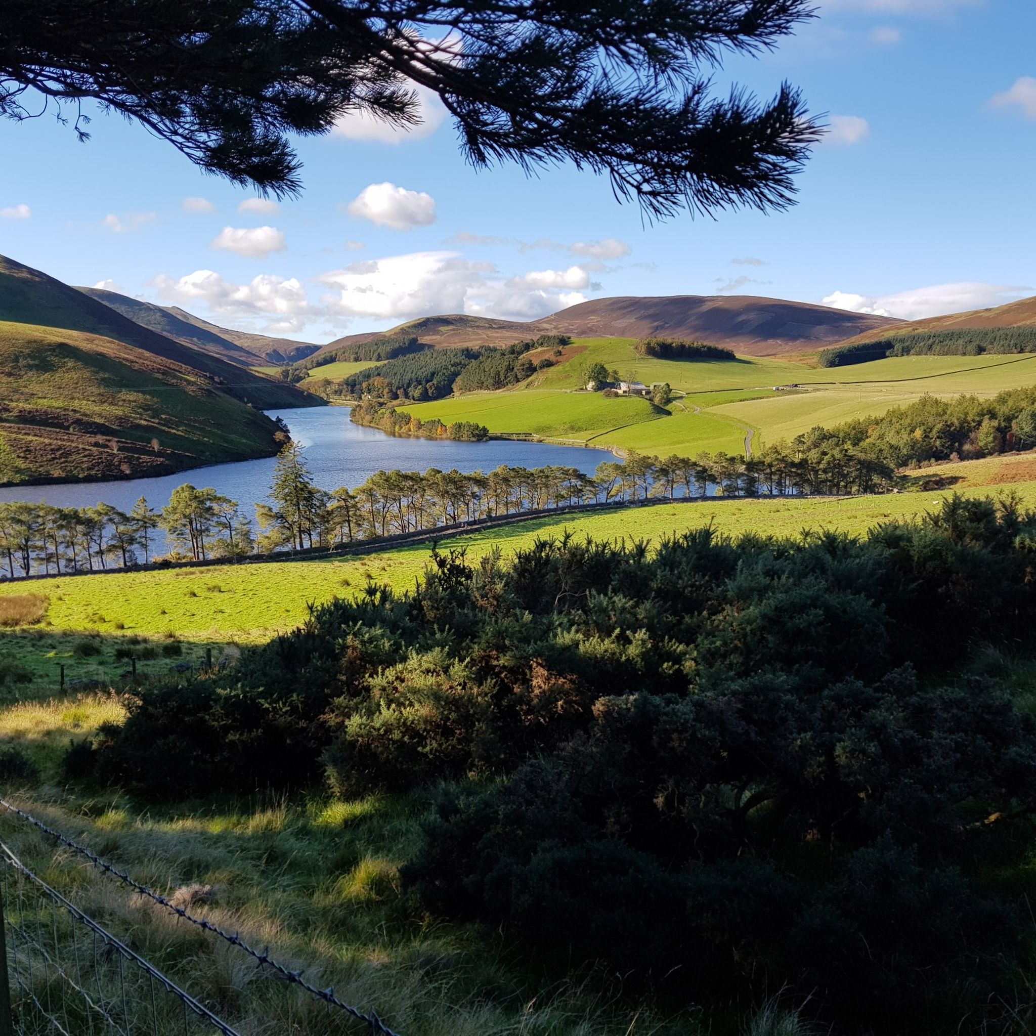
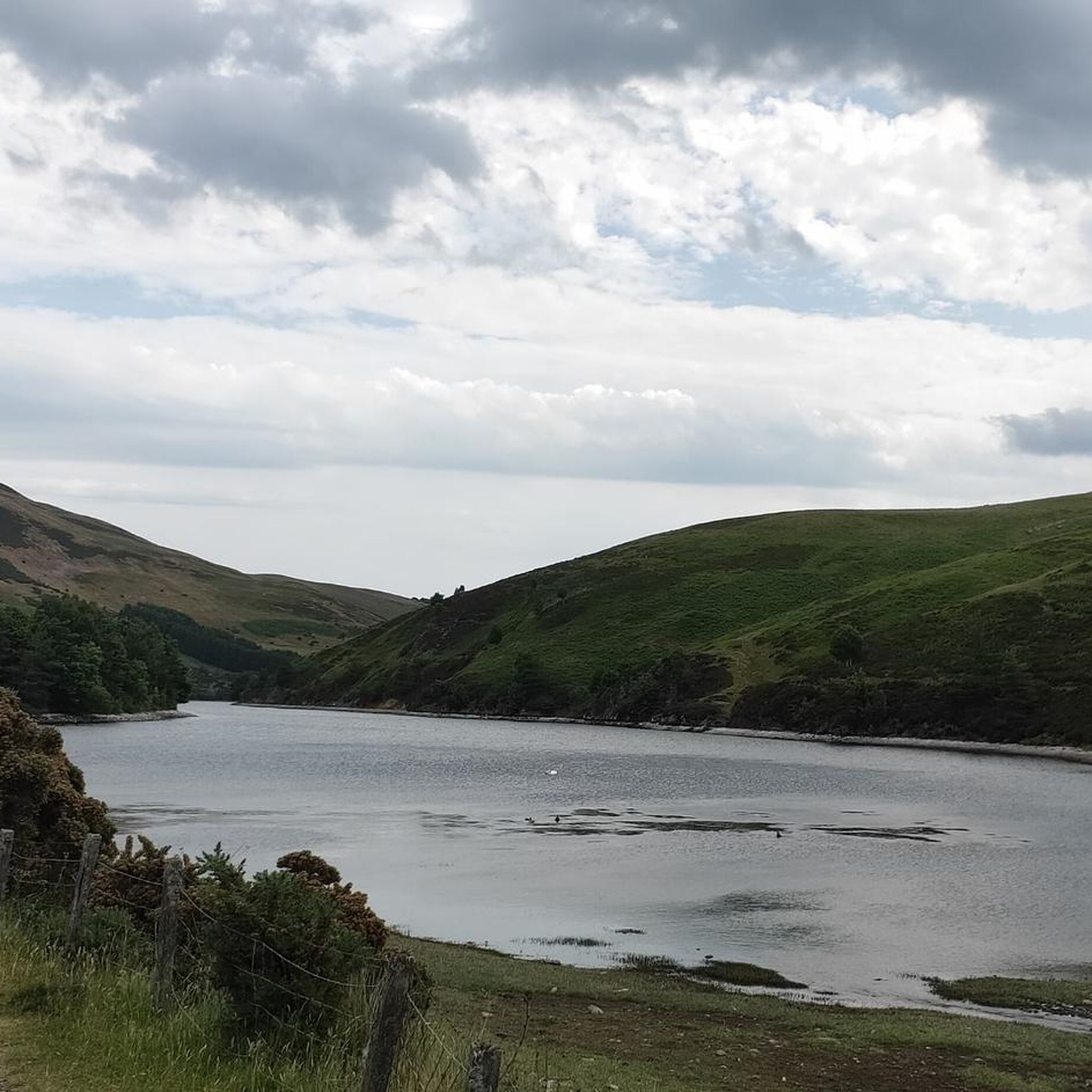
Jogging around Glencorse Reservoir offers a variety of routes within the Pentland Hills near Edinburgh. The area features diverse terrain, including grassy slopes and rocky sections, with options for both paved, easy routes and more challenging paths with significant elevation gain. The reservoir itself is a prominent natural feature, fed by the Glencorse Burn, and the landscape includes historical elements such as the submerged ruins of St. Catherine's Chapel and the impressive 19th-century earth dam.
Best jogging routes around Glencorse Reservoir
- The most popular jogging route is Fala Knowe loop from Glencorse, a 3.3 miles (5.4 km) trail that takes about 40 minutes to complete. This moderate route offers a scenic loop starting from Glencorse.
- Another top favourite among local runners is Maiden's Cleugh loop from Castlelaw, a moderate 5.3 miles (8.6 km) path. This route features varied terrain and takes approximately 1 hour 7 minutes to complete.
- Local runners also love the View from Allermuir Hill – Castlelaw Hill loop from Castlelaw, a 4.1 miles (6.5 km) trail leading through the hills, often completed in about 50 minutes. This route provides panoramic views from Allermuir Hill.
- Jogging around Glencorse Reservoir is defined by the surrounding Pentland Hills, the reservoir itself, and diverse terrain ranging from grassy paths to more rugged sections. The network offers options for easy, moderate, and difficult ability levels.
- The routes in Glencorse Reservoir are highly rated by the komoot community with an average score of 4.5 stars from over 190 reviews. More than 16,000 runners have used komoot to explore Glencorse Reservoir's varied terrain.
Last updated: July 6, 2026
5.0
(1)
39
runners
5.71km
00:45
210m
220m
Moderate run. Good fitness required. Mostly paved surfaces. Suitable for all skill levels.
28
runners
8.62km
01:08
290m
300m
Moderate run. Good fitness required. Mostly accessible paths. Some sure footedness required.

Sign up for free
9
runners
6.54km
00:50
280m
280m
Moderate run. Good fitness required. Mostly paved surfaces. Suitable for all skill levels.
4.8
(9)
349
runners
13.0km
01:55
500m
500m
Hard run. Very good fitness required. Sure-footedness, sturdy shoes and alpine experience required.
5.0
(1)
105
runners
13.8km
01:29
140m
140m
Moderate run. Good fitness required. Mostly paved surfaces. Suitable for all skill levels.
Get access to more routes and recommendations from other explorers.
Sign up for free
Already have an account?
Our route recommendations are based on thousands of hikes, rides, and runs completed by other people on komoot.
Start today with a free account
Your next adventure awaits.
Login or Signup
Tips from the Community

The Pentland Hills (a range of hills south of Edinburgh) offer countless hiking opportunities. One of the "best" (= the northernmost) is Allermuir Hill. There are many paths up the mountain, but the best route is undoubtedly the panoramic route from the Midlothian Snowsports Center parking lot to the summit. The center is...???...interesting... (Skiing on mats in the summer is also possible!), and the summit offers magnificent views in all directions!
0
0


Stunning views. Path gets very gravelly so care needed if you are less experienced off-road
0
0

After the peaks it's all flat terrain and definitely more busy on a dry day. Walk the way back after the last peak if you prefer the challenge of it.
0
0

This is one of the most prominent hills of the Pentland Hills. You have superb views toward Edinburgh, the Firth of Forth, and on clear days, even the Fife and Scottish Highlands. The walk to the summit is moderate, and you'll be walking through diverse landscapes from grassy slopes to more rugged and rocky sections near the top.
1
0

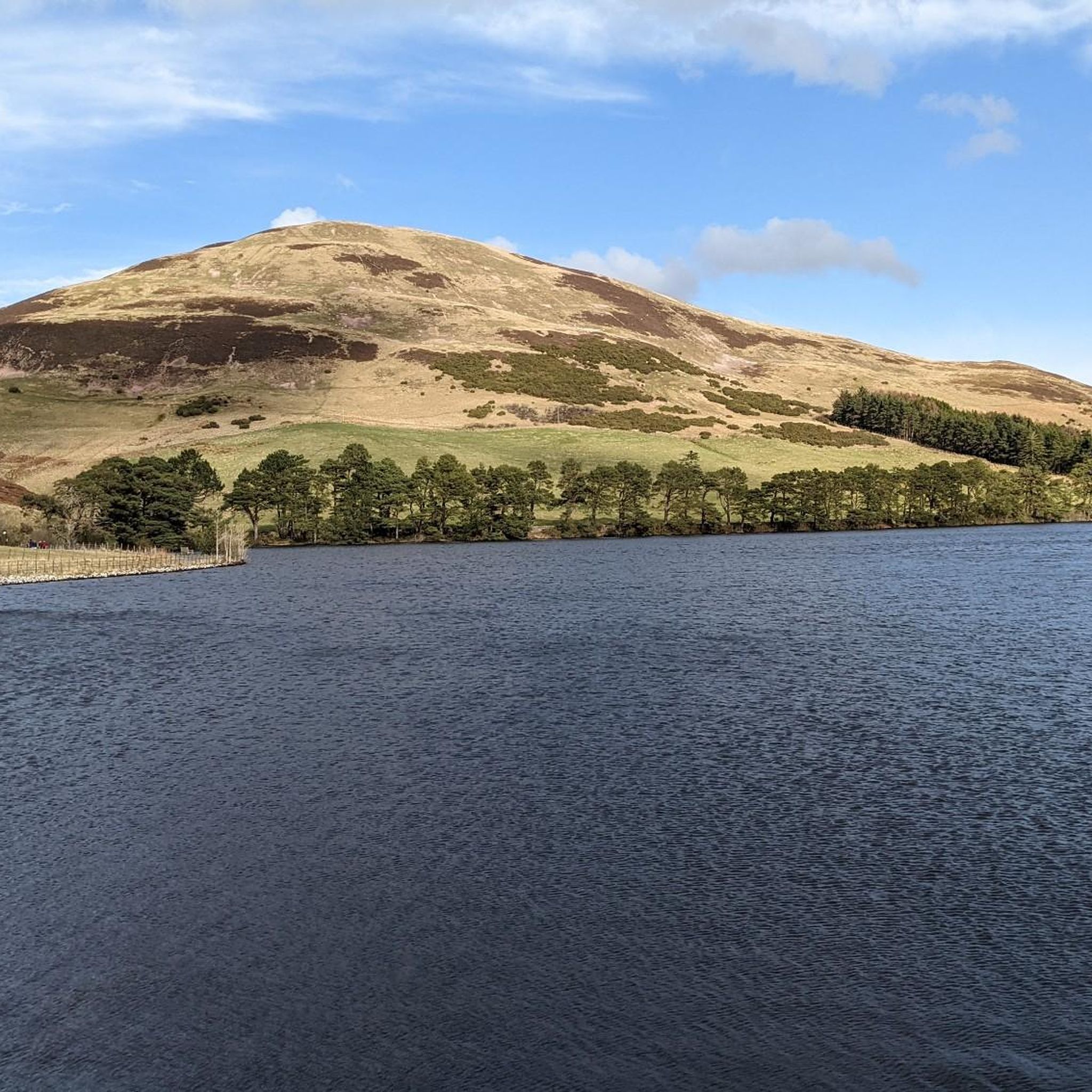
Nestled amongst the Pentland Hills, Glencorse Reservoir is incredibly picturesque. It was built between 1820 and 1824 to provide water to mills in the area and supply drinking water to Edinburgh. Today, the reservoir still supplies water to 450,000 people. The reservoir was created by constructing a dam, which is 77 feet (23.5 m) at its highest point.
2
0

Frequently Asked Questions
How many running routes are available around Glencorse Reservoir?
There are over 540 running routes available around Glencorse Reservoir, offering a wide range of options for different fitness levels and preferences. These include easy, moderate, and difficult trails.
What kind of terrain can I expect on the running trails near Glencorse Reservoir?
The terrain around Glencorse Reservoir is quite diverse. You'll find a mix of grassy slopes and more rugged, rocky sections. Some routes, like the access road along the northern shore, offer smoother, paved surfaces, while others feature significant elevation gain for a more challenging run.
Are there any easy or beginner-friendly jogging routes in the area?
Yes, Glencorse Reservoir offers several easy routes suitable for beginners. For instance, the access road along the northern shore provides a smooth, paved option. Overall, there are 69 easy routes available, ensuring options for all fitness levels.
What are some notable natural features or viewpoints I can see while running?
The area boasts stunning natural features and panoramic viewpoints. You can enjoy breathtaking views from hills like Scald Law, Carnethy Hill, and Allermuir Hill, with sights stretching to Edinburgh, the Firth of Forth, and even the Scottish Highlands on clear days. The Glencorse Burn's outflow waterfall is also a striking sight when water levels are high, and the reservoir itself is beautiful, winding amidst colorful hills.
Are there any historical sites or attractions along the running paths?
Yes, the region is rich in history. You might spot the submerged ruins of the 13th-century chapel of St. Catherine's in the Hopes when water levels are low. The impressive earth dam, built in the 1820s, is also a historical landmark. Nearby, Castlelaw Fort and Earth House offers a glimpse into an Iron Age community.
Can I find circular running routes around Glencorse Reservoir?
Absolutely. Many of the routes around Glencorse Reservoir are circular, offering varied scenery without retracing your steps. An example is the Fala Knowe loop from Glencorse, a moderate 3.3-mile (5.4 km) trail.
Is Glencorse Reservoir accessible by public transport for runners?
Yes, Glencorse Reservoir is accessible from Edinburgh via public transport, making it a convenient escape for city dwellers. There are public transport links available to the area.
Where can I park my car when visiting Glencorse Reservoir for a run?
Convenient parking is available near the Flotterstone Inn, which serves as a good starting point for many trails around Glencorse Reservoir.
What do other runners think about the trails at Glencorse Reservoir?
The running routes in Glencorse Reservoir are highly rated by the komoot community, with an average score of 4.5 stars from over 190 reviews. More than 16,000 runners have used komoot to explore the varied terrain, often praising the diverse landscapes and panoramic views.
Are there any challenging running routes with significant elevation gain?
Yes, for those seeking a challenge, there are routes with significant elevation gain that lead to panoramic viewpoints. A difficult option is the Glencorse Reservoir, Scald Law & Carnethy Hill loop from Flotterstone, which covers nearly 13 km with over 500 meters of ascent.
Are there any routes that offer views from Allermuir Hill?
Yes, you can experience the panoramic views from Allermuir Hill on routes like the View from Allermuir Hill – Castlelaw Hill loop from Castlelaw. This 4.1-mile (6.5 km) trail is a favorite among local runners for its scenic vistas.
What is a good moderate-difficulty running route in the area?
A popular moderate-difficulty option is the Maiden's Cleugh loop from Castlelaw. This 5.3-mile (8.6 km) path features varied terrain and takes approximately 1 hour 7 minutes to complete.
Most popular routes around Glencorse Reservoir

Get inspired with the komoot mobile app


Explore more
Browse the best Running Trails & Routes in other regions.
