The best walks and hikes around Loch Garry
4.2
(58)
721
hikers
4
hikes
Hiking around Loch Garry offers diverse terrain, from gentle loch-side paths to more demanding forest trails and mountain ascents. The region is characterized by its freshwater loch, surrounding woodlands, and dramatic mountains like Meall na Teanga. Hikers can expect varied landscapes, including riverbank paths, native pinewoods, and captivating views of Loch Garry and the River Garry. Moderate elevation changes are common, providing options for different experience levels.
Best hiking trails around Loch Garry
- The most popular hiking route is Meall…
Last updated: August 19, 2026
3.7
(3)
34
hikers
8.36km
02:51
400m
400m
Moderate hike. Good fitness required. Easily-accessible paths. Suitable for all skill levels.
13
hikers
7.11km
02:31
380m
380m
Moderate hike. Good fitness required. Easily-accessible paths. Suitable for all skill levels.

Sign up for free
4.3
(17)
241
hikers
21.4km
06:49
850m
850m
Hard hike. Very good fitness required. Easily-accessible paths. Suitable for all skill levels.
4.7
(38)
433
hikers
11.7km
04:11
690m
690m
Moderate hike. Good fitness required. Easily-accessible paths. Suitable for all skill levels.
Our route recommendations are based on thousands of hikes, rides, and runs completed by other people on komoot.
Start today with a free account
Your next adventure awaits.
Login or Signup
Popular around Loch Garry
Tips from the Community

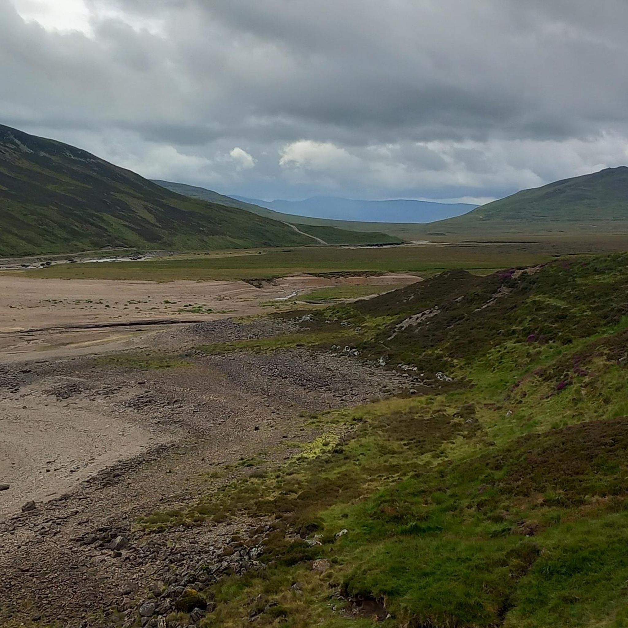
There's actually a double track on both sides of the loch; albeit the northwest side track is far better. The only problem is, is that there's no easy or reliable way to get from one side of the loch to the other at the southern end. If the loch is low, the outflow is a narrow, very shallow, stream that can be easily traversed, however, if the loch is not low ...
3
0

Sgairneach Mhor is a Munro summit in the Drumochter pass area, with a height of 991 metres. The mountain is one of four Munro in the nearby area, and they are often all bagged in a single day, but each peak is still worth its own trip nonetheless.
0
0
Beinn Udlamain is one of the four munros in the Drumochter pass. The mountains in this area are open and heathery, rather than rocks and imposing. The summit stands at 1011 metres above sea-level.
0
0
A’ Mharconaich is a Munro mountain in the Grampian range of Scotland. Standing at 1,001 meters. The summit provides sweeping views of the surrounding Highlands, making it a popular destination for runners, hikers and mountaineers.
0
0

One of the Drumochter Munros, A' Mharconaich means 'the horse place', most likely named after a time when gathering horses occurred here. When you return to the road it is probably the most eye-catching of the hills here.
3
0
Despite only just leaving the main road, there is a fantastic sense of 'remoteness'. This double track crosses the River Truim and railway before heading into the Drumochter hills beyond.
1
0
The most Northerly of the Drumochter Munros. Despite being touted as one of the easier Munros to bag, the views are stunning. On a clear day you can see the Munros along the length of Loch Ericht, towards Ben Alder. Geal-Chàrn translates to 'White Hill'.
4
1

Frequently Asked Questions
How many hiking trails are available around Loch Garry?
The Loch Garry area offers a selection of hiking routes, with komoot featuring 4 distinct trails. These range from moderate walks to more challenging mountain ascents, providing options for various skill levels.
Are there any easy or family-friendly walks around Loch Garry?
While the listed komoot routes are moderate to difficult, the region research indicates that Loch Garry offers diverse terrain, including gentle loch-side paths and easy circular forestry trails. These are often suitable for families looking for less strenuous options. For example, the Ciste Dhubh Trail is noted as an easy circular forestry trail along the River Garry.
Can I bring my dog on the hiking trails near Loch Garry?
The Scottish Highlands, including the Loch Garry area, are generally dog-friendly. However, it's always recommended to keep dogs on a lead, especially in areas with livestock or ground-nesting birds, and to follow the Scottish Outdoor Access Code. Many forest and loch-side paths are suitable for walks with dogs.
Are there any circular hiking routes in the Loch Garry area?
Yes, there are several circular routes. For instance, you can explore the Meall na Leitreach loop from Allt Coire Luidhearnaidh, which is a moderate 5-mile trail. Another option is the Sow of Atholl Summit loop from Allt Coire Luidhearnaidh, a moderate 4.4-mile path. The region also features the Ciste Dhubh Trail, an easy circular forestry trail along the River Garry.
What kind of terrain can I expect on hikes around Loch Garry?
Hikers around Loch Garry will encounter diverse terrain. This includes gentle loch-side paths, winding riverbank trails, lush native pinewoods, and more demanding forest trails with moderate elevation changes. For experienced hikers, there are also challenging ascents of nearby mountains like Meall na Teanga and Ben Tee.
Are there any waterfalls to see on the trails?
Yes, the landscape around Loch Garry includes impressive water features. You can find the Allt na Cailliche Waterfalls, which are part of a popular forest path loop along the river. Small streams fed by mountain runoff also add to the scenic beauty.
What are some notable landmarks or points of interest near Loch Garry?
Beyond the natural beauty, hikers can discover historical and cultural sites. These include remnants of ancient settlements, the historic Invergarry Castle, and the Glengarry Parish Church. The Garry Bridge Trail also offers impressive views over the land and water.
Is there wildlife to spot while hiking around Loch Garry?
The natural environment around Loch Garry provides ample opportunities for wildlife observation. Hikers often spot local species such as deer, various birds, and other native animals within the forests and along the loch-side paths.
What do other hikers say about the trails in Loch Garry?
The trails in Loch Garry are highly regarded by the komoot community, holding an average rating of 4.2 stars from over 49 reviews. Hikers often praise the varied landscapes, captivating loch-side views, and the well-maintained paths that cater to different abilities.
Are there options for challenging hikes in the region?
Yes, for those seeking a challenge, the Loch Garry area offers routes with significant elevation gain. An example is A’ Mharconaich and Beinn Udlamain loop, a difficult 13.3-mile trail with over 850 meters of ascent. The dramatic mountains like Meall na Teanga also provide challenging routes for experienced hikers.
What are the parking options for hikers around Loch Garry?
While specific parking locations for all routes are not detailed, the region is generally accessible for hikers. Routes like the Ciste Dhubh Car Park – River Walk Through the Forest loop suggest designated parking areas are available at common trailheads, such as Ciste Dhubh.
When is the best time of year to go hiking around Loch Garry?
The diverse landscapes of Loch Garry can be enjoyed throughout the year. However, spring and autumn often offer pleasant temperatures and stunning scenery with changing foliage. Summer provides longer daylight hours, while winter hikes can be beautiful but require appropriate gear and caution due to potentially challenging conditions.
Are there places to eat or stay near the hiking routes?
Yes, the region offers amenities for hikers. Some routes pass traditional huts that provide food, drink, and even overnight accommodation, which can be convenient for multi-day excursions or simply for a break during a day hike. The nearby village of Invergarry also offers services.
Most popular routes around Loch Garry

Get inspired with the komoot mobile app


Explore more
Browse the best Hikes in other regions.
